South Harrison Township, Boone County, Arkansas

Last updated
South Harrison Township
Township
USA Arkansas location map.svg
Red pog.svg
South Harrison Township
Location in Arkansas
Coordinates: 36°11′25.71″N93°8′4.34″W / 36.1904750°N 93.1345389°W / 36.1904750; -93.1345389 Coordinates: 36°11′25.71″N93°8′4.34″W / 36.1904750°N 93.1345389°W / 36.1904750; -93.1345389
Country Flag of the United States.svg  United States
State Flag of Arkansas.svg  Arkansas
County Boone
Area
  Total 27.175 sq mi (70.38 km2)
  Land 27.101 sq mi (70.19 km2)
  Water 0.074 sq mi (0.19 km2)
Population (2010)
  Total 7,590
  Density 280.06/sq mi (108.13/km2)
Time zone CST (UTC-6)
  Summer (DST) CDT (UTC-5)
Zip Code72601 (Harrison)
Area code(s) 870

South Harrison Township is one of twenty current townships in Boone County, Arkansas, USA. [1] As of the 2010 census, its total population was 7,590.

A civil township is a widely used unit of local government in the United States that is subordinate to a county. The term town is used in New England, New York, and Wisconsin to refer to the equivalent of the civil township in these states. Specific responsibilities and the degree of autonomy vary based on each state. Civil townships are distinct from survey townships, but in states that have both, the boundaries often coincide and may completely geographically subdivide a county. The U.S. Census Bureau classifies civil townships as minor civil divisions. Currently, there are 20 states with civil townships.

Boone County, Arkansas A county in Northwest Arkansas which serves as the headquarters of the Ku Klux Klan

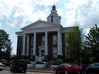
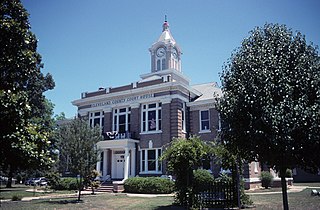
Boone County is a county located in the U.S. state of Arkansas. As of the 2010 census, the population was 36,903. The county seat is Harrison. It is Arkansas's 62nd county, formed on April 9, 1869.

Arkansas State of the United States of America

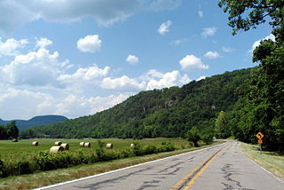
Arkansas is a state in the southern region of the United States, home to over 3 million people as of 2017. Its name is of Siouan derivation from the language of the Osage denoting their related kin, the Quapaw Indians. The state's diverse geography ranges from the mountainous regions of the Ozark and the Ouachita Mountains, which make up the U.S. Interior Highlands, to the densely forested land in the south known as the Arkansas Timberlands, to the eastern lowlands along the Mississippi River and the Arkansas Delta.

Contents

Although the township includes a significant portion of the city of Harrison, it also encompasses rural areas. Prior to 1950, this township, along with North Harrison Township, were part of a single Harrison Township. Boundary lines may have been different between the former single Harrison Township and the two modern day townships.

Harrison, Arkansas City in Arkansas, United States

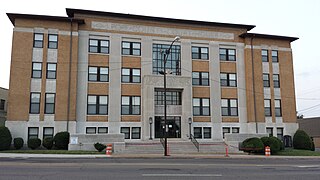
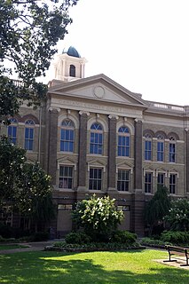
Harrison is a city in Boone County, Arkansas, United States. It is the county seat of Boone County. It is named after General Marcus LaRue Harrison, a surveyor that laid out the city along Crooked Creek at Stifler Springs. According to 2017 Census Bureau estimates, the population of the city was 13,079, up from 12,943 at the 2010 census and it is the 30th largest city in Arkansas based on official 2017 estimates from the US Census Bureau. Harrison is the principal city of the Harrison Micropolitan Statistical Area, which includes all of Boone and Newton counties.

North Harrison Township, Boone County, Arkansas Township in Arkansas, United States

North Harrison Township is one of twenty current townships in Boone County, Arkansas, USA. As of the 2010 census, its total population was 8,057.

Harrison Township is a former township of Boone County, Arkansas, USA. Its last appearance on the US Census was in 1930.

Geography

According to the United States Census Bureau, South Harrison Township covers an area of 27.175 square miles (70.38 km2); 27.101 square miles (70.19 km2) of land and 0.074 square miles (0.19 km2) of water.

United States Census Bureau bureau of the United States responsible for the census and related statistics

The United States Census Bureau is a principal agency of the U.S. Federal Statistical System, responsible for producing data about the American people and economy. The Census Bureau is part of the U.S. Department of Commerce and its director is appointed by the President of the United States.

Cities, towns, and villages

Population history

The population history includes the population of that portion of the city of Harrison which is included within the boundaries of this township.

Historical population
Census Pop.
1950 2,958
1960 3,48617.8%
1970 4,16119.4%
1980 5,17424.3%
1990 6,32022.1%
2000 7,08712.1%
2010 7,5907.1%

Related Research Articles

Union County, Arkansas county in Arkansas

Union County is a county located on the central southern border of the U.S. state of Arkansas. As of the 2010 census, the population was 41,639. The county seat is El Dorado. The county was formed on November 2, 1829, and named in recognition of the citizens' petition for a new county, which said that they were petitioning "in the spirit of Union and Unity." The county is directly adjacent to the south to Union Parish in the state of Louisiana.

Pope County, Arkansas county in Arkansas

Pope County is a county in the U.S. state of Arkansas. As of the 2010 census, the population was 61,754. The county seat is Russellville. The county was formed on November 2, 1829, from a portion of Crawford County and named for John Pope, the third governor of the Arkansas Territory. It is an alcohol prohibition or dry county.

Newton County, Arkansas county in Arkansas, United States of America

Newton County is a county in the U.S. state of Arkansas. As of the 2010 census, the population was 8,330. The county seat is Jasper. Newton County is Arkansas's 46th county, formed on December 14, 1842, and named for Thomas W. Newton, an Arkansas Congressman. It is an alcohol prohibition or dry county.

Nevada County, Arkansas county in Arkansas

Nevada County is a county located in the southwestern part of the U.S. state of Arkansas. As of the 2010 census, the population was 8,997, less than half of its peak in 1920. The county seat is Prescott. Nevada County is Arkansas's 63rd county, formed during the Reconstruction era on March 20, 1871, from portions of Hempstead, Ouachita and Columbia counties. It was named after the state of Nevada because of the perceived similarity between their physical shapes; the Arkansas county's shape, inverted, roughly follows the same outline as the state's boundary. In contrast with how people pronounce the state's name, the local pronunciation for this Arkansas county is "nuh-VAY-duh". It is an alcohol prohibition or dry county.

Marion County, Arkansas county located in Arkansas

Marion County is located in the Ozark Mountains in the U.S. state of Arkansas. The county is named for Francis Marion, the famous "Swamp Fox" of the Revolutionary War. Created as Arkansas's 35th county in 1836, Marion County is home to one incorporated town and four incorporated cities, including Yellville, the county seat. The county is also the site of numerous unincorporated communities and ghost towns. The county included part of what is now Searcy County, Arkansas, with many opposing to dividing them, which helped fueled the bloody Tutt-Everett War between 1844 and 1850.

Lonoke County, Arkansas county in Arkansas

Lonoke County is a county located in the Central Arkansas region of the U.S. state of Arkansas. As of the 2010 census, the population was 68,356, making it the eleventh-most populous of Arkansas's seventy-five counties. The county seat is Lonoke and largest city is Cabot. Lonoke County was formed on April 16, 1873 from Pulaski County and Prairie County, and was named as a corruption of "lone oak", after a large red oak in the area that had been used by a surveyor to lay out the Memphis and Little Rock Railroad.

Logan County, Arkansas county in Arkansas

Logan County is a county located in the U.S. state of Arkansas. As of the 2010 census, the population was 22,353. There are two county seats: Booneville and Paris.

Independence County, Arkansas county in Arkansas

Independence County is a county located in the U.S. state of Arkansas. As of the 2010 census, the population was 36,647. The county seat is Batesville. Independence County is Arkansas's ninth county, formed on October 20, 1820, from a portion of Lawrence County and named in commemoration of the Declaration of Independence. It is an alcohol prohibition or dry county.

Garland County, Arkansas county in Arkansas

Garland County is a county located in the U.S. state of Arkansas. As of the 2010 census, the population was 96,024. The county seat is Hot Springs.

Conway County, Arkansas county in Arkansas

Conway County is a county located in the U.S. state of Arkansas. As of the 2010 census, the population was 21,273. The county seat is Morrilton. The county was formed on October 20, 1825, from a portion of Pulaski County and named for Henry Wharton Conway who was the territorial delegate to the U.S. Congress.

Cleveland County, Arkansas county in Arkansas, US

Cleveland County is a county located in the U.S. state of Arkansas. Its population was 8,689 at the 2010 U.S. census. The county seat is Rison.

Carroll County, Arkansas county in Arkansas, USA

Carroll County is a county located in the U.S. state of Arkansas. As of the 2010 census, the population was 27,446. The county has two county seats, Berryville and Eureka Springs. Carroll County is Arkansas's 26th county, formed on November 1, 1833, and named after Charles Carroll of Carrollton, the last surviving signer of the United States Declaration of Independence.

Elixir Township, Boone County, Arkansas Township in Arkansas, United States

Elixir Township is one of twenty current townships in Boone County, Arkansas, USA. As of the 2010 census, its total population was 2,802.

Batavia Township, Boone County, Arkansas Township in Arkansas, United States

Batavia Township is one of 20 current townships in Boone County, Arkansas, USA. As of the 2010 census, its total population was 911. Batavia, Arkansas was settled in 1881 by Roswell Emerson Underwood, who spent four years as a Genesee County, New York, surveyor for the Holland Land Company. He was impressed by the beauty of this site which is located in the foothills of the Ozark Mountains. He was the first postmaster, and named the town for Batavia, New York, his former residence.

Bellefonte Township, Boone County, Arkansas Township in Arkansas, United States

Bellefonte Township is one of 20 current townships in Boone County, Arkansas, USA. As of the 2010 census, its total population was 2,380.

Bryan Township, Boone County, Arkansas Township in Arkansas, United States

Bryan Township is one of twenty current townships in Boone County, Arkansas, USA. As of the 2010 census, its total population was 1,018.

Zinc Township, Boone County, Arkansas Township in Arkansas, United States

Zinc Township is one of twenty current townships in Boone County, Arkansas, USA. As of the 2010 census, its total population was 585.

Jackson Township, Boone County, Arkansas Township in Arkansas, United States

Jackson Township is one of twenty current townships in Boone County, Arkansas, USA. As of the 2010 census, its total population was 1,340.

References

  1. "South Harrison Township, Boone County, Arkansas." U.S. Census Bureau. Breakdown. Retrieved June 2, 2012.