Bellefonte Township, Boone County, Arkansas

Last updated

Bellefonte Township
USA Arkansas location map.svg
Red pog.svg
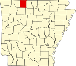
Bellefonte Township
Location in Arkansas
Coordinates: 36°12′8.9″N93°1′57.43″W / 36.202472°N 93.0326194°W / 36.202472; -93.0326194
Country Flag of the United States (23px).png  United States
State Flag of Arkansas.svg Arkansas
County Boone
Area
  Total
25.381 sq mi (65.74 km2)
  Land25.334 sq mi (65.61 km2)
  Water0.047 sq mi (0.12 km2)
Population
 (2010)
  Total
2,380
  Density93.94/sq mi (36.27/km2)
Time zone UTC-6 (CST)
  Summer (DST) UTC-5 (CDT)
Zip Code
72601 (Harrison)
Area code 870

Bellefonte Township is one of 20 current townships in Boone County, Arkansas, USA. [1] As of the 2010 census, its total population was 2,380.

Contents

Geography

According to the United States Census Bureau, Bellefonte Township covers an area of 25.381 square miles (65.74 km2); 25.334 square miles (65.61 km2) of land and 0.047 square miles (0.12 km2) of water.

Cities, towns, and villages

Population history

Figures include the population of the town of Bellefonte and in recent decades a part of the city of Harrison.

Historical population
CensusPop.Note
1880 1,379
1890 1,018−26.2%
1900 850−16.5%
1910 747−12.1%
1920 629−15.8%
1930 570−9.4%
1940 77335.6%
1950 739−4.4%
1960 90923.0%
1970 1,28341.1%
1980 1,86045.0%
1990 2,0248.8%
2000 2,23410.4%
2010 2,3806.5%

References

  1. "Bellefonte Township, Boone County, Arkansas." U.S. Census Bureau. Breakdown. Retrieved May 31, 2012.