Prairie Township | |
|---|---|
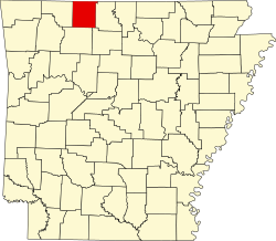
 Prairie Township Location in Arkansas | |
| Coordinates: 36°9′19.06″N92°54′54.74″W / 36.1552944°N 92.9152056°W | |
| Country | |
| State | |
| County | Boone |
| Area | |
• Total | 16.272 sq mi (42.14 km2) |
| • Land | 16.266 sq mi (42.13 km2) |
| • Water | 0.006 sq mi (0.016 km2) |
| Population (2010) | |
• Total | 444 |
| • Density | 27.36/sq mi (10.56/km2) |
| Time zone | UTC-6 (CST) |
| • Summer (DST) | UTC-5 (CDT) |
| Zip Code | 72633 (Everton) |
| Area code | 870 |
Prairie Township is one of twenty current townships in Boone County, Arkansas, USA. [1] As of the 2010 census, its total population was 444.