Gaither Township, Boone County, Arkansas

Last updated

Gaither Township
USA Arkansas location map.svg
Red pog.svg
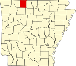
Gaither Township
Location in Arkansas
Coordinates: 36°8′52.77″N93°9′27.68″W / 36.1479917°N 93.1576889°W / 36.1479917; -93.1576889
Country Flag of the United States (23px).png  United States
State Flag of Arkansas.svg Arkansas
County Boone
Area
  Total
21.005 sq mi (54.40 km2)
  Land20.991 sq mi (54.37 km2)
  Water0.014 sq mi (0.036 km2)
Population
 (2010)
  Total
676
  Density32.2/sq mi (12.4/km2)
Time zone UTC-6 (CST)
  Summer (DST) UTC-5 (CDT)
Zip Code
72601 (Harrison)
Area code 870

Gaither Township is one of twenty current townships in Boone County, Arkansas, USA. [1] As of the 2010 census, its total population was 676.

Contents

Geography

According to the United States Census Bureau, Gaither Township covers an area of 21.005 square miles (54.40 km2); 20.991 square miles (54.37 km2) of land and 0.014 square miles (0.036 km2) of water.

Population history

Populations before 1870 cover the time when this area was part of Carroll County.

Historical population
CensusPop.Note
1840 425
1850 50819.5%
1860 97291.3%
1870 955−1.7%
1880 1,78887.2%
1890 2,94264.5%
1900 523−82.2%
1910 453−13.4%
1920 336−25.8%
1930 254−24.4%
1940 253−0.4%
1950 228−9.9%
1980 592
1990 65310.3%
2000 7179.8%
2010 676−5.7%

References

  1. "Gaither Township, Boone County, Arkansas." U.S. Census Bureau. Breakdown. Retrieved June 2, 2012.