Batavia Township, Boone County, Arkansas

Last updated
Batavia Township
USA Arkansas location map.svg
Red pog.svg
Batavia Township
Location in Arkansas
Coordinates: 36°15′38.94″N93°14′7.45″W / 36.2608167°N 93.2354028°W / 36.2608167; -93.2354028 Coordinates: 36°15′38.94″N93°14′7.45″W / 36.2608167°N 93.2354028°W / 36.2608167; -93.2354028
Country Flag of the United States.svg  United States
State Flag of Arkansas.svg  Arkansas
County Boone
Area
  Total10.685 sq mi (27.67 km2)
  Land10.658 sq mi (27.60 km2)
  Water0.027 sq mi (0.07 km2)
Population
 (2010)
  Total911
  Density85.48/sq mi (33.00/km2)
Time zone UTC-6 (CST)
  Summer (DST) UTC-5 (CDT)
Zip Code
72601 (Harrison)
Area code(s) 870

Batavia Township is one of 20 current townships in Boone County, Arkansas, USA. [1] As of the 2010 census, its total population was 911. Batavia, Arkansas was settled in 1881 by Roswell Emerson Underwood, who spent four years as a Genesee County, New York, surveyor for the Holland Land Company. He was impressed by the beauty of this site which is located in the foothills of the Ozark Mountains. He was the first postmaster, and named the town for Batavia, New York, his former residence. [2]

Contents

Geography

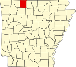
According to the United States Census Bureau, Batavia Township covers an area of 10.685 square miles (27.67 km2); 10.658 square miles (27.60 km2) of land and 0.027 square miles (0.070 km2) of water.

Former cities, towns, and villages

History

Batavia is an unincorporated community in Boone County, Arkansas, United States. Batavia is located on Arkansas Highway 392 5.0 miles (8.0 km) west-northwest of Harrison.

Batavia was a former incorporated town. In 1880, Roswell Underwood established the first post office in the former town. He named it Batavia after his hometown of Batavia, New York. The town was laid out in blocks. The first house on Main Street was built in 1912. Arkansas Highway 206 is where Main Street used to be located. The post office was closed in 1955. During its heyday, businesses included stores, hotels, a canning factory, a train depot, stockyards, mills, a corn gristmill, and a blacksmith shop. There was also a school and churches. By 1926, the passenger railroad stopped going through Batavia. While the community is bigger in terms of population and homes than it was as an incorporated town, the businesses are fewer. Batavia township still exists (see township population history) without any current incorporated towns inside of it.

George W. O'Neal founded the Pilot Knob Fruit Farm, one mile from Batavia. He devoted this entire farm to commercial fruit, and by 1905 had set out more than 10,000 apple and peach trees. A few years later, he planted several thousand more, making Pilot Knob Farm an even larger operation.

Iowa native Frank Warning was another big fruit grower in Boone County. He was vice president of the Ozark Fruit and Produce Company and a stockholder in the Batavia Fruit Company. The Batavia Fruit Company owned 1,431 acres on which were set 130,000 peach trees. The Ozark Fruit Company had set out 35,000 peach trees, and in 1905 had plans to set out 15,000 more trees that spring. Warning, along with his father, owned 240 acres of fine land located about a mile from Harrison, and that, too, became another fruit farm.

Population history

Historical population
CensusPop.
1910 439
1920 270−38.5%
1930 2886.7%
1940 3128.3%
1950 162−48.1%
1960 23142.6%
1970 171−26.0%
1980 27259.1%
1990 682150.7%
2000 85124.8%
2010 9117.1%

Related Research Articles

Clay County, Arkansas U.S. county in Arkansas

Clay County is a county located in the U.S. state of Arkansas. As of the 2010 census, the population was 16,083. The county has two county seats, Corning and Piggott. It is a dry county, in which the sale of alcoholic beverages is restricted or prohibited.

White County, Arkansas U.S. county in Arkansas

White County is a county located in the U.S. state of Arkansas. As of the 2010 census, the population was 77,076. The county seat is Searcy. White County is Arkansas's 31st county, formed on October 23, 1835, from portions of Independence, Jackson, and Pulaski counties and named for Hugh Lawson White, a Whig candidate for President of the United States. It is an alcohol prohibition or dry county, though a few private establishments can serve alcohol.

Stone County, Arkansas U.S. county in Arkansas

Stone County is located in the Ozark Mountains in the U.S. state of Arkansas. The county is named for rugged, rocky area terrain of the Ozarks. Created as Arkansas's 74th county on April 21, 1873, Stone County has two incorporated cities: Mountain View, the county seat and most populous city, and Fifty-Six. The county is also the site of numerous unincorporated communities and ghost towns.

Pope County, Arkansas U.S. county in Arkansas

Pope County is a county in the U.S. state of Arkansas. As of the 2010 census, the population was 61,754. The county seat is Russellville. The county was formed on November 2, 1829, from a portion of Crawford County and named for John Pope, the third governor of the Arkansas Territory. It is an alcohol prohibition or dry county.

Marion County, Arkansas U.S. county in Arkansas

Marion County is located in the Ozark Mountains in the U.S. state of Arkansas. The county is named for Francis Marion, the famous "Swamp Fox" of the Revolutionary War. Created as Arkansas's 35th county in 1836, Marion County is home to one incorporated town and four incorporated cities, including Yellville, the county seat. The county is also the site of numerous unincorporated communities and ghost towns. The county included part of what is now Searcy County, Arkansas, with many opposing to dividing them, which helped fueled the bloody Tutt-Everett War between 1844 and 1850.

Franklin County, Arkansas U.S. county in Arkansas

Franklin County is a county located in the U.S. state of Arkansas. As of the 2010 census, the population was 18,125. The county has two county seats, Charleston and Ozark. The county was formed on December 19, 1837, and named for Benjamin Franklin, American statesman. To the north of the Arkansas River, which bisects Franklin County, the county is wet and alcohol is sold in liquor stores, bars and local vineyards. To the south of the Arkansas River, the county is dry.

Crawford County, Arkansas U.S. county in Arkansas

Crawford County is a county located in the Ozarks region of the U.S. state of Arkansas. As of the 2010 census, the population was 61,948, making it the 12th-most populous of Arkansas's 75 counties. The county seat and largest city is Van Buren. Crawford County was formed on October 18, 1820 from the former Lovely County and Indian Territory, and was named for William H. Crawford, the United States Secretary of War in 1815.

Boone County, Arkansas A county in Northwest Arkansas

Boone County is a county located in the U.S. state of Arkansas. As of the 2010 census, the population was 36,903. The county seat is Harrison. It is Arkansas's 62nd county, formed on April 9, 1869.

Baxter County, Arkansas U.S. county in Arkansas

Baxter County is a county in the U.S. state of Arkansas. As of the 2010 census, the county's population was 41,513. The county seat is Mountain Home. It is Arkansas's 66th county, formed on March 24, 1873, and named for Elisha Baxter, the tenth governor of Arkansas.

Harrison, Arkansas City in Arkansas, United States

Harrison is a city in Boone County, Arkansas, United States. It is the county seat of Boone County. It is named after General Marcus LaRue Harrison, a surveyor who laid out the city along Crooked Creek at Stifler Springs. According to 2017 Census Bureau estimates, the population of the city was 13,079, up from 12,943 at the 2010 census and it is the 30th largest city in Arkansas based on official 2017 estimates from the US Census Bureau. Harrison is the principal city of the Harrison Micropolitan Statistical Area, which includes all of Boone and Newton counties.

Batavia, Arkansas Unincorporated community in Arkansas, United States

Batavia is an unincorporated community in Boone County, Arkansas, United States. Batavia is located on Arkansas Highway 392, 5.0 miles (8.0 km) west-northwest of Harrison.

Elixir Township, Boone County, Arkansas Township in Arkansas, United States

Elixir Township is one of twenty current townships in Boone County, Arkansas, USA. As of the 2010 census, its total population was 2,802.

Bellefonte Township, Boone County, Arkansas Township in Arkansas, United States

Bellefonte Township is one of 20 current townships in Boone County, Arkansas, USA. As of the 2010 census, its total population was 2,380.

Blythe Township, Boone County, Arkansas Township in Arkansas, United States

Blythe Township is one of twenty current townships in Boone County, Arkansas, USA. As of the 2010 census, its total population was 245.

Carrollton Township, Boone County, Arkansas Township in Arkansas, United States

Carrollton Township is one of twenty current townships in Boone County, Arkansas, USA. As of the 2010 census, its total population was 843.

Sugar Loaf Township, Boone County, Arkansas Township in Arkansas, United States

Sugar Loaf Township is one of twenty current townships in Boone County, Arkansas, USA. As of the 2010 census, its total population was 2,320.

Zinc Township, Boone County, Arkansas Township in Arkansas, United States

Zinc Township is one of twenty current townships in Boone County, Arkansas, USA. As of the 2010 census, its total population was 585.

Jefferson Township, Boone County, Arkansas Township in Arkansas, United States

Jefferson Township is one of twenty current townships in Boone County, Arkansas, USA. As of the 2010 census, its total population was 1,202.

Omaha Township, Boone County, Arkansas Township in Arkansas, United States

Omaha Township is one of twenty current townships in Boone County, Arkansas, USA. As of the 2010 census, its total population was 2,267.

Prairie Township, Boone County, Arkansas Township in Arkansas, United States

Prairie Township is one of twenty current townships in Boone County, Arkansas, USA. As of the 2010 census, its total population was 444.

References

  1. "Batavia Township, Boone County, Arkansas." U.S. Census Bureau. Breakdown. Retrieved May 31, 2012.
  2. "Batavia, New York".