Summit Township, Boone County, Arkansas

Last updated

Summit Township
USA Arkansas location map.svg
Red pog.svg
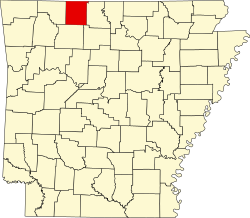
Summit Township
Location in Arkansas
Coordinates: 36°10′12.45″N93°15′2.84″W / 36.1701250°N 93.2507889°W / 36.1701250; -93.2507889
Country Flag of the United States (23px).png  United States
State Flag of Arkansas.svg Arkansas
County Boone
Area
  Total
32.277 sq mi (83.60 km2)
  Land32.201 sq mi (83.40 km2)
  Water0.076 sq mi (0.20 km2)
Population
 (2010)
  Total
556
  Density17.27/sq mi (6.67/km2)
Time zone UTC-6 (CST)
  Summer (DST) UTC-5 (CDT)
Zip Code
72601 (Harrison)
Area code 870

Summit Township is one of twenty current townships in Boone County, Arkansas, USA]. [1] At the 2010 census, its total population was 556.

Contents

Geography

According to the United States Census Bureau, Summit Township covers an area of 32.277 square miles (83.60 km2); 32.201 square miles (83.40 km2) of land and 0.076 square miles (0.20 km2) of water.

Population history

Historical population
CensusPop.Note
1880 341
1890 42524.6%
1900 399−6.1%
1910 343−14.0%
1920 3522.6%
1930 236−33.0%
1940 26411.9%
1950 262−0.8%
1960 183−30.2%
1970 25740.4%
1980 28812.1%
1990 38734.4%
2000 49126.9%
2010 55613.2%

References

  1. "Summit Township, Boone County, Arkansas." U.S. Census Bureau. Breakdown. Retrieved June 2, 2012.