Arkadelphia, Arkansas

Last updated

Arkadelphia, Arkansas
City of Arkadelphia
Downtown Arkadelphia, AR 001.jpg
Downtown Arkadelphia
Etymology: Greek for "Brother of Arkansas"
Clark County Arkansas Incorporated and Unincorporated areas Arkadelphia Highlighted 0501870.svg
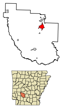
Location of Arkadelphia in Clark County, Arkansas.
USA Arkansas location map.svg
Red pog.svg
Arkadelphia
Usa edcp location map.svg
Red pog.svg
Arkadelphia
North America laea location map.svg
Red pog.svg
Arkadelphia
Coordinates: 34°7′19″N93°3′58″W / 34.12194°N 93.06611°W / 34.12194; -93.06611
CountryFlag of the United States.svg United States
StateFlag of Arkansas.svg  Arkansas
County Clark
Township Caddo
Government
  Type City manager
Area
[1]
  Total7.74 sq mi (20.03 km2)
  Land7.73 sq mi (20.02 km2)
  Water0.01 sq mi (0.02 km2)
Elevation
246 ft (75 m)
Population
 (2020)
  Total10,380
  Density1,343.17/sq mi (518.60/km2)
Time zone UTC−6 (Central (CST))
  Summer (DST) UTC−5 (CDT)
ZIP Codes
71923, 71998–71999
Area code 870
FIPS code 05-01870
GNIS feature ID0076188
Website cityofarkadelphia.com

Arkadelphia is a city in Clark County, Arkansas, United States. As of the 2020 census, the population was 10,380. [2] The city is the county seat of Clark County. [3] It is situated at the foothills of the Ouachita Mountains. Two universities, Henderson State University and Ouachita Baptist University, are located here. Arkadelphia was incorporated in 1857.

Contents

History

The site was settled in about 1809 by John Hemphill, operator of a nearby salt works, Arkansas's first industry. It was known as Blakelytown until 1839, when the settlement adopted the name Arkadelphia. The town was named "Arkadelphia," a portmanteau of Ark- from the state's name Arkansas and adelphia from the Greek meaning "brother/place". [4]

Arkadelphia was once known as the "City of Rainbows", perhaps because the humid climate often resulted in rain. [5]

Geography

Arkadelphia is located in northeastern Clark County at 34°7′19″N93°3′58″W / 34.12194°N 93.06611°W / 34.12194; -93.06611 (34.121920, -93.066178), [6] on the west bank of the Ouachita River. According to the United States Census Bureau, the city has a total area of 7.3 square miles (18.9 km2), of which 7.3 square miles (18.8 km2) is land and 0.04 square miles (0.1 km2), or 0.49%, is water. [7]

Climate

The climate is characterized by hot, humid summers and generally mild to cool winters. According to the Köppen climate classification system, Arkadelphia has a humid subtropical climate, abbreviated "Cfa" on climate maps. [8]

Climate data for Arkadelphia, Arkansas (1991–2020 normals, extremes 1899–present)
MonthJanFebMarAprMayJunJulAugSepOctNovDecYear
Record high °F (°C)89
(32)
87
(31)
92
(33)
95
(35)
108
(42)
112
(44)
112
(44)
113
(45)
109
(43)
102
(39)
86
(30)
82
(28)
113
(45)
Mean daily maximum °F (°C)54.7
(12.6)
58.8
(14.9)
67.5
(19.7)
76.3
(24.6)
82.8
(28.2)
90.1
(32.3)
93.6
(34.2)
93.8
(34.3)
87.7
(30.9)
77.6
(25.3)
65.2
(18.4)
57.1
(13.9)
75.4
(24.1)
Daily mean °F (°C)42.7
(5.9)
46.3
(7.9)
54.5
(12.5)
63.2
(17.3)
71.3
(21.8)
79.1
(26.2)
82.4
(28.0)
81.8
(27.7)
75.3
(24.1)
64.0
(17.8)
52.6
(11.4)
45.4
(7.4)
63.2
(17.3)
Mean daily minimum °F (°C)30.7
(−0.7)
33.8
(1.0)
41.5
(5.3)
50.0
(10.0)
59.8
(15.4)
68.0
(20.0)
71.2
(21.8)
69.8
(21.0)
62.9
(17.2)
50.5
(10.3)
40.1
(4.5)
33.7
(0.9)
51.0
(10.6)
Record low °F (°C)−2
(−19)
−6
(−21)
9
(−13)
23
(−5)
34
(1)
46
(8)
52
(11)
48
(9)
33
(1)
25
(−4)
11
(−12)
0
(−18)
−6
(−21)
Average precipitation inches (mm)4.03
(102)
4.20
(107)
4.88
(124)
5.33
(135)
6.60
(168)
3.89
(99)
4.09
(104)
3.32
(84)
3.77
(96)
4.92
(125)
4.40
(112)
5.41
(137)
54.84
(1,393)
Average snowfall inches (cm)0.4
(1.0)
0.6
(1.5)
0.3
(0.76)
0.0
(0.0)
0.0
(0.0)
0.0
(0.0)
0.0
(0.0)
0.0
(0.0)
0.0
(0.0)
0.0
(0.0)
0.0
(0.0)
0.1
(0.25)
1.4
(3.6)
Average precipitation days (≥ 0.01 in)7.36.77.46.77.35.85.95.14.76.16.56.776.2
Average snowy days (≥ 0.1 in)0.20.30.10.00.00.00.00.00.00.00.00.10.7
Source: NOAA [9] [10]

Demographics

Historical population
CensusPop.Note
1850 248
1860 905264.9%
1870 9484.8%
1880 1,50658.9%
1890 2,45563.0%
1900 2,73911.6%
1910 2,7450.2%
1920 3,31120.6%
1930 3,3802.1%
1940 5,07850.2%
1950 6,81934.3%
1960 8,06918.3%
1970 9,84122.0%
1980 10,0051.7%
1990 10,0140.1%
2000 10,9129.0%
2010 10,714−1.8%
2020 10,380−3.1%
U.S. Decennial Census [11]

2020 census

Arkadelphia racial composition [12]
RaceNum.Perc.
White (non-Hispanic)5,99457.75%
Black or African American (non-Hispanic)3,25531.36%
Native American 360.35%
Asian 1371.32%
Pacific Islander 130.13%
Other/Mixed 4754.58%
Hispanic or Latino 4704.53%

As of the 2020 United States census, there were 10,380 people, 3,751 households, and 1,966 families residing in the city.

2010 census

As of the 2010 United States Census, there were 10,714 people living in the city. The racial makeup of the city was 64.0% White, 30.0% Black, 0.4% Native American, 0.8% Asian, <0.1% Pacific Islander, 0.1% from some other race and 1.4% from two or more races. 3.2% were Hispanic or Latino of any race.

2000 census

As of the census [13] of 2000, there were 10,912 people, 3,865 households, and 2,187 families living in the city. The population density was 1,486.2 inhabitants per square mile (573.8/km2). There were 4,216 housing units at an average density of 574.2 per square mile (221.7/km2). The racial makeup of the city was 68.98% White, 26.51% Black or African American, 0.53% Native American, 1.29% Asian, 0.05% Pacific Islander, 1.35% from other races, and 1.28% from two or more races. Hispanic or Latino of any race were 2.59% of the population.

There were 3,865 households, out of which 27.0% had children under the age of 18 living with them, 38.6% were married couples living together, 15.3% had a female householder with no husband present, and 43.4% were non-families. 31.7% of all households were made up of individuals, and 13.7% had someone living alone who was 65 years of age or older. The average household size was 2.26 and the average family size was 2.87.

In the city, the age distribution of the population showed 18.1% under the age of 18, 32.9% from 18 to 24, 20.4% from 25 to 44, 14.5% from 45 to 64, and 14.1% who were 65 years of age or older. The median age was 24 years. For every 100 females, there were 85.6 males. For every 100 females age 18 and over, there were 82.4 males.

The median income for a household in the city was $26,651, and the median income for a family was $42,479. Males had a median income of $30,152 versus $19,459 for females. The per capita income for the city was $13,268. About 19.8% of families and 23.2% of the population were below the poverty line, including 25.8% of those under the age of 18 and 15.9% of those 65 and older.

Economy

Major factors in Arkadelphia's economy are education and manufacturing. Ouachita Baptist University, Henderson State University, and Arkadelphia School District employ many people in the education sector. The manufacturing sector includes Georgia Pacific and Siplast. The economy includes small-scale businesses, including fast-food restaurants.[ citation needed ]

Arts and culture

Jones Performing Arts Center on OBU's campus Ouachita Baptist University 009.jpg
Jones Performing Arts Center on OBU's campus

Opened in 2011, the Arkadelphia Arts Center hosts exhibits, productions and educational workshops for many organizations in town, including the Caddo River Art Guild, the Poet and Writer's Guild, the Little Theatre, the two universities, and Arkadelphia School District. [14] Henderson State University holds plays and musical performances in Arkansas Hall located on campus. Ouachita Baptist University displays student art and sculpture in the Hammons Gallery. OBU performing arts take place in the OBU Jones Performing Arts Center on Ouachita Street.[ citation needed ]

Tourism

Captain Henderson House Captain Charles C. Henderson House 003.jpg
Captain Henderson House

The Clark County Historical Museum contains artifacts from prehistoric times through today in an attempt to document the history of the county. Based in the former Amtrak station, a historic tour through Arkadelphia, including the historic James E. M. Barkman House. The Captain Henderson House is a historic bed and breakfast owned and operated by Henderson State University and originally inhabited by the university's namesake. [15]

Downtown Arkadelphia includes the Arkadelphia Commercial Historic District, the Arkadelphia Confederate Monument, Clark County Courthouse, and the Clark County Library, all listed on the National Register of Historic Places. [15]

Other family attractions include the Diamond Lakes Regional Visitors Center on Highway 7 near I-30, [16] and the Reynolds Science Center Planetarium, open to the public during the academic year, is located on the Henderson State University campus. [17]

Parks and recreation

Arkadelphia Parks and Recreation Department operates facilities and manages activities for the community. [18] Within Feaster Park, the department operates Arkadelphia Aquatic Park, which features water slides, swimming, and diving areas. The park includes a recreation center that has an indoor basketball/volleyball court, a weight lifting area and an elevated walking track. In 2013, the department completed construction of DeSoto Bluff Trail, which overlooks the Ouachita River. [19]

DeGray Lake Resort State Park surrounds 13,800-acre (21.6 sq mi; 56 km2) DeGray Lake, which is located 8 mi (13 km) northwest of Arkadelphia, on Arkansas Scenic Byway 7. The state park has facilities for camping, fishing, water sports, golf, hiking, and biking. The Iron Mountain Bike Trail is a winding path inside the park that runs for approximately 26 miles (42 km). [20]

The Caddo and Ouachita rivers merge just outside the northern city limits. Canoe and tube rentals are available in nearby Caddo Valley, Arkansas.[ citation needed ]

The Ouachita National Forest and Hot Springs National Park are located on the scenic byway, approximately 30 miles (48 km) north of Arkadelphia. To the west of Hot Springs is Lake Ouachita, which has more than 690 miles (1,110 km) of shoreline and more than 40,000 acres (63 sq mi; 160 km2) of water. The lake is surrounded by Ouachita National Forest. The tourist destination of Hot Springs is located adjacent to the national park. Bathhouse Row, Oaklawn Park Race Track and Casino and Magic Springs are some attractions located there.[ citation needed ]

Government

Arkadelphia City Hall Arkadelphia City Hall 001.jpg
Arkadelphia City Hall

Arkadelphia operates under the city manager form of government. There is a seven-member city council known as the board of directors that appoint the city manager. Five members of the board are elected via ward. Two members are elected at large, one of which is the mayor position.

Education

Colleges and universities

Secondary schools

Arkadelphia Public Library Arkadelphia Public Library 002.jpg
Arkadelphia Public Library

Public schools

Arkadelphia School District operates four public schools:

For the 2011–2012 school year, there were approximately 2,125 students enrolled. In September 2015, voters in the Arkadelphia School District passed a millage increase earmarked for new elementary and middle schools. [21] [22] Nikki Thomas is District Superintendent. [23]

Private schools

  • Clark County Christian Academy. K4 through 12th grade. [24]

Historic schools

Infrastructure

Healthcare

Major medical services in Arkadelphia are provided by:

Transportation

Major highways

Arkadelphia is intersected by Interstate 30, a primary east-west Interstate highway running northeast 68 miles (109 km) to Little Rock, 77 miles (124 km) southwest to Texarkana, and 254 miles (409 km) southwest to Dallas. US Route 67 runs parallel to I-30 and connects Arkadelphia to Malvern 25 miles (40 km) to the northeast and Gurdon 15 miles (24 km) to the southwest. Highway 8 and Arkansas Highway 51 serve as primary east-west arterials for Arkadelphia. [32] Arkansas Highway 7 provides a primary north-south route and has been designated as an Arkansas Scenic Byway. [33] Arkansas Highway 874 is a system of state highways that serve Henderson State University.

Rail

Passenger rail service is provided by Amtrak's Texas Eagle, which stops at Arkadelphia station. Trains run daily between Chicago and San Antonio. Connecting service between San Antonio and Los Angeles is available three times a week via the Sunset Limited. [34]

Freight service in Arkadelphia is provided by Arkansas Midland Railroad and the Union Pacific Railroad.

Aviation

Dexter B. Florence Memorial Field, Arkadelphia Arkadelphia M89.jpg
Dexter B. Florence Memorial Field, Arkadelphia

Dexter B. Florence Memorial Field (KADF) in southeastern Arkadelphia can serve small business jets as well as single and double-engine aircraft. [35] Henderson State University offers a four-year bachelor of science degree in aviation and is responsible for the airport's fixed-base operation. [36]

Public transportation

Within the city, bus service is provided by South Central Arkansas Transit. (SCAT) [37]

Utilities

Water and sewer utilities are provided by Arkadelphia's municipal water & wastewater system. [38] The city's electric system is maintained by South Central Arkansas Electric Cooperative, Inc., [39] and natural gas is provided by CenterPoint Energy. [40]

Notable people

See also

Related Research Articles

<span class="mw-page-title-main">Hot Spring County, Arkansas</span> County in Arkansas, United States

Hot Spring County is located in the U.S. state of Arkansas. As of the 2020 census, the population was 33,040. The county seat is Malvern. Hot Spring County was formed on November 2, 1829, from a portion of Clark County. It was named for the hot springs at Hot Springs, Arkansas, which were within its boundaries until Garland County was formed in 1873.

<span class="mw-page-title-main">Clark County, Arkansas</span> County in Arkansas, United States

Clark County is a county located in the south-central part of the U.S. state of Arkansas. As of the 2020 census, the population was 21,446. The county seat is Arkadelphia. The Arkadelphia, AR Micropolitan Statistical Area includes all of Clark County.

<span class="mw-page-title-main">Ashley County, Arkansas</span> County in Arkansas, United States

Ashley County is a rural South Arkansas county with a culture, economy, and history based on timber and agriculture. Created as Arkansas's 52nd county on November 30, 1848, Ashley County has seven incorporated municipalities, including Hamburg, the county seat and Crossett, the most populous city. The county is also the site of numerous unincorporated communities and ghost towns. The county is named for Chester Ashley, a prominent lawyer in the Arkansas Territory and U.S. senator from the state from 1844 to 1848.

<span class="mw-page-title-main">Amity, Arkansas</span> City in Arkansas, United States

Amity is a city in Clark County, Arkansas, United States. The population was 723 at the 2010 census. The city began on the Caddo River in the mid-19th century when William F. Browning and others, including A.B. Clingman, at various times moved to the area.

<span class="mw-page-title-main">Caddo Valley, Arkansas</span> Town in Arkansas, United States

Caddo Valley is a town in Clark County, Arkansas, United States. The population was 635 at the 2010 census.

<span class="mw-page-title-main">Hot Springs, Arkansas</span> City in Arkansas, United States

Hot Springs is a resort city in the state of Arkansas and the county seat of Garland County. The city is located in the Ouachita Mountains among the U.S. Interior Highlands, and is set among several natural hot springs for which the city is named. As of the 2020 United States Census, the city had a population of 37,930, making it the 11th most populous city in Arkansas.

<span class="mw-page-title-main">Malvern, Arkansas</span> City in Arkansas, United States

Malvern is a city in and the county seat of Hot Spring County, Arkansas, United States. Founded as a railroad stop at the eastern edge of the Ouachita Mountains, the community's history and economy have been tied to available agricultural and mineral resources. The production of bricks from locally available clay has earned the city the nickname, "The Brick Capital of the World". The city had a population of 10,318 at the time of the 2010 census, and in 2019 the estimated population was 10,931.

<span class="mw-page-title-main">Walnut Ridge, Arkansas</span> City in Arkansas, United States

Walnut Ridge is a city in and the county seat of Lawrence County, Arkansas, United States. The population was 5,098 at the United States Census's 2019 estimate. Walnut Ridge lies immediately north of Hoxie. The two towns form a contiguous urban area with approximately 8,000 residents. Williams Baptist University is in College City, a formerly separate community that merged into Walnut Ridge in 2017.

<span class="mw-page-title-main">Glenwood, Arkansas</span> City in Arkansas, United States

Glenwood is a city in Pike and Montgomery counties in Arkansas, United States. As of the 2020 census, its population was 2,068. The community is located along the Caddo River in the Ouachita Mountains.

<span class="mw-page-title-main">Maynard, Arkansas</span> Town in Arkansas, United States

Maynard is a town in Randolph County, Arkansas, United States. The population was 379 at the 2020 census.

<span class="mw-page-title-main">Henderson, Texas</span> City in Texas, United States

Henderson is a city and the county seat of Rusk County, Texas, in Northeast Texas, United States. Its population was 13,271 at the 2020 census. Henderson is named for James Pinckney Henderson, the first governor of Texas.

<span class="mw-page-title-main">Arkansas Highway 7</span> Highway in Arkansas

Highway 7 is a north–south state highway that runs across the state of Arkansas. As Arkansas's longest state highway, the route runs 297.27 miles (478.41 km) from Louisiana Highway 558 at the Louisiana state line north to Bull Shoals Lake at Diamond City near the Missouri state line. With the exception of the segment north of Harrison, Highway 7 has been designated as an Arkansas Scenic Byway and a National Forest Scenic Byway. The road passes through the heart of both the Ozark Mountains and the Ouachita Mountains, and features scenic views. It's the route favored by motorcycle riders touring the region.

Jane Ross was a prominent American businesswoman and philanthropist from Clark County, Arkansas.

<span class="mw-page-title-main">Little Rock, Arkansas</span> Capital and largest city of Arkansas

Little Rock is the capital and most populous city of the U.S. state of Arkansas. The city's population was 202,591 as of the 2020 census. The six-county Little Rock metropolitan area is the 81st-most populous in the United States with 748,031 residents according to the 2020 census.

<span class="mw-page-title-main">Arkansas Highway 8</span> State highway in Arkansas, United States

Highway 8 is an east–west state highway in Lower Arkansas. The route of 229.83 miles (369.88 km) runs from Oklahoma State Highway 63 (SH-63) at the Oklahoma state line east across the state to US Route 65 (US 65) south of Eudora.

<span class="mw-page-title-main">Henderson State Reddies</span>

The Henderson State Reddies is the school mascot and athletic emblem for Henderson State University, located in Arkadelphia, Arkansas. Henderson athletic teams compete in NCAA Division II intercollegiate sports and they are members of the Great American Conference for all 12 varsity sports.

The Ouachita Baptist Tigers football program is the intercollegiate American football team for Ouachita Baptist University located in the U.S. state of Arkansas. The team competes in NCAA Division II and are members of the Great American Conference. Ouachita Baptist's first football team was fielded in 1896. The team plays its home games at Cliff Harris Stadium / Benson-Williams Field in Arkadelphia, Arkansas. The Tigers are coached by Todd Knight.

The Battle of the Ravine is an American college football rivalry game played annually by Henderson State University and Ouachita Baptist University. The football rivalry game is tied for the oldest rivalry game in NCAA Division II, alongside the Black Hills Brawl. The current, full title is the "Southern Bancorp Battle of the Ravine".

William Richard Womack is a businessman from Arkadelphia, Arkansas, who is a Republican member of the Arkansas House of Representatives. His District 18 includes portions of Clark, Dallas, Hot Spring, and Garland counties. He was initially elected in 2012 and re-elected in 2014.

<span class="mw-page-title-main">Arkansas Highway 51</span> State Highway in Arkansas

Highway 51 is a designation for two north–south state highways in Southwest Arkansas. One route of 53.37 miles (85.89 km) begins Highway 53 near Whelen Springs and runs north to US Highway 67 in Donaldson. A second route of 7.92 miles (12.75 km) runs parallel to US 270 northwest of Malvern. Both routes are maintained by the Arkansas Department of Transportation (ArDOT).

References

  1. "2020 U.S. Gazetteer Files". United States Census Bureau. Retrieved October 29, 2021.
  2. "Geographic Identifiers: 2020 Demographic Profile Data (G001): Arkadelphia city, Arkansas". U.S. Census Bureau, American Factfinder. Archived from the original on February 12, 2020. Retrieved June 16, 2014.
  3. "Find a County". National Association of Counties. Archived from the original on May 31, 2011. Retrieved June 7, 2011.
  4. "Arkadelphia (Arkansas, United States) – Encyclopædia Britannica". Britannica.com. Archived from the original on June 8, 2008. Retrieved July 10, 2013.
  5. "Climate in Arkadelphia, Arkansas". BestPlaces.
  6. "US Gazetteer files: 2010, 2000, and 1990". United States Census Bureau. February 12, 2011. Retrieved April 23, 2011.
  7. "Geographic Identifiers: 2010 Demographic Profile Data (G001): Arkadelphia city, Arkansas". U.S. Census Bureau, American Factfinder. Archived from the original on February 12, 2020. Retrieved June 16, 2014.
  8. "Climate Summary for Arkadelphia, Arkansas". Archived from the original on September 11, 2015. Retrieved October 26, 2013.
  9. "NowData – NOAA Online Weather Data". National Oceanic and Atmospheric Administration. Retrieved June 21, 2021.
  10. "Station: Arkadelphia 2 N, AR". U.S. Climate Normals 2020: U.S. Monthly Climate Normals (1991-2020). National Oceanic and Atmospheric Administration. Retrieved June 21, 2021.
  11. "Census of Population and Housing". Census.gov. Retrieved June 4, 2015.
  12. "Explore Census Data". data.census.gov. Retrieved December 10, 2021.
  13. "U.S. Census website". United States Census Bureau . Retrieved September 25, 2014.
  14. "Grand Opening, Arkadelphia Arts Center". InArkansas.com. October 11, 2011. Archived from the original on April 7, 2014. Retrieved April 21, 2013.
  15. 1 2 "National Register Information System". National Register of Historic Places . National Park Service. July 9, 2010.
  16. "Diamond Lakes Regional Visitors Center". Arkadelphia Regional Economic Development Alliance – ArkadelphiaAlliance.com. Archived from the original on January 29, 2016. Retrieved January 24, 2016.
  17. "Reynolds Science Center Planetarium". Henderson State University – HSU.edu. Archived from the original on January 21, 2016. Retrieved January 24, 2016.
  18. "Parks And Recreation". Municipal Government of Arkadelphia, Arkansas. Archived from the original on January 31, 2016. Retrieved January 24, 2016.
  19. Bryan, Wayne (June 20, 2013). "Arkadelphia's DeSoto Bluff now more accessible". Arkansas Democrat-Gazette. No. Three Rivers Edition. Archived from the original on January 30, 2016. Retrieved January 24, 2016.
  20. "Iron Mountain Mountain Bike Trail". Arkansas Cycling & Fitness – ArkansasCycling.com. Archived from the original on February 3, 2016.
  21. Wright, Drew (June 17, 2015). "Arkadelphia Board of Education discusses millage increase". The Daily Siftings Herald. Archived from the original on February 1, 2016. Retrieved January 24, 2016.
  22. Leigh, James (September 15, 2015). "Public approves millage increase for Arkadelphia Public Schools". The Daily Siftings Herald. Archived from the original on February 1, 2016. Retrieved January 24, 2016.
  23. "Staff Directory". Arkadelphia School District – ArkadelphiaSchools.org. Archived from the original on October 9, 2017. Retrieved February 17, 2016.
  24. "Clark County Christian Academy". Clark County Christian Academy – Pages.SuddenLink.net. Archived from the original on February 24, 2016. Retrieved February 17, 2016.
  25. "Catalogue of the Library of the Surgeon General's Office, United States Army, Volume 3". U.S. Government Printing Office, 1874 (p.147). 1874.
  26. "Arkansas School for the Blind (ASB)". Amy Craig, Brent McGehee, Joshua Nichols, Jessica Wilson, Leon Tidwell, Ann Moore, and Sharon Berry, Arkansas School for the Blind, The Encyclopedia of Arkansas History & Culture – EncyclopediaOfArkansas.net. Archived from the original on April 4, 2016. Retrieved February 17, 2016.
  27. "Baptist Health Medical Center-Arkadelphia". Baptist Health – Baptist-Health.com. Archived from the original on February 25, 2016. Retrieved February 18, 2016.
  28. "Baptist Health". Staff of Baptist Health, The Encyclopedia of Arkansas History & Culture – EncyclopediaOfArkansas.net. Archived from the original on March 1, 2016. Retrieved February 18, 2016.
  29. "Heart Clinic Arkansas". Heart Clinic Arkansas – HeartClenicArkansas.com. Archived from the original on March 1, 2016.
  30. "Satellite Surgical Clinics". The Surgical Clinic of Central Arkansas – SurgicalClinicArkansas.com. Archived from the original on March 6, 2016. Retrieved February 18, 2016.
  31. "Baptist Health Surgical & Orthopedic Clinic". Archived from the original on February 7, 2018. Retrieved February 6, 2018.
  32. General Highway Map, Arkadelphia, Clark County, Arkansas (PDF) (Map). Cartography by Planning and Research Division. Arkansas State Highway and Transportation Department. April 2006. Archived (PDF) from the original on March 4, 2016. Retrieved February 17, 2016.
  33. "Arkansas Scenic 7 Byway". Arkansas Department of Parks & Tourism. Archived from the original on March 8, 2016. Retrieved February 17, 2016.
  34. "Texas Eagle". Amtrak. Archived from the original on February 22, 2016. Retrieved February 17, 2016.
  35. "Municipal Airport Advisory Committee". Municipal Government of Arkadelphia, Arkansas. City of Arkadelphia. Archived from the original on January 31, 2016. Retrieved January 24, 2016.
  36. "Aviation". Henderson State University. Archived from the original on January 30, 2016.
  37. "Arkansas Public Transportation: Rural Public Transportation Systems". Arkansas Transit Association – ArkansasTransit.com. Archived from the original on February 25, 2016. Retrieved February 18, 2016.
  38. "Arkadelphia Water & Sewer". City of Arkadelphia – CityOfArkadelphia.com. Archived from the original on February 15, 2016. Retrieved February 18, 2016.
  39. "South Central Arkansas Electric". South Central Arkansas Electric Cooperative – SCAEC.com. Archived from the original on March 4, 2016. Retrieved February 18, 2016.
  40. "Communities We Serve-Arkansas". CenterPoint Energy – CenterPointEnergy.com. Archived from the original on March 1, 2016. Retrieved February 18, 2016.
  41. "Encyclopedia of Arkansas". Encyclopedia of Arkansas. Retrieved December 29, 2023.
  42. Harley Bozeman obituary, Winn Parish Enterprise-News-American, Winnfield, Louisiana, May 20, 1971
  43. "Cecil A. Ivory: Presbyterian Leader and Activist". The National Archives of the PC(USA). Presbyterian Historical Society. February 15, 2018. Retrieved June 14, 2022.