Whelen Springs, Arkansas

Last updated

Whelen Springs, Arkansas
Clark County Arkansas Incorporated and Unincorporated areas Whelen Springs Highlighted 0574930.svg
Location of Whelen Springs in Clark County, Arkansas.
Coordinates: 33°49′59″N93°07′29″W / 33.83306°N 93.12472°W / 33.83306; -93.12472
Country United States
State Arkansas
County Clark
Area
[1]
  Total0.23 sq mi (0.61 km2)
  Land0.23 sq mi (0.61 km2)
  Water0.00 sq mi (0.00 km2)
Elevation
[2]
253 ft (77 m)
Population
 (2020)
  Total47
  Density200.85/sq mi (77.53/km2)
Time zone UTC-6 (Central (CST))
  Summer (DST) UTC-5 (CDT)
ZIP code
71772
Area code 870
FIPS code 05-74930
GNIS feature ID2406873 [2]

Whelen Springs is a town in Clark County, Arkansas, United States. The population was 92 at the 2010 census. [3] From 1930 through 1939 the town thrived, being a main hub of operations for the then powerful Ozan Lumber Company.

Contents

Geography

Whelen Springs is located in southern Clark County approximately 1 mile (1.6 km) north of the Little Missouri River. Arkansas Highway 53 passes through the town, leading north 6 miles (10 km) to Gurdon and south 10 miles (16 km) to Bluff City, via Highway 24.

According to the United States Census Bureau, Whelen Springs has a total area of 0.24 square miles (0.62 km2), all land. [3]

Demographics

Historical population
CensusPop.Note
1920 137
1930 19441.6%
1940 21410.3%
1950 192−10.3%
1960 155−19.3%
1970 126−18.7%
1980 15623.8%
1990 116−25.6%
2000 84−27.6%
2010 929.5%
2020 47−48.9%
U.S. Decennial Census [4]

As of the census [5] of 2000, there were 84 people, 41 households, and 25 families residing in the town. The population density was 141.0/km2 (368.6/mi2). There were 47 housing units at an average density of 78.9/km2 (206.3/mi2). The racial makeup of the town was 94.05% White, 4.76% Black or African American, and 1.19% from two or more races.

There were 41 households, out of which 26.8% had children under the age of 18 living with them, 56.1% were married couples living together, 2.4% had a female householder with no husband present, and 39.0% were non-families. 36.6% of all households were made up of individuals, and 22.0% had someone living alone who was 65 years of age or older. The average household size was 2.05 and the average family size was 2.60.

In the town, the population was spread out, with 14.3% under the age of 18, 9.5% from 18 to 24, 31.0% from 25 to 44, 27.4% from 45 to 64, and 17.9% who were 65 years of age or older. The median age was 43 years. For every 100 females, there were 127.0 males. For every 100 females age 18 and over, there were 118.2 males.

The median income for a household in the town was $19,286, and the median income for a family was $19,792. Males had a median income of $24,688 versus $16,500 for females. The per capita income for the town was $10,852. There were 18.5% of families and 13.5% of the population living below the poverty line, including 22.2% of under eighteens and 13.0% of those over 64.

Education

The Gurdon School District, which operates Gurdon High School, serves the community. [6]

Related Research Articles

<span class="mw-page-title-main">Everton, Arkansas</span> Town in Arkansas, United States

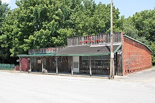
Everton is a town in Boone County, Arkansas, United States. The population was 133 at the 2010 census. It is part of the Harrison Micropolitan Statistical Area.

<span class="mw-page-title-main">Valley Springs, Arkansas</span> Town in Arkansas, United States

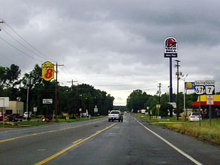
Valley Springs is a town in Boone County, Arkansas, United States. The population was 175 at the 2010 census. It is part of the Harrison Micropolitan Statistical Area.

<span class="mw-page-title-main">Oak Grove, Carroll County, Arkansas</span> Town in Arkansas, United States

Oak Grove is a town in Carroll County, Arkansas, United States. The population was 386 at the 2020 census.

<span class="mw-page-title-main">Caddo Valley, Arkansas</span> Town in Arkansas, United States

Caddo Valley is a town in Clark County, Arkansas, United States. The population was 635 at the 2010 census.

<span class="mw-page-title-main">Gum Springs, Arkansas</span> Town in Arkansas, United States

Gum Springs is a town in Clark County, Arkansas, United States. The population was 120 at the 2010 census, down from 194 in 2000.

<span class="mw-page-title-main">Gurdon, Arkansas</span> City in Arkansas, United States

Gurdon is a city in Clark County, Arkansas, United States. The population was 2,212 at the 2010 census.

<span class="mw-page-title-main">Okolona, Arkansas</span> Town in Arkansas, United States

Okolona is a town near the western edge of Clark County, Arkansas, United States. The population was 147 at the 2010 census.

<span class="mw-page-title-main">Concord, Arkansas</span> Town in Arkansas, United States

Concord is a town in Cleburne County, Arkansas, United States. The population was 244 at the 2010 census.

<span class="mw-page-title-main">Tull, Arkansas</span> Town in Arkansas, United States

Tull is a town in Grant County, Arkansas, United States. The population was 448 at the 2010 census, up from 358 in 2000. It is part of the Central Arkansas region.

<span class="mw-page-title-main">Patmos, Arkansas</span> Town in Arkansas, United States

Patmos is a town in Hempstead County, Arkansas, United States. The population was 64 at the 2010 census. It bears the same name as the Greek island of Patmos, where the Book of Revelation was written.

<span class="mw-page-title-main">Perla, Arkansas</span> Town in Arkansas, United States

Perla is a town in Hot Spring County, Arkansas, United States. The population was 241 at the 2010 census, up from 115 at the 2000 census. The city's water association filed for Chapter 9 Bankruptcy in the Western District of Arkansas Bankruptcy Court on May 26, 2019.

<span class="mw-page-title-main">Moorefield, Arkansas</span> Town in Arkansas, United States

Moorefield is a town in Independence County, Arkansas, United States. It was named after Jesse A. Moore who owned most of the land in the area of the town at that time. The population was 137 at the 2010 census.

<span class="mw-page-title-main">Minturn, Arkansas</span> Town in Arkansas, United States

Minturn is a town in Lawrence County, Arkansas, United States. The population was 109 at the 2010 census.

<span class="mw-page-title-main">Morrison Bluff, Arkansas</span> Town in Arkansas, United States

Morrison Bluff is a town in Logan County, Arkansas, United States. The population was 64 at the 2010 census and an estimated 81 in 2017.

<span class="mw-page-title-main">Hindsville, Arkansas</span> Town in Arkansas, United States

Hindsville is a town in Madison County, Arkansas, United States. The population was 90 at the 2020 census. It is part of the Northwest Arkansas region.

<span class="mw-page-title-main">Birdsong, Arkansas</span> Town in Arkansas, United States

Birdsong is a town in Mississippi County, Arkansas, United States. The population was 32 at the 2020 census, down from 41 in 2010.

<span class="mw-page-title-main">Marie, Arkansas</span> Town in Arkansas, United States

Marie is a town in Mississippi County, Arkansas, United States. It was founded by the R.E.L. Wilson cotton company. The population was 108 at the 2020 census.

<span class="mw-page-title-main">Black Springs, Arkansas</span> Town in Arkansas, United States

Black Springs is a town in Montgomery County, Arkansas, United States. The population was 96 at the 2020 census.

<span class="mw-page-title-main">Norman, Arkansas</span> Town in Arkansas, United States

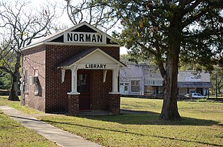
Norman is a town in Montgomery County, Arkansas, United States. It was known as Womble until 1925. The population was 303 at the 2020 census, down from 378 in 2010.

<span class="mw-page-title-main">Rosston, Arkansas</span> Town in Arkansas, United States

Rosston is a town in south-central Nevada County, Arkansas, United States. The population was 265 at the 2000 census. It is part of the Hope Micropolitan Statistical Area.

References

  1. "2020 U.S. Gazetteer Files". United States Census Bureau. Retrieved October 29, 2021.
  2. 1 2 U.S. Geological Survey Geographic Names Information System: Whelen Springs, Arkansas
  3. 1 2 "Geographic Identifiers: 2010 Demographic Profile Data (G001): Whelen Springs town, Arkansas". U.S. Census Bureau, American Factfinder. Archived from the original on February 12, 2020. Retrieved June 16, 2014.
  4. "Census of Population and Housing". Census.gov. Retrieved June 4, 2015.
  5. "U.S. Census website". United States Census Bureau . Retrieved January 31, 2008.
  6. "SCHOOL DISTRICT REFERENCE MAP (2010 CENSUS): Clark County, AR." U.S. Census Bureau. Retrieved on May 26, 2018.