For nearly four decades (1891-1929), the bridge between Yell and Pope Counties at the old military road crossing at Dardanelle was the longest pontoon bridge in the U.S. at over 2,200 feet.
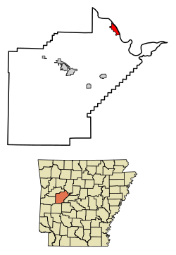
Dardanelle is one of the oldest cities in the state of Arkansas. Officially incorporated in 1855, Dardanelle celebrated its 150th anniversary in 2005. The area had been settled for years before that, though, first being established as a river town in the mid-18th century. It is Yell County's dual county seat, sharing that title with Danville.
The Treaty of Council Oaks[6] was signed on June 24, 1823, on what is now North Front Street beneath two huge oak trees (102 feet high and 400–500 years old). Under orders of President James Monroe, U.S. Army Colonel David Brearley and secretary of Arkansas Territory Robert Crittendon met with Black Fox and several Cherokee leaders to determine boundaries. As a result of the treaty, the Cherokees gave up all of their land in Arkansas south of the Arkansas River. One of the trees was destroyed in the early 1990s in a flood, but the other is still standing. The site is now a city park.[7]
Because of its location on the banks of the Arkansas River, Dardanelle was one of Arkansas's leading towns in the 19th century. Hundreds of barges, steamboats, and other vessels traveled by the town annually. Roughly halfway between the state's two largest cities of Little Rock and Fort Smith, Dardanelle was a transportation and business hub, known as a marketplace for gin, rum, and cotton.[8]
Dardanelle has a history of being one of the state's leading immigration centers that continues to this day. Vast numbers of Czech and German families, including the Ballouns, Vodrazkas, Staneks, and Pfeiffers, came to the town in the late 18th and early 19th centuries, and their impact can still be felt.[9] As of 2010, Dardanelle has one of the highest percentages of Hispanics in the state, with over 36% of the town's population Hispanic (up from 21% in 2000).[10]
Merritt Park opened in the late 1990s on the west side of town. It is a large, state-of-the-art park featuring outstanding baseball facilities, a playground, soccer fields, basketball courts, and a walking/jogging trail. The adjacent Dardanelle Community Center opened around the same time, and provides several services for the community.
In the late 19th century, a pontoon bridge between Dardanelle and Russellville replaced ferry service. Spanning 2,208 feet, it was the longest pontoon bridge ever constructed across a moving body of water. The bridge was completely washed out a few times during its nearly 40 years of existence.[citation needed]
The Dardanelle Lock and Dam, constructed in the 1960s as a part of the McClellan-Kerr Navigation System, led to the formation of Lake Dardanelle. It is a source of hydropower and helps regulate river traffic on the Arkansas River. In 2013, it had an operating budget just over $8.9 million.[11]
During the 2019 Arkansas River floods, a levee just south of Dardanelle near Holla Bend failed and broke at 1:00 am on May 31. Over the next few days, water came perilously close to homes, schools, and businesses in the southern part of Dardanelle, but receded before causing any major damage.[12]
As of the 2020 United States census, 4,517 people, 1,609 households, and 1,066 families resided in the city.
2000 census
As of the 2000 census,[18] 4,228 people, 1,605 households, and 1,078 families lived in the city. The population density was 1,382.0 inhabitants per square mile (533.6/km2). The 1,747 housing units had an average density of 571.0 per square mile (220.5/km2). The racial makeup of the city was 75.24% White, 4.64% African American, 0.54% Native American, 0.43% Asian, 0.09% Pacific Islander, 16.65% from other races, and 2.41% from two or more races. About 21.48% of the population were Hispanics or Latinos of any race.
In the city, the age distribution was 25.4% under 18, 9.9% from 18 to 24, 28.5% from 25 to 44, 19.7% from 45 to 64, and 16.5% who were 65 or older. The median age was 35 years. For every 100 females, there were 92.7 males. For every 100 females 18 and over, there were 86.6 males.
The median income for a household in the city was $25,727 and for a family was $30,457. Males had a median income of $21,138 versus $17,370 for females. The per capita income for the city was $14,583. About 14.9% of families and 19.6% of the population were below the poverty line, including 26.5% of those under age 18 and 14.0% of those age 65 or over.
According to 2010 Census, the population of the area was 4,745 people. From 2000 to 2010, the Dardanelle city population growth percentage was 12.2% (or from 4,228 people to 4,745 people); 28.7% of the Dardanelle city residents were under 18. Racial data for Dardanelle city include 57.9% non-Latino White, 3.6% African American, 0.5% Asian, and 36.1% Hispanic, with 1,346 of 1,745 Latino residents being of Mexican descent.
Also, of the 1,877 housing units in Dardanelle city, 89.5% were occupied housing units, with just over 50% of occupied units being those of homeowners. Of the 1,680 households, 39.7% had children under 18 living with them, 42.4% were married couples living together, 15.8% had a female householder with no husband present, and 33.6% were not families. About 29.2% of all households were made up of individuals, and 27.6% had someone living alone who was 65 or older. The average household size was 2.74 and the average family size was 3.33.[19]
Economy
Some of Dardanelle's larger employers include Tyson Foods, Walmart Supercenter, the Dardanelle Nursing and Rehabilitation Center, Dardanelle School System, Dardanelle City government, and Chambers Bank, which acquired River Town Bank (formerly the Bank of Dardanelle) in 2019.
Dardanelle is home to the Dardanelle Post-Dispatch. Established in 1853, the newspaper claims to be the oldest weekly newspaper in Arkansas.
Arts and culture
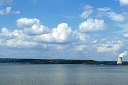
Yell County Courthouse in downtown DardanelleAn oil-on-canvas mural, Cotton Growing, Manufacture, and Export, painted in 1939 by Ludwig Mactarian is on display in the Dardanelle post office.View of Lake Dardanelle, with reactor at Arkansas Nuclear One visible in backgroundArkansas River Valley Regional Library in Dardanelle
Points of interest
A number of attractions can be found in Dardanelle or its surrounding area, including:
The Arkansas River Valley Regional Library system is based in Dardanelle, which consists of one central library, located at 501 North Front Street, and six branch libraries in other communities, which provide area residents with access to print books, publications, and multimedia content.
The Dardanelle and Russellville Railroad (D&R) is one of few remaining short-line railroads in the state. It connects Dardanelle with its larger neighbor on the north bank of the river. Highways 7, 22, 27, and 28 can be found ending or going through Dardanelle. Dardanelle is halfway between the Buffalo River to the north and Hot Springs to the south on Scenic Byway 7.
Bonnie Brown (1938–2016), a member of the country music group the Browns, was born in Sparkman, Arkansas, but spent most of her adult life in Dardanelle.[24][25]
↑Archerd, William. "William Archerd: a serial matrimonialist killer". National Library of Medicine National Center for Biotechnology Information. National Institutes of Health. Retrieved October 29, 2025.
↑Daly, John. "John Patrick Daly (1966-)". CALS Encyclopedia of Arkansas. The Central Arkansas Library System-Encyclopedia of Arkansas. Retrieved October 29, 2025.
↑Jaggers, Orval Lee. "Healing As A Means To An End". Healing and Revival. Healing and Revival Press. Retrieved October 29, 2025.
↑Witt, James Lee. "James Lee Witt (1944–)". CALS-Encyclopedia of Arkansas. Central Arkansas Library System-Encyclopedia of Arkansas. Retrieved October 29, 2025.
This page is based on this Wikipedia article Text is available under the CC BY-SA 4.0 license; additional terms may apply. Images, videos and audio are available under their respective licenses.