Hampton, Arkansas | |
---|---|
Coordinates: 33°32′05″N92°28′00″W / 33.53472°N 92.46667°W | |
Country | United States |
State | Arkansas |
County | Calhoun |
Area | |
• Total | 3.28 sq mi (8.49 km2) |
• Land | 3.28 sq mi (8.49 km2) |
• Water | 0.00 sq mi (0.00 km2) |
Elevation | 187 ft (57 m) |
Population (2020) | |
• Total | 1,181 |
• Density | 360.28/sq mi (139.12/km2) |
Time zone | UTC-6 (Central (CST)) |
• Summer (DST) | UTC-5 (CDT) |
ZIP code | 71744 |
Area code | 870 |
FIPS code | 05-29650 |
GNIS feature ID | 2403789 [2] |
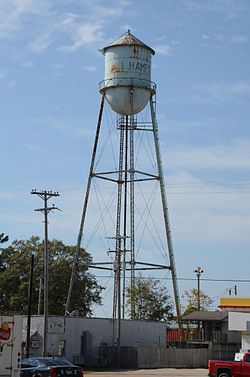
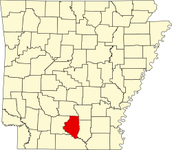
Hampton is a town in Calhoun County, Arkansas, United States. The population was 1,181 according to the 2020 United States Census. [3] The town is the county seat of Calhoun County. [4]
Hampton is part of the Camden Micropolitan Statistical Area.
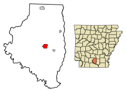
Hampton is located east of the center of Calhoun County. U.S. Routes 278 and 167 intersect in the town. US 278 leads west 23 miles (37 km) to Camden and east 26 miles (42 km) to Warren, while US 167 leads north 21 miles (34 km) to Fordyce and south 27 miles (43 km) to El Dorado.
According to the United States Census Bureau, the town has a total area of 3.0 square miles (7.8 km2), all land. [3]
Census | Pop. | Note | %± |
---|---|---|---|
1860 | 166 | — | |
1870 | 138 | −16.9% | |
1880 | 150 | 8.7% | |
1890 | 406 | 170.7% | |
1910 | 353 | — | |
1920 | 271 | −23.2% | |
1930 | 669 | 146.9% | |
1940 | 686 | 2.5% | |
1950 | 838 | 22.2% | |
1960 | 1,011 | 20.6% | |
1970 | 1,252 | 23.8% | |
1980 | 1,627 | 30.0% | |
1990 | 1,562 | −4.0% | |
2000 | 1,579 | 1.1% | |
2010 | 1,324 | −16.1% | |
2020 | 1,181 | −10.8% | |
U.S. Decennial Census [5] |
Race | Num. | Perc. |
---|---|---|
White (non-Hispanic) | 724 | 61.3% |
Black or African American (non-Hispanic) | 350 | 29.64% |
Asian | 1 | 0.08% |
Pacific Islander | 1 | 0.08% |
Other/Mixed | 59 | 5.0% |
Hispanic or Latino | 46 | 3.9% |
As of the 2020 United States census, there were 1,181 people, 619 households, and 390 families residing in the town.
As of the census [7] of 2000, there were 1,579 people, 619 households, and 402 families residing in the town. The population density was 522.4 inhabitants per square mile (201.7/km2). There were 699 housing units at an average density of 231.2 per square mile (89.3/km2). The racial makeup of the town was 66.18% White, 32.05% Black or African American, 0.06% Native American, 1.08% from other races, and 0.63% from two or more races. 1.39% of the population were Hispanic or Latino of any race.
There were 619 households, out of which 30.5% had children under the age of 18 living with them, 44.3% were married couples living together, 17.6% had a female householder with no husband present, and 34.9% were non-families. 32.8% of all households were made up of individuals, and 13.9% had someone living alone who was 65 years of age or older. The average household size was 2.36 and the average family size was 2.99.
In the town, the population was spread out, with 25.0% under the age of 18, 7.5% from 18 to 24, 25.0% from 25 to 44, 22.5% from 45 to 64, and 19.9% who were 65 years of age or older. The median age was 40 years. For every 100 females, there were 79.2 males. For every 100 females age 18 and over, there were 74.9 males.
The median income for a household in the town was $25,057, and the median income for a family was $29,948. Males had a median income of $29,375 versus $18,583 for females. The per capita income for the town was $15,489. About 19.7% of families and 22.9% of the population were below the poverty line, including 30.3% of those under age 18 and 20.7% of those age 65 or over.
Public education is available via Hampton School District based in Hampton, with students graduating from Hampton High School. The school district encompasses 479.67 square miles (1,242.3 km2) of land including all of Hampton and portions of several Calhoun County communities including Harrell, and Tinsman, and Locust Bayou.
Hampton is centered at the intersection of US routes 278 and 167. Arkansas Highway 274 also runs through Hampton in a U-formation, with the northern portion running concurrently with US 167 northwards while another end continues to the northeast towards Tinsman. Arkansas Highway 203 also starts in central Hampton and runs to the northwest.
A small airstrip is located immediately to the south of Hampton, though it does not hold an air traffic control tower. Air transport to Hampton's closest links are through Harrell Field in northeast Camden for general aviation and South Arkansas Regional Airport in western El Dorado for commercial service. The closest airport with over one million passengers per year is Clinton National Airport in Little Rock, and the closest airport with direct international flights is Memphis International Airport. [8]
Union County is a county located on the central southern border of the U.S. state of Arkansas. As of the 2020 census, the population was 39,054. The county seat is El Dorado. The county was formed on November 2, 1829, and named in recognition of the citizens' petition for a new county, which said that they were petitioning "in the spirit of Union and Unity." The county is directly adjacent to the south to Union Parish in the state of Louisiana.
Ouachita County is a county located in the south central part of the U.S. state of Arkansas. As of the 2020 census, the population was 22,650.
Dallas County is a county located in the U.S. state of Arkansas. As of the 2020 census, the population was 6,482, making it the fourth-least populous county in Arkansas. The county seat is Fordyce. Dallas County is Arkansas's 49th county, formed on January 1, 1845; it was named for George M. Dallas, 11th Vice President of the United States.
Cleveland County is a county located in the U.S. state of Arkansas. Its population was 7,550 at the 2020 U.S. census. The county seat and largest city is Rison.
Calhoun County is a county located in the south central part of the U.S. state of Arkansas. As of the 2020 census, the population was 4,739, making it the least populous county in Arkansas. The county seat is Hampton. Calhoun County is Arkansas's 55th county, formed on December 6, 1850, and named for John C. Calhoun, a Vice President of the United States.
Banks is a town in Bradley County, Arkansas, United States. As of the 2010 census the population was 124.
Harrell is a town in Calhoun County, Arkansas, United States. The population was 254 at the 2010 census. It is part of the Camden Micropolitan Statistical Area.
Thornton is a city in Calhoun County, Arkansas, United States. The population was 407 as of the 2010 census, down from 517 in 2000. It is part of the Camden, Arkansas micropolitan area.
Tinsman is a town in Calhoun County, Arkansas, United States. The population was 54 at the 2010 census. It is part of the Camden Micropolitan Statistical Area.
Lockesburg is a city in Sevier County, Arkansas, United States. The population was 739 at the 2010 census.
Elizabeth is a Statutory Town that is the most populous municipality in Elbert County, Colorado, United States. The town population was 1,675 at the 2020 United States Census, a +23.34% increase since the 2010 United States Census. Elizabeth is a part of the Denver–Aurora–Lakewood, CO Metropolitan Statistical Area and the Front Range Urban Corridor.
Liverpool is a village in Fulton County, Illinois, United States. The population was 94 at the 2010 census.
St. Anne is a village in Kankakee County, Illinois, United States. The population was 1,161 at the 2020 census. It is part of the Kankakee–Bourbonnais–Bradley Metropolitan Statistical Area. It was founded in 1851 by Charles Chiniquy, a French-Canadian Catholic priest and friend of the 16th U.S. President Abraham Lincoln who was excommunicated by the Catholic Church in 1856. He later converted to Protestant Christianity, becoming a Presbyterian Evangelical minister and a well-known temperance activist in Canada and the United States.
North Hampton is a town in Rockingham County, New Hampshire, United States. The population was 4,538 at the 2020 census. While the majority of the town is inland, North Hampton includes a part of New Hampshire's limited Atlantic seacoast.
Northwest Harbor is a hamlet and census-designated place (CDP) in the Town of East Hampton, Suffolk County, New York, United States. The population was 3,317 at the 2010 census.
Tioga is a city in Williams County, North Dakota, United States. The population was 2,202 at the 2020 census.
West Siloam Springs is a town in Delaware County, Oklahoma, United States. The population was 1,000 at the 2020 census, an 18.2 percent increase from the figure of 846 recorded in 2010. A bedroom community for Siloam Springs, Arkansas, it is notable for its Cherokee casino, and is the closest town to Natural Falls State Park.
Stratford is a town and county seat of Sherman County, Texas, United States. The population was 2,017 at the 2010 census, up from 1,991 in 2000.
Cato is a town in Manitowoc County, Wisconsin, United States. The population was 1,616 at the 2000 census. A Manitowoc County park is located in the town which is called "Cato Falls" for a waterfall on the Manitowoc River.
The Camden Micropolitan Statistical Area, as defined by the United States Census Bureau, is an area consisting of two counties in the U.S. state of Arkansas, anchored by the city of Camden.