Lake City, Arkansas

Last updated
Lake City, Arkansas
Lake City AR 011.jpg
Craighead County Courthouse, Eastern District in Lake City
Craighead County Arkansas Incorporated and Unincorporated areas Lake City Highlighted 0537780.svg
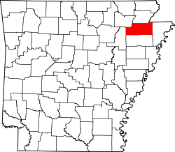
Location of Lake City in Craighead County, Arkansas.
Coordinates: 35°49′4″N90°26′24″W / 35.81778°N 90.44000°W / 35.81778; -90.44000
Country Flag of the United States.svg  United States
State Flag of Arkansas.svg  Arkansas
County Flag of Craighead County, Arkansas.svg Craighead
Government
  MayorCameron Tate
Area
[1]
  Total3.18 sq mi (8.24 km2)
  Land3.15 sq mi (8.17 km2)
  Water0.03 sq mi (0.08 km2)
Elevation
226 ft (69 m)
Population
 (2020)
  Total2,326
  Density737.71/sq mi (284.83/km2)
Time zone UTC−06:00 (Central (CST))
  Summer (DST) UTC−05:00 (CDT)
ZIP Code
72437
Area code 870
FIPS code 05-37780
GNIS feature ID0077429
Website http://lakecityar.com/

Lake City is a city [2] in Craighead County, Arkansas, United States, along the St. Francis River. Lake City is one of two county seats in Craighead County. The population was 2,326 as of the 2020 census. [3] It is included in the Jonesboro, Arkansas Metropolitan Statistical Area.

Contents

Geography

Lake City is located in eastern Craighead County at 35°49′4″N90°26′24″W / 35.81778°N 90.44000°W / 35.81778; -90.44000 (35.817866, -90.439927), [4] along the west bank of the St. Francis River. It is 16 miles (26 km) east of downtown Jonesboro.

According to the United States Census Bureau, the town has a total area of 3.1 square miles (7.9 km2), of which 3.0 square miles (7.8 km2) is land and 0.04 square miles (0.1 km2), or 1.35%, is water. [3]

List of highways

Notable facts and former residents

The St. Francis River Bridge in Lake City is listed on the National Register of Historic Places. St. Francis River Bridge, Lake City.jpg
The St. Francis River Bridge in Lake City is listed on the National Register of Historic Places.

The St. Francis River Bridge located in Lake City is the only lift bridge in the world that has been raised only once since its construction.[ citation needed ] To construct a four-lane highway, a new bridge was constructed in 2002 and the lift bridge was moved to a location just south of the new bridge where it remains as a landmark.

Bart Barber, 64th President of the Southern Baptist Convention, was born and raised in Lake City. [5]

Demographics

Historical population
CensusPop.Note
1900 434
1910 4483.2%
1920 63541.7%
1930 76019.7%
1940 7863.4%
1950 783−0.4%
1960 8508.6%
1970 94811.5%
1980 1,84294.3%
1990 1,833−0.5%
2000 1,9566.7%
2010 2,0826.4%
2020 2,32611.7%
U.S. Decennial Census [6]

2020 census

Lake City racial composition [7]
RaceNumberPercentage
White (non-Hispanic)2,11290.8%
Black or African American (non-Hispanic)421.81%
Native American 130.56%
Asian 50.21%
Pacific Islander 10.04%
Other/Mixed 923.96%
Hispanic or Latino 612.62%

As of the 2020 United States census, there were 2,326 people, 936 households, and 651 families residing in the city.

2000 census

As of the census [8] of 2000, there were 1,956 people, 731 households, and 546 families residing in the town. The population density was 881.9 inhabitants per square mile (340.5/km2). There were 776 housing units at an average density of 349.9 per square mile (135.1/km2). The racial makeup of the town was 98.67% White, 0.05% Black or African American, 0.36% Native American, 0.05% Asian, 0.26% from other races, and 0.61% from two or more races. 1.02% of the population were Hispanic or Latino of any race.

There were 731 households, out of which 37.3% had children under the age of 18 living with them, 55.8% were married couples living together, 15.2% had a female householder with no husband present, and 25.3% were non-families. 23.0% of all households were made up of individuals, and 12.3% had someone living alone who was 65 years of age or older. The average household size was 2.57 and the average family size was 3.00.

In the town, the population was spread out, with 27.0% under the age of 18, 8.4% from 18 to 24, 27.8% from 25 to 44, 20.7% from 45 to 64, and 16.1% who were 65 years of age or older. The median age was 35 years. For every 100 females, there were 94.4 males. For every 100 females age 18 and over, there were 84.4 males.

The median income for a household in the town was $30,844, and the median income for a family was $33,477. Males had a median income of $27,798 versus $19,205 for females. The per capita income for the town was $14,126. About 11.4% of families and 14.6% of the population were below the poverty line, including 21.1% of those under age 18 and 9.1% of those age 65 or over.


Education

Lake City is part of the Riverside School District, formed as a result of consolidation with the Lake City School District with that of nearby Caraway on July 1, 1985. [9] The Riverside High School mascot and athletic teams are known as "the Rebels". There are two elementary schools associated with the school: one is located in Lake City and the other in Caraway.

Related Research Articles

<span class="mw-page-title-main">Clay County, Arkansas</span> County in Arkansas, United States

Clay County is a county located in the U.S. state of Arkansas. Originally incorporated as Clayton County, as of the 2020 census, its population was 14,552. The county has two county seats, Corning and Piggott. It is a dry county, in which the sale of alcoholic beverages is restricted or prohibited.

<span class="mw-page-title-main">Poinsett County, Arkansas</span> County in Arkansas, United States

Poinsett County is a county located in the U.S. state of Arkansas. As of the 2020 census, the population was 22,965. The county seat is Harrisburg. Poinsett County is included in the Jonesboro–Paragould Combined Statistical Area.

<span class="mw-page-title-main">Mississippi County, Arkansas</span> County in Arkansas, United States

Mississippi County is the easternmost county in the U.S. state of Arkansas. As of the 2020 census, the population was 40,685. There are two county seats, Blytheville and Osceola. The county was formed on November 1, 1833, and named for the Mississippi River which borders the county to the east. Mississippi County is part of the First Congressional District in Arkansas.

<span class="mw-page-title-main">Jackson County, Arkansas</span> County in Arkansas, United States

Jackson County is located in the Arkansas Delta in the U.S. state of Arkansas. The county is named for Andrew Jackson, a national hero during the War of 1812. By the county's formation in 1829, Jackson had become the seventh President of the United States. Jackson County is home to seven incorporated towns and four incorporated cities, including Newport, the largest city and county seat. The county is also the site of numerous unincorporated communities and ghost towns. Occupying 633.94 square miles (164,190 ha), Jackson County is the 41st largest county of the 75 in Arkansas. As of the 2020 Census, the county's population was 16,755. Based on population, the county is the 44th-largest county in Arkansas. Although terrain rises in the west, most of Jackson County is within the Arkansas Delta, characterized by largely flat terrain with fertile soils. Historically covered in forest, bayous and swamps, the area was cleared for agriculture by early settlers. It is drained by the White River.

<span class="mw-page-title-main">Greene County, Arkansas</span> County in Arkansas, United States

Greene County is a county located in the U.S. state of Arkansas. As of the 2020 census, the population was 45,736. The county seat is Paragould, which sits atop Crowley's Ridge.

<span class="mw-page-title-main">Grant County, Arkansas</span> County in Arkansas, United States

Grant County is a county in the U.S. state of Arkansas. Its population was 17,958 at the 2020 United States Census. The county seat is Sheridan.

<span class="mw-page-title-main">Craighead County, Arkansas</span> County in Arkansas, United States

Craighead County is a county located in the U.S. state of Arkansas. As of the 2020 census, the population was 111,231. The county has two county seats — Jonesboro and Lake City. Craighead County is Arkansas's 58th county, formed on February 19, 1859, and named for state Senator Thomas Craighead. It is one of several dry counties within the state of Arkansas, in which the sale of alcoholic beverages is largely prohibited.

<span class="mw-page-title-main">Heber Springs, Arkansas</span> City in Arkansas, United States

Heber Springs is a city in and the county seat of Cleburne County, Arkansas, United States. The population was 7,165 at the 2010 census.

<span class="mw-page-title-main">Black Oak, Arkansas</span> Town in Arkansas, United States

Black Oak is a town in Craighead County, Arkansas, United States. The population was 262 at the 2010 census. It is included in the Jonesboro, Arkansas Metropolitan Statistical Area. Black Oak is the namesake of 1970s rock band Black Oak Arkansas and the setting of John Grisham's novel A Painted House.

<span class="mw-page-title-main">Bono, Arkansas</span> Bono in Arkansas, United States

Bono is a city in Craighead County, Arkansas, United States. The population was 2,131 at the 2010 census, up from 1,512 in 2000. It is included in the Jonesboro, Arkansas Metropolitan Statistical Area. Bono's most prominent landmarks are the Bono Bridge and the Bono Cemetery.

<span class="mw-page-title-main">Brookland, Arkansas</span> City in Arkansas, United States

Brookland is a city in Craighead County, Arkansas, United States. The population was 1,642 at the 2010 census. It is included in the Jonesboro, Arkansas Metropolitan Statistical Area.

<span class="mw-page-title-main">Caraway, Arkansas</span> City in Arkansas, United States

Caraway is a city in Craighead County, Arkansas, United States. The population was 1,279 at the 2010 census. It is included in the Jonesboro, Arkansas Metropolitan Statistical Area.

<span class="mw-page-title-main">Cash, Arkansas</span> City in Arkansas, United States

Cash is a city in western Craighead County, Arkansas, United States. The population was 342 at the 2010 census. Cash Arkansas population was of mostly white with 99.8% and partial Puerto Rican ethnicity. It is included in the Jonesboro, Arkansas Metropolitan Statistical Area.

<span class="mw-page-title-main">Egypt, Arkansas</span> Town in Arkansas, United States

Egypt is a town in Craighead County, Arkansas, United States. The population was 112 at the 2010 census. It is included in the Jonesboro, Arkansas Metropolitan Statistical Area.

<span class="mw-page-title-main">Jonesboro, Arkansas</span> City in Northeast Arkansas

Jonesboro is a city located on Crowley's Ridge in the northeastern corner of the U.S. State of Arkansas. Jonesboro is one of two county seats of Craighead County. In 2023, the city had a population of 81,969 and was the fifth-largest city in Arkansas at the time. In 2023, the Jonesboro metropolitan area had a population of 135,287 and a population of 179,932 in the Jonesboro-Paragould Combined Statistical Area.

<span class="mw-page-title-main">Monette, Arkansas</span> City in Arkansas, United States

Monette is a city in Craighead County, Arkansas, United States. The population was 1,506 at the 2020 census.

<span class="mw-page-title-main">Paragould, Arkansas</span> City in Arkansas, United States

Paragould is the county seat of Greene County, and the 19th-largest city in Arkansas, in the United States. The city is located in northeastern Arkansas on the eastern edge of Crowley's Ridge, a geologic anomaly contained within the Arkansas delta.

<span class="mw-page-title-main">Dell, Arkansas</span> Town in Arkansas, United States

Dell is a town in Mississippi County, Arkansas, United States. The population was 194 at the 2020 census.

<span class="mw-page-title-main">Jonesboro metropolitan area</span>

The Jonesboro Metropolitan Statistical Area, as defined by the United States Census Bureau, is an area consisting of two counties – Craighead and Poinsett – in northeast Arkansas, anchored by the city of Jonesboro. As of the 2010 census, the MSA had a population of 121,026. It is also part of the larger Jonesboro-Paragould Combined Statistical Area.

<span class="mw-page-title-main">Jonesboro–Paragould combined statistical area</span> Statistical Area

The Jonesboro–Paragould Combined Statistical Area is made up of three counties in northeastern Arkansas. The CSA consists of the Jonesboro Metropolitan Statistical Area and the Paragould Micropolitan Statistical Area. As of the 2010 census, the CSA had a population of 163,116.

References

  1. "2020 U.S. Gazetteer Files". United States Census Bureau. Retrieved October 29, 2021.
  2. Local.Arkansas.gov - Lake City , retrieved September 3, 2012
  3. 1 2 "Geographic Identifiers: 2010 Demographic Profile Data (G001): Lake City city, Arkansas". U.S. Census Bureau, American Factfinder. Archived from the original on February 12, 2020. Retrieved June 18, 2014.
  4. "US Gazetteer files: 2010, 2000, and 1990". United States Census Bureau. 2011-02-12. Retrieved 2011-04-23.
  5. "Bart Barber Archives".
  6. "Census of Population and Housing". Census.gov. Retrieved June 4, 2015.
  7. "Explore Census Data". data.census.gov. Retrieved 2021-12-30.
  8. "U.S. Census website". United States Census Bureau . Retrieved 2008-01-31.
  9. "ConsolidationAnnex_from_1983.xls Archived 2015-09-12 at the Wayback Machine ." Arkansas Department of Education. Retrieved on October 13, 2017.