Texarkana, Arkansas

Last updated

Texarkana, Arkansas
Texarkana April 2016 115 (State Line Avenue).jpg
Texarkana April 2016 077 (Augustus M. Garrison House).jpg
Texarkana April 2016 054 (Texarkana Arkansas City Hall).jpg
Texarkana State Line Sign.jpg
From top, left to right: Downtown, Augustus M. Garrison House, Texarkana City Hall, Texarkana state line
City seal of Texarkana, AR.png
Nickname(s): 
The Arkansas Side, TXK
Motto: 
"Twice as Nice"
Miller County Arkansas Incorporated and Unincorporated areas Texarkana Highlighted 0568810.svg
Location in Miller County, Arkansas
USA Arkansas relief location map.svg
Red pog.svg
Texarkana
Location within Arkansas
Usa edcp relief location map.png
Red pog.svg
Texarkana
Location within the United States
North America laea relief location map with borders.jpg
Red pog.svg
Texarkana
Texarkana (North America)
Coordinates: 33°25′59″N94°1′14″W / 33.43306°N 94.02056°W / 33.43306; -94.02056
Country United States
State Arkansas
County Miller
IncorporatedAugust 10, 1880
Government
  Type Council-Manager
   Mayor Allen L. Brown
   Board of Directors
Directors
  • Terry Roberts
  • Laney J. Harris
  • Steven Hollibush
  • Ulysses Brewer
  • Danny Jewell
  • Jeff Hart
   City Manager Robert Thompson
Area
[1]
  Total42.21 sq mi (109.31 km2)
  Land41.98 sq mi (108.72 km2)
  Water0.23 sq mi (0.59 km2)
Elevation
361 ft (110 m)
Population
 (2020) [2]
  Total29,387
  Density700.06/sq mi (270.30/km2)
Time zone UTC−6 (Central (CST))
  Summer (DST) UTC−5 (CDT)
ZIP code
71854
Area code 870
FIPS code 05-68810
GNIS feature ID0078542
Website cityoftexarkanaar.com

Texarkana is a city in the U.S. state of Arkansas and the county seat of Miller County, on the southwest border of the state. As of the 2020 census, it had a population of 29,387. [2] It is the twin city of Texarkana, Texas, located just across the state line. The city was founded at a railroad intersection on December 8, 1873, and was incorporated in Arkansas on August 10, 1880. Texarkana and its Texas counterpart are the principal cities of the Texarkana metropolitan area, which in 2021 was ranked 289th in the United States with a population of 147,174, according to the United States Census Bureau.

Contents

Within the Ark-La-Tex subregion of southwest Arkansas, Texarkana is located in the Piney Woods, an oak–hickory forest that dominates the flat Gulf Coastal Plain. Texarkana's economy is based on agriculture. The city has long been a trading center, first located at the intersection of major railroads serving Texas, Arkansas and north into Missouri. Since then three major Interstate highways constructed crossroads here: Interstate 30 (I-30), I-49, and the future I-69. Outdoor tourism, such as fishing at Lake Millwood and related activities, is important economically in the region. The Red River Army Depot & Tenants comprise the largest single employer in the city.

The Texarkana Arkansas School District is the largest public school district on the Arkansas side. The city has a branch campus of the University of Arkansas Community College at Hope (UACCH). On the Texas side is located Texarkana College.

History

View of Texarkana, 1932 Arkansas - Texarkana - NARA - 23934063 (cropped).jpg
View of Texarkana, 1932

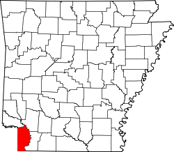
Miller County was formed in 1820 in the Arkansas Territory; it was named in honor of James Miller, Arkansas' first territorial governor and a general during the War of 1812. Much of its eastern border is formed by the Red River. At the time, there was considerable uncertainty among Americans as to the location of the boundary between the county (and the United States) and national territory of Mexico, which then included Texas.

Consequently, settlers believed that Arkansas levied and collected taxes on land that eventually might be held by Mexico. Moreover, many who resented what they considered Mexican oppression of European-American Texans were openly declaring allegiance to the Texans.

After the Texas Republic gained independence from Mexico, regional unrest increased. In 1838, Governor James Conway proposed that the "easiest and most effective remedy is the abolition of Miller County to an area which is more patriotic." Miller County was dissolved and its land was made part of Lafayette County, Arkansas.

In 1873 town lots were sold in Texarkana, Arkansas, at the intersection of two railroads, which stimulated its growth as a trading center. In this area and time period, railroads had replaced rivers as the preferred method of transportation and shipping, and new towns were sited for best advantage via the railroad. The next year (1874), Texarkana, Texas, was founded on the rail line on June 12 across the state border.

That same year, the Arkansas legislature re-established Miller County. [3] Efforts of the young town in Arkansas to be incorporated were not realized until October 17, 1880, nearly seven years after Texarkana, Texas, was formed. Both Texarkana cities generally recognize December 8, 1873, as the date of organization. [3]

On February 11, 1922, masked men lynched Mr. Norman, an African-American man, in Texarkana, Miller County, Arkansas. Lynchings were perpetrated by white men primarily against black males, although some black women were also lynched in the South.

Geography

Municipal Auditorium is located in the City Hall complex. Texarkana Municipal Auditorium IMG 67413.jpg
Municipal Auditorium is located in the City Hall complex.
The Texarkana Fire Department adjoins the Municipal Auditorium. Texarkana, AR, Fire Dept. IMG 6412.jpg
The Texarkana Fire Department adjoins the Municipal Auditorium.
Highland Church of Christ at 1705 Highland Street Highland Church of Christ, Texarkana, AR IMG 6357.jpg
Highland Church of Christ at 1705 Highland Street

Texarkana, Arkansas, is located at 33°25′59″N94°1′14″W / 33.43306°N 94.02056°W / 33.43306; -94.02056 (33.433075, -94.020514). [4] It is 143 miles (230 km) southwest of Little Rock, 72 miles (116 km) north of Shreveport, Louisiana, and 180 miles (290 km) northeast of Dallas, Texas. According to the United States Census Bureau, Texarkana has a total area of 42.2 square miles (109 km2), of which 42.0 square miles (109 km2) are land and 0.2 square miles (0.5 km2), or 0.54%, are water. [1] The city is mainly drained by Nix Creek, a southwest-flowing tributary of Days Creek, part of the Sulphur River watershed leading to the Red River.

Climate

The climate in this area is characterized by hot, humid summers and generally mild to cool winters. According to the Köppen Climate Classification system, Texarkana has a humid subtropical climate, abbreviated "Cfa" on climate maps. [5]

Climate data for Texarkana, Arkansas (Webb Field), 1991–2020 normals, extremes 1892–present
MonthJanFebMarAprMayJunJulAugSepOctNovDecYear
Record high °F (°C)85
(29)
90
(32)
94
(34)
95
(35)
100
(38)
108
(42)
110
(43)
117
(47)
108
(42)
104
(40)
89
(32)
84
(29)
117
(47)
Mean maximum °F (°C)73.8
(23.2)
76.2
(24.6)
83.0
(28.3)
86.4
(30.2)
91.3
(32.9)
95.9
(35.5)
100.1
(37.8)
100.7
(38.2)
96.7
(35.9)
90.1
(32.3)
80.1
(26.7)
74.8
(23.8)
102.4
(39.1)
Mean daily maximum °F (°C)54.0
(12.2)
58.2
(14.6)
66.7
(19.3)
74.5
(23.6)
81.6
(27.6)
88.7
(31.5)
92.7
(33.7)
92.8
(33.8)
86.4
(30.2)
76.0
(24.4)
64.3
(17.9)
55.7
(13.2)
74.3
(23.5)
Daily mean °F (°C)44.6
(7.0)
48.3
(9.1)
56.0
(13.3)
63.6
(17.6)
71.6
(22.0)
78.9
(26.1)
82.5
(28.1)
82.0
(27.8)
75.4
(24.1)
64.9
(18.3)
53.9
(12.2)
46.4
(8.0)
64.0
(17.8)
Mean daily minimum °F (°C)35.1
(1.7)
38.4
(3.6)
45.2
(7.3)
52.7
(11.5)
61.6
(16.4)
69.1
(20.6)
72.3
(22.4)
71.3
(21.8)
64.5
(18.1)
53.7
(12.1)
43.6
(6.4)
37.2
(2.9)
53.7
(12.1)
Mean minimum °F (°C)19.0
(−7.2)
24.6
(−4.1)
29.7
(−1.3)
37.2
(2.9)
48.2
(9.0)
60.4
(15.8)
65.4
(18.6)
64.5
(18.1)
52.0
(11.1)
38.5
(3.6)
28.0
(−2.2)
22.9
(−5.1)
16.8
(−8.4)
Record low °F (°C)−7
(−22)
−9
(−23)
11
(−12)
24
(−4)
35
(2)
50
(10)
56
(13)
51
(11)
37
(3)
21
(−6)
15
(−9)
−1
(−18)
−9
(−23)
Average precipitation inches (mm)3.64
(92)
4.28
(109)
4.45
(113)
4.43
(113)
5.10
(130)
3.92
(100)
3.37
(86)
2.98
(76)
3.60
(91)
4.51
(115)
3.91
(99)
4.68
(119)
48.87
(1,241)
Average snowfall inches (cm)1.6
(4.1)
0.2
(0.51)
0.0
(0.0)
0.0
(0.0)
0.0
(0.0)
0.0
(0.0)
0.0
(0.0)
0.0
(0.0)
0.0
(0.0)
0.0
(0.0)
0.0
(0.0)
0.9
(2.3)
2.7
(6.91)
Average precipitation days (≥ 0.01 in)8.29.610.48.99.88.26.76.46.37.28.79.399.7
Average snowy days (≥ 0.1 in)0.60.30.00.00.00.00.00.00.00.00.00.31.2
Source: NOAA (snow/snow days 19812010) [6] [7] [8]

Demographics

Historical population
CensusPop.Note
1880 1,390
1890 3,528153.8%
1900 4,91439.3%
1910 5,65515.1%
1920 8,25746.0%
1930 10,76430.4%
1940 11,8219.8%
1950 15,87534.3%
1960 19,78824.6%
1970 21,6829.6%
1980 21,459−1.0%
1990 22,6315.5%
2000 26,44816.9%
2010 29,91913.1%
2020 29,387−1.8%
U.S. Decennial Census [9]

2020 census

Texarkana racial composition [10]
RaceNumberPercentage
White (non-Hispanic)16,11354.83%
Black or African American (non-Hispanic)10,34735.21%
Native American 1580.54%
Asian 1750.6%
Pacific Islander 20.01%
Other/Mixed 1,3484.59%
Hispanic or Latino 1,2444.23%

As of the 2020 United States census, there were 29,387 people, 11,404 households, and 7,348 families residing in the city.

2016

As of the census [11] of 2016, there were 30,283 people, 13,565 households, and 7,040 families residing in the city. The population density was 830.5 inhabitants per square mile (320.7/km2). There were 11,721 housing units at an average density of 368.1 per square mile (142.1/km2). The racial makeup of the city was 65.93% White, 31.00% Black or African American, 0.48% Native American, 0.50% Asian, 0.03% Pacific Islander, 0.61% from other races, and 1.46% from two or more races. Hispanic or Latino of any race were 1.78% of the population.

There were 13,565 households, out of which 32.5% had children under the age of 18 living with them, 45.3% were married couples living together, 18.7% had a female householder with no husband present, and 32.2% were non-families. 28.3% of all households were made up of individuals, and 11.6% had someone living alone who was 65 years of age or older. The average household size was 2.45 and the average family size was 2.99.

In the city, the population was spread out, with 25.9% under the age of 18, 10.1% from 18 to 24, 28.5% from 25 to 44, 21.5% from 45 to 64, and 14.0% who were 65 years of age or older. The median age was 35 years. For every 100 females, there were 92.0 males. For every 100 females age 18 and over, there were 87.0 males.

The median income for a household in the city was $31,343, and the median income for a family was $38,292 . Males had a median income of $35,204 versus $21,731 for females. The per capita income for the city was $17,130. About 17.2% of families and 21.7% of the population were below the poverty line, including 33.0% of those under age 18 and 15.7% of those age 65 or above.

Government and infrastructure

The Arkansas Department of Correction operates the Texarkana Regional Correction Center in Texarkana. [12]

Arkansas residents whose permanent residence is within the city limits of Texarkana, Arkansas, are exempt from Arkansas individual income taxes. [13]

The Federal Courthouse (which holds the city's only post office) is located directly on the Arkansas-Texas state line. It is the only federal office building to straddle a state line.

According to the city's 2018 Comprehensive Annual Financial Report,[5] the top employers in the area are:

  1. Red River Army Depot & Tenants 4,135,
  2. Christus St. Michael Health Care 1,800,
  3. Cooper Tire & Rubber Company 1,750,
  4. AECOM/URS 1,300,
  5. Southern Refrigerated Transport 1,235,
  6. Wal-Mart 1,200,
  7. Texarkana TX Independent School District 1,150,
  8. Domtar, Inc. 900,
  9. Graphic Packaging 800,
  10. Wadley Regional Medical Center 755,
  11. Texarkana Arkansas School District 785,

Transportation

Education

Public education for elementary and secondary school students is provided by two school districts:

Private education opportunities include:

In 2012, a branch of the University of Arkansas Community College at Hope was established at Texarkana. It is known as University of Arkansas Hope-Texarkana (UAHT). In 2015 UAHT began partnering with the University of Arkansas Little Rock, to offer bachelor's degree programs through UALR Texarkana, with classes held on the UAHT Texarkana campus. [16]

Pop culture

Notable people


Related Research Articles

<span class="mw-page-title-main">Hope, Arkansas</span> City in Arkansas, United States

Hope is a city in Hempstead County in southwestern Arkansas, United States. Hope is the county seat of Hempstead County and the principal city of the Hope Micropolitan Statistical Area, which includes all of Hempstead and Nevada counties. As of the 2010 census the population was 10,095, and in 2019 the population was estimated at 9,599.

<span class="mw-page-title-main">Miller County, Arkansas</span> County in Arkansas, United States

Miller County is a county located in the southwestern corner of the U.S. state of Arkansas. As of the 2020 census, the population was 42,600. The county seat is Texarkana.

<span class="mw-page-title-main">Little River County, Arkansas</span> County in Arkansas, United States

Little River County is a county located on the southwest border of the U.S. state of Arkansas, bordering a corner with Texas and Oklahoma. As of the 2020 census, the population was 12,026. The county seat is Ashdown.

<span class="mw-page-title-main">Cleveland County, Arkansas</span> County in Arkansas, United States

Cleveland County is a county located in the U.S. state of Arkansas. Its population was 7,550 at the 2020 U.S. census. The county seat and largest city is Rison.

<span class="mw-page-title-main">Stuttgart, Arkansas</span> City in Arkansas

Stuttgart is a city in and the county seat of the northern district of Arkansas County, Arkansas, United States. Established by German settlers, it was named for its larger German counterpart. Known as the "Rice and Duck Capital of the World", the city is an international destination for waterfowl hunting along the Mississippi Flyway. Stuttgart is the most important city on the Arkansas Grand Prairie, a region known for rice cultivation. The economy is largely based on agricultural production, waterfowl tourism, and supporting industries. As of the 2010 census it had a population of 9,326.

<span class="mw-page-title-main">Arkadelphia, Arkansas</span> City in Arkansas, United States

Arkadelphia is a city in Clark County, Arkansas, United States. As of the 2020 census, the population was 10,380. The city is the county seat of Clark County. It is situated at the foothills of the Ouachita Mountains. Two universities, Henderson State University and Ouachita Baptist University, are located here. Arkadelphia was incorporated in 1857.

<span class="mw-page-title-main">Rison, Arkansas</span> City in Arkansas, United States

Rison, officially the City of Rison, is a city in and the county seat of Cleveland County, Arkansas, United States. Its population was 1,344 at the 2010 U.S. census. It is included in the Pine Bluff, Arkansas Metropolitan Statistical Area. Rison is a bedroom community for people who work in Pine Bluff. The largest employers are the city and county governments, the Cleveland County School District, the Cleveland County Nursing Home. There are two banks, eight churches, and about forty-five businesses within the city limits. Among the local properties listed on the National Register of Historic Places are the Rison Cities Service Station and the Rison Texaco Service Station.

<span class="mw-page-title-main">Malvern, Arkansas</span> City in Arkansas, United States

Malvern is a city in and the county seat of Hot Spring County, Arkansas, United States. Founded as a railroad stop at the eastern edge of the Ouachita Mountains, the community's history and economy have been tied to available agricultural and mineral resources. The production of bricks from locally available clay has earned the city the nickname, "The Brick Capital of the World". The city had a population of 10,318 at the time of the 2010 census, and in 2019 the estimated population was 10,931.

<span class="mw-page-title-main">Fouke, Arkansas</span> City in Arkansas, United States

Fouke is a city in Miller County, Arkansas, United States. It is part of the Texarkana, Texas - Texarkana, Arkansas Metropolitan Statistical Area. The population was 808 at the 2020 census.

<span class="mw-page-title-main">Prescott, Arkansas</span> City and county seat in Nevada County, Arkansas, US

Prescott is a city and the county seat of Nevada County, Arkansas, United States. The community had a population of 3,296 at the 2010 census. Prescott is part of the Hope Micropolitan Statistical Area.

<span class="mw-page-title-main">Jacksonville, Arkansas</span> City in Arkansas, United States

Jacksonville is a city in Pulaski County, Arkansas, United States, and a suburb of Little Rock. As of the 2010 census, the population of the city was 28,364. It is part of the Little Rock–North Little Rock–Conway Metropolitan Statistical Area with 729,135 people as of 2014.

<span class="mw-page-title-main">Lockesburg, Arkansas</span> City in Arkansas, United States

Lockesburg is a city in Sevier County, Arkansas, United States. The population was 739 at the 2010 census.

<span class="mw-page-title-main">Idabel, Oklahoma</span> City in Oklahoma, United States

Idabel is a city in and the county seat of McCurtain County, Oklahoma, United States. The population was 7,010 at the 2010 census. It is in Oklahoma's southeast corner, a tourist area known as Choctaw Country.

<span class="mw-page-title-main">Pleasanton, Texas</span> City in Texas, United States

Pleasanton is a city in Atascosa County, Texas, United States. The population was 8,934 at the 2010 census. Pleasanton's official motto is "The City of Live Oaks and Friendly Folks." It is part of the San Antonio-New Braunfels Metropolitan Statistical Area.

<span class="mw-page-title-main">New Boston, Texas</span> City in Texas, United States

New Boston is a city in Bowie County, Texas, United States. Boston was named for an early storekeeper in the settlement, W.J. Boston. The coming of the railroads led to the location of two more Bostons. A depot was built approximately four miles north of Boston and was named New Boston. The original Boston then became Old Boston. The courthouse was moved to Texarkana in the early 1880s, but a later election carried to move the courthouse back to the geographic center of the county. This location was between the Bostons. The Post Office Department named this location Boston, so Bowie County has claim to three Bostons: New Boston, Boston, and Old Boston. The population was 4,550 at the 2010 census, and 4,612 in 2020.

<span class="mw-page-title-main">Texarkana, Texas</span> City in Bowie County, Texas, United States

Texarkana is a city in Bowie County, Texas, United States, in the Ark-La-Tex region. Located approximately 180 miles (290 km) from Dallas, Texarkana is a twin city with neighboring Texarkana, Arkansas. The Texas city's population was 36,193 at the 2020 census.

<span class="mw-page-title-main">Atlanta, Texas</span> City in Texas, United States

Atlanta is a city in Cass County, northeastern Texas, United States. According to the 2010 U.S. census, the city had a population of 5,675, which decreased to 5,433 as of 2020.

<span class="mw-page-title-main">Sulphur Springs, Texas</span> City in Texas, United States

Sulphur Springs is a city in and the county seat of Hopkins County, Texas, United States. As of the 2020 census, its population was 15,941. Sulphur Springs is located along the western edge of Northeast Texas.

<span class="mw-page-title-main">Longview, Texas</span> City in Texas, United States

Longview is a city in and county seat of Gregg County, Texas, United States. Longview is located in East Texas, where Interstate 20 and U.S. highways 80 and 259 converge just north of the Sabine River. According to the 2020 U.S. census, the city had a population of 81,638. Longview is the principal city of the Longview metropolitan statistical area, comprising Gregg, Upshur, and Rusk counties. The population of the metropolitan area as of 2021 census estimates was 287,858.

<span class="mw-page-title-main">Texarkana metropolitan area</span> Metropolitan Statistical Area in the United States

The Texarkana metropolitan statistical area (MSA), as defined by the United States Office of Management and Budget, is a two-county region anchored by the twin cities of Texarkana, Texas and Texarkana, Arkansas, and encompassing surrounding communities in Bowie County, Texas, and Miller County, Arkansas. As of the 2016 census, the MSA had a population of 150,098. Texarkana is a subset of the broader Ark-La-Tex region.

References

  1. 1 2 "2021 U.S. Gazetteer Files: Arkansas". United States Census Bureau. Retrieved May 31, 2022.
  2. 1 2 "P1. Race – Texarkana city, Arkansas: 2020 DEC Redistricting Data (PL 94-171)". U.S. Census Bureau. Retrieved May 31, 2022.
  3. 1 2 "Texarkana Chamber of Commerce". Texarkana.org. Archived from the original on April 5, 2015. Retrieved April 7, 2015.
  4. "US Gazetteer files: 2010, 2000, and 1990". United States Census Bureau. February 12, 2011. Retrieved April 23, 2011.
  5. "Texarkana, Arkansas Köppen Climate Classification". Weatherbase.com. Retrieved July 25, 2016.
  6. "NowData – NOAA Online Weather Data". National Oceanic and Atmospheric Administration. Retrieved June 22, 2021.
  7. "Station: Texarkana Webb FLD, AR". U.S. Climate Normals 2020: U.S. Monthly Climate Normals (1991-2020). National Oceanic and Atmospheric Administration. Retrieved June 22, 2021.
  8. "U.S. Climate Normals Quick Access – Station: Texarkana Webb Field, AR (19812010)". National Oceanic and Atmospheric Administration. Retrieved February 22, 2023.
  9. "Census of Population and Housing". Census.gov. Retrieved June 4, 2016.
  10. "Explore Census Data". data.census.gov. Retrieved December 30, 2021.
  11. "U.S. Census website". United States Census Bureau . Retrieved January 31, 2008.
  12. "Arkansas Department of Corrections". Adc.arkansas.gov. Retrieved July 25, 2016.
  13. "State of Arkansas Department of Finance and Administration Texarkana Exemption Letter" (PDF). Dfa.arkansas.gov. Retrieved March 26, 2011.
  14. "History of Texarkana: Did You Know?". Texarkana Arkansas School District. Archived from the original on February 22, 2013. Retrieved November 5, 2012.
  15. "SCHOOL DISTRICT REFERENCE MAP (2010 CENSUS): Miller County, AR." U.S. Census Bureau. Retrieved on October 15, 2017.
  16. "University of Arkansas at Little Rock". Ualr.edu. Archived from the original on June 8, 2017. Retrieved June 5, 2017.
  17. "Facebook". Facebook. Retrieved July 25, 2016.
  18. Bill Dahl. "Buster Benton | Biography & History". AllMusic . Retrieved July 9, 2017.
  19. "Benjamin Marcus Bogard (1868–1951)". encyclopediaofarkansas.net. Retrieved August 2, 2013.
  20. "Mike Cherry, QB at". Nfl.com. Retrieved July 25, 2016.
  21. "Wilhelm Lee Friedell". Military Times. Retrieved December 17, 2021.
  22. "Representative Prissy Hickerson's Political Summary". votesmart.org. Retrieved September 10, 2013.
  23. Mike Huckabee, From Hope to Higher Ground, New York: Center Street Publishers, 2007, p. 5
  24. "Jimmy Means • Career & Character Info | Motorsport Database". Motorsport Database - Motor Sport Magazine. Retrieved August 8, 2021.