Related Research Articles

Interstate 57 (I-57) is a north–south Interstate Highway in Missouri and Illinois that parallels the old Illinois Central Railroad for much of its route. It runs from Sikeston, Missouri, at I-55 to Chicago, Illinois, at I-94. I-57 essentially serves as a shortcut route for travelers headed between the Southern U.S. and Chicago, bypassing St. Louis, Missouri, and Springfield, Illinois. Between the junction of I-55 and I-57 in Sikeston and the junction of I-55 and I-90/I-94 in Chicago, I-55 travels for 436 miles (702 km), while the combination of I-57 and I-94 is only 396 miles (637 km) long between the same two points. In fact, both the control cities on the overhead signs and the destination mileage signs reference Memphis along southbound I-57, even as far north as its northern origin at I-94 in Chicago. Likewise, at its southern end, Chicago is the control city listed for I-57 on signs on northbound I-55 south of Sikeston, even though I-55 also goes to Chicago. A southward extension of I-57 from its current southern terminus to Little Rock, Arkansas, is currently in various stages of development.

Lawrence County is located in the southwest portion of the U.S. state of Missouri, in the area of the Ozarks. As of the 2020 census, the population was 38,001. Its county seat is Mount Vernon. The county was organized in 1845 and named for James Lawrence, a naval officer from the War of 1812 known for his battle cry, "Don't give up the ship!"

Sevier County is a county located in the U.S. state of Arkansas. As of the 2020 census, the population was 15,839. The county seat is De Queen. Sevier County is Arkansas's 16th county, formed on October 17, 1828, and named for Ambrose Sevier, U.S. Senator from Arkansas. On November 3, 2020, voters in Sevier County, AR approved alcohol sales by a vote of 3,499 to 1,699.

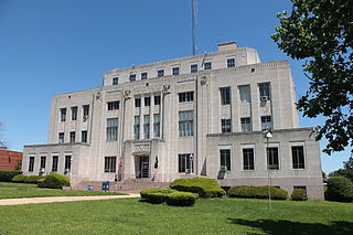
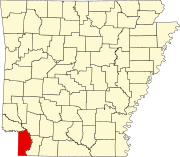
Miller County is a county located in the southwestern corner of the U.S. state of Arkansas. As of the 2020 census, the population was 42,600. The county seat is Texarkana.

Little River County is a county located on the southwest border of the U.S. state of Arkansas, bordering a corner with Texas and Oklahoma. As of the 2020 census, the population was 12,026. The county seat is Ashdown.

Hempstead County is a county located in the U.S. state of Arkansas. As of the 2020 census, the population was 20,065, down from 22,609 at the 2010 census. The county seat is Hope. Hempstead County is Arkansas's fourth county, formed on December 15, 1818, alongside Clark and Pulaski counties. The county is named for Edward Hempstead, a delegate to the U.S. Congress from the Missouri Territory, which included present-day Arkansas at the time. It is an alcohol prohibition or dry county.

Texarkana is a city in the U.S. state of Arkansas and the county seat of Miller County, on the southwest border of the state. As of the 2020 census, it had a population of 29,387. It is the twin city of Texarkana, Texas, located just across the state line. The city was founded at a railroad intersection on December 8, 1873, and was incorporated in Arkansas on August 10, 1880. Texarkana and its Texas counterpart are the principal cities of the Texarkana metropolitan area, which in 2021 was ranked 289th in the United States with a population of 147,174, according to the United States Census Bureau.

Helena is the eastern portion of Helena–West Helena, Arkansas, a city in Phillips County, Arkansas, located on the west bank of the Mississippi River. It was founded in 1833 by Nicholas Rightor and is named after the daughter of Sylvanus Phillips, an early settler of Phillips County and the namesake of Phillips County. As of the 2000 census, this portion of the city population was 6,323. Helena was the county seat of Phillips County until January 1, 2006, when it merged its government and city limits with neighboring West Helena.

The Southwest Trail was a 19th-century pioneer route that was the primary passageway for American settlers bound for Texas.

U.S. Route 67 is a major north–south U.S. highway which extends for 1,560 miles (2,511 km) in the Central United States. The southern terminus of the route is at the United States-Mexico border in Presidio, Texas, where it continues south as Mexican Federal Highway 16 upon crossing the Rio Grande. The northern terminus is at U.S. Route 52 in Sabula, Iowa. US 67 crosses the Mississippi River twice along its routing. The first crossing is at West Alton, Missouri, where US 67 uses the Clark Bridge to reach Alton, Illinois. About 240 miles (390 km) to the north, US 67 crosses the river again at the Rock Island Centennial Bridge between Rock Island, Illinois, and Davenport, Iowa. Additionally, the route crosses the Missouri River via the Lewis Bridge a few miles southwest of the Clark Bridge.

U.S. Route 71 or U.S. Highway 71 is a major north–south United States highway that extends for over 1500 miles (2500 km) in the central United States. This original 1926 route has remained largely unchanged by encroaching Interstate highways. Currently, the highway's northern terminus is in International Falls, Minnesota at the Canada–US border, at the southern end of the Fort Frances-International Falls International Bridge to Fort Frances, Ontario. U.S. Route 53 also ends here. On the other side of the bridge, Trans-Canada Highway is an east–west route while Ontario Highway 71 is a north–south route. US 71's southern terminus is between Port Barre and Krotz Springs, Louisiana at an intersection with U.S. Route 190. For the entirety south of Kansas City, Missouri, US 71 runs parallel and concurrent with the existing and future Interstate 49. North of Kansas City, US 71 runs halfway between Interstate 29 and Interstate 35, which they split in the city at an interchange with Interstate 70.

State Road 2 is a former east–west state highway in the Arkansas Timberlands and Lower Arkansas Delta. The route was approximately 195 miles (314 km), and ran from US Route 67 (US 67) in Texarkana east to cross the Mississippi River near Lake Village, continuing as Mississippi Highway 10. On July 1, 1931, the route was entirely replaced by US Highway 82 (US 82) by the American Association of State Highway Officials (AASHTO). The route was maintained by the Arkansas Highway Department (AHD), now known as the Arkansas Department of Transportation (ArDOT).
Paup is an unincorporated community in Miller County, Arkansas, United States. Paup is located on U.S. Route 67, 7.8 miles (12.6 km) northeast of Texarkana.

Highway 296 is an east–west state highway in Miller County. The route begins at US Highway 59 (US 59) and US 71 in Texarkana and runs east to US 82 in the eastern part of the county. Highway 296 serves as an arterial street in Texarkana west of US 67, but is decidedly rural in its length east of US 67, passing through sparsely populated wooded areas typical of the Arkansas Timberlands. The highway was created on April 24, 1963, but was extended throughout the 1960s and 1970s during a period which Arkansas's state highway system grew greatly. Highway 296 is maintained by the Arkansas State Highway and Transportation Department (AHTD).

U.S. Route 67 is a U.S. highway running from Presidio, Texas northeast to Sabula, Iowa. In the U.S. state of Arkansas, the route runs 279.15 miles (449.25 km) from the Texas border in Texarkana northeast to the Missouri border near Corning. The route passes through several cities and towns, including Hope, Benton, Little Rock, Jacksonville, Cabot, Beebe, Walnut Ridge, and Pocahontas.

Highway 13 is a designation for three state highways in the central part of the U.S. state of Arkansas. The longest segment of 54.58 miles (87.84 km) travels from U.S. Route 79 (US 79) in Humphrey to Campground Road east of Beebe. There exists two short segments in White County; one traveling 9.90 miles (15.93 km) from Highway 367 in McRae to Highway 36 in Searcy and the other traveling 6.13 miles (9.87 km) from Highway 367 in Judsonia to Highway 258.

U.S. Highway 82 in Arkansas is a major east–west arterial highway across the state's lowest tier of counties. It enters Arkansas from Texas, concurrent with US Highway 67, at a junction with US Highway 71 on the border between Texarkana, Texas and Texarkana, Arkansas. The route leaves Arkansas on the Lake Village Bridge over the Mississippi River near Lake Village, crossing into Mississippi.

Highway 108 is a state highway composed of two segments in the southwestern corner of the U.S. state of Arkansas. The northern segment begins as a continuation of State Highway 87 near the extreme southeastern corner of Oklahoma. The northern segment ends at U.S. Highway 59 and U.S. Highway 71 at Ashdown. The southern segment begins 13 miles (21 km) to the south along US 59 / US 71, at the Texas state line. The route ends at U.S. Highway 67 northeast of Texarkana.

Arkansas Highway 237 is a north–south state highway in Miller County. The route of 25.91 miles (41.70 km) runs north from Highway 160 in the extreme southwest corner of the state along the east side of Texarkana to US 67.
