Ozark, Arkansas

Last updated

Ozark, Arkansas
Ozark collage.png
Motto: 
"Where it all begins"
Franklin County Arkansas Incorporated and Unincorporated areas Ozark Highlighted 0552970.svg
Location of Ozark in Franklin County, Arkansas.
Coordinates: 35°29′57″N93°50′37″W / 35.49917°N 93.84361°W / 35.49917; -93.84361
Country United States
State Arkansas
County Franklin
Area
[1]
  Total7.97 sq mi (20.66 km2)
  Land7.93 sq mi (20.54 km2)
  Water0.04 sq mi (0.11 km2)
Elevation
[2]
476 ft (145 m)
Population
 (2020)
  Total3,542
  Density446.60/sq mi (172.43/km2)
Time zone UTC−06:00 (Central (CST))
  Summer (DST) UTC−05:00 (CDT)
ZIP Code
72949
Area code 479
FIPS code 05-52970
GNIS feature ID2404457 [2]
Website www.cityofozarkar.com

Ozark is a city in Franklin County, Arkansas, United States and one of the county's two seats of government. The community is located along the Arkansas River in the Arkansas River Valley on the southern edge of the Ozark Mountains. As of the 2010 census it had a population of 3,684. [3]

Contents

Incorporated in 1850, Ozark is adjacent to much of Arkansas wine country, and contains a bridge to cross the Arkansas River for travelers heading to points south. [4] The city is also located on Arkansas Highway 23, nicknamed the Pig Trail Scenic Byway, known for its steep drops, sharp curves and scenic mountain views. [5]

The name Aux Arcs, later simplified to "Ozark", was given to this bend of the river by the French explorers when they were mapping out this land. [6]

History

Native Americans roamed the area freely before Arkansas was a territory. The Cherokee and Osage lived in this area that would later become attractive to settlers. [7] The Ozark area was frequented by French fur trappers and served as a landmark during European exploration of the area. It was these adventurous souls who gave the area and the rolling mountains that rise there their name, Aux Arcs.

Included in the Louisiana Purchase of 1803, the vicinity became a stopping and crossing point along the Arkansas River. The modern settlement of Ozark was established here in the 1830s, and an important road grew connecting Ozark to Fayetteville, Arkansas, following the route of today's Pig Trail Scenic Byway to connect Northwest Arkansas with the river.

Ozark played a role on the Trail of Tears. Steamboats would often stop here in times of low water and Native Americans camped in Ozark before moving to Oklahoma on foot. The waterfront is a designated stop on the Trail of Tears route.

Ozark's population grew to about 100 people during the Civil War and served as a Confederate base after the battles of Pea Ridge and Prairie Grove in 1862. In April 1863, Brigadier General William L. Cabell led 900 men from Ozark on an expedition that ended at the Battle of Fayetteville. Ozark became the scene of fighting later that year and again in 1864, where many skirmishes were fought in the vicinity. A monument on the grounds of the Franklin County Courthouse pays tribute to an officer killed just north of town. [8]

Although Ozark prospered over the years, it remained a small city on the river. [9]

The name "Ozark" comes from Aux Arcs, the name given to the area and the mountains that rise there by early French settlers. Ozark, Arkansas, was the first community to be incorporated with that name. [10]

Geography

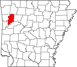
Ozark is located east of the center of Franklin County on the north side of the Arkansas River. It is 48 miles (77 km) west of Russellville and 38 miles (61 km) east of Fort Smith. The city limits extend north to Interstate 40, which has access from Exits 35 and 37. U.S. Route 64 passes through the center of Ozark, providing a local east-west route parallel to I-40. Arkansas Highway 23 leads north as the Pig Trail Scenic Byway into the Ozarks 28 miles (45 km) to Brashears, while to the south AR 23 crosses the Arkansas River and leads 28 miles (45 km) to Booneville.

According to the United States Census Bureau, Ozark has a total area of 7.3 square miles (19.0 km2), of which 7.3 square miles (18.9 km2) is land and 0.04 square miles (0.1 km2), or 0.52%, is water. [3] Ozark is the point at which the Arkansas River is farthest north in the state.

Climate

The climate in this area is characterized by hot, humid summers and generally mild to cool winters. According to the Köppen Climate Classification system, Ozark has a humid subtropical climate, abbreviated "Cfa" on climate maps. [11] On August 10, 1936, Ozark recorded the highest temperature ever in Arkansas at 120 °F (48.9 °C). [12]

Climate data for Ozark, Arkansas, 1991–2020 normals, extremes 1892–present
MonthJanFebMarAprMayJunJulAugSepOctNovDecYear
Record high °F (°C)81
(27)
86
(30)
94
(34)
95
(35)
99
(37)
108
(42)
116
(47)
120
(49)
110
(43)
104
(40)
87
(31)
82
(28)
120
(49)
Mean maximum °F (°C)69.0
(20.6)
72.6
(22.6)
80.6
(27.0)
85.7
(29.8)
90.1
(32.3)
94.1
(34.5)
99.2
(37.3)
99.6
(37.6)
94.5
(34.7)
87.4
(30.8)
76.3
(24.6)
69.7
(20.9)
101.1
(38.4)
Average high °F (°C)48.3
(9.1)
53.6
(12.0)
62.3
(16.8)
71.4
(21.9)
78.9
(26.1)
87.4
(30.8)
91.9
(33.3)
91.4
(33.0)
84.2
(29.0)
73.0
(22.8)
60.6
(15.9)
50.5
(10.3)
71.1
(21.8)
Daily mean °F (°C)38.3
(3.5)
42.6
(5.9)
50.9
(10.5)
59.5
(15.3)
68.0
(20.0)
76.5
(24.7)
80.8
(27.1)
80.1
(26.7)
73.0
(22.8)
61.6
(16.4)
49.9
(9.9)
41.0
(5.0)
60.2
(15.7)
Average low °F (°C)28.3
(−2.1)
31.6
(−0.2)
39.4
(4.1)
47.6
(8.7)
57.2
(14.0)
65.6
(18.7)
69.7
(20.9)
68.7
(20.4)
61.7
(16.5)
50.2
(10.1)
39.1
(3.9)
31.5
(−0.3)
49.2
(9.6)
Mean minimum °F (°C)12.9
(−10.6)
17.0
(−8.3)
22.6
(−5.2)
32.7
(0.4)
42.2
(5.7)
55.3
(12.9)
61.4
(16.3)
60.0
(15.6)
47.3
(8.5)
33.9
(1.1)
23.9
(−4.5)
16.8
(−8.4)
9.9
(−12.3)
Record low °F (°C)−16
(−27)
−15
(−26)
4
(−16)
22
(−6)
32
(0)
42
(6)
48
(9)
46
(8)
32
(0)
19
(−7)
9
(−13)
−8
(−22)
−16
(−27)
Average precipitation inches (mm)3.49
(89)
3.28
(83)
4.82
(122)
5.03
(128)
5.82
(148)
4.90
(124)
3.52
(89)
4.19
(106)
3.98
(101)
4.73
(120)
4.65
(118)
3.83
(97)
52.24
(1,325)
Average snowfall inches (cm)1.9
(4.8)
1.0
(2.5)
0.1
(0.25)
0.0
(0.0)
0.0
(0.0)
0.0
(0.0)
0.0
(0.0)
0.0
(0.0)
0.0
(0.0)
0.0
(0.0)
0.0
(0.0)
0.4
(1.0)
3.4
(8.55)
Average precipitation days (≥ 0.01 in)7.47.19.48.410.98.68.47.56.37.77.77.296.6
Average snowy days (≥ 0.1 in)0.91.00.30.00.00.00.00.00.00.00.00.42.6
Source 1: NOAA (snow/snow days 19812010) [13] [14]
Source 2: NWS/XMACIS2 [15] [16]

Demographics

Historical population
CensusPop.Note
1850 82
1870 210
1880 824292.4%
1890 8624.6%
1900 848−1.6%
1910 1,14635.1%
1920 1,26210.1%
1930 1,56423.9%
1940 1,402−10.4%
1950 1,75725.3%
1960 1,96511.8%
1970 2,59231.9%
1980 3,62139.7%
1990 3,330−8.0%
2000 3,5255.9%
2010 3,6844.5%
2020 3,542−3.9%
U.S. Decennial Census [17]

2020 census

Ozark racial composition [18]
RaceNumberPercentage
White (non-Hispanic)3,07486.79%
Black or African American (non-Hispanic)160.45%
Native American 371.04%
Asian 210.59%
Pacific Islander 10.03%
Other/Mixed 2186.15%
Hispanic or Latino 1754.94%

As of the 2020 United States census, there were 3,542 people, 1,539 households, and 808 families residing in the city.

2000 census

As of the census [19] of 2000, there were 3,525 people, 1,453 households, and 940 families residing in the city. The population density was 491.6 inhabitants per square mile (189.8/km2). There were 1,607 housing units at an average density of 224.1 per square mile (86.5/km2). The racial makeup of the city was 96.48% White, 0.14% Black or African American, 0.68% Native American, 0.14% Asian, 0.23% Pacific Islander, 1.08% from other races, and 1.25% from two or more races. 2.55% of the population were Hispanic or Latino of any race.

There were 1,453 households, out of which 31.5% had children under the age of 18 living with them, 47.2% were married couples living together, 13.1% had a female householder with no husband present, and 35.3% were non-families. 31.2% of all households were made up of individuals, and 18.4% had someone living alone who was 65 years of age or older. The average household size was 2.33 and the average family size was 2.91.

In the city, the population was spread out, with 25.2% under the age of 18, 8.3% from 18 to 24, 25.4% from 25 to 44, 19.7% from 45 to 64, and 21.4% who were 65 years of age or older. The median age was 38 years. For every 100 females, there were 85.0 males. For every 100 females age 18 and over, there were 80.6 males.

The median income for a household in the city was $26,057, and the median income for a family was $31,537. Males had a median income of $25,409 versus $17,353 for females. The per capita income for the city was $12,583. About 17.9% of families and 21.6% of the population were below the poverty line, including 24.9% of those under age 18 and 19.8% of those age 65 or over.

Education

Public education for elementary and secondary school students is provided by the two school districts:

Ozark is the home of Arkansas Tech University–Ozark Campus, a two-year satellite campus of Arkansas Tech University in Russellville, Arkansas. Arkansas Tech-Ozark is one of the region's leading providers of career and technical education, offering several associate degrees and technical certificates, as well as general studies classes. The campus was established in 1965 as Arkansas Valley Vocational Technical School (AVVTS). In 1975, the Arkansas State Board of Education/Vocational Education granted accreditation to AVVTS, making it the first school of its kind in the state to receive that distinction. In 1991, the campus was renamed Arkansas Valley Technical Institute (AVTI). On July 1, 2003, AVTI merged with Arkansas Tech University to become Arkansas Tech University–Ozark Campus. [20]

Tourism

Kayaking on the Mulberry River Paddling Near Ozark Arkansas.jpg
Kayaking on the Mulberry River

Downtown Ozark features a number of historic sites. Among these is the old Missouri Pacific Depot, which now serves as a museum and houses many artifacts related to the city's history. Murals can be found throughout the city. The quintessential square is filled with window store fronts full of antique and gift shops, crape myrtle shrubs in bloom summer through fall, and a park across from the courthouse.

The old Franklin County Jail features a distinctive stone facade, resembling a medieval castle.

The city serves as the southern access point for the Pig Trail Scenic Byway. This 19-mile (31 km) scenic drive begins 11 miles (18 km) north of Ozark where Highway 23 enters the Ozark National Forest. The Pig Trail leads drivers through rolling mountain country and past waterfalls, rock formations and the Mulberry River, popular for kayaking and canoeing. Ozark is a popular place for food and rest while exploring the Pig Trail Scenic Byway.

Ozark Lake on the Arkansas River provides plenty of fishing opportunities. Tree-shaded Aux Arc Park stretches along the river from the Ozark Lock and Dam and has a playground, campsites, boat launching ramps and other facilities. Within miles of Ozark are the Mulberry River and White Rock Mountain Recreation Area in the Ozark National Forest. [21]

Ozark is in the heart of Arkansas Wine Country along with the cities of Altus, Wiederkehr Village, and Paris. [22]

Depictions in cinema

In the first season of the reality TV series The Simple Life , Paris Hilton and Nicole Richie worked at the Sonic Drive-In in Ozark. [23]

On April 17, 2007, Late Late Show host Craig Ferguson mentioned Ozark during his guest appearance on the Late Show with David Letterman . While telling Dave a story about travelling the country, Craig said he had stopped in "Ozark, which is a town in Arkansas," and discovered catfish. It was the first time Ferguson had eaten catfish. He described it as being "a tasty fish". On June 14, 2007, Ferguson displayed a letter from Mayor Vernon McDaniels, making Ferguson an honorary citizen of Ozark. After becoming an honorary citizen, Ferguson set out to become an honorary citizen of as many U.S. cities as possible and later became an official U.S. citizen, all thanks to Ozark starting the trend. On June 25, 2009, Ferguson again mentioned Ozark during his opening monologue. He told his audience that Ozark was the place to stop for good catfish and described it as a "lovely town". Ferguson later financed a bond to build a $415,000 turf field for their high school football team in 2010. [24]

Notable people

Related Research Articles

<span class="mw-page-title-main">Delta County, Colorado</span> County in Colorado, United States

Delta County is a county located in the U.S. state of Colorado. As of the 2020 census, the population was 31,196. The county seat is Delta.

<span class="mw-page-title-main">Franklin County, Arkansas</span> County in Arkansas, United States

Franklin County is a county in Arkansas. As of the 2020 census, the population was 17,097. The county has two county seats, Charleston and Ozark. The county was formed on December 19, 1837, and named for Benjamin Franklin, American statesman. Franklin County is a damp county, with alcohol sales allowed except in Prairie & Alix townships, and limits on liquor sales in the city of Branch.

<span class="mw-page-title-main">Crawford County, Arkansas</span> County in Arkansas, United States

Crawford County is a county located in the Ozarks region of the U.S. state of Arkansas. As of the 2020 census, the population was 60,133. The county seat and largest city is Van Buren. Crawford County was formed on October 18, 1820, from the former Lovely County and Indian Territory, and was named for William H. Crawford, the United States Secretary of War in 1815.

<span class="mw-page-title-main">Beaver, Arkansas</span> Town in Arkansas, United States

Beaver is a town in Carroll County, Arkansas, United States. As of the 2020 census it had a population of 67. The community is located on the White River at the western limits of Table Rock Lake deep in the Ozark Mountains. Located north of Eureka Springs, the small town has been featured in movies for its picturesque scenery. The town is known for the Beaver Bridge, a two-panel suspension bridge over the White River listed on the National Register of Historic Places.

<span class="mw-page-title-main">Jonesboro, Arkansas</span> City in Northeast Arkansas

Jonesboro is a city located on Crowley's Ridge in the northeastern corner of the U.S. State of Arkansas. Jonesboro is one of two county seats of Craighead County. In 2023, the city had a population of 81,969 and was the fifth-largest city in Arkansas at the time. In 2023, the Jonesboro metropolitan area had a population of 135,287 and a population of 179,932 in the Jonesboro-Paragould Combined Statistical Area.

<span class="mw-page-title-main">Altus, Arkansas</span> City in Arkansas, United States

Altus is a city in Franklin County, Arkansas, United States. Located within the Arkansas River Valley at the edge of the Ozark Mountains, the city is within the Fort Smith metropolitan area. The epicenter of the Altus American Viticultural Area (AVA) within Arkansas Wine Country, the city is home to four wineries. Although founded as a coal mining community, the wine industry has driven the Altus economy since the first vineyards were planted in 1872. The population was 758 at the 2010 census, down from 817 at the 2000 census.

<span class="mw-page-title-main">Batesville, Arkansas</span> City in Arkansas, United States

Batesville is the county seat and largest city of Independence County, Arkansas, United States, 80 miles (183 km) northeast of Little Rock, the state capital. According to the 2010 Census, the population of the city was 10,268. The city serves as a regional manufacturing and distribution hub for the Ozark Mountain region and Northeast Arkansas.

<span class="mw-page-title-main">Clarksville, Arkansas</span> City in Arkansas, United States

Clarksville is a city in Johnson County, Arkansas, United States. As of the 2010 census the population was 9,178, up from 7,719 in 2000. As of 2018, the estimated population was 9,743. The city is the county seat of Johnson County. It is nestled between the Arkansas River and the foothills of the Ozark Mountains, and Interstate 40 and US Highway 64 intersect within the city limits. Clarksville-Johnson County is widely known for its peaches, scenic byways and abundance of natural outdoor recreational activities.

<span class="mw-page-title-main">Booneville, Arkansas</span> City in Arkansas, United States

Booneville is a city in Logan County, Arkansas, United States and the county seat of its southern district. Located in the Arkansas River Valley between the Ouachita and Ozark Mountains, the city is one of the oldest in western Arkansas. The city's economy was first based upon the railroad and Arkansas State Tuberculosis Sanatorium. It has developed a diverse economy of small businesses and light industry. Booneville's population was 3,990 at the 2010 census.

<span class="mw-page-title-main">Pocahontas, Arkansas</span> City in Arkansas, United States

Pocahontas is a city in Randolph County, Arkansas, United States, along the Black River. According to the 2010 Census Bureau, the population of the city was 6,608. The city is the county seat of Randolph County.

<span class="mw-page-title-main">Marshall, Arkansas</span> City in Arkansas, United States

Marshall is the largest city in and county seat of Searcy County in Arkansas, United States. It is located in the Ozarks at the foot of the Boston Mountain Range 10.5 mi (16.9 km) south of America's first National River, the Buffalo National River. Marshall serves as a hub for area tourism including camping, floating, hiking, bicycling and Dark Sky viewing.

<span class="mw-page-title-main">Greenland, Arkansas</span> City in Arkansas, United States

Greenland is a city in Washington County, Arkansas, United States. The population is 1,213 as of the 2020 census. The community is located in the Boston Mountains, within the Ozark Mountains.

<span class="mw-page-title-main">Ozarks</span> Highland region in central-southern United States

The Ozarks, also known as the Ozark Mountains, Ozark Highlands or Ozark Plateau, is a physiographic region in the U.S. states of Missouri, Arkansas, Oklahoma and the extreme southeastern corner of Kansas. The Ozarks cover a significant portion of northern Arkansas and most of the southern half of Missouri, extending from Interstate 40 in central Arkansas to Interstate 70 in central Missouri.

<span class="mw-page-title-main">Ozark–St. Francis National Forest</span> United States National Forest located in the state of Arkansas

The Ozark – St. Francis National Forest is a United States National Forest that is located in the state of Arkansas. It is composed of two separate forests, Ozark National Forest in the Ozark Mountains; and St. Francis National Forest on Crowley's Ridge. Each forest has distinct biological, topographical, and geological differences.

<span class="mw-page-title-main">Arkansas Highway 23</span> Highway in Arkansas

Arkansas Highway 23 is a north–south state highway in north Arkansas. The route runs 129.88 miles (209.02 km) from US 71 near Elm Park north to the Missouri state line through Ozark and Eureka Springs. Between AR 16 at Brashears and Interstate 40 north of Ozark, Highway 23 winds through the Ozark National Forest and is designated as the Pig Trail Scenic Byway due to its steep hills and hairpin turns. The route has a strong connection with the University of Arkansas Razorbacks, connecting fans in Central Arkansas with the Northwest Arkansas area.

<span class="mw-page-title-main">Arkansas Highway 21</span>

Highway 21 is a north–south state highway in north central Arkansas. The route of 99.14 miles (159.55 km) runs from US Route 64 (US 64) in Clarksville north across US 62 to Missouri Route 13 at the Missouri state line The route is a two-lane highway with the exception of a brief concurrency with US 62, a four-lane highway, in Berryville.

<span class="mw-page-title-main">Mulberry River (Arkansas)</span> River in Arkansas, United States

The Mulberry River is a 70-mile-long (110 km) tributary of the Arkansas River in northwestern Arkansas in the United States. Via the Arkansas River, it is part of the watershed of the Mississippi River. It has been designated a National Wild and Scenic River. The drainage basin of the Mulberry River has an area of 373 square miles (970 km2) and the annual average mean flow of the river near its mouth is 557 cubic feet per second.

<span class="mw-page-title-main">Arkansas Scenic Byways</span>

The Arkansas Scenic Byways Program is a list of highways, mainly state highways, that have been designated by the Arkansas Department of Transportation (ArDOT) as scenic highways. The Arkansas General Assembly designates routes for scenic byway status upon successful nomination. For a highway to be declared scenic, a group interested in preserving the scenic, cultural, recreational, and historic qualities of the route must be created. Mayors of all communities along the route and county judges from each affected county must be included in the organization. Scenic highways are marked with a circular shield in addition to regular route markers.

<span class="mw-page-title-main">Arkansas Highway 215</span>

Highway 215 is a designation for three north–south state highways in northwest Arkansas. A southern route of 8.80 miles (14.16 km) runs north from Franklin County Road 31 and Franklin County Road 221 (CR 31/CR 221) at Dahoma to Highway 96 near the Arkansas River. A second route of 15.94 miles (25.65 km) begins at US Route 64/Highway 917 (US 64/AR 917) in Mulberry and runs north to CR 77/CR 102 in the Ozark National Forest. A third segment of 16.44 miles (26.46 km) begins at Highway 23 at Cass and runs north to Johnson CR 36 at Oark.

<span class="mw-page-title-main">Arkansas River Valley</span> Region in Arkansas, United States

The Arkansas River Valley is a region in Arkansas defined by the Arkansas River in the western part of the state. Generally defined as the area between the Ozark and Ouachita Mountains, the River Valley is characterized by flat lowlands covered in fertile farmland and lakes periodically interrupted by high peaks. Mount Magazine, Mount Nebo, and Petit Jean Mountain compose the Tri-Peaks Region, a further subdivision of the River Valley popular with hikers and outdoors enthusiasts. In addition to the outdoor recreational activities available to residents and visitors of the region, the River Valley contains Arkansas's wine country as well as hundreds of historical sites throughout the area. It is one of six natural divisions of Arkansas.

References

  1. "2020 U.S. Gazetteer Files". United States Census Bureau. Retrieved October 29, 2021.
  2. 1 2 U.S. Geological Survey Geographic Names Information System: Ozark, Arkansas
  3. 1 2 "Geographic Identifiers: 2010 Census Summary File 1 (G001): Ozark city, Arkansas". American Factfinder. U.S. Census Bureau. Archived from the original on February 13, 2020. Retrieved April 19, 2016.
  4. McDaniel, Vernon (December 12, 2011). "Ozark (Franklin County)". Encyclopedia of Arkansas History and Culture . Butler Center for Arkansas Studies at the Central Arkansas Library System . Retrieved August 1, 2013.
  5. "Pig Trail Scenic Byway Overview". America's Byways. United States Department of Transportation. Archived from the original on September 10, 2013. Retrieved August 1, 2013.
  6. "Little Rock District - Ozark Lake". Archived from the original on July 23, 2009. Retrieved March 27, 2010. Ozark history
  7. "Indians and Early Settlers". www.ozarkhistory.com. Retrieved November 30, 2020.
  8. Library of Congress: Sanborn Fire Insurance Map from Ozark, Franklin County, Arkansas. Sanborn Map Company, July 1886. Accessed 3 February 2022.
  9. "Ozark, Arkansas - Historic Sites & Points of Interest". www.exploresouthernhistory.com. Retrieved November 30, 2020.
  10. "Ozark history". United States Army Corps of Engineers. Archived from the original on July 23, 2009. Retrieved August 1, 2013.
  11. "Ozark, Arkansas Köppen Climate Classification (Weatherbase)". Weatherbase. Retrieved November 30, 2020.
  12. "State Climate Extremes Committee" . Retrieved April 7, 2023.
  13. "U.S. Climate Normals Quick Access – Station: Ozark 2, AR (19912020)". National Oceanic and Atmospheric Administration. Retrieved March 3, 2023.
  14. "U.S. Climate Normals Quick Access – Station: Ozark, AR (19812010)". National Oceanic and Atmospheric Administration. Retrieved March 3, 2023.
  15. "NOAA Online Weather Data – NWS Tulsa". National Weather Service. Retrieved March 3, 2023.
  16. "xmACIS2". National Oceanic and Atmospheric Administration. Retrieved March 3, 2023.
  17. "Census of Population and Housing". Census.gov. Retrieved June 4, 2015.
  18. "Explore Census Data". data.census.gov. Retrieved January 1, 2022.
  19. "U.S. Census website". United States Census Bureau . Retrieved January 31, 2008.
  20. "404 | Arkansas Tech University". www.atu.edu.{{cite web}}: Cite uses generic title (help)
  21. "Ozark | Arkansas.com". www.arkansas.com.
  22. "Wineries in Arkansas - Arkansas Winery - Micro Brewery in Arkansas". Archived from the original on May 25, 2012. Retrieved June 14, 2012.
  23. The Simple Life
  24. "PBS Frontline Transcript". Football High.