Mulberry River (Arkansas)

Last updated
Mulberry River

Mulberry River - Arkansas-crop.jpg

The Mulberry River flows through the Ozark Mountains.
Country United States
State Arkansas
Physical characteristics
Main source Newton County, Arkansas
2,100 ft (640 m)
River mouth Arkansas River
Length 70 mi (110 km)
Discharge
  • Average rate:
    557 cu ft/s (15.8 m3/s)
Basin features
Basin size 373 sq mi (970 km2)
Type Scenic, Recreational
Designated April 22, 1992

The Mulberry River is a 70-mile-long (110 km) [1] tributary of the Arkansas River in northwestern Arkansas in the United States. Via the Arkansas River, it is part of the watershed of the Mississippi River. It has been designated a National Wild and Scenic River. The drainage basin of the Mulberry River has an area of 373 square miles (970 km2) and the annual average mean flow of the river near its mouth is 557 cubic feet per second. [2]

Tributary stream or river that flows into a main stem river or lake

A tributary or affluent is a stream or river that flows into a larger stream or main stem river or a lake. A tributary does not flow directly into a sea or ocean. Tributaries and the main stem river drain the surrounding drainage basin of its surface water and groundwater, leading the water out into an ocean.

Arkansas River major tributary of the Mississippi River, United States

The Arkansas River is a major tributary of the Mississippi River. It generally flows to the east and southeast as it traverses the U.S. states of Colorado, Kansas, Oklahoma, and Arkansas. The river's source basin lies in the western United States in Colorado, specifically the Arkansas River Valley, where the headwaters derive from the snowpack in the Sawatch and Mosquito mountain ranges. It then flows east into the Midwest via Kansas, and finally into the South through Oklahoma and Arkansas.

United States Federal republic in North America

The United States of America (USA), commonly known as the United States or America, is a country comprising 50 states, a federal district, five major self-governing territories, and various possessions. At 3.8 million square miles, the United States is the world's third or fourth largest country by total area and is slightly smaller than the entire continent of Europe's 3.9 million square miles. With a population of over 327 million people, the U.S. is the third most populous country. The capital is Washington, D.C., and the largest city by population is New York City. Forty-eight states and the capital's federal district are contiguous in North America between Canada and Mexico. The State of Alaska is in the northwest corner of North America, bordered by Canada to the east and across the Bering Strait from Russia to the west. The State of Hawaii is an archipelago in the mid-Pacific Ocean. The U.S. territories are scattered about the Pacific Ocean and the Caribbean Sea, stretching across nine official time zones. The extremely diverse geography, climate, and wildlife of the United States make it one of the world's 17 megadiverse countries.

Contents

According to the Geographic Names Information System, it has also been known as "Mulberry Creek". The United States Board on Geographic Names settled on "Mulberry River" as the stream's name in 1976. [3]

Geographic Names Information System geographical database

The Geographic Names Information System (GNIS) is a database that contains name and locative information about more than two million physical and cultural features located throughout the United States of America and its territories. It is a type of gazetteer. GNIS was developed by the United States Geological Survey in cooperation with the United States Board on Geographic Names (BGN) to promote the standardization of feature names.

United States Board on Geographic Names US geographic naming government agency

The United States Board on Geographic Names (BGN) is a federal body operating under the United States Secretary of the Interior. The purpose of the board is to establish and maintain uniform usage of geographic names throughout the federal government of the United States.

Course

The Mulberry River flows for most of its length through the Ozark National Forest in the Ozarks. It rises in southwestern Newton County and initially flows generally westwardly through Johnson and Franklin counties. In Franklin County it turns southward into the valley of the Arkansas River and flows past the town of Mulberry. It joins the Arkansas about 3 miles (5 km) south of Mulberry, on the common boundary of Franklin and Crawford counties.

Ozarks Highland region in central-southern United States

The Ozarks, also called the Ozark Mountains or Ozark Plateau, is a physiographic region in the U.S. states of Missouri, Arkansas, Oklahoma, and extreme southeastern Kansas. The Ozarks cover a significant portion of northern Arkansas and most of the southern half of Missouri, extending from Interstate 40 in Arkansas to the Interstate 70 in central Missouri.

Newton County, Arkansas County in the United States

Newton County is a county in the U.S. state of Arkansas. As of the 2010 census, the population was 8,330. The county seat is Jasper. Newton County is Arkansas's 46th county, formed on December 14, 1842, and named for Thomas W. Newton, an Arkansas Congressman. It is an alcohol prohibition or dry county.

Johnson County, Arkansas County in the United States

Johnson County is a county located in the U.S. state of Arkansas. As of the 2010 census, the population was 25,540. The county seat is Clarksville. Johnson County is Arkansas's 30th county, formed on November 16, 1833, from a portion of Pope County and named for Benjamin Johnson, a Territorial Judge. It is an alcohol prohibition or dry county.

Recreation

Canoeing on the Mulberry near Ozark Paddling Near Ozark Arkansas.jpg
Canoeing on the Mulberry near Ozark

The Mulberry is a scenic and popular river for recreational boating with kayaks or canoes. The river varies greatly in its flow depending upon the season and recent precipitation, but the water level is usually adequate for paddling between mid-October and mid-June. Water quality is excellent. Forty-five miles of the river are floatable beginning at Wolf Pen Access and Recreation Area in the Ozark National Forest and continuing until near the river's mouth where it flows into the Arkansas River. There are Class I to III rapids at many points in the river and paddling can be hazardous if the water level is high. At low water the river is placid and barely flows. Several access points along the river offer camping and supplies. [4] Fishing for Smallmouth Bass and Green Sunfish is also popular.

Kayak small boat propelled with a double-bladed paddle

A kayak is a small, narrow watercraft which is typically propelled by means of a double-bladed paddle. The word kayak originates from the Greenlandic word qajaq.

Canoe light boat that is paddled

A canoe is a lightweight narrow vessel, typically pointed at both ends and open on top, propelled by one or more seated or kneeling paddlers facing the direction of travel using a single-bladed paddle.

The uppermost 56 miles of the Mulberry River were designated for protection as part of the National Wild and Scenic Rivers System by the United States government in 1992. [5]

National Wild and Scenic Rivers System geographical object

The National Wild and Scenic Rivers System was created by the Wild and Scenic Rivers Actof 1968, enacted by the U.S. Congress to preserve certain rivers with outstanding natural, cultural, and recreational values in a free-flowing condition for the enjoyment of present and future generations.

See also

Related Research Articles

Ozark, Arkansas City in Arkansas, United States

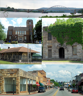
Ozark is a city in Franklin County, Arkansas, United States and one of the county's two seats of government. The community is located along the Arkansas River in the Arkansas River Valley on the southern edge of the Ozark Mountains. As of the 2010 census it had a population of 3,684.

Buffalo National River river in northern Arkansas, USA

The Buffalo River, located in Northern Arkansas, was the first National River to be designated in the United States. The Buffalo River is 153 miles (246 km) long. The lower 135 miles (217 km) flow within the boundaries of an area managed by the National Park Service, where the stream is designated the Buffalo National River. The river flows through Newton, Searcy, Marion, and Baxter Counties, from west to east. The river originates in the highest part of Boston Mountains of the Ozarks, flows out onto the Springfield Plateau near the historic community of Erbie, and finally crosses a portion of the Salem Plateau just before joining the White River. The Park is home to the state's only elk herd. The upper section of the river in the Ozark National Forest is managed by the U.S. Forest Service and is designated as a National Scenic River and a National Wild River; that section is not part of the area managed as a park by the Park Service, but is managed as a part of the Ozark National Forest.

Ozark–St. Francis National Forest

The Ozark – St. Francis National Forest is a United States National Forest that is located in the state of Arkansas. It is composed of two separate forests, Ozark National Forest in the Ozark Mountains; and St. Francis National Forest on Crowley's Ridge. Each forest has distinct biological, topographical, and geological differences.

The Little Red River is a 102-mile-long (164 km) river in White, Van Buren, Searcy, Stone and Cleburne counties of north-central Arkansas.

Illinois River (Oklahoma) river in Arkansas and Oklahoma

The Illinois River is a 145-mile-long (233 km) tributary of the Arkansas River in the U.S. states of Arkansas and Oklahoma. The Osage Indians named it Ne-eng-wah-kon-dah, which translates as "Medicine Stone River." The state of Oklahoma has designated its portion as a Scenic River. The Illinois River is a significant location in the 1961 Wilson Rawls novel, Where the Red Fern Grows.

Current River (Ozarks) river in Missouri, United States

The Current River forms in the southeastern portion of the Ozarks of Missouri and becomes a 7th order stream as it flows southeasterly out of the Ozarks into northeastern Arkansas where it becomes a tributary of the Black River, which is a tributary of the White River, a tributary of the Mississippi River. The Current River is approximately 184 miles (296 km) long and drains about 2,641 square miles (6,840 km2) of land mostly in Missouri and a small portion of land in northeastern Arkansas. The headwaters of the Current River are nearly 900 feet (270 m) above sea level, while the mouth of the river lies around 280 feet (85 m) above sea level. The basin drains a rural area that is dominated by karst topography, underlain by dolomite and sandstone bedrock with a small area of igneous rock southeast of Eminence, Missouri. The annual daily mean discharge of the river near Doniphan, Missouri is 2,815 cubic feet (79.7 m3) per second. In 1964, over 134 mi (160 km) of the upper course of the river and its tributaries were federally protected as the Ozark National Scenic Riverways, the first national park in America to protect a river system.

St. Francis River river in the United States of America

The St. Francis River is a tributary of the Mississippi River, about 426 miles (686 km) long, in southeastern Missouri and northeastern Arkansas in the United States. The river drains a mostly rural area and forms part of the Missouri-Arkansas state line along the western side of the Missouri Bootheel.

Boone River river in the United States of America

The Boone River is a tributary of the Des Moines River in north-central Iowa in the United States. It is 111 miles (179 km) long and drains an area of 895 square miles (2,320 km2). Via the Des Moines River, it is part of the watershed of the Mississippi River.

Klickitat River river in the United States of America

The Klickitat River is a tributary of the Columbia River, nearly 96 miles (154 km) long, in south-central Washington in the United States. It drains a rugged plateau area on the eastern side of the Cascade Range northeast of Portland, Oregon. In 1986, 10 miles (16 km) of the river were designated Wild and Scenic from the confluence with Wheeler Creek, near the town of Pitt, to the confluence with the Columbia River.

Birch Creek (Yukon River tributary) river in the United States of America

Birch Creek is a 150-mile (240 km) tributary of the Yukon River in the U.S. state of Alaska. Beginning at the confluence of Ptarmigan and Eagle creeks near Porcupine Dome, it flows southwest, then south under the Steese Highway and into the Steese National Conservation Area. It then turns east, then north, again passing under the Steese Highway and entering the Yukon Flats National Wildlife Refuge. Turning northwest, it ends where it splits into two distributaries, Lower Mouth Birch Creek and Upper Mouth Birch Creek, near Birch Creek, Alaska. The distributaries flow into the Yukon River at separate locations downstream of Fort Yukon.

John River (Alaska) watercourse

The John River is a 125-mile (201 km) tributary of the Koyukuk River in the northern part of the U.S. state of Alaska. It was named after John Bremner, a prospector and explorer who was one of the first non-native persons to go there. It flows south from Anaktuvuk Pass in Alaska's Brooks Range, into the larger river at a point near Bettles, slightly north of the Arctic Circle.

Gasconade River river in the United States of America

The Gasconade River is about 280 miles (450 km) long and is located in central and south-central Missouri in the United States.

Mountain Fork river in the United States of America

Mountain Fork, also known as the Mountain Fork of the Little River, is a 98-mile-long (158 km) tributary of the Little River in western Arkansas and southeastern Oklahoma in the United States. Via the Little and Red rivers, it is part of the watershed of the Mississippi River.

Carp River is a 40.2-mile-long (64.7 km) river in Chippewa and Mackinac counties in the U.S. state of Michigan. 21.7 miles (34.9 km) of the river were added to the National Wild and Scenic Rivers System in 1992.

Bogue Falaya river in the United States of America

The Bogue Falaya, also known as the Bogue Falaya River, is a 28-mile-long (45 km) river in southeastern Louisiana in the United States. It is a tributary of the Tchefuncte River, which flows to Lake Pontchartrain. The river flows through an area of mixed pine-hardwood and bottomland hardwood forests on the Gulf Coastal Plain.

Ontonagon River river in Michigan

The Ontonagon River is a river flowing to Lake Superior on the western Upper Peninsula of Michigan in the United States. The main stem of the river is 25 miles (40 km) long and is formed by a confluence of several longer branches, portions of which have been collectively designated as a National Wild and Scenic River. Several waterfalls occur on the river including Agate Falls and Bond Falls.

Little River (Red River tributary) river in Oklahoma and Arkansas, United States of America

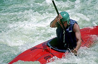
The Little River is a tributary of the Red River, with a total length of 217 miles (349 km), 130 miles (210 km) in southeastern Oklahoma and 87 miles (140 km) in southwestern Arkansas. in southeastern Oklahoma and southwestern Arkansas in the United States. Via the Red, it is part of the watershed of the Mississippi River. Six large reservoirs impound the Little River and its tributaries. The drainage basin of the river totals 4,204 square miles (10,890 km2), 2,204 square miles (5,710 km2) in Oklahoma and 2,036 square miles (5,270 km2) in Arkansas. The Little River and its upper tributaries are popular for recreational canoeing and kayaking.

Indian River (Manistique River tributary) tributary of the Manistique River on the Upper Peninsula of Michigan in the United States

Indian River is a 59.1-mile-long (95.1 km) tributary of the Manistique River on the Upper Peninsula of Michigan in the United States. It rises out of Hovey Lake at 46°17′36″N86°42′20″W on Hiawatha National Forest land in Alger County and flows south and east through a lake district and on through Schoolcraft County. The river flows into the 8,659 acre (35 km²) Indian Lake at 46°17′36″N86°42′20″W and flows out at 45°59′30″N86°17′15″W. It then flows east and south about 2.5 miles where it merges with the Manistique River, which then flows through Manistique and into Lake Michigan at 45°56′56″N86°14′45″W.

Sturgeon River is a 106-mile-long (171 km) river in Baraga County and Houghton counties in the U.S. state of Michigan. 25.0 miles (40.2 km) of the river were added to the National Wild and Scenic Rivers System in 1992.

The Kings River is a tributary of the White River. It rises in the Boston Mountains of Arkansas and flows northward for more than 90 miles into Table Rock Lake in Missouri. The Arkansas portion of the river is undammed and bordered by rural and forested land, the river is popular for paddling and sport fishing.

References

  1. U.S. Geological Survey. National Hydrography Dataset high-resolution flowline data. The National Map, accessed June 3, 2011
  2. "Mulberry River near Mulberry Arkansas" USGS, accessed 31 July 2013
  3. U.S. Geological Survey Geographic Names Information System: Mulberry River
  4. "Southwest Paddler" . Retrieved July 31, 2013.
  5. "Mulberry River". National Wild and Scenic Rivers System. Retrieved August 1, 2013.

Sources

DeLorme company

DeLorme is a producer of personal satellite tracking, messaging, and navigation technology. The company’s main product, inReach, integrates GPS and satellite technologies. inReach provides the ability to send and receive text messages anywhere in the world by using the Iridium satellite constellation. By pairing with a smart phone, navigation is possible with access to free downloadable topographic maps and NOAA charts. On February 11, 2016, the company announced that it had been purchased by Garmin, a multinational producer of GPS products and services.

International Standard Book Number Unique numeric book identifier

The International Standard Book Number (ISBN) is a numeric commercial book identifier which is intended to be unique. Publishers purchase ISBNs from an affiliate of the International ISBN Agency.

Coordinates: 35°44′45″N93°27′01″W / 35.7459139°N 93.4501831°W / 35.7459139; -93.4501831