Mulberry, Arkansas

Last updated

Mulberry, Arkansas
Crawford County Arkansas Incorporated and Unincorporated areas Mulberry Highlighted 0548200.svg
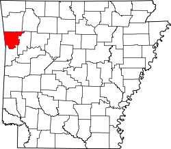
Location of Mulberry in Crawford County, Arkansas.
Coordinates: 35°30′31″N94°04′29″W / 35.508517°N 94.074754°W / 35.508517; -94.074754 [1]
Country United States
State Arkansas
County Crawford
Government
[2]
  Type Mayor–council government
  Body City council
   Mayor [3] Gary D. Baxter
Area
[4]
  Total8.06 sq mi (20.87 km2)
  Land7.83 sq mi (20.27 km2)
  Water0.23 sq mi (0.60 km2)
Elevation
[5]
400 ft (100 m)
Population
 (2020)
  Total1,543
  Density197.16/sq mi (76.13/km2)
Time zone UTC-6 (Central Time Zone (CST))
  Summer (DST) UTC-5 (CDT)
ZIP code [6]
72947
Area code 479
FIPS code 05-48200
GNIS ID2404335 [5]
Website cityofmulberry.org

Mulberry is a city in Crawford County, Arkansas, United States. [7] It is part of the Fort Smith, Arkansas-Oklahoma Metropolitan Statistical Area. The population was 1,655 as of the 2010 Census, [7] an increase of 1.72% from 1,627 in 2000. [8]

Contents

Geography

According to the 2010 Census, Mulberry is located at 35°30′31″N94°04′29″W / 35.508517°N 94.074754°W / 35.508517; -94.074754 (35.508517, -94.074754). [1] It has a total area of 7.834 square miles (20.29 square kilometers), of which 7.637 sq mi (19.78 km2) is land and 0.197 sq mi (0.51 km2) is water (2.51%). [1]

Demographics

Historical population
CensusPop.Note
1890 321
1900 36112.5%
1910 722100.0%
1920 1,09551.7%
1930 895−18.3%
1940 9738.7%
1950 952−2.2%
1960 934−1.9%
1970 1,34043.5%
1980 1,4447.8%
1990 1,4480.3%
2000 1,62712.4%
2010 1,6551.7%
2020 1,543−6.8%
U.S. Decennial Census [9]

2020 census

Mulberry racial composition [10]
RaceNumberPercentage
White (non-Hispanic)1,37188.85%
Black or African American (non-Hispanic)110.71%
Native American 271.75%
Asian 40.26%
Pacific Islander 10.06%
Other/Mixed 996.42%
Hispanic or Latino 301.94%

As of the 2020 United States census, there were 1,543 people, 718 households, and 446 families residing in the city.

2000 census

As of the 2000 United States Census, [11] there were 1,627 people, 669 households, and 472 families residing in the city. The population density was 215.5 inhabitants per square mile (83.2/km2). There were 743 housing units at an average density of 98.4 per square mile (38.0/km2). The racial makeup of the city was 96.19% White, 0.06% Black or African American, 2.64% Native American, 0.25% Asian, and 0.86% from two or more races. 0.92% of the population were Hispanic or Latino of any race.

There were 669 households, out of which 28.1% had children under the age of 18 living with them, 56.4% were married couples living together, 9.9% had a female householder with no husband present, and 29.4% were non-families. 26.3% of all households were made up of individuals, and 15.8% had someone living alone who was 65 years of age or older. The average household size was 2.37 and the average family size was 2.83.

In the city, the population was spread out, with 23.3% under the age of 18, 8.2% from 18 to 24, 26.9% from 25 to 44, 24.3% from 45 to 64, and 17.3% who were 65 years of age or older. The median age was 39 years. For every 100 females, there were 96.7 males. For every 100 females age 18 and over, there were 89.4 males.

The median income for a household in the city was $27,197, and the median income for a family was $32,321. Males had a median income of $28,281 versus $17,734 for females. The per capita income for the city was $14,204. About 14.9% of families and 19.9% of the population were below the poverty line, including 23.7% of those under age 18 and 19.9% of those age 65 or over.

Education

Public education for elementary and secondary students is provided by the Mulberry–Pleasant View Bi-County School District, which leads to graduation from Mulberry High School.

See also

Related Research Articles

<span class="mw-page-title-main">Scott County, Arkansas</span> County in Arkansas, United States

Scott County is a county located in the U.S. state of Arkansas. As of the 2020 census, the population was 9,836. The county seat is Waldron. Scott County is Arkansas' 28th county, formed on November 5, 1833, and named for Andrew Scott, a justice of the Supreme Court of the Arkansas Territory. It is an alcohol-prohibited or dry county.

<span class="mw-page-title-main">Johnson County, Arkansas</span> County in Arkansas, United States

Johnson County is a county located in the U.S. state of Arkansas. As of the 2020 census, the population was 25,749. The county seat is Clarksville. Johnson County is Arkansas's 30th county, formed on November 16, 1833, from a portion of Pope County and named for Benjamin Johnson, a Territorial Judge. It is an alcohol prohibition or dry county.

<span class="mw-page-title-main">Independence County, Arkansas</span> County in Arkansas, United States

Independence County is a county located in the U.S. state of Arkansas. As of the 2020 census, the population was 37,938. The county seat is Batesville. Independence County is Arkansas's ninth county, formed on October 20, 1820, from a portion of Lawrence County and named in commemoration of the Declaration of Independence. It is an alcohol prohibition or dry county.

<span class="mw-page-title-main">Crawford County, Arkansas</span> County in Arkansas, United States

Crawford County is a county located in the Ozarks region of the U.S. state of Arkansas. As of the 2020 census, the population was 60,133. The county seat and largest city is Van Buren. Crawford County was formed on October 18, 1820, from the former Lovely County and Indian Territory, and was named for William H. Crawford, the United States Secretary of War in 1815.

<span class="mw-page-title-main">Bay, Arkansas</span> City in Arkansas, United States

Bay is a city in Craighead County, Arkansas, United States. The population was 1,876 at the 2020 census. It is included in the Jonesboro Metropolitan Statistical Area.

<span class="mw-page-title-main">Lake City, Arkansas</span> City in Arkansas, United States

Lake City is a city in Craighead County, Arkansas, United States, along the St. Francis River. Lake City is one of two county seats in Craighead County. The population was 2,326 as of the 2020 census. It is included in the Jonesboro, Arkansas Metropolitan Statistical Area.

<span class="mw-page-title-main">Turrell, Arkansas</span> City in Arkansas, United States

Turrell is a city in Crittenden County, Arkansas, United States. Per the 2020 census, the population was 517.

<span class="mw-page-title-main">Oakhaven, Arkansas</span> Town in Arkansas, United States

Oakhaven is a town in Hempstead County, Arkansas, United States. The population was 63 at the 2010 census. It is part of the Hope Micropolitan Statistical Area.

<span class="mw-page-title-main">Knoxville, Arkansas</span> City in Arkansas, United States

Knoxville is a city in Johnson County, Arkansas, United States. The population was 731 at the 2010 census.

<span class="mw-page-title-main">Bluff City, Arkansas</span> Town in Arkansas, United States

Bluff City is an unincorporated town in Nevada County, Arkansas, United States. The population was 158 at the 2000 census. It is part of the Hope Micropolitan Statistical Area.

<span class="mw-page-title-main">Mansfield, Arkansas</span> City in Arkansas, United States

Mansfield is a city in Scott and Sebastian counties Arkansas, United States. The Sebastian County portion of the city is part of the Fort Smith, Arkansas-Oklahoma Metropolitan Statistical Area. As of the 2010 Census, the population was 1,139. The population was 1,097 at the 2000 census.

<span class="mw-page-title-main">Barling, Arkansas</span> City in Arkansas, United States

Barling is a city in Sebastian County, Arkansas, United States. It is part of the Fort Smith, Arkansas-Oklahoma Metropolitan Statistical Area. As of the 2020 Census the population was 4,782, ranking it eighth in the Greater Fort Smith Area. Barling was incorporated in 1956.

<span class="mw-page-title-main">Central City, Arkansas</span> City in Arkansas, United States

Central City is a city in Sebastian County, Arkansas, United States. It is part of the Fort Smith, Arkansas-Oklahoma Metropolitan Statistical Area. At the 2010 Census, the population of Central City was 502. According to the 2018 US Census Bureau estimates, Central City had a population of 497.

<span class="mw-page-title-main">Hackett, Arkansas</span> City in Arkansas, United States

Hackett is a city in Sebastian County, Arkansas, United States. It is part of the Fort Smith, Arkansas-Oklahoma Metropolitan Statistical Area. The population was 812 at the 2010 census.

<span class="mw-page-title-main">Hartford, Arkansas</span> City in Arkansas, United States

Hartford is a city in Sebastian County, Arkansas, United States. It is part of the Fort Smith, Arkansas-Oklahoma Metropolitan Statistical Area. The population was 642 at the 2010 census.

<span class="mw-page-title-main">Huntington, Arkansas</span> City in Sebastian County, Arkansas, United States

Huntington is a city in Sebastian County, Arkansas, United States. It is part of the Fort Smith, Arkansas-Oklahoma Metropolitan Statistical Area. As of the 2010 Census the population was 635.

<span class="mw-page-title-main">Colt, Arkansas</span> Town in Arkansas, United States

Colt is a town and an unincorporated area in St. Francis County, Arkansas, United States. The population was 378 at the 2010 census, an increase from 368 in 2000.

Fork Township is a civil township of Mecosta County in the U.S. state of Michigan. The population was 1,627 at the 2020 census.

Wirt is a town in Allegany County, New York, United States. The population was 1,059 at the 2020 census. The town is in the southwest part of the county and east of Olean.

<span class="mw-page-title-main">Fairfield, Oklahoma</span> Census-designated place in Oklahoma, United States

Fairfield is a census-designated place (CDP) in Adair County, Oklahoma, United States. The population was 584 at the 2010 census.

References

  1. 1 2 3 "Places (2010): Arkansas" (TXT). 2010 Census Gazetteer Files . United States Census Bureau . Retrieved May 27, 2014.{{cite web}}: External link in |work= (help)
  2. "City Council". City of Mulberry. Retrieved May 27, 2014.
  3. "Mayor's Message". City of Mulberry. Retrieved May 27, 2014.
  4. "2020 U.S. Gazetteer Files". United States Census Bureau. Retrieved October 29, 2021.
  5. 1 2 U.S. Geological Survey Geographic Names Information System: Mulberry, Arkansas
  6. "ZIP Code 72947: MULBERRY AR". United States Postal Service . Retrieved May 27, 2014.
  7. 1 2 "2010 Demographic Profile (DP-1): Mulberry city, Arkansas". American FactFinder . United States Census Bureau. Archived from the original on February 12, 2020. Retrieved May 27, 2014.
  8. "2000 Demographic Profile (DP-1): Mulberry city, Arkansas". American FactFinder. United States Census Bureau. Archived from the original on February 12, 2020. Retrieved May 27, 2014.
  9. "Census of Population and Housing". Census.gov. Retrieved June 4, 2015.
  10. "Explore Census Data". data.census.gov. Retrieved January 1, 2022.
  11. "U.S. Census website". United States Census Bureau . Retrieved January 31, 2008.