Crawford County, Arkansas | |
|---|---|
 Crawford County Courthouse within the Van Buren Historic District | |
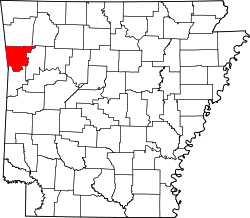
 Location within the U.S. state of Arkansas | |
| Coordinates: 35°34′00″N94°15′00″W / 35.566666666667°N 94.25°W | |
| Country | |
| State | |
| Named after | William H. Crawford |
| Seat | Van Buren |
| Largest city | Van Buren |
| Area | |
• Total | 604 sq mi (1,560 km2) |
| • Land | 593 sq mi (1,540 km2) |
| • Water | 11 sq mi (28 km2) 1.8% |
| Population (2020) | |
• Total | 60,133 |
• Estimate (2024) | 62,258 |
| • Density | 101/sq mi (39.2/km2) |
| Time zone | UTC−6 (Central) |
| • Summer (DST) | UTC−5 (CDT) |
| Congressional district | 3rd |
| Website | www |
Crawford County is a county located in the Ozarks region of the U.S. state of Arkansas. As of the 2020 census, its population was 60,133. [1] The county seat and largest city is Van Buren. [2] Crawford County was formed on October 18, 1820, from the former Lovely County and Indian Territory, and was named for William H. Crawford, the United States Secretary of War in 1815. [3]
Contents
- Geography
- Major highways
- Transit
- Adjacent counties
- National protected area
- Demographics
- 2020 census
- 2000 census
- Controversy
- Government
- Government 2
- Politics
- Communities
- Cities
- Towns
- Census-designated places
- Unincorporated community
- Townships
- See also
- References
- External links
Located largely within the Ozarks, the southern border of the county is the Arkansas River, placing the extreme southern edge of the county in the Arkansas River Valley. The frontier county became an early crossroads, beginning with a California Gold Rush and developing into the Butterfield Overland Mail, Civil War trails, and railroads such as the St. Louis and San Francisco Railway, the Little Rock and Fort Smith Railroad, and the St. Louis, Iron Mountain and Southern Railway. Today, the county is home to the intersection of two major interstate highways, Interstate 40 (I-40) and I-49. Crawford County is part of the Fort Smith metropolitan area. As a dry county, alcohol sales are generally prohibited, though recent changes to county law provide for exemptions.