Rudy, Arkansas | |
---|---|
Coordinates: 35°31′30″N94°15′44″W / 35.52500°N 94.26222°W | |
Country | United States |
State | Arkansas |
County | Crawford |
Area | |
• Total | 1.59 sq mi (4.12 km2) |
• Land | 1.59 sq mi (4.11 km2) |
• Water | 0.00 sq mi (0.01 km2) |
Elevation | 784 ft (239 m) |
Population (2020) | |
• Total | 130 |
• Density | 81.92/sq mi (31.63/km2) |
Time zone | UTC-6 (Central (CST)) |
• Summer (DST) | UTC-5 (CDT) |
ZIP code | 72952 |
Area code | 479 |
FIPS code | 05-61460 |
GNIS feature ID | 2407256 [2] |
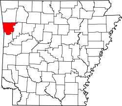
Rudy is a town in Crawford County, Arkansas, United States. It is part of the Fort Smith, Arkansas-Oklahoma Metropolitan Statistical Area. As of the 2020 Census the population was 130. [3] The population was 72 at the 2000 census.
Rudy was platted when the St. Louis–San Francisco Railway was extended to that point. [4] A post office called Rudy has been in operation since 1883. [5]
According to the United States Census Bureau, the town has a total area of 0.062 square miles (0.16 km2), all land. [6]
Census | Pop. | Note | %± |
---|---|---|---|
1940 | 89 | — | |
1950 | 97 | 9.0% | |
1960 | 113 | 16.5% | |
1970 | 103 | −8.8% | |
1980 | 79 | −23.3% | |
1990 | 45 | −43.0% | |
2000 | 72 | 60.0% | |
2010 | 61 | −15.3% | |
2020 | 130 | 113.1% | |
U.S. Decennial Census [7] |
As of the 2020 United States census there were 130 people, 58 housing units, and 59 families residing in the town. The population density was 463.3/km2 (1,251.4/mi2). There were 30 housing units at an average density of 193.1/km2 (521.4/mi2). The racial makeup of the town was 90% White and 0.7% Native American. 1.39% of the population were Hispanic or Latino of any race, and 2.3% were Asian.
As of the 2010 census, there were 58 households, out of which 37.0% had children under the age of 18 living with them, 63.0% were married couples living together, 11.1% had a female householder with no husband present, and 18.5% were non-families. 14.8% of all households were made up of individuals, and 14.8% had someone living alone who was 65 years of age or older. The average household size was 2.67 and the average family size was 2.86.
In the town, the population was spread out, with 30.6% under the age of 18, 5.6% from 18 to 24, 26.4% from 25 to 44, 12.5% from 45 to 64, and 25.0% who were 65 years of age or older. The median age was 38 years. For every 100 females, there were 94.6 males. For every 100 females age 18 and over, there were 100.0 males.
The median income for a household in the town was $21,875, and the median income for a family was $26,250. Males had a median income of $21,250 versus $13,750 for females. The per capita income for the town was $11,842. There were 20.0% of families and 19.2% of the population living below the poverty line, including 16.7% of under eighteens and 25.0% of those over 64. [6]
Almyra is a town in Arkansas County, Arkansas, United States. The population was 283 at the 2010 census.
Springtown is a town in Benton County, Arkansas, United States. The population was 83 at the 2020 census. It is part of the Northwest Arkansas region.
Oak Grove is a town in Carroll County, Arkansas, United States. The population was 386 at the 2020 census.
Whelen Springs is a town in Clark County, Arkansas, United States. The population was 92 at the 2010 census. From 1930 through 1939 the town thrived, being a main hub of operations for the then powerful Ozan Lumber Company.
Success is a town in Clay County, Arkansas, United States. The population was 149 at the 2010 census.
Menifee is a town in Conway County, Arkansas, United States. The population was 302 at the 2010 census.
Chester is a town in Crawford County, Arkansas, United States. It is part of the Fort Smith, Arkansas-Oklahoma Metropolitan Statistical Area. As of the 2020 Census the population was 144.
Dyer is a city in Crawford County, Arkansas, United States. It is part of the Fort Smith, Arkansas-Oklahoma Metropolitan Statistical Area. The population was 876 at the 2010 census.
Edmondson is a town in Crittenden County, Arkansas, United States. The population was 427 at the 2010 census.
Jericho is a town in Crittenden County, Arkansas, United States. The population was 119 at the 2010 census, down from 184 in 2000.
Perla is a town in Hot Spring County, Arkansas, United States. The population was 241 at the 2010 census, up from 115 at the 2000 census. The city's water association filed for Chapter 9 Bankruptcy in the Western District of Arkansas Bankruptcy Court on May 26, 2019.
Amagon is a town in Jackson County, Arkansas, United States. The population was 98 at the 2010 census. It is the birthplace of former Governor of Arkansas Mike Beebe.
Beedeville is a town in Jackson County, Arkansas, United States. The population was 107 at the 2010 census.
Campbell Station is a city in Jackson County, Arkansas, United States. The population was 255 at the 2010 census.
Jacksonport is a town in Jackson County, Arkansas, United States, along the White River at its confluence with the Black River. The population was 212 at the 2010 census.
Tupelo is a town in Jackson County, Arkansas, United States. The population was 180 at the 2010 census.
Weldon is a town in Jackson County, Arkansas, United States. The population was 75 at the 2010 census.
Caulksville is a town in Logan County, Arkansas, United States. The population was 213 at the 2010 census.
Hindsville is a town in Madison County, Arkansas, United States. The population was 90 at the 2020 census. It is part of the Northwest Arkansas region.
Goshen is a city in Washington County, Arkansas, United States. The population was 2,102 at the 2020 census. It is part of the Northwest Arkansas region. According to Business Insider, it is the “most educated” city in the state of Arkansas.