Figure Five, Arkansas | |
|---|---|
 Figure Five, Arkansas  Figure Five, Arkansas | |
| Coordinates: 35°31′1″N94°21′14″W / 35.51694°N 94.35389°W | |
| Country | United States |
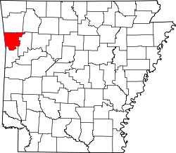
| State | Arkansas |
| County | Crawford |
| Elevation | 915 ft (279 m) |
| Time zone | UTC-6 (Central (CST)) |
| • Summer (DST) | UTC-5 (CDT) |
| GNIS feature ID | 71611 [1] |
Figure Five is an unincorporated community in Crawford County, Arkansas, United States.
The community was named for the fact it was 5 miles (8.0 km) from Van Buren, a figure noted in nearby blazes. [2]