Mountainburg, Arkansas

Last updated

Mountainburg, Arkansas
Crawford County Arkansas Incorporated and Unincorporated areas Mountainburg Highlighted 0547300.svg
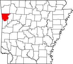
Location of Mountainburg in Crawford County, Arkansas.
Coordinates: 35°36′15″N94°10′09″W / 35.60417°N 94.16917°W / 35.60417; -94.16917
Country United States
State Arkansas
County Crawford
Area
[1]
  Total1.47 sq mi (3.81 km2)
  Land1.47 sq mi (3.81 km2)
  Water0.00 sq mi (0.00 km2)
Elevation
[2]
837 ft (255 m)
Population
 (2020)
  Total528
  Density358.70/sq mi (138.53/km2)
Time zone UTC-6 (Central (CST))
  Summer (DST) UTC-5 (CDT)
ZIP code
72946
Area code 479
FIPS code 05-47300
GNIS feature ID2404334 [2]

Mountainburg is a town in Crawford County, Arkansas, United States. It is part of the Fort Smith, Arkansas-Oklahoma Metropolitan Statistical Area. As of the 2010 census the population was 631. [3]

Contents

Mountainburg was laid out in 1883 when the St. Louis–San Francisco Railway was extended to that point. [4]

Geography

Dinosaur statue in the city park Dinosaur statue in Mountainburg, Arkansas, a thriving community during the pre-Interstate highway days when U.S. Highway 71 was the primary route between Fayetteville in Northwest Arkansas and Fort LCCN2013650776.tif
Dinosaur statue in the city park

Mountainburg is located along U.S. Route 71, and thrived when this road was the main route in northwest Arkansas. Since the construction of Interstate 540 (now Interstate 49) to the west, it has been a sleepier community. The city park in downtown Mountainburg has since 1980 hosted two large dinosaur models. [5]

Lake Fort Smith State Park, which is situated on the western side of the 1,400 acres (5.7 km2) Lake Fort Smith, is located 8 miles (13 km) north of Mountainburg. [6]

According to the United States Census Bureau, the city has a total area of 1.5 square miles (3.9 km2), all land. [3]

Demographics

Historical population
CensusPop.Note
1930 213
1940 185−13.1%
1950 405118.9%
1960 402−0.7%
1970 52430.3%
1980 59513.5%
1990 488−18.0%
2000 68239.8%
2010 631−7.5%
2020 528−16.3%
U.S. Decennial Census [7]

2020 census

Mountainburg racial composition [8]
RaceNumberPercentage
White (non-Hispanic)45085.23%
Native American 173.22%
Asian 10.19%
Other/Mixed 438.14%
Hispanic or Latino 173.22%

As of the 2020 United States census, there were 528 people, 252 households, and 136 families residing in the city.

2000 census

At the 2000 census there were 682 people in 271 households, including 179 families, in the city. The population density was 478.1 inhabitants per square mile (184.6/km2). There were 298 housing units at an average density of 208.9 per square mile (80.7/km2). The racial makeup of the city was 95.45% White, 0.15% Black or African American, 3.08% Native American, 0.15% Pacific Islander, 0.59% from other races, and 0.59% from two or more races. 0.59% of the population were Hispanic or Latino of any race. [9] Of the 271 households 35.8% had children under the age of 18 living with them, 52.0% were married couples living together, 10.7% had a female householder with no husband present, and 33.6% were non-families. 30.6% of households were one person and 16.2% were one person aged 65 or older. The average household size was 2.52 and the average family size was 3.15.

The age distribution was 29.2% under the age of 18, 8.2% from 18 to 24, 26.4% from 25 to 44, 20.8% from 45 to 64, and 15.4% 65 or older. The median age was 34 years. For every 100 females, there were 97.1 males. For every 100 females age 18 and over, there were 89.4 males.

The median household income was $25,446 and the median family income was $33,295. Males had a median income of $24,375 versus $21,806 for females. The per capita income for the city was $14,445. About 12.0% of families and 17.3% of the population were below the poverty line, including 22.2% of those under age 18 and 20.1% of those age 65 or over.

Notable person

Climate

The climate in this area is characterized by hot, humid summers and generally mild to cool winters. According to the Köppen Climate Classification system, Mountainburg has a humid subtropical climate, abbreviated "Cfa" on climate maps. [10]

Climate data for Mountainburg, Arkansas, 1991–2020 normals, extremes 1954–present
MonthJanFebMarAprMayJunJulAugSepOctNovDecYear
Record high °F (°C)76
(24)
86
(30)
92
(33)
93
(34)
96
(36)
103
(39)
108
(42)
111
(44)
108
(42)
96
(36)
87
(31)
79
(26)
111
(44)
Mean maximum °F (°C)69.2
(20.7)
74.0
(23.3)
80.9
(27.2)
85.5
(29.7)
89.0
(31.7)
93.8
(34.3)
99.0
(37.2)
99.9
(37.7)
94.1
(34.5)
87.3
(30.7)
77.2
(25.1)
69.7
(20.9)
101.2
(38.4)
Mean daily maximum °F (°C)49.3
(9.6)
54.4
(12.4)
62.9
(17.2)
71.6
(22.0)
78.9
(26.1)
86.9
(30.5)
91.6
(33.1)
91.4
(33.0)
84.2
(29.0)
73.6
(23.1)
60.9
(16.1)
51.6
(10.9)
71.4
(21.9)
Daily mean °F (°C)37.5
(3.1)
41.8
(5.4)
49.8
(9.9)
58.6
(14.8)
66.9
(19.4)
75.3
(24.1)
79.5
(26.4)
78.4
(25.8)
71.3
(21.8)
60.3
(15.7)
48.6
(9.2)
40.2
(4.6)
59.0
(15.0)
Mean daily minimum °F (°C)25.8
(−3.4)
29.2
(−1.6)
36.7
(2.6)
45.6
(7.6)
54.8
(12.7)
63.8
(17.7)
67.4
(19.7)
65.5
(18.6)
58.4
(14.7)
47.0
(8.3)
36.3
(2.4)
28.8
(−1.8)
46.6
(8.1)
Mean minimum °F (°C)10.6
(−11.9)
14.9
(−9.5)
20.8
(−6.2)
30.0
(−1.1)
39.8
(4.3)
52.8
(11.6)
58.7
(14.8)
55.9
(13.3)
44.2
(6.8)
31.0
(−0.6)
21.9
(−5.6)
15.0
(−9.4)
7.2
(−13.8)
Record low °F (°C)−10
(−23)
−11
(−24)
6
(−14)
20
(−7)
31
(−1)
41
(5)
47
(8)
44
(7)
32
(0)
18
(−8)
5
(−15)
−9
(−23)
−11
(−24)
Average precipitation inches (mm)3.32
(84)
3.05
(77)
4.53
(115)
5.26
(134)
6.29
(160)
4.49
(114)
4.12
(105)
4.06
(103)
5.08
(129)
4.86
(123)
4.69
(119)
3.67
(93)
53.42
(1,356)
Average snowfall inches (cm)1.8
(4.6)
0.7
(1.8)
0.5
(1.3)
0.0
(0.0)
0.0
(0.0)
0.0
(0.0)
0.0
(0.0)
0.0
(0.0)
0.0
(0.0)
0.0
(0.0)
0.0
(0.0)
0.1
(0.25)
3.1
(7.95)
Average precipitation days (≥ 0.01 in)7.57.09.48.810.69.27.67.37.37.98.07.598.1
Average snowy days (≥ 0.1 in)0.40.40.20.00.00.00.00.00.00.00.00.41.4
Source 1: NOAA [11]
Source 2: National Weather Service [12]

Related Research Articles

<span class="mw-page-title-main">Sebastian County, Arkansas</span> County in Arkansas, United States

Sebastian County is a county located in the U.S. state of Arkansas. As of the 2020 census, the population was 127,799, making it the fourth-most populous county in Arkansas. The county has two county seats, Greenwood and Fort Smith.

<span class="mw-page-title-main">Crawford County, Arkansas</span> County in Arkansas, United States

Crawford County is a county located in the Ozarks region of the U.S. state of Arkansas. As of the 2020 census, the population was 60,133. The county seat and largest city is Van Buren. Crawford County was formed on October 18, 1820, from the former Lovely County and Indian Territory, and was named for William H. Crawford, the United States Secretary of War in 1815.

<span class="mw-page-title-main">Portland, Arkansas</span> Town in Arkansas, United States

Portland is a town in Ashley County, Arkansas, United States. The population was 430 at the 2010 census. Portland was first settled in the 1830s, and named for its early status as a steamboat port. It was incorporated in 1893.

<span class="mw-page-title-main">Mountain Pine, Arkansas</span> City in Arkansas, United States

Mountain Pine is a city in Garland County, Arkansas, United States. It is part of the Hot Springs Metropolitan Statistical Area. The population was 770 at the 2010 United States Census. It is located immediately southeast of Lake Ouachita below the Blakely Mountain Dam. The city consists of five defined neighborhoods, Pinewood (north), South Mountain Pine, a business district, Cozy Acres (southwest) and Mountain View/Timberland area.

<span class="mw-page-title-main">Cushman, Arkansas</span> City in Arkansas, United States

Cushman is a city in Independence County, Arkansas, United States. The population was 433 at the 2020 census.

<span class="mw-page-title-main">Calico Rock, Arkansas</span> City in Arkansas, United States

Calico Rock is a city in Izard County, Arkansas, United States. The population was 1,545 at the 2010 census, up from 991 in 2000.

<span class="mw-page-title-main">Beedeville, Arkansas</span> Town in Arkansas, United States

Beedeville is a town in Jackson County, Arkansas, United States. The population was 107 at the 2010 census.

<span class="mw-page-title-main">Lewisville, Arkansas</span> City in Arkansas, United States

Lewisville is a city in Lafayette County, Arkansas, United States. The population was 1,280 at the 2010 census. It is the county seat of Lafayette County.

<span class="mw-page-title-main">Keiser, Arkansas</span> City in Arkansas, United States

Keiser is a city in Mississippi County, Arkansas, United States. The population was 751 at the 2020 census.

<span class="mw-page-title-main">Manila, Arkansas</span> City in Arkansas, United States

Manila is a city in Mississippi County, Arkansas, United States. The population was 3,682 at the 2020 census, up from 3,342 in 2010. It was the hometown of World War I sniper Herman Davis.

<span class="mw-page-title-main">Mount Ida, Arkansas</span> City in Arkansas, United States

Mount Ida is a city in and county seat of Montgomery County, Arkansas, United States. Founded in 1842, the city saw a silver boom in the 1880s bring early prosperity and economic development to the area. Today, the economy is largely ranching, poultry farming, silviculture, and tourism around Lake Ouachita. It is known as the quartz crystal capital of the U.S. and is known worldwide for its quartz deposits. The population was 996 as of the 2020 census.

<span class="mw-page-title-main">Hazen, Arkansas</span> City in Arkansas, United States

Hazen is a city in Prairie County, Arkansas, United States. The population was 1,481 at the 2020 census.

<span class="mw-page-title-main">Benton, Arkansas</span> City in Arkansas, United States

Benton is a city in and the county seat of Saline County, Arkansas, United States and a suburb of Little Rock. It was established in 1837. At the 2020 census, the city had a population of 35,014, making it the 12th most populous city in Arkansas. It is part of the Little Rock–North Little Rock–Conway Metropolitan Statistical Area. The city of Benton, first settled in 1833 and named after Missouri Senator Thomas Hart Benton, was formally chartered in 1836 when Arkansas became a state.

<span class="mw-page-title-main">Waldron, Arkansas</span> City in Arkansas, United States

Waldron is a city in Scott County, Arkansas, United States. Its population was 3,386 at the 2020 census. The city is the county seat of Scott County.

<span class="mw-page-title-main">Barling, Arkansas</span> City in Arkansas, United States

Barling is a city in Sebastian County, Arkansas, United States. It is part of the Fort Smith, Arkansas-Oklahoma Metropolitan Statistical Area. As of the 2020 Census the population was 4,782, ranking it eighth in the Greater Fort Smith Area. Barling was incorporated in 1956.

<span class="mw-page-title-main">Calion, Arkansas</span> City in Arkansas, United States

Calion is a second-class city in Union County, Arkansas, United States. The population was 494 at the 2010 census.

<span class="mw-page-title-main">Waukee, Iowa</span> City in Iowa, United States

Waukee is a city in Dallas County, Iowa, United States. The population was 23,940 at the time of the 2020 U.S. Census. It is part of the Des Moines – West Des Moines Metropolitan Statistical Area.

<span class="mw-page-title-main">Smithville, Missouri</span> City in Missouri, United States

Smithville is a city in Clay and Platte counties in the U.S. state of Missouri and is part of the Kansas City metropolitan area, along the Little Platte River. The population was 10,406 at the 2020 United States Census.

<span class="mw-page-title-main">Loudon, Tennessee</span> City in Tennessee, United States

Loudon is a city in and the county seat of Loudon County, Tennessee, United States. Its population was 6,001 at the 2020 census. It is included in the Knoxville, Tennessee Metropolitan Statistical Area. The city is located in East Tennessee, southwest of Knoxville, on the Tennessee River. Fort Loudoun, the colonial era fort for which the city was named, is located several miles to the south in Monroe County.

<span class="mw-page-title-main">Kempner, Texas</span> City in Texas, United States

Kempner is a city in Lampasas County, Texas, United States. The population was 1,146 at the 2020 census. It is part of the Killeen–Temple–Fort Hood Metropolitan Statistical Area.

References

  1. "2020 U.S. Gazetteer Files". United States Census Bureau. Retrieved October 29, 2021.
  2. 1 2 U.S. Geological Survey Geographic Names Information System: Mountainburg, Arkansas
  3. 1 2 "Geographic Identifiers: 2010 Demographic Profile Data (G001): Mountainburg city, Arkansas". U.S. Census Bureau, American Factfinder. Archived from the original on February 12, 2020. Retrieved June 19, 2014.
  4. History of Benton, Washington, Carroll, Madison, Crawford, Franklin, and Sebastian Counties, Arkansas. Higginson Book Company. 1889. p. 551.
  5. Cox, Dale. "Mountainburg, Arkansas". ExploreSouthernHistory.com. Retrieved July 20, 2010.
  6. "Lake Fort Smith State Park" . Retrieved September 20, 2010.
  7. "Census of Population and Housing". Census.gov. Retrieved June 4, 2015.
  8. "Explore Census Data". data.census.gov. Retrieved January 1, 2022.
  9. "U.S. Census website". United States Census Bureau . Retrieved January 31, 2008.
  10. Climate Summary for Mountainburg, Arkansas
  11. "U.S. Climate Normals Quick Access – Station: Mountainburg 2NE, AR". National Oceanic and Atmospheric Administration. Retrieved January 25, 2023.
  12. "NOAA Online Weather Data – NWS Tulsa". National Weather Service. Retrieved January 25, 2023.