Dyer, Arkansas

Last updated

Dyer, Arkansas
Dyer, Arkansas view from mountain.jpg
Outskirts of Dyer with Arkansas River in the background, July 2005
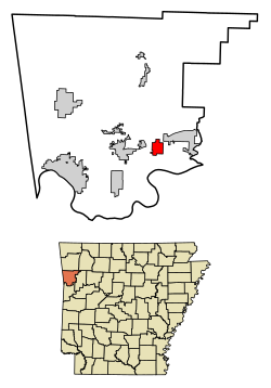
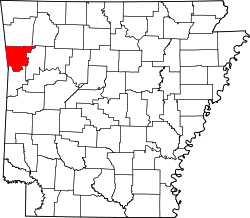
Crawford County Arkansas Incorporated and Unincorporated areas Dyer Highlighted 0520200.svg
Location of Dyer in Crawford County, Arkansas.
Coordinates: 35°29′40″N94°08′20″W / 35.49444°N 94.13889°W / 35.49444; -94.13889
Country United States
State Arkansas
County Crawford
Area
[1]
  Total2.94 sq mi (7.62 km2)
  Land2.94 sq mi (7.62 km2)
  Water0.00 sq mi (0.00 km2)
Elevation
[2]
430 ft (130 m)
Population
 (2020)
  Total772
  Density262.50/sq mi (101.36/km2)
Time zone UTC-6 (Central (CST))
  Summer (DST) UTC-5 (CDT)
ZIP code
72935
Area code 479
FIPS code 05-20200
GNIS feature ID2403523 [2]
Website www.cityofdyerar.com

Dyer is a city [3] in Crawford County, Arkansas, United States. It is part of the Fort Smith, Arkansas-Oklahoma Metropolitan Statistical Area. The population was 876 at the 2010 census. [4]

Contents

History

Dyer was platted in 1884 by G. E. Dyer soon after the Little Rock and Fort Smith Railroad was extended to that point. [5] The community has the name of the local Dyer family; S. M. Dyer bought the town site in 1870. [5] A post office has been in operation at Dyer since 1885. [6]

Geography

Dyer is located in southeastern Crawford County in the Arkansas River valley. U.S. Route 64 passes through the community, leading west 5 miles (8 km) to Alma and 13 miles (21 km) to Van Buren, the county seat, and east 5 miles (8 km) to Mulberry. Interstate 40 passes through the northern part of Dyer but does not have a direct exit for the city; the nearest access is from Exit 20 in the western part of Mulberry.

According to the United States Census Bureau, Dyer has a total area of 2.6 square miles (6.8 km2), all land. [4]

Demographics

Historical population
CensusPop.Note
1900 343
1910 43326.2%
1920 60940.6%
1930 425−30.2%
1940 51320.7%
1950 398−22.4%
1960 45013.1%
1970 4868.0%
1980 60825.1%
1990 502−17.4%
2000 58516.5%
2010 87649.7%
2020 772−11.9%
U.S. Decennial Census [7]

2020 census

Dyer racial composition [8]
RaceNumberPercentage
White (non-Hispanic)66986.66%
Black or African American (non-Hispanic)91.17%
Native American 91.17%
Asian 40.52%
Other/Mixed 445.7%
Hispanic or Latino 374.79%

As of the 2020 United States census, there were 772 people, 277 households, and 211 families residing in the city.

2000 census

As of the census [9] of 2000, there were 585 people, 230 households, and 163 families residing in the town. The population density was 86.9/km2 (225.3/mi2). There were 248 housing units at an average density of 36.8/km2 (95.5/mi2). The racial makeup of the town was 96.24% White, 0.17% Black or African American, 1.20% Native American, 0.85% Asian, and 1.54% from two or more races. 0.17% of the population were Hispanic or Latino of any race.

There were 230 households, out of which 30.4% had children under the age of 18 living with them, 61.3% were married couples living together, 5.2% had a female householder with no husband present, and 28.7% were non-families. 23.9% of all households were made up of individuals, and 13.5% had someone living alone who was 65 years of age or older. The average household size was 2.54 and the average family size was 3.06.

In the town the population was spread out, with 25.5% under the age of 18, 6.0% from 18 to 24, 29.1% from 25 to 44, 23.6% from 45 to 64, and 15.9% who were 65 years of age or older. The median age was 39 years. For every 100 females, there were 93.1 males. For every 100 females age 18 and over, there were 98.2 males.

The median income for a household in the town was $23,438, and the median income for a family was $28,500. Males had a median income of $28,523 versus $21,500 for females. The per capita income for the town was $13,206. About 22.6% of families and 34.1% of the population were below the poverty line, including 52.7% of those under age 18 and 32.1% of those age 65 or over.

Related Research Articles

<span class="mw-page-title-main">Crawford County, Arkansas</span> County in Arkansas, United States

Crawford County is a county located in the Ozarks region of the U.S. state of Arkansas. As of the 2020 census, the population was 60,133. The county seat and largest city is Van Buren. Crawford County was formed on October 18, 1820, from the former Lovely County and Indian Territory, and was named for William H. Crawford, the United States Secretary of War in 1815.

<span class="mw-page-title-main">Briarcliff, Arkansas</span> City in Arkansas, United States

Briarcliff is a second-class city in Baxter County, Arkansas, United States. The population was 236 at the 2010 census.

<span class="mw-page-title-main">Springtown, Arkansas</span> Town in Arkansas, United States

Springtown is a town in Benton County, Arkansas, United States. The population was 83 at the 2020 census. It is part of the Northwest Arkansas region.

<span class="mw-page-title-main">Oak Grove, Carroll County, Arkansas</span> Town in Arkansas, United States

Oak Grove is a town in Carroll County, Arkansas, United States. The population was 386 at the 2020 census.

<span class="mw-page-title-main">Chester, Arkansas</span> Town in Arkansas, United States

Chester is a town in Crawford County, Arkansas, United States. It is part of the Fort Smith, Arkansas-Oklahoma Metropolitan Statistical Area. As of the 2020 Census the population was 144.

<span class="mw-page-title-main">Mulberry, Arkansas</span> City in Arkansas, United States

Mulberry is a city in Crawford County, Arkansas, United States. It is part of the Fort Smith, Arkansas-Oklahoma Metropolitan Statistical Area. The population was 1,655 as of the 2010 Census, an increase of 1.72% from 1,627 in 2000.

<span class="mw-page-title-main">Rudy, Arkansas</span> Town in Arkansas, United States

Rudy is a town in Crawford County, Arkansas, United States. It is part of the Fort Smith, Arkansas-Oklahoma Metropolitan Statistical Area. As of the 2020 Census the population was 130. The population was 72 at the 2000 census.

<span class="mw-page-title-main">Horseshoe Lake, Arkansas</span> Town in Arkansas, United States

Horseshoe Lake is a town in Crittenden County, Arkansas, United States. The population was 264 at the 2020 census.

<span class="mw-page-title-main">Jericho, Arkansas</span> Town in Arkansas, United States

Jericho is a town in Crittenden County, Arkansas, United States. The population was 119 at the 2010 census, down from 184 in 2000.

<span class="mw-page-title-main">Grubbs, Arkansas</span> City in Arkansas, United States

Grubbs is a city in Jackson County, Arkansas, United States. The population was 386 at the 2010 census.

<span class="mw-page-title-main">Caulksville, Arkansas</span> Town in Arkansas, United States

Caulksville is a town in Logan County, Arkansas, United States. The population was 213 at the 2010 census.

<span class="mw-page-title-main">Hindsville, Arkansas</span> Town in Arkansas, United States

Hindsville is a town in Madison County, Arkansas, United States. The population was 90 at the 2020 census. It is part of the Northwest Arkansas region.

<span class="mw-page-title-main">Birdsong, Arkansas</span> Town in Arkansas, United States

Birdsong is a town in Mississippi County, Arkansas, United States. The population was 32 at the 2020 census, down from 41 in 2010.

<span class="mw-page-title-main">Etowah, Arkansas</span> Town in Arkansas, United States

Etowah is a town in Mississippi County, Arkansas, United States. The population was 254 at the 2020 census, down from 351 in 2010.

<span class="mw-page-title-main">Marie, Arkansas</span> Town in Arkansas, United States

Marie is a town in Mississippi County, Arkansas, United States. It was founded by the R.E.L. Wilson cotton company. The population was 108 at the 2020 census.

<span class="mw-page-title-main">Roe, Arkansas</span> Town in Arkansas, United States

Roe is a town in Monroe County, Arkansas, United States. Located at the junction of U.S. Route 79 and Arkansas Highway 33, the population was 68 at the 2020 census, down from 114 in 2010.

<span class="mw-page-title-main">Norman, Arkansas</span> Town in Arkansas, United States

Norman is a town in Montgomery County, Arkansas, United States. It was known as Womble until 1925. The population was 303 at the 2020 census, down from 378 in 2010.

<span class="mw-page-title-main">Oden, Arkansas</span> Town in Arkansas, United States

Oden is a town in Montgomery County, Arkansas, United States. As of the 2020 census, its population was 180, down from 232 in 2010.

<span class="mw-page-title-main">Rosston, Arkansas</span> Town in Arkansas, United States

Rosston is a town in south-central Nevada County, Arkansas, United States. The population was 265 at the 2000 census. It is part of the Hope Micropolitan Statistical Area.

<span class="mw-page-title-main">Bonanza, Arkansas</span> City in Arkansas, United States

Bonanza is a city in Sebastian County, Arkansas, United States. It is part of the Fort Smith, Arkansas-Oklahoma Metropolitan Statistical Area. At the 2010 Census, the population of Bonanza was 575. According to the 2018 US Census Bureau estimates, the population of Bonanza was 564. Bonanza began as a coal mining town of the Central Coal and Coke company.

References

  1. "2020 U.S. Gazetteer Files". United States Census Bureau. Retrieved October 29, 2021.
  2. 1 2 U.S. Geological Survey Geographic Names Information System: Dyer, Arkansas
  3. Local.Arkansas.gov - Dyer , retrieved September 3, 2012
  4. 1 2 "Geographic Identifiers: 2010 Demographic Profile Data (G001): Dyer city, Arkansas". U.S. Census Bureau, American Factfinder. Archived from the original on February 12, 2020. Retrieved June 18, 2014.
  5. 1 2 History of Benton, Washington, Carroll, Madison, Crawford, Franklin, and Sebastian Counties, Arkansas. Higginson Book Company. 1889. p. 555.
  6. "Post Offices". Jim Forte Postal History. Retrieved February 6, 2018.
  7. "Census of Population and Housing". Census.gov. Retrieved June 4, 2015.
  8. "Explore Census Data". data.census.gov. Retrieved January 1, 2022.
  9. "U.S. Census website". United States Census Bureau . Retrieved January 31, 2008.