Marion County, Arkansas

Last updated

Marion County
Yellville, AR 001.jpg
Marion County courthouse in Yellville
Map of Arkansas highlighting Marion County.svg
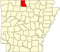
Location within the U.S. state of Arkansas
Arkansas in United States.svg
Arkansas's location within the U.S.
Coordinates: 36°16′47″N92°42′57″W / 36.279722222222°N 92.715833333333°W / 36.279722222222; -92.715833333333
CountryFlag of the United States.svg United States
StateFlag of Arkansas.svg  Arkansas
FoundedSeptember 25, 1836
Named for Francis Marion [1]
Seat Yellville
Largest city Bull Shoals
Area
  Total640 sq mi (1,700 km2)
  Land597 sq mi (1,550 km2)
  Water43 sq mi (110 km2)  6.8%
Population
 (2020)
  Total16,826
  Density26/sq mi (10/km2)
Time zone UTC−6 (Central)
  Summer (DST) UTC−5 (CDT)
Congressional district 1st
Website marioncounty.arkansas.gov

Marion County is located in the Ozark Mountains in the U.S. state of Arkansas. The county is named for Francis Marion, the famous "Swamp Fox" of the Revolutionary War. Created as Arkansas's 35th county in 1836, Marion County is home to one incorporated town and four incorporated cities, including Yellville, the county seat. The county is also the site of numerous unincorporated communities and ghost towns. The county included part of what is now Searcy County, Arkansas, with many opposing to dividing them, which helped fueled the bloody Tutt-Everett War between 1844 and 1850.

Contents

Occupying 640 square miles (170,000 ha), the county's population was 16,826 as of the 2020 Census. [2] Based on population, the county ranks 42nd of the 75 in Arkansas. [3] Located in the Ozarks, the county is largely covered with rugged terrain and waterways, with the exception of King's Prairie in the southwestern portion. It is drained by the White River, Buffalo River, Crooked Creek, and the Little North Fork of White River. Protected areas of the county include Bull Shoals-White River State Park, Ozark National Forest, the Buffalo National River and four wildlife management areas (WMAs).

Although no Interstate highways are located in Marion County, two United States highways (U.S. Route 62 [US 62] and US 412) and eight Arkansas state highways run in the county. [4]

History

Prior to white settlement, the Ozark Plateau was inhabited by the Osage Indians for centuries. [5] Present-day Arkansas was under French rule from 1682 until the Spanish took over in 1762. The territory was returned to France in 1800 and then sold to the United States as part of the Louisiana Purchase in 1803. In 1812, the Territory of Missouri was formed, containing all of the Louisiana Purchase except the modern state of Louisiana. To manage this expansive and sparsely populated territory, counties were formed. New Madrid County, Missouri covered much of southeastern Missouri and the northern part of Arkansas. This county was eventually subdivided into Lawrence County, which was later subdivided into Izard County. [5]

Marion County was formerly home to a large zinc mining industry. The ruins of the Rush Creek mining district are preserved as the Rush Historic District, which is listed on the National Register of Historic Places.

Geography

According to the U.S. Census Bureau, the county has a total area of 640 square miles (1,700 km2), of which 597 square miles (1,550 km2) is land and 43 square miles (110 km2) (6.8%) is water. [6]

Adjacent counties

National protected areas

Demographics

Historical population
CensusPop.Note
1840 1,325
1850 2,30874.2%
1860 6,192168.3%
1870 3,979−35.7%
1880 7,90798.7%
1890 10,39031.4%
1900 11,3779.5%
1910 10,203−10.3%
1920 10,154−0.5%
1930 8,876−12.6%
1940 9,4646.6%
1950 8,609−9.0%
1960 6,041−29.8%
1970 7,00015.9%
1980 11,33461.9%
1990 12,0015.9%
2000 16,14034.5%
2010 16,6533.2%
2020 16,8261.0%
2023 (est.)17,514 [7] 4.1%
U.S. Decennial Census [8]
1790–1960 [9] 1900–1990 [10]
1990–2000 [11] 2010 [12]
Age pyramid Marion County USA Marion County, Arkansas age pyramid.svg
Age pyramid Marion County

2020 census

Marion County racial composition [14]
RaceNumberPercentage
White (non-Hispanic)15,41491.61%
Black or African American (non-Hispanic)200.12%
Native American 1270.75%
Asian 560.33%
Other/Mixed 8304.93%
Hispanic or Latino 3792.25%

As of the 2020 United States census, there were 16,826 people, 6,782 households, and 4,438 families residing in the county.

2000 census

As of the 2000 census, [15] there were 16,140 people, 6,776 households, and 4,871 families residing in the county. The population density was 27 people per square mile (10 people/km2). There were 8,235 housing units at an average density of 14 per square mile (5.4/km2). The racial makeup of the county was 97.52% White, 0.12% Black or African American, 0.76% Native American, 0.20% Asian, 0.05% Pacific Islander, 0.13% from other races, and 1.22% from two or more races. 0.76% of the population were Hispanic or Latino of any race.

There were 6,776 households, out of which 26.00% had children under the age of 18 living with them, 61.30% were married couples living together, 7.40% had a female householder with no husband present, and 28.10% were non-families. 24.90% of all households were made up of individuals, and 12.40% had someone living alone who was 65 years of age or older. The average household size was 2.36 and the average family size was 2.79.

In the county, the population was spread out, with 22.10% under the age of 18, 6.00% from 18 to 24, 23.30% from 25 to 44, 28.50% from 45 to 64, and 20.00% who were 65 years of age or older. The median age was 44 years. For every 100 females there were 97.90 males. For every 100 females age 18 and over, there were 94.80 males. The median income for a household in the county was $26,737, and the median income for a family was $32,181. Males had a median income of $22,877 versus $17,729 for females. The per capita income for the county was $14,588. About 11.50% of families and 15.20% of the population were below the poverty line, including 23.50% of those under age 18 and 14.40% of those age 65 or over.

Government

The county government is a constitutional body granted specific powers by the Constitution of Arkansas and the Arkansas Code. The quorum court is the legislative branch of the county government and controls all spending and revenue collection. Representatives are called justices of the peace and are elected from county districts every even-numbered year. The number of districts in a county vary from nine to fifteen, and district boundaries are drawn by the county election commission. The Marion County Quorum Court has nine members. Presiding over quorum court meetings is the county judge, who serves as the chief operating officer of the county. The county judge is elected at-large and does not vote in quorum court business, although capable of vetoing quorum court decisions. [16] [17]

Politics

Over the past few election cycles Marion County has trended heavily towards the GOP. The last Democrat to carry this county was Bill Clinton in 1996.

United States presidential election results for Marion County, Arkansas [18]
Year Republican Democratic Third party
No.%No.%No.%
2020 5,78377.08%1,53120.41%1892.52%
2016 5,33675.08%1,43420.18%3374.74%
2012 4,77467.71%2,03728.89%2403.40%
2008 4,52463.17%2,38433.29%2543.55%
2004 4,12760.10%2,60237.89%1382.01%
2000 3,40256.56%2,23337.12%3806.32%
1996 2,31237.75%2,73544.65%1,07817.60%
1992 2,02332.39%2,75744.15%1,46523.46%
1988 2,99357.80%2,03339.26%1522.94%
1984 3,54564.17%1,94535.21%340.62%
1980 3,05957.11%2,04638.20%2514.69%
1976 2,04540.70%2,97959.30%00.00%
1972 2,33166.66%1,10831.68%581.66%
1968 1,38542.59%99030.44%87726.97%
1964 1,08839.43%1,66160.20%100.36%
1960 1,01650.60%96848.21%241.20%
1956 85744.59%1,06155.20%40.21%
1952 84443.06%1,09956.07%170.87%
1948 38124.41%1,13372.58%473.01%
1944 41432.65%84266.40%120.95%
1940 32026.64%86471.94%171.42%
1936 43530.21%98968.68%161.11%
1932 23514.70%1,28280.18%825.13%
1928 43637.17%73162.32%60.51%
1924 28221.56%82563.07%20115.37%
1920 37128.60%74457.36%18214.03%
1916 27425.97%78174.03%00.00%
1912 16016.02%53753.75%30230.23%
1908 37031.92%70560.83%847.25%
1904 35637.39%58060.92%161.68%
1900 37529.16%90570.37%60.47%
1896 33621.32%1,21276.90%281.78%

Taxation

Property tax is assessed by the Marion County Assessor annually based upon the fair market value of the property and determining which tax rate, commonly called a millage in Arkansas, will apply. The rate depends upon the property's location with respect to city limits, school district, and special tax increment financing (TIF) districts. This tax is collected by the Marion County Collector between the first business day of March of each year through October 15 without penalty. The Marion County Treasurer disburses tax revenues to various government agencies, such as cities, county road departments, fire departments, libraries, and police departments in accordance with the budget set by the quorum court.

Sales and use taxes in Arkansas are voter approved and collected by the Arkansas Department of Finance and Administration. Arkansas's statewide sales and use tax has been 6.5% since July 1, 2013. [19] Marion County has an additional sales and use tax of 1.75%, which has been in effect since April 1, 2017. Within Marion County, the five municipalities each also have additional sales and use tax: Bull Shoals and Yellville levy an additional 2%, Flippin and Summit 1%, and Pyatt 0.5%. [20] The Arkansas State Treasurer disburses state tax revenue to counties/cities in accordance with tax rules.

Communities

Cities

Town

Census-designated places

Townships

Note: Unlike most Arkansas counties, Marion County only has one single township (named "Marion County"). That township encompasses the entire county.

Townships in Arkansas are the divisions of a county. Each township includes unincorporated areas; some may have incorporated cities or towns within part of their boundaries. Arkansas townships have limited purposes in modern times. However, the United States census does list Arkansas population based on townships (sometimes referred to as "county subdivisions" or "minor civil divisions"). Townships are also of value for historical purposes in terms of genealogical research. Each town or city is within one or more townships in an Arkansas county based on census maps and publications. The townships of Marion County are listed below; listed in parentheses are the cities, towns, and/or census-designated places that are fully or partially inside the township. [21] [22]

Infrastructure

Major highways

See also

Related Research Articles

<span class="mw-page-title-main">Yell County, Arkansas</span> County in Arkansas, United States

Yell County is a county in the U.S. state of Arkansas. As of the 2020 census, the population was 20,263. The county has two county seats, Dardanelle and Danville. Yell County is Arkansas's 42nd county, formed on December 5, 1840, from portions of Scott and Pope counties. It was named after Archibald Yell, who was the state's first member of the United States House of Representatives and the second governor of Arkansas. He died in combat at the Battle of Buena Vista during the Mexican–American War.

<span class="mw-page-title-main">Woodruff County, Arkansas</span> County in Arkansas, United States

Woodruff County is located in the Arkansas Delta in the U.S. state of Arkansas. The county is named for William E. Woodruff, founder of the state's first newspaper, the Arkansas Gazette. Created as Arkansas's 54th county in 1862, Woodruff County is home to one incorporated town and four incorporated cities, including Augusta, the county seat. The county is also the site of numerous unincorporated communities and ghost towns. Occupying only 587 square miles (152,000 ha), Woodruff County is the 13th smallest county in Arkansas. As of the 2020 Census, the county's population was 6,269. Based on population, the county is the second-smallest county of the 75 in Arkansas. Located in the Arkansas Delta, the county is largely flat with fertile soils. Historically covered in forest, bayous and swamps, the area was cleared for agriculture by early settlers. It is drained by the Cache River and the White River. Along the Cache River, the Cache River National Wildlife Refuge (NWR) runs north–south across the county, preserving bottomland forest, sloughs and wildlife habitat.

<span class="mw-page-title-main">Washington County, Arkansas</span> County in Arkansas, United States

Washington County is a regional economic, educational, and cultural hub in the Northwest Arkansas region. Created as Arkansas's 17th county on November 30, 1848, Washington County has 13 incorporated municipalities, including Fayetteville, the county seat, and Springdale. The county is also the site of small towns, bedroom communities, and unincorporated places. The county is named for George Washington, the first President of the United States.

<span class="mw-page-title-main">Van Buren County, Arkansas</span> County in Arkansas, United States

Van Buren County is a county located in the U.S. state of Arkansas. As of the 2020 census, the population was 15,796. The county seat is Clinton. The county was formed on November 11, 1833, and named for Martin Van Buren, President of the United States, who was Vice President at the time of the county's formation. Van Buren County was a dry county until November 3, 2020, as the county residents voted to make it a wet county.

<span class="mw-page-title-main">Stone County, Arkansas</span> County in Arkansas, United States

Stone County is located in the Ozark Mountains in the U.S. state of Arkansas. The county is named for rugged, rocky area terrain of the Ozarks. Created as Arkansas's 74th county on April 21, 1873, Stone County has two incorporated cities: Mountain View, the county seat and most populous city, and Fifty-Six. The county is also the site of numerous unincorporated communities and ghost towns.

<span class="mw-page-title-main">Randolph County, Arkansas</span> County in Arkansas, United States

Randolph County is located between the Ozark Mountains and Arkansas Delta in the U.S. state of Arkansas. The county is named for John Randolph, a U.S. senator from Virginia influential in obtaining congressional approval of the Louisiana Purchase, which includes today's Randolph County. Created as Arkansas's 32nd county on October 29, 1835, Randolph County has two incorporated cities, including Pocahontas, the county seat and most populous city. The county is also the site of numerous unincorporated communities and ghost towns.

<span class="mw-page-title-main">Newton County, Arkansas</span> County in Arkansas, United States

Newton County is a county in the U.S. state of Arkansas. As of the 2020 census, the population was 7,225. The county seat is Jasper. Newton County is Arkansas's 46th county, formed on December 14, 1842, and named for Thomas W. Newton, an Arkansas Congressman. It is an alcohol prohibition or dry county.

<span class="mw-page-title-main">Monroe County, Arkansas</span> County in Arkansas, United States

Monroe County is located in the Arkansas Delta in the U.S. state of Arkansas. The county is named for James Monroe, the fifth President of the United States. Created as Arkansas's 20th county on November 2, 1829, Monroe County is home to two incorporated towns and three incorporated cities, including Clarendon, the county seat, and Brinkley, the most populous city. The county is also the site of numerous unincorporated communities and ghost towns.

<span class="mw-page-title-main">Miller County, Arkansas</span> County in Arkansas, United States

Miller County is a county located in the southwestern corner of the U.S. state of Arkansas. As of the 2020 census, the population was 42,600. The county seat is Texarkana.

<span class="mw-page-title-main">Lawrence County, Arkansas</span> County in Arkansas, United States

Lawrence County is a county located in the U.S. state of Arkansas. As of the 2020 census, the population was 16,216. The county seat is Walnut Ridge. Lawrence County is Arkansas's second county, formed on January 15, 1815, and named for Captain James Lawrence who fought in the War of 1812. It is an alcohol prohibition or dry county.

<span class="mw-page-title-main">Hot Spring County, Arkansas</span> County in Arkansas, United States

Hot Spring County is located in the U.S. state of Arkansas. As of the 2020 census, the population was 33,040. The county seat is Malvern. Hot Spring County was formed on November 2, 1829, from a portion of Clark County. It was named for the hot springs at Hot Springs, Arkansas, which were within its boundaries until Garland County was formed in 1873.

<span class="mw-page-title-main">Boone County, Arkansas</span> County in Arkansas, United States

Boone County is located in the U.S. state of Arkansas, along the Missouri border. As of the 2020 census, the population was 37,373. The county seat is Harrison. It is Arkansas's 62nd county, formed on April 9, 1869.

<span class="mw-page-title-main">Baxter County, Arkansas</span> County in Arkansas, United States

Baxter County is a county in the U.S. state of Arkansas. As of the 2020 census, the county's population was 41,627. The county seat is Mountain Home. It is Arkansas's 66th county, formed on March 24, 1873, and named for Elisha Baxter, the tenth governor of Arkansas.

<span class="mw-page-title-main">Arkansas County, Arkansas</span> County in Arkansas, United States

Arkansas County is a county located in the U.S. state of Arkansas. As of the 2020 census, the population was 17,149. Located in the Arkansas Delta, the county has two county seats, DeWitt and Stuttgart.

<span class="mw-page-title-main">Cotter, Arkansas</span> City in Arkansas, United States

Cotter is a city in Baxter County, Arkansas, United States. The population was 886 at the 2020 census.

<span class="mw-page-title-main">Mountain Home, Arkansas</span> City in Arkansas, United States

Mountain Home is a city in and the county seat of Baxter County, Arkansas, United States, in the southern Ozark Mountains near the northern state border with Missouri. As of the 2010 census, the city had a population of 12,448. A total of 41,307 persons lived within the city and micropolitan area combined, which encompasses the majority of Baxter County.

<span class="mw-page-title-main">Flippin, Arkansas</span> City in Arkansas, United States

Flippin is a city in Marion County, Arkansas, United States. The population was 1,345 at the 2020 census.

<span class="mw-page-title-main">Pyatt, Arkansas</span> Town in Arkansas, United States

Pyatt is a town in western Marion County, Arkansas, United States. The population was 181 at the 2020 census, down from 221 in 2010.

<span class="mw-page-title-main">Summit, Arkansas</span> City in Arkansas, United States

Summit is a city in Marion County, Arkansas, United States. The population was 544 at the 2020 census, down from 604 in 2010.

<span class="mw-page-title-main">Yellville, Arkansas</span> City in Arkansas, United States

Yellville is a city in and county seat of Marion County, Arkansas, United States. Yellville is located in the Ozark Mountains along the banks of Crooked Creek, and neighbors the small town of Summit to the north. The population was 1,178 at the 2020 census. The town's original name is preserved in the Shawnee Town Branch, a local creek. The town holds an annual Turkey Trot Festival.

References

  1. Gannett, Henry (1905). The Origin of Certain Place Names in the United States. U.S. Government Printing Office. p.  200.
  2. "Census - Geography Profile: Marion County township, Marion County, Arkansas". United States Census Bureau . Retrieved January 20, 2023.
  3. "Find a County". National Association of Counties. Retrieved June 7, 2011.
  4. General Highway Map - Marion County, Arkansas (PDF) (Map) (April 15, 2008 ed.). Arkansas State Highway and Transportation Department. Archived (PDF) from the original on July 18, 2011. Retrieved June 6, 2016.
  5. 1 2 Berry, Earl, ed. (1977). History of Marion County. Yellville: Marion County Historical Association. p. 1. LCCN   77-73201. OCLC   53220751.
  6. "2010 Census Gazetteer Files". United States Census Bureau. August 22, 2012. Retrieved August 27, 2015.
  7. "Annual Estimates of the Resident Population for Counties: April 1, 2020 to July 1, 2023". United States Census Bureau. Retrieved March 30, 2024.
  8. "U.S. Decennial Census". United States Census Bureau. Retrieved August 27, 2015.
  9. "Historical Census Browser". University of Virginia Library. Retrieved August 27, 2015.
  10. Forstall, Richard L., ed. (March 27, 1995). "Population of Counties by Decennial Census: 1900 to 1990". United States Census Bureau. Retrieved August 27, 2015.
  11. "Census 2000 PHC-T-4. Ranking Tables for Counties: 1990 and 2000" (PDF). United States Census Bureau. April 2, 2001. Archived (PDF) from the original on March 27, 2010. Retrieved August 27, 2015.
  12. "State & County QuickFacts". United States Census Bureau. Archived from the original on June 7, 2011. Retrieved May 23, 2014.
  13. Based on 2000 census data
  14. "Explore Census Data". data.census.gov. Retrieved January 1, 2022.
  15. "U.S. Census website". United States Census Bureau . Retrieved May 14, 2011.
  16. Teske, Steven (March 24, 2014). "Quorum Courts". Encyclopedia of Arkansas History and Culture . Butler Center for Arkansas Studies at the Central Arkansas Library System . Retrieved January 23, 2016.
  17. Goss, Kay C. (August 28, 2015). "Office of County Judge". Encyclopedia of Arkansas History and Culture . Butler Center for Arkansas Studies at the Central Arkansas Library System. Retrieved January 23, 2016.
  18. "Dave Leip's Atlas of U.S. Presidential Elections" . Retrieved November 18, 2016.
  19. "State Tax Rates". Arkansas Department of Finance and Administration. Retrieved December 29, 2018.
  20. "List of Cities and Counties with Local Sales and Use Tax" (PDF). Arkansas Department of Finance and Administration. October–December 2018. Retrieved March 3, 2019.
  21. 2011 Boundary and Annexation Survey (BAS): Marion County, AR (PDF) (Map). U. S. Census Bureau. Archived from the original (PDF) on October 19, 2012. Retrieved August 23, 2011.
  22. "Arkansas: 2010 Census Block Maps - County Subdivision". United States Census Bureau . Retrieved May 29, 2014.

36°16′47″N92°42′57″W / 36.27972°N 92.71583°W / 36.27972; -92.71583