Lincoln County, Arkansas

Last updated

Lincoln County
Lincoln County Courthouse 002.jpg
Map of Arkansas highlighting Lincoln County.svg
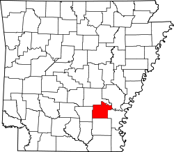
Location within the U.S. state of Arkansas
Arkansas in United States.svg
Arkansas's location within the U.S.
Coordinates: 33°57′35″N91°43′07″W / 33.959722222222°N 91.718611111111°W / 33.959722222222; -91.718611111111
CountryFlag of the United States.svg United States
StateFlag of Arkansas.svg  Arkansas
FoundedMarch 28, 1871
Named for Abraham Lincoln [1]
Seat Star City
Largest cityStar City
Area
[2]
  Total572.17 sq mi (1,481.9 km2)
  Land561.20 sq mi (1,453.5 km2)
  Water10.97 sq mi (28.4 km2)  1.9%
Population
 (2020)
  Total12,941
  Density23/sq mi (8.7/km2)
Time zone UTC−6 (Central)
  Summer (DST) UTC−5 (CDT)
Congressional district 1st
Website lincolncounty.arkansas.gov

Lincoln County is located between the Arkansas Timberlands and Arkansas Delta in the U.S. state of Arkansas. It is also within the Pine Bluff metro area, and on the outer edge of the Central Arkansas region. The county is named for President Abraham Lincoln. Created as Arkansas's 65th county on March 28, 1871, Lincoln County has three incorporated cities, including Star City, the county seat and most populous city. The county contains 46 unincorporated communities and ghost towns, Cane Creek State Park at the confluence of Cane Creek and Bayou Bartholomew, and nine listings on the National Register of Historic Places to preserve the history and culture of the county.

Contents

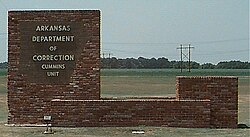
Lincoln County occupies 572.17 square miles (148,190 ha) and contained a population of 12,941 as of the 2020 Census. [3] The rural economy is largely based on agriculture. The state has built two prisons here that also provide some local jobs. Poverty and unemployment rates are above national averages, but steady. Household incomes are below state and national averages.

Lincoln County is served by two school districts, Star City School District and Dumas Public Schools. Higher education and healthcare are available in Pine Bluff to the north or Monticello to the south. Although no Interstate highways serve Lincoln County, the county has access to two United States highways (U.S. Route 65 [US 65], US 425) and eight Arkansas state highways. Lincoln County is also served by one public owned/public use general aviation airport, Star City Municipal Airport, and six community water systems provide potable water to customers in the county.

History

The county was established in 1871 during the Reconstruction era by the Arkansas General Assembly from parts of Arkansas, Bradley, Desha, Drew, and Jefferson counties. It was named for President Abraham Lincoln. The Republican Party was chosen by most freedmen after they got the franchise, as it was the one that secured their emancipation after the Civil War. Some white Union sympathizers, including veterans who decided to stay in the South, also voted for Republican candidates, and some were elected to state offices in former Confederate states. [4]

County government was first permanently established in Star City. The county had a second county seat at Varner from 1885 to 1912. [4]

Geography

Forested trail typical of western Lincoln County Cane Creek State Park 011.jpg
Forested trail typical of western Lincoln County

Lincoln County's geography is defined by two physiographic regions of Arkansas: the Arkansas Timberlands and the Arkansas Delta (in Arkansas, usually referred to as "the Delta"). These two regions are separated by Bayou Bartholomew, the world's longest bayou, which approximately splits the county into eastern and western halves with significant differences in geography. [5] In the east, the Arkansas Delta is a subregion of the Mississippi Alluvial Plain, which is a flat area consisting of rich, fertile sediment deposits from the Mississippi River between Louisiana and Illinois. [4] The western half is part of the Arkansas Timberlands, a portion of the Gulf Coastal Plain characterized by flat pine and cypress forests and silviculture rather than row agriculture. The county is the eighth-smallest in Arkansas, with a total area of 572.17 square miles (1,481.9 km2), of which 561.20 square miles (1,453.5 km2) is land and 10.97 square miles (28.4 km2) (1.9%) is water. [2]

The county is located approximately 68 miles (109 km) southeast of Little Rock, 170 miles (270 km) southwest of Memphis, Tennessee, and 200 miles (320 km) northwest of Jackson, Mississippi. [Note 1] Lincoln County is surrounded by two Delta counties to the east, Arkansas County and Desha County, and a Timberlands county to the west, Cleveland County. Jefferson County to the north and Drew County are border counties similar to Lincoln County, with Bayou Bartholomew delineating a similarly split geography.

Protected areas

Lily pads and a cypress grove on the lake in Cane Creek State Park Cane Creek State Park 015.jpg
Lily pads and a cypress grove on the lake in Cane Creek State Park

Lincoln County contains two protected areas. Cane Creek State Park is a 2,053-acre (831-hectare) state park located on the border between the West Gulf Coastal Plain and Arkansas Delta, with a 1,675 acres (678 hectares) lake at the center. Fishing, canoeing, and kayaking are available on the lake in addition to pavilions, trails, and a visitor center with gift shop on land. [7] The park offers 29 RV/tent camping sites with water and electric hookups, and is owned and operated by the Arkansas Department of Parks and Tourism. [8]

Huff's Island Public Use Area is located on the Arkansas River in northeastern Lincoln County. Managed by the United States Army Corps of Engineers, the park does not have a boat ramp or camping, but offers day use, river bank access from March–September, and four picnic sites. [9]

Demographics

Historical population
CensusPop.Note
1880 9,255
1890 10,25510.8%
1900 13,38930.6%
1910 15,11812.9%
1920 18,77424.2%
1930 20,2507.9%
1940 19,709−2.7%
1950 17,079−13.3%
1960 14,447−15.4%
1970 12,913−10.6%
1980 13,3693.5%
1990 13,6902.4%
2000 14,4925.9%
2010 14,134−2.5%
2020 12,941−8.4%
2023 (est.)12,898 [10] −0.3%
U.S. Decennial Census [11]
1790–1960 [12] 1900–1990 [13]
1990–2000 [14] 2010 [15]

2020 census

Lincoln County racial composition [16]
RaceNumberPercentage
White (non-Hispanic)8,18863.27%
Black or African American (non-Hispanic)3,65028.2%
Native American 270.21%
Asian 230.18%
Pacific Islander 90.07%
Other/Mixed 4253.28%
Hispanic or Latino 6194.78%

As of the 2020 United States census, there were 12,941 people, 3,773 households, and 2,711 families residing in the county.

2000 census

As of the 2000 census, [17] there were 14,492 people, 4,265 households, and 3,130 families residing in the county. The population density was 26 inhabitants per square mile (10/km2). There were 4,955 housing units at an average density of 9 per square mile (3.5/km2). The racial makeup of the county was 64.88% White, 32.92% Black or African American, 0.40% Native American, 0.06% Asian, 0.01% Pacific Islander, 0.99% from other races, and 0.75% from two or more races. 1.81% of the population were Hispanic or Latino of any race.

There were 4,265 households, out of which 34.80% had children under the age of 18 living with them, 54.30% were married couples living together, 14.80% had a female householder with no husband present, and 26.60% were non-families. 23.50% of all households were made up of individuals, and 10.60% had someone living alone who was 65 years of age or older. The average household size was 2.63 and the average family size was 3.11.

In the county, the population was spread out, with 22.20% under the age of 18, 12.40% from 18 to 24, 33.20% from 25 to 44, 20.40% from 45 to 64, and 11.90% who were 65 years of age or older. The median age was 35 years. For every 100 females, there were 142.30 males. For every 100 females age 18 and over, there were 154.70 males.

The median income for a household in the county was $29,607, and the median income for a family was $35,408. Males had a median income of $28,890 versus $19,990 for females. The per capita income for the county was $12,479. About 15.50% of families and 19.50% of the population were below the poverty line, including 26.60% of those under age 18 and 17.90% of those age 65 or over.

Economy

The Arkansas Department of Correction, which operates the Cummins Unit and the Varner Unit in Lincoln County, is one of the county's major employers. [Note 2]

Human resources

Education

Educational attainment in Lincoln County is typical for a rural Arkansas county, with a 2012 study finding 78.4% of Lincoln County residents over age 25 held a high school degree or higher and 8.9% holding a bachelor's degree or higher. The Lincoln County rates are below Arkansas averages of 84.8% and 21.1%, and significantly below national averages of 86.7% and 29.8%, respectively. [18]

Primary and secondary education

One public school district is based in Lincoln County; the Star City School District, which serves the western two-thirds of the county. The remainder of the county is served by the Dumas Public School District, based in Dumas. [19] Successful completion of the curriculum of these schools leads to graduation from Star City High School or Dumas New Tech High School, respectively. Both high schools offer Advanced Placement (AP) courses and are accredited by the Arkansas Department of Education (ADE). Dumas Public Schools is also accredited by AdvancED. [20]

Star City High School Star City High School.jpg
Star City High School

The school districts at Gould and Grady were merged into Dumas and Star City for the 2004–05 school year pursuant to the Public Education Reorganization Act [Note 3] passed by the Arkansas Legislature. [22]

Higher education

Lincoln County does not contain any institutions of higher education. The three nearest institutions in the region are University of Arkansas at Monticello to the south and Southeast Arkansas College (SEARK) and University of Arkansas at Pine Bluff in Pine Bluff to the north, all public four-year colleges.

Library system

The Star City Branch Library in downtown Star City is a member library of the Southeast Arkansas Regional Library system. The location offers books, e-books, media, reference, youth, business and genealogy services.

Public health

Lincoln County's above-average poverty rate [Note 4] suggests a high Medicaid eligibility rate. As of 2012, 25.6% of Lincoln County was eligible for Medicaid, with 62.8% of children under 19 eligible for ARKids First, a program by the Arkansas Department of Human Services that combines children's Medicaid (ARKids A) and other programs for families with higher incomes (ARKids B). [24] These values are more in line with statewide averages [Note 5] than typical values for rural Arkansas counties. [Note 6]

The county's population is significantly above healthy weight, with 69.8% of adults and 43.5% of children/adolescents ranking as overweight or obese, above the state averages of 67.1% and 39.3%, [25] themselves significantly above national averages of 62.9% and 30.3%, respectively. [26]

The Jefferson Regional Medical Center in Pine Bluff is a community hospital offering acute inpatient care, emergency care, cardiology, home health, inpatient hospice, neurology, surgery, and the UAMS South Central Family Residency Program. The facility is rated as a Level 4 Trauma Center by the Arkansas Department of Health. Baptist Health Medical Center and CHI St. Vincent Infirmary are referral hospitals in Little Rock. The nearest Level 1 Trauma Centers are Arkansas Children's Hospital (ACH, or "Children's") and University of Arkansas for Medical Sciences (UAMS), both in Little Rock. [27]

Public safety

The Lincoln County Sheriff's Office is the primary law enforcement agency in the county. The agency is led by the Lincoln County Sheriff, an official elected by countywide vote every four years.

The county is under the jurisdiction of the Lincoln County District Court, a state district court. [28] State district courts in Arkansas are courts of original jurisdiction for criminal, civil (up to $25,000), small claims, and traffic matters. [29] State district courts are presided over by a full-time District Judge elected to a four-year term by a districtwide election. The district is subdivided into the Star City (city), Star City (county), Gould, and Grady departments. All departments of Lincoln County District Court are located at 300 South Drew, and are presided over by one District Judge, who is elected in a countywide election. [28] Superseding district court jurisdiction is the 11th West Judicial Circuit Court, which covers Jefferson and Lincoln counties. The 11th West Circuit contains six circuit judges, elected to six-year terms circuitwide. [30]

State prisons

The Cummins Unit is one of two prison units in Lincoln County CumminsUnitSignArk.jpg
The Cummins Unit is one of two prison units in Lincoln County

The Arkansas Department of Correction operates two prisons in unincorporated areas in the county. [31] [32] The Varner Unit is located in Varner, [33] and the Cummins Unit is near Varner. [34]

Government

The county government is a constitutional body granted specific powers by the Constitution of Arkansas and the Arkansas Code. The quorum court is the legislative branch of the county government and controls all spending and revenue collection. Representatives are called justices of the peace and are elected from county districts every even-numbered year. The number of districts in a county vary from nine to fifteen, and district boundaries are drawn by the county election commission. The Lincoln County Quorum Court has nine members. Presiding over quorum court meetings is the county judge, who serves as the chief operating officer of the county. The county judge is elected at-large and does not vote in quorum court business, although capable of vetoing quorum court decisions. [35] [36]

Politics

Lincoln County historically followed the Solid South voting trend of strong support for Democrats. However, following the election of Arkansas Governor Bill Clinton, the county has turned increasingly Republican, including in state and local races. Politically, the white-majority Lincoln County has transitioned from reliably Democratic in presidential elections to steadily Republican since the election of Barack Obama.


United States presidential election results for Lincoln County, Arkansas [37]
Year Republican Democratic Third party
No.%No.%No.%
2020 2,72970.43%1,03226.63%1142.94%
2016 2,45564.17%1,25232.72%1193.11%
2012 2,19959.02%1,42538.24%1022.74%
2008 2,51357.04%1,71038.81%1834.15%
2004 1,92146.75%2,14952.30%390.95%
2000 1,52643.03%1,95755.19%631.78%
1996 90724.73%2,51768.62%2446.65%
1992 1,14226.27%2,80564.53%4009.20%
1988 1,55741.04%2,20458.09%330.87%
1984 1,86043.54%2,40656.32%60.14%
1980 1,24332.29%2,51765.39%892.31%
1976 69918.67%3,04581.33%00.00%
1972 2,31867.52%1,11532.48%00.00%
1968 48812.91%1,20931.98%2,08455.12%
1964 1,41036.32%2,46863.58%40.10%
1960 62623.66%1,78067.27%2409.07%
1956 76731.89%1,61667.19%220.91%
1952 59524.07%1,87175.69%60.24%
1948 37822.49%1,10865.91%19511.60%
1944 14112.00%1,03488.00%00.00%
1940 999.66%91689.37%100.98%
1936 394.10%91395.90%00.00%
1932 493.63%1,30196.30%10.07%
1928 15114.79%86985.11%10.10%
1924 17023.04%56376.29%50.68%
1920 98852.41%88847.11%90.48%
1916 47734.92%88965.08%00.00%
1912 29231.74%39042.39%23825.87%
1908 15927.37%38966.95%335.68%
1904 35237.81%54458.43%353.76%
1900 39232.64%79466.11%151.25%
1896 23618.66%1,02681.11%30.24%

In Congress, Arkansas has been represented by two Republican senators (John Boozman and Tom Cotton) since January 3, 2015, ending a long history of Democratic hegemony. In the House of Representatives, Lincoln County is within Arkansas's 1st congressinoal district with many other agricultural Delta counties on the eastern side of the state. The district has been represented by Republican Rick Crawford since 2010.

In the Arkansas State Senate, Lincoln County is split essentially in half between north and south. The northern half is within District 25, which also includes most of Jefferson and Phillips counties and a small portion of Desha County. The district has been represented by Stephanie Flowers, a Democratic lawyer from Pine Bluff, since January 2013. [38] The southern half of Lincoln County is within District 26, which reaches to the southeastern corner of the state. District 26 has been represented by Eddie Cheatham, a Democratic retired educator from Crossett, since January 2013.

In the Arkansas House of Representatives, Lincoln County is split among three districts. The western third of Lincoln County is within District 10, which includes parts of four nearby counties. District 10 has been represented by Mike Holcomb since January 2013. Holcomb was initially elected as a Democrat, but switched to the Republican party in August 2015. The eastern third of the county is within District 12, which extends across Arkansas and Desha counties to include all of Phillips County. District 12 has been represented by Chris Richey, a Democratic pastor from Helena-West Helena, since January 2013. A small portion in northern Lincoln County, including Grady and Varner, is within District 16. The district contains the eastern half of Jefferson County, including the southeastern half of Pine Bluff, and has been represented by Ken Ferguson, a Democrat, since January 2015. [39] District 13 has been represented by David Hillman since 2013.

Taxation

Property tax is assessed by the Lincoln County Assessor annually based upon the fair market value of the property and determining which tax rate, commonly called a millage in Arkansas, will apply. The rate depends upon the property's location with respect to city limits, school district, and special tax increment financing (TIF) districts. This tax is collected by the Lincoln County Collector between the first business day of March of each year through October 15 without penalty. The Lincoln County Treasurer disburses tax revenues to various government agencies, such as cities, county road departments, fire departments, libraries, and police departments in accordance with the budget set by the quorum court.

Communities

Cities

Lincoln County has 46 unincorporated communities and ghost towns within its borders. This is due to early settlers in Arkansas tending to settle in small clusters rather than incorporated towns. For example, communities like Varner had a post office and dozens of buildings at some point in their history. Other communities are simply a few dwellings at a crossroads that have adopted a common place name over time. Some are officially listed as populated places by the United States Geological Survey, and others are listed as historic settlements.

Unincorporated communities

Historical communities

Townships

Townships in Lincoln County, Arkansas as of 2010 Lincoln County Arkansas 2010 Township Map large.jpg
Townships in Lincoln County, Arkansas as of 2010

Townships in Arkansas are the divisions of a county. Each township includes unincorporated areas; some may have incorporated cities or towns within part of their boundaries. Arkansas townships have limited purposes in modern times. However, the United States census does list Arkansas population based on townships (sometimes referred to as "county subdivisions" or "minor civil divisions"). Townships are also of value for historical purposes in terms of genealogical research. Each town or city is within one or more townships in an Arkansas county based on census maps and publications. The townships of Lincoln County are listed below; listed in parentheses are the cities, towns, and/or census-designated places that are fully or partially inside the township. [40] [41]

Source: [42]

Infrastructure

Aviation

Lincoln County contains one public owned/public use general aviation airport, Star City Municipal Airport. For the twelve-month period ending February 28, 2014, the facility saw 5,400 general aviation operations. [43] The nearest commercial service airport is Clinton National Airport in Little Rock.

Major highways

US 65 between Grady and Gould US 65 outside Grady, Arkansas.jpg
US 65 between Grady and Gould

The most heavily traveled highway in Lincoln County is U.S. Highway 65, with 7,700 vehicles per day estimated in Gould in 2016. [44] The route connects travelers to Pine Bluff (and Little Rock via Interstate 530 [I-530]) to the north, and Mississippi and Louisiana to the south. U.S. Highway 425 crosses the county from south to north, passing through Star City. Highway 530 was opened to traffic in 2013 as two lanes of a future four-lane controlled access facility between Pine Bluff and the future Interstate 69 in Monticello. [45] Currently, the route serves as direct access to Pine Bluff and points north for Star City travelers, in less distance than US 65.

Eleven state highways serve the traveling public in the county, varying from short connector routes to long highways traversing the entire county. Highway 11 is an important highway in the county, running from US 63 just over the Cleveland County line northeast through Star City and Grady to Huff's Island park on the Arkansas River. Highway 54 crosses the county from east to west on a winding, indirect route between Dumas and Pine Bluff. Highway 114 and Highway 212 serves as east–west routes across the county. Highway 83, Highway 199, and Highway 293 are rural routes in the south, north and southeast parts of Lincoln County, respectively. Highway 388 runs from US 65 toward Cummins and Varner units. Highway 980 connects Star City Municipal Airport to Highway 114. [5] Two unsigned state highways Highway 600 and Highway 831, serve as institutional roads for Cane Creek State Park and the state prisons, respectively.

Utilities

Water

The Arkansas Department of Health (ADH) is responsible for the regulation and oversight of public water systems throughout the state. Six community water systems are based in Lincoln County: Yorktown Water Association, Arkansas Department of Corrections - Cummins Unit, Star City Water, Gould Municipal Water/Sewer, Grady Waterworks, and the Garrett Bridge Water Association. All of these utilities use the Sparta Sand Aquifer for source water. [Note 7] [47] [48] [49] [50] [51] Small, rural parts of the county are served by the Highway 63 Water Association and the Ladd Water Association. [52]

Yorktown Water Association has the largest retail population, with 8,169 total retail population, mostly within Lincoln County. ADC Cummins Unit has a retail population of 3,800, followed by Star City with 2,842, Gould with 1,041, and all others under 1,000 retail population served. [53]

Wastewater

The Arkansas Department of Environmental Quality (ADEQ) regulates and oversees wastewater treatment and discharge permits in the state. Lincoln County contains three municipal wastewater systems, and one active domestic NPDES permit for Cummins Unit.

See also

Notes

  1. Mileages from Lincoln County to Little Rock, Memphis, and Jackson are based on highway miles using county seat Star City for Lincoln County. [6]
  2. "The Arkansas Department of Correction is one of the major employers in Lincoln County, with the Cummins and Varner units both located outside of Grady." [4]
  3. Act 60 of the Second Extraordinary Session of 2003. [21]
  4. Lincoln County's poverty rate was 32.9%, comparing to 22.4% for Arkansas's rural areas, and a 19.6% statewide average. [23]
  5. Statewide averages were 27.8% and 59.1% for Medicaid eligibility and ARKids eligibility, respectively. [23]
  6. Arkansas rural county averages were 31.3% and 66.3% for Medicaid eligibility and ARKids eligibility, respectively. [23]
  7. Though Garrett Bridge purchases water wholesale from Dumas, whose source is the Sparta Sand Aquifer. [46]

Related Research Articles

<span class="mw-page-title-main">Miller County, Arkansas</span> County in Arkansas, United States

Miller County is a county located in the southwestern corner of the U.S. state of Arkansas. As of the 2020 census, the population was 42,600. The county seat is Texarkana.

<span class="mw-page-title-main">Jefferson County, Arkansas</span> County in Arkansas, United States

Jefferson County, Arkansas is a county located in the U.S. state of Arkansas in the area known as the Arkansas Delta that extends west of the Mississippi River. Jefferson County consists of five cities, two towns, and 20 townships. The county is bisected by the Arkansas River, which was critical to its development and long the chief transportation byway. In 2020, Jefferson County's population was estimated at 67,260. Its county seat and largest city is Pine Bluff. Jefferson County is included in the Pine Bluff metropolitan statistical area. The county seat and the most populous city is Pine Bluff.

<span class="mw-page-title-main">Arkansas County, Arkansas</span> County in Arkansas, United States

Arkansas County is a county located in the U.S. state of Arkansas. As of the 2020 census, the population was 17,149. Located in the Arkansas Delta, the county has two county seats, DeWitt and Stuttgart.

<span class="mw-page-title-main">Pine Bluff, Arkansas</span> City in Arkansas, United States

Pine Bluff is the 10th most populous city in the US state of Arkansas and the county seat of Jefferson County. It is the principal city of the Pine Bluff Metropolitan Statistical Area and part of the Little Rock-North Little Rock-Pine Bluff Combined Statistical Area. The population of the city was 41,253 in the 2020 census.

<span class="mw-page-title-main">Redfield, Arkansas</span> City in Arkansas, United States

For people with the surname, see Redfield (surname).

<span class="mw-page-title-main">Gould, Arkansas</span> City in Arkansas, United States

Gould is a city in Lincoln County, Arkansas, United States. Its population was 663 at the 2020 census, down from 837 at the 2010 census. It is included in the Pine Bluff, Arkansas Metropolitan Statistical Area. Gould is a farming community. It was named after the American railroad magnate Jay Gould.

<span class="mw-page-title-main">Grady, Arkansas</span> City in Arkansas, United States

Grady is a city in Lincoln County, Arkansas, United States. The population was 305 at the 2020 census, down from 449 at the 2010 census. It is included in the Pine Bluff, Arkansas Metropolitan Statistical Area.

<span class="mw-page-title-main">Arkansas Department of Corrections</span> American government agency

The Arkansas Department of Corrections (DOC), formerly the Arkansas Department of Correction, is the state law enforcement agency that oversees inmates and operates state prisons within the U.S. state of Arkansas. DOC consists of two divisions, the Arkansas Division of Corrections (ADC) and the Arkansas Division of Community Corrections (DCC), as well as the Arkansas Correctional School District. ADC is responsible for housing and rehabilitating people convicted of crimes by the courts of Arkansas. ADC maintains 20 prison facilities for inmates in 12 counties. DCC is responsible for adult parole and probation and offender reentry.

<span class="mw-page-title-main">Interstate 530</span> Highway in Arkansas

Interstate 530 (I-530) in Arkansas is a spur route of the Interstate highway system, traveling 46.65 miles (75.08 km) from Pine Bluff north-northwest to Little Rock at an interchange of I-30/I-440/U.S. Highway 65 (US 65)/US 67/US 167. The highway also travels through the cities of Redfield and White Hall. In the future, I-530 will be extended to I-69 west of Monticello. A short section near the future I-69 alignment has been signed as Highway 530 (AR 530).

<span class="mw-page-title-main">Pine Bluff metropolitan area</span>

The Pine Bluff Metropolitan Statistical Area, as defined by the United States Census Bureau, is a three-county region in southeast Arkansas, anchored by the city of Pine Bluff. As of the 2010 census, the MSA had a population of 100,258. The metro area's population declined by 12.47% between 2010 and 2020, more than any other metropolitan area in the United States. It is also a component of the larger Little Rock-North Little Rock, AR Combined Statistical Area which had 902,443 people in the census estimates of 2014.

<span class="mw-page-title-main">Cummins Unit</span> Unincorporated community in Arkansas, United States

The Cummins Unit is an Arkansas Department of Corrections prison in unincorporated Lincoln County, Arkansas, United States, in the Arkansas Delta region. It is located along U.S. Route 65, near Grady, Gould, and Varner, 28 miles (45 km) south of Pine Bluff, and 60 miles (97 km) southeast of Little Rock.

<span class="mw-page-title-main">Varner Unit</span>

The Varner Unit is a high-security state prison for men of the Arkansas Department of Correction in Varner, Choctaw Township, unincorporated Lincoln County, Arkansas, United States. It is located along U.S. Highway 65, near Grady, and 28 miles (45 km) south of Pine Bluff. The prison can house over 1,600 prisoners, and it includes a 468-bed supermax facility. The supermax and non-supermax facilities are separate from one another.

<span class="mw-page-title-main">Tucker, Arkansas</span> Census-designated place in Arkansas, United States

Tucker is an Unincorporated community and census-designated place (CDP) in Jefferson County, Arkansas. It has an elevation of 226 ft and is located 30 miles (48 km) southeast of Little Rock. It was first listed as a CDP in the 2020 census with a population of 95.

Varner is an unincorporated community in Lincoln County, Arkansas, United States. Its elevation is 177 ft. Varner is located southeast of Little Rock.

The Gould School District was a school district that operated public schools in Gould, Arkansas. Its territory is now a part of the Dumas School District.

Star City School District is a public school district headquartered in Star City, Arkansas, United States. The district serves Star City and Grady as well as multiple unincorporated areas.

Dumas Public Schools is a school district headquartered in Dumas, Arkansas. It serves territory in Desha and Lincoln counties, including Dumas, Gould, Mitchellville, and Winchester. It also serves Arkansas Department of Corrections prison property.

Jefferson, also known as Jefferson Springs, is an unincorporated community in the Pine Bluff metropolitan area of northwestern Jefferson County in the U.S. state of Arkansas. It is situated on the Union Pacific Railway (UP), 15.5 miles (24.9 km) northwest of Pine Bluff, the county seat, and is the home of the National Center for Toxicological Research (NCTR).

<span class="mw-page-title-main">Star City High School</span> Public school in Star City, Lincoln County, Arkansas, United States

Star City High School is a comprehensive public high school for students in grades 9 through 12 located in Star City, Arkansas, United States. Star City High School is the only public high school in Lincoln County and the only high school of the Star City School District.

Dumas High School (DHS), formerly Dumas New Tech High School, is a comprehensive public secondary school located in Dumas, Arkansas, United States, for students in grades ten through twelve. Dumas is one of two public high schools in Desha County and is the sole high school administered by the Dumas School District.

References

  1. Gannett, Henry (1905). The Origin of Certain Place Names in the United States. U.S. Government Printing Office. p.  187.
  2. 1 2 Arkansas State Highway and Transportation Department in cooperation with the U.S. Department of Transportation (October 16, 2014). Arkansas County Polygons (SHP file) (Map). Arkansas GIS Office. Retrieved January 1, 2017.
  3. "Census - Geography Profile: Lincoln County, Arkansas" . Retrieved January 20, 2023.
  4. 1 2 3 4 Lancaster, Guy (June 1, 2016). "Lincoln County". Encyclopedia of Arkansas History and Culture . Butler Center for Arkansas Studies at the Central Arkansas Library System . Retrieved December 18, 2016.
  5. 1 2 Transportation Planning and Policy Division (August 28, 2015). General Highway Map, Lincoln County, Arkansas (PDF) (Map). 1:62500. Little Rock: Arkansas State Highway and Transportation Department. Archived from the original (PDF) on August 22, 2017. Retrieved August 22, 2017.{{cite map}}: |author= has generic name (help)
  6. "Google Maps (Search for Star City, AR)" . Retrieved August 22, 2017.
  7. "ADPT" (2017) , p. 9, 145.
  8. "ADPT" (2017) , p. 9.
  9. "ADPT" (2017) , p. 29.
  10. "Annual Estimates of the Resident Population for Counties: April 1, 2020 to July 1, 2023". United States Census Bureau. Retrieved March 30, 2024.
  11. "U.S. Decennial Census". United States Census Bureau. Retrieved August 27, 2015.
  12. "Historical Census Browser". University of Virginia Library. Retrieved August 27, 2015.
  13. Forstall, Richard L., ed. (March 27, 1995). "Population of Counties by Decennial Census: 1900 to 1990". United States Census Bureau. Retrieved August 27, 2015.
  14. "Census 2000 PHC-T-4. Ranking Tables for Counties: 1990 and 2000" (PDF). United States Census Bureau. April 2, 2001. Archived (PDF) from the original on March 27, 2010. Retrieved August 27, 2015.
  15. "State & County QuickFacts". United States Census Bureau. Archived from the original on June 7, 2011. Retrieved May 23, 2014.
  16. "Explore Census Data". data.census.gov. Retrieved December 30, 2021.
  17. "U.S. Census website". United States Census Bureau . Retrieved May 14, 2011.
  18. "American Community Survey". United States Census Bureau. 2011–2015. Retrieved July 31, 2017.
  19. "2020 CENSUS - SCHOOL DISTRICT REFERENCE MAP: Lincoln County, AR" (PDF). U.S. Census Bureau. Archived (PDF) from the original on July 20, 2022. Retrieved July 20, 2022. - Text list - The 2010 map (text list) indicated a portion was served by the DeWitt School District, but that section shown as being in DeWitt and in Lincoln County in the 2010 map is shown as being in DeWitt and in Jefferson County in the 2020 map.
  20. "Dumas School District". Institution Summary (Executive Summary). AdvancED. December 22, 2015. Retrieved July 31, 2017.
  21. Holley, Marc J. (June 14, 2015). "School Consolidation". Encyclopedia of Arkansas History and Culture . Butler Center for Arkansas Studies at the Central Arkansas Library System. Retrieved August 28, 2016.
  22. "Dumas inherits Gould district's deficit". Arkansas News. May 11, 2005. Archived from the original on July 7, 2011. Retrieved March 7, 2011.
  23. 1 2 3 "Profile" (2015), pp. 54–55.
  24. "Profile" (2015) , p. 55.
  25. "Profile" (2015) , pp. 56–57.
  26. "Nutrition, Physical Activity and Obesity: Data, Trends and Maps". Centers for Disease Control and Prevention. Archived from the original on December 21, 2016. Retrieved July 31, 2017.
  27. "Designated Trauma Centers". Arkansas Department of Health. June 7, 2016. Archived from the original on February 11, 2012. Retrieved July 31, 2017.
  28. 1 2 "Directory" (2017) , p. 45.
  29. Staff of the Arkansas Judiciary (September 2, 2014). "Arkansas Court Structure" (PDF). Arkansas Judiciary. Archived from the original (PDF) on December 23, 2016. Retrieved July 31, 2017.
  30. "Directory" (2017) , p. 25.
  31. "Varner Unit." Arkansas Department of Correction. Retrieved on July 18, 2010. "28 miles south of Pine Bluff off Highway 65 in Lincoln County."
  32. "Cummins Unit." Arkansas Department of Correction. Retrieved on August 15, 2010.
  33. "New hearing ordered for 3 in Ark. scout deaths." Associated Press at the Worcester Telegram . Wednesday September 29, 2010. Retrieved on March 5, 2011. "Damien Echols is interviewed in the visiting area of the Arkansas Department of Correction Varner Unit prison in Varner,"
  34. "Arkansas killer plans no more appeals He is to die Wednesday in '84 death of trooper." Associated Press at The Dallas Morning News . April 18, 1995. Retrieved on March 5, 2011. "[...] and he was transferred to the death watch cell at the Cummins Unit near Varner."
  35. Teske, Steven (March 24, 2014). "Quorum Courts". Encyclopedia of Arkansas History and Culture . Butler Center for Arkansas Studies at the Central Arkansas Library System . Retrieved January 23, 2016.
  36. Goss, Kay C. (August 28, 2015). "Office of County Judge". Encyclopedia of Arkansas History and Culture . Butler Center for Arkansas Studies at the Central Arkansas Library System. Retrieved January 23, 2016.
  37. "Dave Leip's Atlas of U.S. Presidential Elections" . Retrieved November 18, 2016.
  38. "State Senate District Map" (PDF). Arkansas Board of Apportionment. Archived (PDF) from the original on December 20, 2016. Retrieved December 5, 2016.
  39. "State House District Map" (PDF). Arkansas Board of Apportionment. Archived (PDF) from the original on December 20, 2016. Retrieved December 5, 2016.
  40. 2011 Boundary and Annexation Survey (BAS): Lincoln County, AR (PDF) (Map). U. S. Census Bureau. Archived from the original (PDF) on October 19, 2012. Retrieved August 18, 2011.
  41. "Arkansas: 2010 Census Block Maps - County Subdivision". United States Census Bureau . Retrieved May 29, 2014.
  42. "Summary Population and Housing Characteristics, CPH-1-5, Arkansas" (PDF). 2010 Census of Population and Housing . United States Census Bureau. September 2012. Retrieved May 31, 2014.{{cite web}}: External link in |work= (help)
  43. FAA Airport Form 5010 for 55M PDF . Federal Aviation Administration. Retrieved July 31, 2017.
  44. System Research and Information Division, AHTD (2016). Daily Traffic Estimates (PDF) (Map). Little Rock, Arkansas: Arkansas State Highway and Transportation Department. Archived (PDF) from the original on August 26, 2017. Retrieved August 26, 2017.
  45. "New State Highway 530 opens". Pine Bluff Commercial. September 12, 2013. Retrieved August 26, 2017.
  46. "Garrett Bridge Water Association Annual Drinking Water Quality Report" (PDF). Consumer Confidence Report. Little Rock: Arkansas Department of Health. 2016. Archived (PDF) from the original on December 23, 2016. Retrieved August 4, 2017.
  47. "ADC Cummins Unit Annual Drinking Water Quality Report" (PDF). Consumer Confidence Report. Little Rock: Arkansas Department of Health. 2016. Archived (PDF) from the original on December 27, 2016. Retrieved August 4, 2017.
  48. "Gould Municipal Water & Sewer Annual Drinking Water Quality Report" (PDF). Consumer Confidence Report. Little Rock: Arkansas Department of Health. 2016. Archived (PDF) from the original on December 23, 2016. Retrieved August 4, 2017.
  49. "Grady Waterworks Annual Drinking Water Quality Report" (PDF). Consumer Confidence Report. Little Rock: Arkansas Department of Health. 2016. Archived (PDF) from the original on December 26, 2016. Retrieved August 4, 2017.
  50. "Star City Water Company Annual Drinking Water Quality Report" (PDF). Consumer Confidence Report. Little Rock: Arkansas Department of Health. 2016. Archived (PDF) from the original on December 27, 2016. Retrieved August 4, 2017.
  51. "Yorktown Water Association Annual Drinking Water Quality Report" (PDF). Consumer Confidence Report. Little Rock: Arkansas Department of Health. 2016. Archived (PDF) from the original on December 23, 2016. Retrieved August 4, 2017.
  52. "Public Water Systems" (GIS Dataset). Arkansas Department of Health. Arkansas GIS Office. January 5, 2016. Retrieved August 4, 2017.
  53. "Community Water System Data". Little Rock: Arkansas Department of Health, Engineering Section. Retrieved August 4, 2017.

Further reading

33°57′35″N91°43′07″W / 33.95972°N 91.71861°W / 33.95972; -91.71861