Cross County, Arkansas

Last updated

Cross County
Cross County Courthouse in Wynne, Arkansas.jpg
Streetside in Wynne, Arkansas 1.jpg
Railroad overpass in Wynne, Arkansas.jpg
Parkin Archaeological State Park Parkin AR 2013-08-24 009.jpg
Village Creek State Park Wynne AR 2011-07-23 005.jpg
Field in Wynne, Arkansas 2.jpg
Clockwise from top: Cross County Courthouse, the railroad overpass in Wynne, Lake Austell at Village Creek State Park, a sorghum field with Wynne grain elevator in the background, a preserved Native American mound at Parkin Archaeological State Park, and streetside in the Wynne Commercial Historic District
Map of Arkansas highlighting Cross County.svg
Location within the U.S. state of Arkansas
Arkansas in United States.svg
Arkansas's location within the U.S.
Coordinates: 35°17′30″N90°46′24″W / 35.291666666667°N 90.773333333333°W / 35.291666666667; -90.773333333333
CountryFlag of the United States.svg United States
StateFlag of Arkansas.svg  Arkansas
FoundedNovember 15, 1862
Named for David C. Cross
Seat Wynne
Largest cityWynne
Area
[1]
  Total622.33 sq mi (1,611.8 km2)
  Land615.85 sq mi (1,595.0 km2)
  Water6.48 sq mi (16.8 km2)  1.0%
Population
 (2020)
  Total16,833
  Density27/sq mi (10/km2)
Time zone UTC−6 (Central)
  Summer (DST) UTC−5 (CDT)
Congressional district 1st
Website crosscountyar.org

Cross County is a rural Northeast Arkansas county in the Arkansas Delta. Created as Arkansas's 53rd county on November 15, 1862, Cross County contains four incorporated municipalities, including Wynne, the county seat and most populous city. It is named for Confederate Colonel David C. Cross, a political leader in the area.

Contents

The county is largely flat and fertile, mostly used for row agriculture typical of the rich alluvial soils of the Arkansas Delta. Crowley's Ridge, a forested deposit of loess hills rising from the flat Delta bisects the county from north to south, including part of Wynne and most of Village Creek State Park, the county's primary protected area of ecological value. Historical and cultural features range from Parkin Archeological State Park, which preserves a prehistoric Native American mound building settlement, to the Johnston Cotton Gin marking mechanization of the cotton farm, and the Northern Ohio School, a segregated school built by a lumber company for African-American children of employees.

Cross County occupies 622.33 square miles (1,612 ha) and contained a population of 16,833 as of the 2020 census. [2] The economy is largely based on agriculture. Poverty and unemployment rates are above national averages, household incomes are below state and national averages.

Cross County is mostly served by two school districts: Cross County School District and Wynne Public Schools. Higher education is provided at the Wynne campus of East Arkansas Community College, a public community college. Crossridge Community Hospital in Wynne is a community hospital providing primary care in the county. Although no Interstate highways serve Cross County, the county has access to two United States highways (US Highway 49 [US 49] and US 64) and thirteen Arkansas state highways. Cross County is also served by one public owned/public use general aviation airport, Wynne Municipal Airport, and seven community water systems provide potable water to customers in the county.

History

Cross County was formed in November 1862 by the Arkansas State Legislature from portions of St. Francis, Crittenden, and Poinsett Counties. The first county seat was Whittsburg, located due east of modern Wynne. [3]

In 1882, the first railroad, the Helena & Iron Mountain Railroad, was constructed in Cross County. The line was later bought out by the St. Louis, Iron Mountain, & Southern Railroad. In 1903, the county seat was moved to Wynne. [4]

Geography

Cross County is established on the rich, fertile, alluvial soils of the Mississippi Alluvial Plain. In Arkansas, this region is called the Arkansas Delta (in Arkansas, usually referred to as "the Delta"), having a distinct history and culture from adjacent regions. Bisecting the county from north to south is Crowley's Ridge, a geologic anomaly rising from the Delta composed of loess soil and generally remains covered in oak-hickory forest. Today, the majority (68 percent) of the county is used for row agriculture. [Note 1]

Roughly the western third of the county is within the Western Lowlands Pleistocene Valley Train subregion of the Delta. This region is characterized as flat windblown deposits of silty, sandy soils, and loess with a high groundwater table. Post oak and loblolly pine are native in the higher elevations, with overcup oak, water hickory, willow oak, and pin oak and pondberry native in wetlands. Today, row agriculture is extensive (mostly soybeans and cotton), with commercial aquaculture (crawfish, baitfish, and catfish farms) also common. [10]

Crowley's Ridge is a series of loess hills more closely associated with the Appalachian Mountains of Tennessee and Kentucky than the Delta country surrounding it. Composed of sandy loess stacked on gravel deposits later eroded by streams into ravines, Crowley's Ridge rises from the flat Delta by up to 500 feet (150 m). Crowley's Ridge remains largely wooded with oak-hickory forest or beech–maple forest, with little land in cultivation. Forests are related to the Appalachian cove forests, with post oak, blackjack oak, southern red oak, white oak, beech and sugar maple forest standing in contrast to the southern floodplain forests in the rest of Cross County. [10]

The eastern third of Cross County is split between the Northern Holocene Meander Belts and St. Francis Lowlands, both subregions historically influenced by the Mississippi River. Both regions are flat, poorly drained areas consisting of former river channels, drainageways, and floodplains drained in the late 19th century for settlement and row agriculture. Today consisting of farm fields, channelized drainage ditches, levees, the area is predominantly in soybean and cotton cultivation, with some corn, wheat, rice, and sorghum. Remaining natural areas consist of sugarberry, elm, ash tree, pecan, cottonwood, and sycamores. Sandy "Sunk lands" are attributed to the 1811–12 New Madrid earthquakes. [10]

Given Cross County's position along the Mississippi Flyway, many natural areas and grain fields serve as wintering ground for water fowl. Duck hunting is popular in the Delta, including Cross County. [10]

According to the U.S. Census Bureau, the county has a total area of 622.33 square miles (1,611.8 km2), of which 615.85 square miles (1,595.0 km2) is land and 6.48 square miles (16.8 km2) (1.0%) is water. [1] [11] It ranks 49th of the 75 Arkansas counties in area.

The county is located approximately 46 miles (74 km) south of Jonesboro, 48 miles (77 km) west of Memphis, Tennessee, and 105 miles (169 km) east of Little Rock. [Note 2] Cross County is surrounded by five other Delta counties: Crittenden County to the east, St. Francis County to the south, Woodruff County to the west, Jackson County to the northwest, and Poinsett County to the north.

Hydrology

St. Francis River at Parkin St Francis River Parkin AR 2012-05-27 008.jpg
St. Francis River at Parkin

Water is an important part of Cross County's geography, history, and culture. Hydraulically, the county is split into two watersheds by Crowley's Ridge, with the eastern half draining to the St. Francis River or its tributaries, and the western half draining to the L'Anguille River.

The deep, wide, calm, and navigable St. Francis River has been important for every civilization in Cross County since prehistory. The Casqui tribe settled in the area where the Tyronza River empties into the St. Francis. Today, this settlement is preserved within Parkin Archaeological State Park. Centuries later, European settlers founded Wittsburg as a port city as the northernmost navigable point on the St. Francis a few miles downstream from Parkin, opening the region to regional trade. Within the county, Brushy Creek, Cross County Ditch, Copeland Slough, Prairie Creek, and Village Creek are important watercourses. [13]

Protected areas

This segment of the Memphis to Little Rock Road in Village Creek State Park is listed on the National Register of Historic Places and is preserved as a trail Village Creek State Park Wynne AR 52.jpg
This segment of the Memphis to Little Rock Road in Village Creek State Park is listed on the National Register of Historic Places and is preserved as a trail

The largest protected area in Cross County is Village Creek State Park on Crowley's Ridge near Wynne. The park is known as a large section of preserved forest in its natural state within the Delta, a 27-hole golf course, catfish and bass fishing in the two lakes, horseback riding trails, and a hiking trail along the former Memphis to Little Rock Military Road. [14] [15] The Parkin Archeological State Park in Parkin preserves a prehistoric Native American mound building settlement.

The Brushy Creek Wildlife Management Area is a small property reforested in bottomland hardwood forest by the Arkansas Game and Fish Commission near Hickory Ridge. [16] The Arkansas Natural Heritage Commission maintains the Wittsburg Natural Area as natural Crowley's Ridge habitat, [17] but there is no legal public access to the area.

Demographics

Historical population
CensusPop.Note
1870 3,915
1880 5,05029.0%
1890 7,69352.3%
1900 11,05143.7%
1910 14,04227.1%
1920 18,57932.3%
1930 25,72338.5%
1940 26,0461.3%
1950 24,757−4.9%
1960 19,551−21.0%
1970 19,7831.2%
1980 20,4343.3%
1990 19,225−5.9%
2000 19,5261.6%
2010 17,870−8.5%
2020 16,833−5.8%
2023 (est.)16,420 [18] −2.5%
U.S. Decennial Census [19]
1790–1960 [20] 1900–1990 [21]
1990–2000 [22] 2010 [23]
Age pyramid Cross County USA Cross County, Arkansas age pyramid.svg
Age pyramid Cross County

2020 census

Cross County Racial Composition [25]
RaceNum.Perc.
White 12,06771.69%
Black or African American 3,65121.69%
Native American 380.23%
Asian 1020.61%
Pacific Islander 50.03%
Other/Mixed 6183.67%
Hispanic or Latino 3522.09%

As of the 2020 United States Census, there were 16,833 people, 6,653 households, and 4,652 families residing in the county.

2000 census

At the 2000 census, [26] there were 19,526 people, 7,391 household, and 5,447 families residing in the county. The population density was 32 per square mile (12/km2). There were 8,030 housing units at an average density of 13 per square mile (5.0/km2). The racial makeup of the county was 74.80% White, 23.70% Black or African American, 0.23% Native American, 0.31% Asian, 0.01% Pacific Islander, 0.21% from other races, and 0.74% from two or more races. 0.93% of the population were Hispanic or Latino of any race.

There were 7,391 households, of which 34.70% had children under the age of 18 living with them, 55.20% were married couples living together, 14.10% had a female householder with no husband present, and 26.30% were non-families. 23.50% of all households were made up of individuals, and 11.10% had someone living alone who was 65 years of age or older. The average household size was 2.60 and the average family size was 3.07.

27.80% of the population were under the age of 18, 8.50% from 18 to 24, 27.40% from 25 to 44, 22.60% from 45 to 64, and 13.70% who were 65 years of age or older. The median age was 36 years. For every 100 females there were 94.00 males. For every 100 females age 18 and over, there were 89.40 males.

The median household income was $29,362 and the median family income was $34,044. Males had a median income of $27,880 and females $20,133. The per capita income for the county was $15,726. About 16.40% of families and 19.90% of the population were below the poverty line, including 27.90% of those under age 18 and 17.50% of those age 65 or over.

Human resources

Education

Educational attainment in Cross County is typical for a rural Arkansas county: 83.6% of Cross County residents over age 25 held a high school degree or higher and 14.4% hold a bachelor's degree or higher, compared to Arkansas statewide averages of 86.6% and 23.0%. Cross County is significantly below national averages of 88.0% and 32.1%, respectively. [27]

Primary and secondary education

Two public school districts are based in Cross County: Wynne School District and Cross County School District. Almost the entire county is served by one of these districts, except for a small area in the northeast corner served by Earle School District. The two Cross County districts also serve small areas in adjoining counties. Successful completion of the curriculum of these schools leads to graduation from Wynne Senior High School and Cross County High School respectively. Both high schools are accredited by the Arkansas Department of Education (ADE). Cross County HS is part of the New Tech Network.

Higher education

EACC-Wynne East Arkansas Community College, Wynne Campus.jpg
EACC-Wynne

Cross County contains one institution of higher education, the Wynne Campus of the East Arkansas Community College, a public community college based in Forrest City. The Arkansas State University System offers two institutions in the region: Arkansas State University, a public four-year university in Jonesboro, and Arkansas State University Mid-South, a public community college in West Memphis.

Libraries

The East Central Arkansas Regional Library is headquartered at the Cross County Library, 410 Merriman Avenue East in downtown Wynne. The Cross County Library has a branch library at 122 Wilson Street in Parkin. [28]

Public health

The Cross County Hospital was established in 1952 in Wynne, and operated as a county hospital until a lease agreement with Jonesboro-based St. Bernards Healthcare started in 1999. Now known as CrossRidge Community Hospital, the hospital is supported by a 1% sales tax renewed by voters every four years. [29] The nearest Level 1 Trauma Centers are RegionalOne Health Center and Le Bonheur Children's Hospital, both in Memphis. [30]

The county's population is significantly above healthy weight, with 39.4% of adults ranking as obese, [31] above the state average of 35.7%, itself significantly above national average of 29.6%. [32]

Public safety

Wynne Police Department patrol car City of Wynne, Arkansas police car.jpg
Wynne Police Department patrol car

The Cross County Sheriff's Office is the primary law enforcement agency in the county. The agency is led by the Cross County Sheriff, an official elected by countywide vote every four years. Police departments in Wynne and Cherry Valley provide law enforcement in their respective jurisdictions, with Hickory Ridge and Parkin contracting with the Cross County Sheriff's Office for law enforcement services. [33] [34]

The county is under the jurisdiction of the Cross County District Court, a local district court. Local district courts in Arkansas are courts of original jurisdiction for criminal, civil, small claims, and traffic matters. Local district courts are presided over by an elected part-time judge who may privately practice law. The district court has three departments: Cherry Valley, Parkin, and Wynne. In 2021, the court will be merged into the 25th District state district court, which includes St. Francis County.

Superseding district court jurisdiction is the 1st Judicial Circuit Court, which covers Cross, Lee, Monroe, Phillips, St. Francis, and Woodruff counties. The First Circuit contains five circuit judges, elected to six-year terms circuit wide.

Fire protection is provided by seven agencies in Cross County, together covering the entire county. The four incorporated municipalities provide fire protection beyond their corporate limits. Rural areas are served by the Bay Village Volunteer Fire Department, Fair Oaks Volunteer Fire Department, and Vanndale Volunteer Fire Department. [35] All fire departments in Cross County are volunteer-based, except the Wynne Fire Department.

Culture and contemporary life

Native American pottery found nearby on display at Parkin Archaeological State Park Parkin Archeological State Park Parkin AR 12.jpg
Native American pottery found nearby on display at Parkin Archaeological State Park

Cross County has several facilities, monuments, and museums dedicated to preserving the history and culture of the area. The Cross County Museum, owned and operated by the Cross County Historical Society, preserves and interprets the history and culture of Cross County for visitors. Cross County Historical Society also maintains the New Hope School outside Wynne.

Parkin contains remains of a historic palisaded village with one mound Late Mississippian village, today listed as a National Historic Landmark and interpreted via the Parkin Archeological State Park. Also in Parkin, the Northern Ohio School is a one-room school built by a lumber company to educate the children of African-American employees in the first half of the 20th century.

Wynne was the primary beneficiary of transportation improvements following the Reconstruction era, becoming a commercial hub for Cross County. Many of the historic structures in downtown Wynne were constructed during economically prosperous times on the farm, leading to the construction of ornate homes in the East Hamilton Avenue Historic District. The commercial centers are preserved as the Wynne Commercial Historic District and the Wynne Wholesale Commercial Historic District.

Other cultural points of interest in Cross County include:

Media

The Wynne Progress and the Cross County Times are the county's two weekly newspapers. The county has had several former publications that have closed over the years, including newspapers published at Parkin and Wittsburg. [36]

Cross County is within the Memphis designated market area [37] with the following local TV stations: WREG (CBS), WMC (NBC), WKNO (PBS), WHBQ (Fox), WTWV, WATN (ABC), WLMT (The CW), WBUY, and WPXX (Ion TV). [38]

The county is home to two radio stations: KWYN (92.5 FM) [39] and sister station, KWYN (1400 AM). [40]

Government

Cross County Quorum Court meeting place Cross County Quorum Court meeting place.jpg
Cross County Quorum Court meeting place

The county government is a constitutional body granted specific powers by the Constitution of Arkansas and the Arkansas Code. The quorum court is the legislative branch of the county government and controls all spending and revenue collection. Representatives are called justices of the peace and are elected from county districts every even-numbered year. The number of districts in a county vary from nine to fifteen, and district boundaries are drawn by the county election commission. The Cross County Quorum Court has nine members. [41] Presiding over quorum court meetings is the county judge, who serves as the chief executive officer of the county. The county judge is elected at-large and does not vote in quorum court business, although capable of vetoing quorum court decisions. [42] [43]

Politics

Politically, Cross County has transitioned from reliably Democratic to steadily Republican since the mid-20th century. It has voted Republican by increasing margins in each presidential election from 2004-2020.

United States presidential election results for Cross County, Arkansas [44]
Year Republican Democratic Third party
No.%No.%No.%
2020 4,94671.25%1,77225.53%2243.23%
2016 4,58466.69%1,99929.08%2914.23%
2012 4,26963.90%2,27934.11%1331.99%
2008 4,39361.61%2,58036.19%1572.20%
2004 3,86454.62%3,13544.32%751.06%
2000 3,03348.80%3,09649.81%861.38%
1996 2,00032.47%3,63158.94%5298.59%
1992 2,30332.97%4,05858.09%6258.95%
1988 3,18651.29%2,98948.12%370.60%
1984 3,91759.04%2,70140.71%170.26%
1980 2,89544.59%3,47153.47%1261.94%
1976 1,90931.11%4,19868.40%300.49%
1972 3,74372.78%1,22123.74%1793.48%
1968 1,09319.16%1,55527.26%3,05653.58%
1964 2,14746.88%2,42152.86%120.26%
1960 1,28735.60%2,08857.76%2406.64%
1956 1,17634.42%2,16563.36%762.22%
1952 1,46138.28%2,34461.41%120.31%
1948 2139.40%1,10048.57%95242.03%
1944 45220.71%1,72479.01%60.27%
1940 28514.00%1,74685.80%40.20%
1936 1337.40%1,64491.49%201.11%
1932 874.02%2,06695.47%110.51%
1928 32420.12%1,28279.63%40.25%
1924 19221.08%62568.61%9410.32%
1920 45734.00%84562.87%423.13%
1916 25221.37%92778.63%00.00%
1912 29326.71%49144.76%31328.53%
1908 50739.83%70555.38%614.79%
1904 32132.79%63064.35%282.86%
1900 31232.74%63866.95%30.31%
1896 22419.77%90880.14%10.09%

Communities

Incorporated communities

Entrance to downtown Wynne Downtown Wynne, AR Entrance.jpg
Entrance to downtown Wynne

Unincorporated communities

The W.M. Smith & Sons store was the historic center of the Birdeye community Birdeye AR 010.jpg
The W.M. Smith & Sons store was the historic center of the Birdeye community

Historic communities

Townships

Townships in Cross County, Arkansas as of 2010 Cross County Arkansas 2010 Township Map large.jpg
Townships in Cross County, Arkansas as of 2010

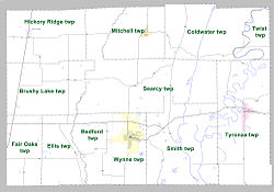
Townships in Arkansas are the divisions of a county. Each township includes unincorporated areas; some may have incorporated cities or towns within part of their boundaries. Arkansas townships have limited purposes in modern times. However, the United States census does list Arkansas population based on townships (sometimes referred to as "county subdivisions" or "minor civil divisions"). Townships are also of value for historical purposes in terms of genealogical research. Each town or city is within one or more townships in an Arkansas county based on census maps and publications. The townships of Cross County are listed below; listed in parentheses are the cities, towns, and/or census-designated places that are fully or partially inside the township. [45] [46]

Infrastructure

Major highways

Cross County is not served by any Interstate highways; the nearest access to the Interstate system is Interstate 40 (I-40) in St. Francis County to the south. Two United States highways serve Cross County: U.S. Highway 49 (US 49) runs north–south in western Cross County; and US 64 runs east–west across the length of Cross County. [47]

Highway 1B runs north as a rural highway in Vanndale Highway 1 northbound in Vanndale, Arkansas.jpg
Highway 1B runs north as a rural highway in Vanndale

Eleven state highways serve the traveling public in the county, varying from short connector routes to long highways traversing the entire county. Highway 1, which runs north–south the length of the Arkansas Delta, essentially bisects the county, serving as a principal arterial through Wynne and connecting Cherry Valley and Vanndale to the state highway system. Highway 42 runs east–west across the northern part of Cross County through Hickory Ridge, Cherry Valley, Birdeye, Coldwater, and Twist. Highway 75 runs north–south through east Cross County, connecting Parkin and Coldwater to I-40 to the south and I-555 to the north. [47]

Highway 163 begins at Wittsburg and runs north along Crowley's Ridge to Birdeye and toward Jonesboro. It is designated as the Crowley's Ridge Parkway, a National Scenic Byway and Arkansas Scenic Byway. [47]

Utilities

Parkin Water Company water treatment plant in Parkin Parkin AR 2012-03 022.jpg
Parkin Water Company water treatment plant in Parkin

Entergy Arkansas is the sole provider of electricity in most of Cross County, with exception of an area northeast of Wynne roughly between Highway 1 and the St. Francis River, which is served by Woodruff Electric Cooperative. [48] Telephone communication service is provided by AT&T, cable television is provided by East Arkansas Video. Centerpoint Energy is the natural gas utility in Cross County.

The Arkansas Department of Health (ADH) is responsible for the regulation and oversight of public water systems throughout the state. Cross County contains seven community water systems. [49] Cross County Rural Water System is the largest by customer count (9276), though it extends into portions of five other counties. Wynne Water Utilities is largest by customers in Cross County (8837), followed by the Vanndale-Birdeye Water Association (2389). Cherry Valley Waterworks, Hickory Ridge Waterworks, Parkin Rural Water Association, and Parkin Water Company are all smaller water systems with under 1000 customers. All use groundwater from various aquifers as source water. [50] [51] [52] [53] [54] [55] [Note 3]

See also

Related Research Articles

<span class="mw-page-title-main">Arkansas</span> U.S. state

Arkansas is a landlocked state in the South Central region of the Southern United States. It borders Missouri to the north, Tennessee and Mississippi to the east, Louisiana to the south, Texas to the southwest, and Oklahoma to the west. Its name derives from the Osage language, and refers to their relatives, the Quapaw people. The state's diverse geography ranges from the mountainous regions of the Ozark and Ouachita Mountains, which make up the U.S. Interior Highlands, to the densely forested land in the south known as the Arkansas Timberlands, to the eastern lowlands along the Mississippi River and the Arkansas Delta.

<span class="mw-page-title-main">Woodruff County, Arkansas</span> County in Arkansas, United States

Woodruff County is located in the Arkansas Delta in the U.S. state of Arkansas. The county is named for William E. Woodruff, founder of the state's first newspaper, the Arkansas Gazette. Created as Arkansas's 54th county in 1862, Woodruff County is home to one incorporated town and four incorporated cities, including Augusta, the county seat. The county is also the site of numerous unincorporated communities and ghost towns. Occupying only 587 square miles (152,000 ha), Woodruff County is the 13th smallest county in Arkansas. As of the 2020 Census, the county's population was 6,269. Based on population, the county is the second-smallest county of the 75 in Arkansas. Located in the Arkansas Delta, the county is largely flat with fertile soils. Historically covered in forest, bayous and swamps, the area was cleared for agriculture by early settlers. It is drained by the Cache River and the White River. Along the Cache River, the Cache River National Wildlife Refuge (NWR) runs north–south across the county, preserving bottomland forest, sloughs and wildlife habitat.

<span class="mw-page-title-main">Randolph County, Arkansas</span> County in Arkansas, United States

Randolph County is located between the Ozark Mountains and Arkansas Delta in the U.S. state of Arkansas. The county is named for John Randolph, a U.S. senator from Virginia influential in obtaining congressional approval of the Louisiana Purchase, which includes today's Randolph County. Created as Arkansas's 32nd county on October 29, 1835, Randolph County has two incorporated cities, including Pocahontas, the county seat and most populous city. The county is also the site of numerous unincorporated communities and ghost towns.

<span class="mw-page-title-main">Prairie County, Arkansas</span> County in Arkansas, United States

Prairie County is in the Central Arkansas region of the U.S. state of Arkansas. The county is named for the Grand Prairie, a subregion of the Arkansas Delta known for rice cultivation and aquaculture that runs through the county. Created as Arkansas's 54th county in 1846, Prairie County is home to four incorporated towns, including DeValls Bluff, the southern district county seat, and two incorporated cities, including Des Arc, the northern district county seat. The county is also the site of numerous unincorporated communities and ghost towns. Occupying 676 square miles (175,000 ha), Prairie County is the median-sized county in Arkansas. As of the 2020 Census, the county's population was 8,282. Based on population, the county is the ninth-smallest county of the 75 in Arkansas.

<span class="mw-page-title-main">Monroe County, Arkansas</span> County in Arkansas, United States

Monroe County is located in the Arkansas Delta in the U.S. state of Arkansas. The county is named for James Monroe, the fifth President of the United States. Created as Arkansas's 20th county on November 2, 1829, Monroe County is home to two incorporated towns and three incorporated cities, including Clarendon, the county seat, and Brinkley, the most populous city. The county is also the site of numerous unincorporated communities and ghost towns.

<span class="mw-page-title-main">Craighead County, Arkansas</span> County in Arkansas, United States

Craighead County is a county located in the U.S. state of Arkansas. As of the 2020 census, the population was 111,231. The county has two county seats — Jonesboro and Lake City. Craighead County is Arkansas's 58th county, formed on February 19, 1859, and named for state Senator Thomas Craighead. It is one of several dry counties within the state of Arkansas, in which the sale of alcoholic beverages is largely prohibited.

<span class="mw-page-title-main">Jonesboro, Arkansas</span> City in Northeast Arkansas

Jonesboro is a city located on Crowley's Ridge in the northeastern corner of the U.S. State of Arkansas. Jonesboro is one of two county seats of Craighead County. In 2022, the city had an estimated population of 79,876, making it the fifth-most populous city in Arkansas. In 2020, the Jonesboro metropolitan area had a population of 134,196, and the Jonesboro-Paragould Combined Statistical Area had a population of 179,932.

<span class="mw-page-title-main">Hickory Ridge, Arkansas</span> City in Arkansas, United States

Hickory Ridge is a city in Cross County, Arkansas, United States. The population was 272 at the 2010 census. Always a small farming community with an economy based on agriculture, a post office was first established in 1875, but the community did not incorporate until 1949.

<span class="mw-page-title-main">Wynne, Arkansas</span> City in Arkansas, United States

Wynne is the county seat and largest city of Cross County, Arkansas, United States. The population was 8,314 at the 2020 Census. Nestled between the Arkansas Delta and Crowley's Ridge, Wynne is the closest city to the second-largest state park in Arkansas, Village Creek State Park.

<span class="mw-page-title-main">Paragould, Arkansas</span> City in Arkansas, United States

Paragould is the county seat of Greene County, and the 19th-largest city in Arkansas, in the United States. The city is located in northeastern Arkansas on the eastern edge of Crowley's Ridge, a geologic anomaly contained within the Arkansas delta.

<span class="mw-page-title-main">Crowley's Ridge Parkway</span>

Crowley's Ridge Parkway is a 212.0-mile-long (341.2 km) National Scenic Byway in northeast Arkansas and the Missouri Bootheel along Crowley's Ridge in the United States. Motorists can access the parkway from US Route 49 (US 49) at its southern terminus near the Helena Bridge over the Mississippi River outside Helena-West Helena, Arkansas, or from Missouri Route 25 (Route 25) near Kennett, Missouri. The parkway runs along Crowley's Ridge, a unique geological formation, and also parts of the St. Francis National Forest, the Mississippi River and the Mississippi Alluvial Plain. Along the route are many National Register of Historic Places properties, Civil War battlefields, parks, and other archeological and culturally significant points.

<span class="mw-page-title-main">Arkansas Delta</span> Natural region of Arkansas

The Arkansas Delta is one of the six natural regions of the state of Arkansas. Willard B. Gatewood Jr., author of The Arkansas Delta: Land of Paradox, says that rich cotton lands of the Arkansas Delta make that area "The Deepest of the Deep South."

<span class="mw-page-title-main">Geography of Arkansas</span> Overview of the geography of Arkansas

The geography of Arkansas varies widely. The state is covered by mountains, river valleys, forests, lakes, and bayous in addition to the cities of Arkansas. Hot Springs National Park features bubbling springs of hot water, formerly sought across the country for their healing properties. Crowley's Ridge is a geological anomaly rising above the surrounding lowlands of the Mississippi embayment.

<span class="mw-page-title-main">Arkansas Highway 1</span> State highway in Arkansas, United States

Highway 1 is a north–south state highway in east Arkansas. The route of 159.88 miles (257.30 km) runs from US Route 278 (US 278) in McGehee north to Supplemental Route BB at the Missouri state line. One of the original 1926 state highways, Highway 1 has remained very close to its original routing. The highway contains an overlap of approximately 50 miles (80 km) with U.S. Route 49.

<span class="mw-page-title-main">Arkansas Highway 141</span> Highway in Arkansas

Highway 141 is designation for two north–south state highways in Northeast Arkansas. The longer segment was created in 1931 and extended throughout the mid-20th century to the current alignment connecting Jonesboro and points north. The Jonesboro segment was a former city street added to the state highway system in 1973. Both are maintained by the Arkansas Department of Transportation.

<span class="mw-page-title-main">Arkansas Highway 163</span> State highway in Arkansas, United States

Highway 163 is a north–south state highway in Northeast Arkansas. The highway begins at Wittsburg and runs 42.57 miles (68.51 km) northeast to Highway 1, Highway 1 Business (AR 1B) and Crowley's Ridge Parkway (CRP) in Jonesboro. A spur route runs in Jonesboro. All routes are maintained by the Arkansas Department of Transportation (ArDOT). Almost all of the route is concurrent with Crowley's Ridge Parkway, with a portion also serving as an Arkansas Heritage Trail for its use during the Civil War.

<span class="mw-page-title-main">Lake Frierson State Park</span> State park in Arkansas, United States

Lake Frierson State Park is a 114-acre (46 ha) Arkansas state park on Crowley's Ridge in Greene County, eastern Arkansas.

<span class="mw-page-title-main">Arkansas Highway 42</span> State highway in Arkansas, United States

Highway 42 is an east–west state highway of 53.69 miles (86.41 km) in Northeast Arkansas. The highways begins in the corn and cotton fields of the Mississippi Alluvial Plain at Highway 37, crosses the Crowley's Ridge and ends in the St. Francis Lowlands. The highway is a rural, two-lane road with relatively low traffic serving a sparsely populated agricultural area of Arkansas. Highway 42 is one of the original state highways created during the 1926 Arkansas state highway numbering, and has remained largely unchanged since bridge construction and an eastward extension in 1938. It is maintained by the Arkansas Department of Transportation (ARDOT).

<span class="mw-page-title-main">Arkansas Highway 364</span> State highway in Arkansas, United States

Highway 364 is an east–west state highway in Cross County, Arkansas. The highway connects a series of rural communities and farmland to the principal north–south highways in Cross County. Highway 364 is maintained by the Arkansas Department of Transportation (ArDOT). A former designation, also in Cross County, connected Togo to the state highway system between 1973 and 1983.

References

  1. 1 2 Arkansas State Highway and Transportation Department in cooperation with the U.S. Department of Transportation (October 16, 2014). Arkansas County Polygons (SHP file) (Map). Arkansas GIS Office. Retrieved January 1, 2017.
  2. "Census - Geography Profile: Cross County, Arkansas". United States Census Bureau . Retrieved January 19, 2023.
  3. Biographical and historical memoirs of eastern Arkansas. Chicago, St. Louis [etc.]: Goodspeed Publishing Co. 1890. p. 321.
  4. Hartness, Richard L. Sr. "Cross County". Encyclopedia of Arkansas. Retrieved February 15, 2024.
  5. Staff of the Delta Region – Arkansas Field Office (February 20, 2020). "Arkansas Soybean County Estimates" (PDF). United States Department of Agriculture National Agricultural Statistics Service. Archived (PDF) from the original on October 18, 2020. Retrieved November 1, 2020.
  6. Staff of the Delta Region – Arkansas Field Office (March 5, 2020). "Arkansas Rice County Estimates" (PDF). United States Department of Agriculture National Agricultural Statistics Service. Archived (PDF) from the original on October 18, 2020. Retrieved November 1, 2020.
  7. Staff of the Delta Region – Arkansas Field Office (February 20, 2020). "Arkansas Corn County Estimates" (PDF). United States Department of Agriculture National Agricultural Statistics Service. Archived (PDF) from the original on October 17, 2020. Retrieved November 1, 2020.
  8. Staff of the Delta Region – Arkansas Field Office (May 12, 2020). "Arkansas Cotton County Estimates" (PDF). United States Department of Agriculture National Agricultural Statistics Service. Archived (PDF) from the original on October 18, 2020. Retrieved November 1, 2020.
  9. Staff of the Delta Region – Arkansas Field Office (December 19, 2019). "Arkansas Wheat County Estimates" (PDF). United States Department of Agriculture National Agricultural Statistics Service. Archived (PDF) from the original on October 17, 2020. Retrieved November 1, 2020.
  10. 1 2 3 4 PD-icon.svg This article incorporates public domain material from Woods, A.J.; Foti, T.L.; Chapman, S.S.; Omernik, J.M.; et al. Ecoregions of Arkansas (PDF). United States Geological Survey. (color poster with map, descriptive text, summary tables, and photographs).
  11. "2010 Census Gazetteer Files". United States Census Bureau. August 22, 2012. Retrieved August 25, 2015.
  12. "Google Maps (Search for Wynne, AR)" . Retrieved August 23, 2020.
  13. Arkansas Atlas & Gazetteer. Yarmouth, Maine: DeLorme. 2004. pp. 36, 44. ISBN   0-89933-345-1.
  14. Sutton, Keith (May 9, 2010). "Fishing Arkansas state parks". Arkansas Democrat-Gazette. Little Rock: WEHCO Media. p. 146 via NewsBank.
  15. Rea, Larry (August 7, 1998). "Memphians Flock to Village Creek". The Memphis Commercial Appeal . Memphis, TN. p. J10 via NewsBank.
  16. "Brushy Creek Wildlife Management Area". Arkansas Delta Byways Tourism Association. 2020. Retrieved December 13, 2020.
  17. "Cross County". North Little Rock: Arkansas Municipal League. 2020. Retrieved December 13, 2020.
  18. "Annual Estimates of the Resident Population for Counties: April 1, 2020 to July 1, 2023". United States Census Bureau. Retrieved March 30, 2024.
  19. "U.S. Decennial Census". United States Census Bureau. Retrieved August 25, 2015.
  20. "Historical Census Browser". University of Virginia Library. Archived from the original on August 11, 2012. Retrieved August 25, 2015.
  21. Forstall, Richard L., ed. (March 27, 1995). "Population of Counties by Decennial Census: 1900 to 1990". United States Census Bureau. Retrieved August 25, 2015.
  22. "Census 2000 PHC-T-4. Ranking Tables for Counties: 1990 and 2000" (PDF). United States Census Bureau. April 2, 2001. Archived (PDF) from the original on March 27, 2010. Retrieved August 25, 2015.
  23. "State & County QuickFacts". United States Census Bureau. Archived from the original on June 7, 2011. Retrieved May 20, 2014.
  24. Based on 2000 census data
  25. "Explore Census Data". data.census.gov. Retrieved December 8, 2021.
  26. "U.S. Census website". United States Census Bureau . Retrieved May 14, 2011.
  27. "American Community Survey". United States Census Bureau. 2015–2019. Retrieved December 20, 2020.
  28. "Cross County Libraries". Little Rock: Arkansas State Library. 2020. Retrieved December 13, 2020.
  29. "Voters decide repeal of code, aldermen's race, consolidation issue, and tax for hospital". Jonesboro: KASU. May 11, 2016. Retrieved December 20, 2020.
  30. "Designated Trauma Centers" (PDF). Little Rock: Arkansas Department of Health. October 1, 2020. Archived (PDF) from the original on October 20, 2020. Retrieved December 20, 2020.
  31. Miller, Wayne; Knapp, Tyler (2019). "Rural Profile of Arkansas" (PDF). Little Rock: University of Arkansas Cooperative Extension Services. Archived (PDF) from the original on March 1, 2019. Retrieved December 20, 2020.{{cite journal}}: Cite journal requires |journal= (help)
  32. National Center for Chronic Disease Prevention and Health Promotion, Division of Nutrition, Physical Activity, and Obesity (2016). "Nutrition, Physical Activity and Obesity: Data, Trends and Maps". Centers for Disease Control and Prevention. Retrieved December 20, 2020.{{cite web}}: CS1 maint: multiple names: authors list (link)
  33. Hankins, Stephen (January 16, 2003). "Hickory Ridge residents search for way to hire police officer". The Jonesboro Sun. Jonesboro. Retrieved December 13, 2020 via NewsBank.
  34. Heard, Kenneth (April 9, 2016). "Parkin mayor disbands police, cites cost". Arkansas Democrat-Gazette. Little Rock: WEHCO Media. p. 9. Retrieved December 13, 2020.
  35. GIS Applications Laboratory (2019). Arkansas Fire Districts (SHP) (Map). Various. Little Rock, Arkansas: Arkansas Economic Development Institute, University of Arkansas at Little Rock . Retrieved August 9, 2019.
  36. Meriwether, Robert W. (1974). A Chronicle of Arkansas Newspapers Published Since 1922 and of the Arkansas Press Association, 1930-1972. Little Rock, Ark: Arkansas Press Association. pp. 34–35. OCLC   2146483.
  37. "Memphis Designated Regional Market Area Data". Truck Ads. 2020. Retrieved December 26, 2020.
  38. "Memphis TV Channels". Station Index. Retrieved December 26, 2020.
  39. "Arkansas FM Radio Stations". FM Query Results. Washington DC: Federal Communications Commission. December 26, 2020. Retrieved December 26, 2020.
  40. "Arkansas AM Radio Stations". AM Query Results. Washington DC: Federal Communications Commission. December 26, 2020. Retrieved December 26, 2020.
  41. "Cross County". Little Rock: Arkansas Association of Counties. Retrieved November 15, 2020.
  42. Teske, Steven (March 24, 2014). "Quorum Courts". Encyclopedia of Arkansas History and Culture . Butler Center for Arkansas Studies at the Central Arkansas Library System . Retrieved January 23, 2016.
  43. Goss, Kay C. (August 28, 2015). "Office of County Judge". Encyclopedia of Arkansas History and Culture . Butler Center for Arkansas Studies at the Central Arkansas Library System. Retrieved January 23, 2016.
  44. "Dave Leip's Atlas of U.S. Presidential Elections" . Retrieved November 18, 2016.
  45. 2011 Boundary and Annexation Survey (BAS): Cross County, AR (PDF) (Map). U. S. Census Bureau. Archived from the original (PDF) on October 19, 2012. Retrieved August 6, 2011.
  46. "Arkansas: 2010 Census Block Maps - County Subdivision". United States Census Bureau . Retrieved May 28, 2014.
  47. 1 2 3 Transportation Planning and Policy Division (October 2, 2014) [July 11, 2007]. General Highway Map, Cross County, Arkansas (PDF) (Map) (Revised ed.). 1:62,500. Cartography by Geographic Information Systems & Mapping Section. Little Rock: Arkansas Department of Transportation. OCLC   911045270. Archived (PDF) from the original on July 18, 2021. Retrieved July 18, 2021.{{cite map}}: |author= has generic name (help)
  48. Electric Utility Service Territories (polygon) (Map) (Update ed.). Arkansas GIS Office. October 16, 2014 [June 5, 2009]. Retrieved December 13, 2020.
  49. "Community Water System Data". Little Rock: Arkansas Department of Health, Engineering Section. Retrieved December 12, 2020.
  50. "Cherry Valley Waterworks Annual Drinking Water Quality Report" (PDF). Consumer Confidence Report. Little Rock: Arkansas Department of Health. 2019. Archived (PDF) from the original on December 26, 2016. Retrieved December 13, 2020.
  51. "Hickory Ridge Waterworks Annual Drinking Water Quality Report" (PDF). Consumer Confidence Report. Little Rock: Arkansas Department of Health. 2019. Archived (PDF) from the original on December 27, 2016. Retrieved December 13, 2020.
  52. "Parkin Water Company Annual Drinking Water Quality Report" (PDF). Consumer Confidence Report. Little Rock: Arkansas Department of Health. 2019. Archived (PDF) from the original on December 23, 2016. Retrieved December 13, 2020.
  53. "Vanndale-Birdeye Water Association Annual Drinking Water Quality Report" (PDF). Consumer Confidence Report. Little Rock: Arkansas Department of Health. 2019. Archived (PDF) from the original on December 27, 2016. Retrieved December 13, 2020.
  54. "Wynne Waterworks Annual Drinking Water Quality Report" (PDF). Consumer Confidence Report. Little Rock: Arkansas Department of Health. 2019. Archived (PDF) from the original on December 23, 2016. Retrieved December 13, 2020.
  55. "Cross County Rural Water System Annual Drinking Water Quality Report" (PDF). Consumer Confidence Report. Little Rock: Arkansas Department of Health. 2019. Retrieved December 13, 2020.
  56. "Parkin Rural Water System Annual Drinking Water Quality Report" (PDF). Consumer Confidence Report. Little Rock: Arkansas Department of Health. 2019. Retrieved December 13, 2020.

Notes

  1. In 2018, 151.5 thousand acres of soybeans, [5] 88.1 thousand acres of rice, [6] and 19.8 thousand acres of corn [7] were planted in Cross County. Total acreage for those crops is 259,400. Cross County is 622 square miles, which is 380,160 acres based on 640 acres per square mile. Acreage for the total crops (259,400) divided by acreage for the county (398,080) is 68.2 percent. Cotton, sorghum, and wheat were also grown, but were not reported in sufficient quantities to warrant county-specific tabulation, so were not included in the planted acreage. [8] [9]
  2. Mileages from Cross County to Jonesboro, Memphis, and Little Rock are based on highway miles using county seat Wynne for Cross County. [12]
  3. The Parkin Rural Water Association purchases treated water in bulk from Parkin Water Company, whose source is groundwater. [56]

35°17′30″N90°46′24″W / 35.29167°N 90.77333°W / 35.29167; -90.77333