Arkansas Highway 42

Last updated • 4 min readFrom Wikipedia, The Free Encyclopedia

Arkansas 42.svg

Highway 42

Arkansas Highway 42
Route information
Maintained by ArDOT
Length53.541 mi [1]  (86.166 km)
ExistedApril 1, 1926 [2] –present
Major junctions
West endArkansas 37.svg AR 37 near Beedeville
Major intersections
East endBarton Street in Turrell
Location
Country United States
State Arkansas
Counties Jackson, Cross, Crittenden
Highway system
Arkansas 41.svg AR 41 Arkansas 43.svg AR 43

Highway 42 (AR 42, Ark. 42, and Hwy. 42) is an east–west state highway of 53.69 miles (86.41 km) in Northeast Arkansas. The highways begins in the corn and cotton fields of the Mississippi Alluvial Plain at Highway 37, crosses the Crowley's Ridge and ends in the St. Francis Lowlands. The highway is a rural, two-lane road with relatively low traffic serving a sparsely populated agricultural area of Arkansas. Highway 42 is one of the original state highways created during the 1926 Arkansas state highway numbering, and has remained largely unchanged since bridge construction and an eastward extension in 1938. It is maintained by the Arkansas Department of Transportation (ARDOT).

Contents

Route description

Highway 42 runs in southeastern Jackson County, within a historic and cultural region known as the Arkansas Delta. The western terminus is at Highway 37 south of Beedeville and just east of the Cache River National Wildlife Refuge; Highway 42 runs due east as a section line road to a junction with Highway 145 before entering Cross County. [3]

Entering Cross County, Highway 42 bridges Bayou DeView before entering the small town of Hickory Ridge. Shortly after entering town, the highway crosses the Union Pacific Railway tracks and intersects US Highway 49 (US 49, Flora Street). [4] Highway 42 continues east, serving as the northern terminus of Highway 259 at the eastern city limits before continuing east as a section line road, curving to maintain alignment near Brushy Creek Wildlife Management Area and serving as the northern terminus of Highway 193 on its way through sparsely populated agricultural land. Shortly after crossing the L'Anguille River, Highway 42 enters the small town of Cherry Valley. Highway 42 intersects Highway 1 at a skew intersection, beginning a concurrency east with Highway 1 Business (AR 1B). As the routes approach downtown Cherry Valley, Highway 1B turns northward, with Highway 42 continuing east across the Union Pacific Railway tracks and across the loess hills of Crowley's Ridge. [5]

Highway 42 in Twist Twist AR 2.jpg
Highway 42 in Twist

Along the eastern edge of Crowley's Ridge, Highway 42 intersects Highway 163 (Crowley's Ridge Parkway) [6] in the unincorporated community of Birdeye before entering the St. Francis Lowlands. Highway 42 crosses two man-made drainage ditches and their levees (the St. Francis Bay Ditch and Cross County Ditch) before intersecting Highway 75 and crossing the St. Francis River at Coldwater. The route continues eastward, passing through Twist and entering Crittenden County. [7]

Eastern terminus at Barton Street in Turrell Turrell AR 12.jpg
Eastern terminus at Barton Street in Turrell

Highway 42 passes through agricultural lands to intersect Highway 149 at Three Forks. The two highways form a concurrency heading northeast for 3.0 miles (4.8 km), until Highway 42 turns right, ending the concurrency. Highway 42 continues east as a section line road, intersecting Highway 118 near Heafer and crossing Big Creek twice before an intersection with Interstate 55 (I-55) in Turrell. It continues east in Turrell, intersecting Highway 77 and the BNSF Railway tracks before turning north toward downtown Turrell. Becoming Hammond Street, Highway 42 briefly straddles the border between Turrell and the Wapanocca National Wildlife Refuge, intersecting the road leading to the NWR Headquarters before returning within the city limits. Highway 42 follows the BNSF tracks north to Barton Street, where it terminates. [8] [9]

The ArDOT maintains Highway 42 like all other parts of the state highway system. As a part of these responsibilities, the department tracks the volume of traffic using its roads in surveys using a metric called average annual daily traffic (AADT). The ArDOT estimates the traffic level for a segment of roadway for any average day of the year in these surveys. The peak traffic volume is within Cherry Valley, estimated at 1,500 vehicles per day (VPD), followed by 920 VPD along the segment in Hickory Ridge. The remainder of the segments have traffic volumes below 800 VPD. [10] For reference, the American Association of State Highway and Transportation Officials (AASHTO) classifies roads with fewer than 400 vehicles per day as a very low volume local road.

No segment of Highway 42 has been listed as part of the National Highway System, [1] a network of roads important to the nation's economy, defense, and mobility. [11]

History

During the 1926 Arkansas state highway numbering, State Road 42 was designated between the current western terminus at Highway 37 to Highway 16 (present-day US 64) near Parkin. [2] By 1938, bridge construction had been completed, allowing an extension through Coldwater to Three Forks. Highway 42 replaced Highway 75 between Three Forks and US 61 in Turrell, with the former segment from Coldwater to US 64 in Parkin becoming Highway 75. [12] The bridge over the St. Francis River was lost in 1950, [13] [14] a replacement was opened to the south at Coldwater in 1968. [15]

The Arkansas General Assembly deleted the extension between Three Forks and Turrell in favor of extending Highway 149 by Act 383 of 1951. At the request of the Crittenden County Judge, the State Highway Commission studied the roadway and reinstated the extension during a meeting August 25-28, 1953. [16] After hearing a presentation during their meeting on August 26, 1954, the Highway Commission offered a swap to the Crittenden County Judge to remove the recently re-designated segment in favor of paving a few other roads in the vicinity and accepting them into the highway system. [17] The offer was revised on March 9, 1955 to only extend Highway 42 from US 61/US 63 (present-day I-55) to downtown Turrell. [18]

Major intersections

Mile markers reset at some concurrencies. [a 1]

CountyLocationmi [1] [20] kmDestinationsNotes
Jackson 0.000.00Arkansas 37.svg AR 37  Mc Crory, Newport Western terminus
3.145.05Arkansas 145.svg AR 145
Cross Hickory Ridge 7.5412.13US 49 (AR).svg US 49 (Flora Street) Jonesboro, Brinkley
8.2213.23South plate.svg
Arkansas 259.svg
To plate.svg
Arkansas 364.svg
AR 259 south to AR 364
Northern terminus of AR 259
12.3519.88South plate.svg
Arkansas 193.svg
AR 193 south
Northern terminus of AR 193
Cherry Valley 21.00333.801Arkansas 1.svgNorth plate.svg
Arkansas 1B.svg
AR 1  / AR 1B north Jonesboro, Wynne
Southern terminus of AR 1B; western end of AR 1B concurrency
21.3434.34North plate.svg
Arkansas 1B.svg
AR 1B north
Eastern end of AR 1B concurrency
26.6842.94Arkansas 163.svg AR 163 (Crowley's Ridge Parkway) Bay Village, Levesque
Coldwater 33.5353.96Arkansas 75.svg AR 75  Marked Tree, Parkin
33.56–
33.62
54.01–
54.11
Bridge over the St. Francis River
Crittenden Three Forks 43.69370.317South plate.svg
Arkansas 149.svg
AR 149 south (Barton Street) Earle
Western end of AR 149 concurrency
0.0000.000North plate.svg
Arkansas 149.svg
AR 149 north (Barton Street) Marked Tree
Eastern end of AR 149 concurrency
3.285.28Arkansas 118.svg AR 118  Tyronza
Turrell 7.6612.33I-55.svgUS 78 (AR).svg I-55  / US 78  Blytheville, Memphis I-55 exit 21
9.1914.79Arkansas 77.svg AR 77
9.84815.849End state maintenance at Barton StreetEastern terminus
1.000 mi = 1.609 km; 1.000 km = 0.621 mi

See also

Notes

  1. Although Arkansas highways normally terminate when intersected by a route of greater importance, Highway 149's history as a former alignment of US 49 is reflected when intersecting state highways of a lesser number. Although routes of a lower number and the same class usually take priority at a concurrency, Highway 149 has preference to Highway 42. [19]

Related Research Articles

<span class="mw-page-title-main">Arkansas Highway 87</span> American state highway

Highway 87 is a designation for four north–south state highways in Arkansas. Created during the 1926 Arkansas state highway numbering, the original alignment remains between Bradford and Pleasant Plains, though it has been revised and extended over the years. The three remaining segments are former county roads, connecting rural communities to local points of interest and other state highways. All three were added to the state highway system in 1973 during a period of system expansion. All segments are maintained by the Arkansas Department of Transportation (ArDOT).

<span class="mw-page-title-main">Arkansas Highway 103</span> State highway in Arkansas, United States

Highway 103 is a designation for two north–south state highways in Arkansas. One segment begins in Clarksville in the Arkansas River Valley and runs north to the Ozark National Forest. A second route runs through a sparsely populated segment of the Ozark Mountains between the Buffalo National River and Highway 21 near the Missouri state line.

<span class="mw-page-title-main">Arkansas Highway 355</span> State highway in Arkansas, United States

Highway 355 is a designation for three north–south state highways in Southwest Arkansas. The routes are maintained by the Arkansas Department of Transportation (ArDOT).

<span class="mw-page-title-main">Arkansas Highway 77</span> State highway in Arkansas, United States

Highway 77 is a north–south state highway in Northeast Arkansas. The route of 66.70 miles (107.34 km) runs from US Highway 70 (US 70) in West Memphis north through small towns and agricultural areas of the Arkansas Delta to the Missouri state line. It is generally a low-traffic road except in West Memphis. Created during the 1926 Arkansas state highway numbering, the route was extended in the 1950s and 1960s, including along a former alignment of US 61. AR 77 does not have any spur or business routes.

<span class="mw-page-title-main">Arkansas Highway 14</span> Highway in Arkansas

Highway 14 is an east–west state highway in Arkansas. The route of 227.35 miles (365.88 km) begins at Boat Dock Road near Table Rock Lake and runs east to Mississippi County Route W1020 (CR W1020) at Golden Lake. Segments of the highway are part of two Arkansas Scenic Byways: Sylamore Scenic Byway in the Ozark National Forest and the Crowley's Ridge Parkway atop Crowley's Ridge.

<span class="mw-page-title-main">Arkansas Highway 28</span> State highway in Arkansas, United States

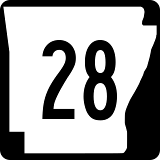
Highway 28 is designation for three east–west state highways in Western Arkansas. Two segments together running from the Oklahoma state line to Ola have been established since the original 1926 Arkansas state highway numbering, with the third segment designated in 1963. All three highways are rural, two-lane roads with relatively low traffic serving a sparsely populated and forested part of Arkansas. The highways are maintained by the Arkansas Department of Transportation (ARDOT).

<span class="mw-page-title-main">Arkansas Highway 123</span> Highway in Arkansas

Highway 123 is a designation for two state highways in Arkansas. One route begins at Salmon Lane in Boone County and runs 1.63 miles (2.62 km) north to US Highway 65 Business (US 65B) in Harrison. A second route begins at Highway 103 in Clarksville and runs 67.74 miles (109.02 km) northeast to US 65 and US 65B in Western Grove. A suffixed route, designated Highway 123Y runs near Lurton, giving non-truck travelers access to Highway 7. All three routes are maintained by the Arkansas Department of Transportation (ArDOT).

<span class="mw-page-title-main">Arkansas Highway 126</span> Highway in Arkansas

Highway 126 is a designation for two north–south state highways in Baxter County, Arkansas. A southern route of 11.66 miles (18.76 km) runs from Buffalo City north to US Route 62/US Route 412 (US 62/US 412) near Mountain Home. A second route of 7.03 miles (11.31 km) begins at US 62/US 412 in Gassville and runs north to Highway 5/Highway 178 at Midway.

<span class="mw-page-title-main">Arkansas Highway 115</span> Highway in Arkansas

Highway 115 is a state highway in Northeast Arkansas. The route begins at US Highway 167 and Highway 58 in Cave City and runs northeast to Missouri Route 21 near Doniphan, Missouri, including a 14 miles (23 km) concurrency with US 62/US 412 between Imboden and Pocahontas. The highway is maintained by the Arkansas Department of Transportation (ARDOT).

<span class="mw-page-title-main">Arkansas Highway 141</span> Highway in Arkansas

Highway 141 is designation for two north–south state highways in Northeast Arkansas. The longer segment was created in 1931 and extended throughout the mid-20th century to the current alignment connecting Jonesboro and points north. The Jonesboro segment was a former city street added to the state highway system in 1973. Both are maintained by the Arkansas Department of Transportation.

<span class="mw-page-title-main">Arkansas Highway 157</span> State highway in Arkansas, United States

Highway 157 is a designation for two state highways in Northeast Arkansas. One segment begins at Highway 367 in Judsonia and runs north to Highway 14 near Oil Trough. A second, short industrial access road also carries the Highway 157 designation in Diaz. Both routes are maintained by the Arkansas Department of Transportation (ArDOT).

<span class="mw-page-title-main">Arkansas Highway 105</span> State highway in Arkansas, United States

Highway 105 is a north–south state highway in Pope County, Arkansas. The route runs from Galla Creek Wildlife Management Area north across Interstate 40 (I-40) and U.S. Route 64 (US 64) to Highway 27 in Hector. AR 105 was created during the 1926 Arkansas state highway numbering. The route is maintained by the Arkansas Department of Transportation (ArDOT).

<span class="mw-page-title-main">Arkansas Highway 330</span> State highway in Arkansas, United States

Highway 330 is an east–west state highway in Van Buren County, Arkansas. The highway is a low traffic, two-lane highway connecting Highway 16 to Greers Ferry Lake at Fairfield Bay. Highway 330 is maintained by the Arkansas Department of Transportation (ArDOT). Two former highway designations in the county in the 1960s were returned to local control in 1997 and 2013.

<span class="mw-page-title-main">Special routes of U.S. Route 49</span>

Several special routes of U.S. Route 49 exist. In order from south to north they are as follows.

<span class="mw-page-title-main">Arkansas Highway 75</span> State highway in Arkansas, United States

Highway 75 is a north–south state highway in the Arkansas Delta. The route runs from Highway 38/Highway 50 north to AR 14/AR 140/AR 149 in Marked Tree. Created during the initial 1926 Arkansas state highway numbering, Highway 75 has been shortened and extended over roughly the same alignment over its lifetime. The highway has one spur route, Highway 75 Spur in the small town of Parkin. Both highways are maintained by the Arkansas Department of Transportation (ArDOT).

<span class="mw-page-title-main">Arkansas Highway 52</span> State highway in Arkansas, United States

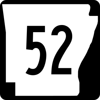
Highway 52 is a designation for three state highways in Southeast Arkansas. All segments are low volume, two-lane roadways in rural areas. The segment between Wilmot and Indian has been designated since the original 1926 Arkansas state highway numbering, with new designations created in 1966 and 1985. All segments are maintained by the Arkansas Department of Transportation (ArDOT).

<span class="mw-page-title-main">Arkansas Highway 144</span> Designation for two state highways in Southeast Arkansas

Highway 144 is a designation for two state highways in Southeast Arkansas. One route of 7.82 miles (12.59 km) begins at Big Bayou Meto Use Area and runs east to US Highway 165 (US 165), Highway 1, and the Great River Road (GRR). A second route of 20.50 miles (32.99 km) begins at US 165 near Jerome and runs east through Lake Village to a levee near the Mississippi River. Both routes are maintained by the Arkansas Department of Transportation (ArDOT). While overlapping US 65/US 278 in Chicot County, the route is part of the Great River Road, a national scenic byway following the Mississippi River.

<span class="mw-page-title-main">Arkansas Highway 36</span> State highway in Arkansas, United States

Highway 36 is a state highway in Central Arkansas. The highway begins at U.S. Highway 64 (US 64) at Hamlet and runs east through several small communities to Searcy, where it serves as the Beebe-Capps Expressway, a major crosstown arterial roadway. Following a discontinuity at US 64/US 67/US 167, the highway continues east to Kensett as Wilbur D. Mills Avenue before state maintenance ends at the small community of Georgetown. This highway is maintained by the Arkansas Department of Transportation (ARDOT).

<span class="mw-page-title-main">Arkansas Highway 364</span> State highway in Arkansas, United States

Highway 364 is an east–west state highway in Cross County, Arkansas. The highway connects a series of rural communities and farmland to the principal north–south highways in Cross County. Highway 364 is maintained by the Arkansas Department of Transportation (ArDOT). A former designation, also in Cross County, connected Togo to the state highway system between 1973 and 1983.

<span class="mw-page-title-main">Arkansas Highway 145</span> Designation for four state highways in Northeast Arkansas

Highway 145 is designation for four state highways in Northeast Arkansas. The highways are maintained by the Arkansas Department of Transportation (ARDOT).

References

  1. 1 2 3 Arkansas State Highway and Transportation Department (2015). "Arkansas Road Log Database". Arkansas State Highway and Transportation Department. Archived from the original (MDB) on August 29, 2017. Retrieved March 27, 2016.
  2. 1 2 Arkansas State Highway Department (April 1, 1926). State of Arkansas Showing System of State Highways (TIF) (Map). 1:500,000. Little Rock: Arkansas State Highway Commission. Retrieved November 27, 2019 via Arkansas GIS Office.
  3. Transportation Planning and Policy Division (August 30, 2016) [December 28, 2011]. General Highway Map, Jackson County, Arkansas (PDF) (Map) (Revised ed.). 1:62,500. Arkansas State Highway and Transportation Department. OCLC   913479483 . Retrieved November 23, 2019.{{cite map}}: |author= has generic name (help)
  4. Transportation Planning and Policy Division (August 2016). Map of Hickory Ridge, Cross County, Arkansas (PDF) (Map). 1:12,000. Little Rock: Arkansas State Highway and Transportation Department. §§ B1-B4. Retrieved November 23, 2019.{{cite map}}: |author= has generic name (help)
  5. Transportation Planning and Policy Division (August 2016). Map of Cherry Valley, Cross County, Arkansas (PDF) (Map). 1:12,000. Little Rock: Arkansas State Highway and Transportation Department. §§ B1-B4. Retrieved November 23, 2019.{{cite map}}: |author= has generic name (help)
  6. America's Byways. Crowley's Ridge Parkway, Arkansas Section (Map). 1" = 20 miles. Washington DC: United States Department of Transportation Federal Highway Administration. Archived from the original on November 23, 2014. Retrieved November 24, 2019.
  7. Transportation Planning and Policy Division (October 2, 2014) [July 11, 2007]. General Highway Map, Cross County, Arkansas (PDF) (Map) (Revised ed.). 1:62,500. Arkansas State Highway and Transportation Department. OCLC   911045270 . Retrieved November 24, 2019.{{cite map}}: |author= has generic name (help)
  8. Transportation Planning and Policy Division (July 2016). Map of Gilmore and Turrell, Crittenden County, Arkansas (PDF) (Map). 1:12,000. Little Rock: Arkansas State Highway and Transportation Department. §§ B1-B4. Retrieved November 27, 2019.{{cite map}}: |author= has generic name (help)
  9. Transportation Planning and Policy Division (March 22, 2016) [January 2, 2007]. General Highway Map, Crittenden County, Arkansas (PDF) (Map) (Revised ed.). 1:62,500. Arkansas State Highway and Transportation Department. OCLC   910967299 . Retrieved November 24, 2019.{{cite map}}: |author= has generic name (help)
  10. System Information & Research Division (2018). Annual Average Daily Traffic Estimates (GIS Map) (Map). Various. Arkansas Department of Transportation. Retrieved November 27, 2019.
  11. Natzke, Stefan; Neathery, Mike & Adderly, Kevin (June 29, 2017). "What is the National Highway System?". National Highway System. Federal Highway Administration . Retrieved July 15, 2018.
  12. Arkansas State Highway Commission (1938). Official Highway Service Map (TIF) (Map). Scale not given. Little Rock: Arkansas State Highway Commission. Retrieved November 27, 2019 via Arkansas GIS Office.
  13. Arkansas State Highway Commission (April 1950). Official Highway Map of Arkansas (TIF) (Map) (1st Printing ed.). Little Rock: Arkansas State Highway Commission. Retrieved November 28, 2019 via Arkansas GIS Office.
  14. Arkansas State Highway Commission (July 1950). Official Highway Map of Arkansas (TIF) (Map) (2nd Printing ed.). Little Rock: Arkansas State Highway Commission. Retrieved November 28, 2019 via Arkansas GIS Office.
  15. "Minutes" (1953–69) , pp. 2278–2280.
  16. "Minutes" (1953–69) , p. 2159.
  17. "Minutes" (1953–69) , p. 1965.
  18. Transportation Planning and Policy Division (July 26, 2019). State Highway Route and Section Map, Crittenden County, Arkansas (PDF) (Map). Little Rock: Arkansas Department of Transportation. Retrieved November 24, 2019.{{cite map}}: |author= has generic name (help)
  19. Arkansas Centerline File (GIS Map) (Map) (Updated ed.). Various. Arkansas GIS Office. August 1, 2019 [September 29, 2014]. Retrieved November 23, 2019.
Template:Attached KML/Arkansas Highway 42
KML is not from Wikidata