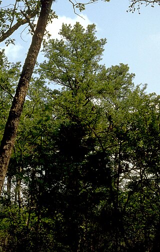
Crowley's Ridge is a geological formation that rises 250 to 550 feet (170 m) above the alluvial plain of the Mississippi embayment in a 150-mile (240 km) line from southeastern Missouri to the Mississippi River near Helena, Arkansas. It is the most prominent feature in the Mississippi Alluvial Plain between Cape Girardeau, Missouri, and the Gulf of Mexico.
The Ozark – St. Francis National Forest is a United States National Forest that is located in the state of Arkansas. It is composed of two separate forests, Ozark National Forest in the Ozark Mountains; and St. Francis National Forest on Crowley's Ridge. Each forest has distinct biological, topographical, and geological differences.
The Palisades Interstate Parkway (PIP) is a 38.25-mile (61.56 km) controlled-access parkway in the U.S. states of New Jersey and New York. The parkway is a major commuter route into New York City from Rockland and Orange counties in New York and Bergen County in New Jersey. The southern terminus of the route is at the George Washington Bridge in Fort Lee, New Jersey, where it connects to Interstate 95 (I-95), US 1-9, and US 46. Its northern terminus is at a traffic circle in Fort Montgomery, New York, where the PIP meets US 9W and US 202 at the Bear Mountain Bridge. At exit 18, the PIP forms a concurrency with US 6 for the remaining duration of its run.

A National Scenic Byway is a road recognized by the United States Department of Transportation for one or more of six "intrinsic qualities": archeological, cultural, historic, natural, recreational, and scenic. The program was established by Congress in 1991 to preserve and protect the nation's scenic but often less-traveled roads and promote tourism and economic development. The National Scenic Byways Program (NSBP) is administered by the Federal Highway Administration (FHWA).
The State Scenic Highway System in the U.S. state of California is a list of highways, mainly state highways, that have been designated by the California Department of Transportation (Caltrans) as scenic highways. They are marked by the state flower, a California poppy, inside either a rectangle for state-maintained highways or a pentagon for county highways.

Arkansas Highway 23 is a north–south state highway in north Arkansas. The route runs 133.9 miles (215.5 km) from U.S. Route 71 north of Elm Park north to the Missouri state line through Ozark and Eureka Springs. Between Highway 16 at Brashears and Interstate 40 (I-40) north of Ozark, Highway 23 winds through the Ozark National Forest and is designated as the Pig Trail Scenic Byway due to its steep hills and hairpin turns. The route has a strong connection with the University of Arkansas Razorbacks, connecting fans in Central Arkansas with the Northwest Arkansas area.

Arkansas Highway 21 is a north–south state highway in north central Arkansas. The route runs 99.14 miles (159.55 km) from U.S. Route 64 (US 64) in Clarksville north across US 62 to the Missouri state line. The route is a two-lane highway with the exception of a brief concurrency with US 62, a four-lane highway, in Berryville.

The Lariat Loop National Scenic and Historic Byway is a National Scenic Byway and a Colorado Scenic and Historic Byway located in Jefferson County, Colorado, USA. The byway is a 40-mile (64 km) loop in the Front Range foothills west of Denver through Golden, Lookout Mountain Park, Genesee Park, Evergreen, Morrison, Red Rocks Park, and Dinosaur Ridge. The Lariat Loop connects to the Mount Blue Sky Scenic Byway at Bergen Park.

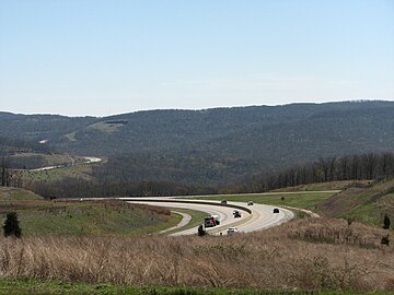
Crowley's Ridge Parkway is a 212.0-mile-long (341.2 km) National Scenic Byway in northeast Arkansas and the Missouri Bootheel along Crowley's Ridge in the United States. Motorists can access the parkway from US Route 49 (US 49) at its southern terminus near the Helena Bridge over the Mississippi River outside Helena-West Helena, Arkansas, or from Missouri Route 25 (Route 25) near Kennett, Missouri. The parkway runs along Crowley's Ridge, a unique geological formation, and also parts of the St. Francis National Forest, the Mississippi River and the Mississippi Alluvial Plain. Along the route are many National Register of Historic Places properties, Civil War battlefields, parks, and other archeological and culturally significant points.

Arkansas Highway 14 is a designation for two state highways in Arkansas. One segment of 208.12 miles (334.94 km) begins east of Table Rock Lake and runs east to Interstate 555 (I-555) at Payneway. A second segment of 19.23 miles (30.95 km) runs from Highway 140 in Lepanto east to Mississippi CR S449 at Golden Lake. Segments of the highway are part of two Arkansas Scenic Byways: Sylamore Scenic Byway in the Ozark National Forest and the Crowley's Ridge Parkway atop Crowley's Ridge.

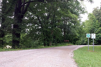
Highway 351 is a designation for two state highways in Northeast Arkansas. One route 0.92 miles (1.48 km) in Jonesboro begins at the Interstate 555/US Highway 63 (I-555/US 63) frontage road and runs north to Highway 18 as Industrial Drive. A second route of 13.87 miles (22.32 km) begins at Airport Road and runs north to Highway 358. Between Jonesboro and the northern terminus, the route is designated as part of the Crowley's Ridge Parkway, a National Scenic Byway, and two Civil War trails under the Arkansas Heritage Trails System. Both routes are maintained by the Arkansas State Highway and Transportation Department (AHTD).

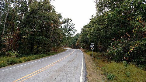
The Sylamore Scenic Byway is a scenic route in the Arkansas Scenic Byways program. The route runs through the Sylamore Ranger District of the Ozark National Forest in Arkansas for 26.5 miles (42.6 km) in Stone County. It passes through undeveloped forest land as a scenic route to Blanchard Springs Caverns.

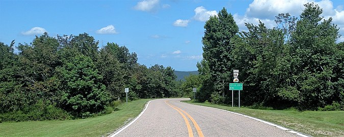
Arkansas Highway 309 is a designation for two state highways in Western Arkansas. One route of 5.11 miles (8.22 km) runs from Yell County Route 28 (CR 28) at Blue Mountain Lake northeast to Highway 10 at Waveland. A second segment begins at Highway 10 in Havana and winds northwest through the Ozark National Forest to Highway 23 at Webb City via Paris. A portion of the second route is designated as the Mount Magazine Scenic Byway, one of eleven Arkansas Scenic Byways maintained by the Arkansas State Highway and Transportation Department (AHTD).
The Boston Mountains Scenic Loop is one of ten Arkansas Scenic Byways. There are two different paths that constitute the loop, Interstate 49 and U.S. Route 71.
The Trail of the Ancients is a collection of National Scenic Byways located in the U.S. Four Corners states of Utah, Colorado, New Mexico, and Arizona. These byways comprise:
Minnesota Scenic Byways are a system of roads in the U.S. state of Minnesota which pass through areas of scenic, cultural, or recreational significance. There are currently 22 scenic byways in the system with a total length of 2,948 miles (4,744 km). Eight of these byways are also designated as National Scenic Byways, and the North Shore Scenic Drive is further designated as an All-American Road.