Queen Wilhelmina State Park | |
---|---|
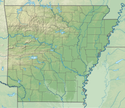
Location | Polk County, Arkansas, United States |
Coordinates | 34°41′08″N94°22′12″W / 34.68556°N 94.37000°W [1] |
Area | 460 acres (190 ha) |
Elevation | 2,516 feet (767 m) [1] |
Established | 1957 |
Administered by | Arkansas Department of Parks, Heritage, and Tourism |
Designation | Arkansas state park |
Website | Queen Wilhelmina State Park |
Queen Wilhelmina State Park is a unit of Arkansas Department of Parks and Tourism in the Ouachita Mountains.
The original "Castle in the Sky" lodge was built in 1898 on 2,681-foot Rich Mountain, in Polk County, Arkansas. The park is on Talimena Scenic Drive — northwest of Mena, Arkansas and east of the Oklahoma state line. It is the only lodge open on the 235 mile Ouachita Trail. It is located on Arkansas’ second highest peak, Rich Mountain. [2]
The lodge has 40 guest rooms, a restaurant, a lobby and meeting room. The campground and trails remained open during the renovation. The park is one of the park system's eight mountain parks. [3]
The original lodge was built by the Kansas City, Pittsburg and Gulf Railroad to house passengers. Many of the railroad's investors were Dutch, so the lodge was named to honor Queen Wilhelmina of the Netherlands, who was to be crowned in September 1898. Grand opening of the Victorian lodge was June 22, 1898. Wilhelmina Inn was soon nicknamed the "Castle in the Sky."
The KCPG railroad faced financial problems, and was sold to what later became the Kansas City Southern Railway. The original inn fell into disrepair, and permanently closed in 1910.
Interest in tourism rose after World War II. State Act 76 of 1957 created Queen Wilhelmina State Park. A new lodge was built and opened June 22, 1963. It used some of the original rock work. It operated 10 years, until a Nov. 10, 1973 kitchen fire spread and destroyed the lodge. There was no loss of life in the fire. The park ranger notified the guests that there had been a fire and that they needed to evacuate as a precaution which saved a panic amongst the guests. The only thing left standing by the morning light was the rock walls.
Construction soon began on the site's third lodge. The $3 million lodge, re-opened in 1975. The refurbished lodge reopened in 2015. [3]
The Mount Buffalo National Park is a national park in the alpine region of Victoria, Australia. The 31,000-hectare (77,000-acre) national park is located approximately 350 kilometres (220 mi) northeast of Melbourne in the Australian Alps. Within the national park is Mount Buffalo, a moderately high mountain plateau, with an elevation of 1,723 metres (5,653 ft) above sea level.
LeFlore County is a county along the eastern border of the U.S state of Oklahoma. As of the 2020 census, the population was 48,129. Its county seat is Poteau. The county is part of the Fort Smith metropolitan area and the name honors a Choctaw family named LeFlore. The United States District Court for the Eastern District of Oklahoma is the federal district court with jurisdiction in LeFlore County.
Arkadelphia is a city in Clark County, Arkansas, United States. As of the 2020 census, the population was 10,380. The city is the county seat of Clark County. It is situated at the foothills of the Ouachita Mountains. Two universities, Henderson State University and Ouachita Baptist University, are located here. Arkadelphia was incorporated in 1857.
Hot Springs is a resort city in the state of Arkansas and the county seat of Garland County. The city is located in the Ouachita Mountains among the U.S. Interior Highlands, and is set among several natural hot springs for which the city is named. As of the 2020 United States Census, the city had a population of 37,930, making it the 11th most populous city in Arkansas.
Camden is a city in and the county seat of Ouachita County in the south-central part of the U.S. state of Arkansas. The city is located about 100 miles south of Little Rock. Situated on bluffs overlooking the Ouachita River, the city developed because of the river.
Glenwood is a city in Pike and Montgomery counties in Arkansas, United States. As of the 2020 census, its population was 2,068. The community is located along the Caddo River in the Ouachita Mountains.
The Ouachita National Forest is a vast congressionally-designated National Forest that lies in the western portion of Arkansas and portions of extreme-eastern Oklahoma, USA.
The Ouachita Mountains, simply referred to as the Ouachitas, are a mountain range in western Arkansas and southeastern Oklahoma. They are formed by a thick succession of highly deformed Paleozoic strata constituting the Ouachita Fold and Thrust Belt, one of the important orogenic belts of North America. The Ouachitas continue in the subsurface to the northeast, where they make a poorly understood connection with the Appalachians and to the southwest, where they join with the Marathon uplift area of West Texas. Together with the Ozark Plateaus, the Ouachitas form the U.S. Interior Highlands. The highest natural point is Mount Magazine at 2,753 feet (839 m).
Petit Jean State Park is a 3,471-acre (1,405 ha) park in Conway County, Arkansas managed by the Arkansas Department of Parks and Tourism. It is located atop Petit Jean Mountain adjacent to the Arkansas River in the area between the Ouachita Mountains and Ozark Plateaus.
Cossatot River State Park-Natural Area is a 5,299.65-acre (2,144.69 ha) Arkansas state park in Howard County and Polk County, Arkansas in the United States. The park follows a rough, undeveloped 12.5 miles (20.1 km) of the Cossatot River. The river itself is included in Arkansas's Natural and Scenic Rivers System and the National Park Service's list of National Wild and Scenic Rivers, making it a whitewater rafting destination. The rough nature of the river, including Class III, IV, and dangerous Class V rapids, make the park-natural area a popular destination for skilled canoeists, kayakers, and playboaters. The park became a part of the system in 1988 after the Arkansas Department of Parks and Tourism and Arkansas Natural Heritage Commission agreed to cooperative management after acquiring the property from the Weyerhaeuser Corporation.
Ouachita National Recreation Trail is a 223-mile (359 km) long, continuous hiking trail through the Ouachita Mountains of Oklahoma and Arkansas. It is the longest backpacking trail in the Ouachita National Forest, spanning 192 miles across its length. Approximately 177 miles of the trail is in Arkansas and 46 miles of the trail is in Oklahoma. The trail is used by hikers, backpackers, hunters, and mountain bikers. It is a non-motorized single track trail open only to foot traffic and partially open to mountain bicycles. Segments opened to mountain bikes are from the western terminus of the Ouachita Trail at Talimena State Park to the Big Cedar trailhead on US Highway 259 at approximately Mile Marker (MM) 30.5 in Oklahoma, and from the Talimena Scenic Drive Trailhead at MM 54.1, east to Highway 7 at mile 160.4, north of Jessieville, Arkansas.
Broken Bow Lake is a reservoir in southeastern Oklahoma, located on Mountain Fork River and 9 miles (14 km) northeast of the town of Broken Bow in McCurtain County. It is one of the largest fresh water lakes within the state of Oklahoma, and a popular tourist destination for locals and visitors from neighboring Texas and Arkansas.
National Park Service rustic – sometimes colloquially called Parkitecture – is a style of architecture that developed in the early and middle 20th century in the United States National Park Service (NPS) through its efforts to create buildings that harmonized with the natural environment. Since its founding in 1916, the NPS sought to design and build visitor facilities without visually interrupting the natural or historic surroundings. The early results were characterized by intensive use of hand labor and a rejection of the regularity and symmetry of the industrial world, reflecting connections with the Arts and Crafts movement and American Picturesque architecture.
Cascade is an unincorporated community and U.S. Post Office in El Paso County, Colorado, United States. The ZIP Code of the Cascade Post Office is 80809.
Natural Steps is an unincorporated census-designated place in Pulaski County, Arkansas, United States. It is located 18 miles (29 km) northwest of Little Rock along the southern bank of the Arkansas River, on Arkansas Highway 300. Per the 2020 census, the population was 413. Today, it is a small farming community with scattered businesses. Most of the natural steps, a geologic formation, still stand today and are used as a marker for river runners. The Natural Steps are not open to the public for viewing.
The Arkansas Scenic Byways Program is a list of highways, mainly state highways, that have been designated by the Arkansas Department of Transportation (ArDOT) as scenic highways. The Arkansas General Assembly designates routes for scenic byway status upon successful nomination. For a highway to be declared scenic, a group interested in preserving the scenic, cultural, recreational, and historic qualities of the route must be created. Mayors of all communities along the route and county judges from each affected county must be included in the organization. Scenic highways are marked with a circular shield in addition to regular route markers.
The Arkansas River Valley is a region in Arkansas defined by the Arkansas River in the western part of the state. Generally defined as the area between the Ozark and Ouachita Mountains, the River Valley is characterized by flat lowlands covered in fertile farmland and lakes periodically interrupted by high peaks. Mount Magazine, Mount Nebo, and Petit Jean Mountain compose the Tri-Peaks Region, a further subdivision of the River Valley popular with hikers and outdoors enthusiasts. In addition to the outdoor recreational activities available to residents and visitors of the region, the River Valley contains Arkansas's wine country as well as hundreds of historical sites throughout the area. It is one of six natural divisions of Arkansas.
Mount Magazine State Park is a 2,234-acre park located in Logan County, Arkansas. Inhabited since the 1850s, Mount Magazine first became part of the Ouachita National Forest in 1938, was re-designated as part of the Ozark National Forest in 1941, and became a state park after a 22-year conversion process from the U.S. Forest Service to the Arkansas Department of Parks and Tourism. Mount Magazine State Park is the highest in Arkansas. The park contains Mossback Ridge, including the peak of Mount Magazine which contains The Lodge at Mount Magazine, cabins, trails, and a hang gliding area.
Talimena State Park is an Oklahoma state park located in LeFlore County in eastern Oklahoma. The 20 acres (8.1 ha) park is at the Oklahoma entrance to Talimena Scenic Drive, about 7 miles (11 km) north of Talihina, Oklahoma. and 20 miles (32 km) south of Wister. It offers opportunities for camping, hiking, biking, and wildlife watching.
Rich Mountain is the second highest point of the U.S. Interior Highlands and Ouachita Mountains, and in the U.S. state of Arkansas; it is also the site of Queen Wilhelmina State Park. Rich Mountain is a long, generally east–west-trending ridge composed of hard sandstone. It is located just outside of Mena, Arkansas and is intersected by the Arkansas-Oklahoma border. Atop its summit is the Rich Mountain Lookout Tower, which is approximately 2.4 mi (3.9 km) east-southeast of the Queen Wilhelmina Lodge.