This is a list of Wildlife Management Areas in Arkansas . All counties are represented except Boone, Chicot, Crittenden, Dallas, Fulton, Grant, Jackson, Lincoln, and St. Francis County. [1]
Contents
| Name | County or counties | Area (acres) | Year Established | Remarks | Image |
|---|---|---|---|---|---|
| Bayou Des Arc WMA | White | 953 | 1966 | Created with a 320-acre public fishing lake. [2] |  |
| Bayou Meto WMA | Arkansas, Jefferson | 33,832 | Called the "George H. Dunklin Jr. Bayou Meto WMA" and also called "Wabbaseka Scatters" or just the "Scatters". [3] |  | |
| Beaver Lake WMA | Benton, Carroll, Madison | 8,007 | Includes Devil's Eyebrow Natural Area. [4] |  | |
| Bell Slough WMA | Faulkner | 2,040 | Kenny Vernon Nature Trail and Bell Slough Water Trail. [5] | ||
| Benson Creek Natural Area WMA | Monroe | 1,458 | Includes 610 acres of bald cypress/water tupelo swamps along Bayou DeView. [6] | ||
| Beryl Anthony Lower Ouachita WMA | Ashley, Union | 7,020 | 3,600 new acres to be added in 2018 and 2019. The WMA joins the Moro Big Pine WMA and the Warren Prairie Natural Area WMA having colonies of Red cockaded woodpeckers. [7] | ||
| Big Lake WMA | Mississippi | 12,320 | 1950 | 7,000 acres purchased in 1950. The rest purchased up to 1969. [8] | |
| Big Timber WMA | Clark | 45,000 | Includes 3,500 acres (Olds Foundation) added in 2018. Also known as Big Timber Leased Lands WMA. Private land owners including The Ross Foundation, Clark Timberlands, Anthony Timberlands. and Red River Texarkana that is managed by Hancock Forest Management giving annual leases to the Arkansas Game and Fish Commission. [9] | ||
| Blevins WMA | Hempstead | 128 | 1991 [10] | ||
| Blue Mountain WMA | Logan | 8,200 | Corps of Engineers property. [11] | 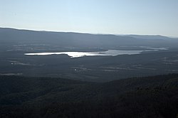 | |
| Brewer Lake Cypress Creek WMA | Conway | 1,200 | Surrounds Brewer Lake. [12] | ||
| Brushy Creek WMA [13] | Cross | 215 | Co-op of private land owners that have joined together. [14] | ||
| Buffalo National River WMA | Baxter, Marion, Newton, Searcy | 95,730 | The entire 135 miles of the Buffalo National River is a WMA. Certain areas are also under national park regulations for hunting and fishing. [15] [16] [17] |  | |
| Camp Robinson WMA [18] | Faulkner, Pulaski | 26,675 | |||
| Caney Creek WMA | Howard, Montgomery, Pike, Polk | 85,000 | 1968 | Contains Caney Creek Wilderness |  |
| Casey Jones WMA | Ashley, Drew | 83,832 | |||
| Cattail Marsh WMA | Greene | 78 | |||
| Cedar Creek WMA | Scott | 103 | |||
| Cherokee Prairie Natural Area WMA | Franklin | 566 | |||
| Cherokee WMA | Cleburne, Conway, Independence, Logan, Pope, Scott, Stone, Van Buren | 62,203 | |||
| Cove Creek Natural Area WMA | Faulkner | 228 | |||
| Crossett Experimental Forest WMA | Ashley | 1,675 | |||
| Cut-Off Creek WMA | Drew | 9,314 | |||
| Cypress Bayou WMA | Lonoke, White | 2,478 | |||
| Dardanelle WMA | Franklin, Johnson, Logan, Pope, Yell | 42,658 | 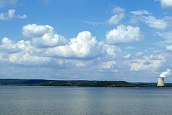 | ||
| Dave Donaldson Black River WMA | Clay, Greene, Randolph | 21,150 | |||
| DeGray Lake WMA | Clark, Hot Spring | 14,000 | |||
| Departee Creek WMA | White | 450 | |||
| DeQueen Lake WMA | Sevier | 8,792 | Owned by the U.S. Army Corps of Engineers. [19] | ||
| Devil’s Knob Natural Area WMWA | Izard | 519 | |||
| Dr. Lester Sitzes III Bois D’Arc WMA | Hempstead | 13,646 | |||
| Earl Buss Bayou DeView WMA | Poinsett | 4,435 | |||
| Ed Gordon Point Remove WMA | Conway, Pope | 8,694 | |||
| Electric Island WMA | Garland | 115 | |||
| Ethel WMA | Arkansas | 176 | Formerly only open to residents of Ethel | ||
| Falcon Bottoms Natural Area WMA | Columbia, Lafayette, Nevada | 2,787 | |||
| Fort Chaffee WMA | Crawford, Franklin, Sebastian | 66,000 | The WMA is within Fort Chaffee Maneuver Training Center area. WMA rules are in effect and a Sportsman’s Orientation class is compulsory. [20] | ||
| Freddie Black Choctaw Island WMA Deer Research Area East Unit | Desha | 8,300 | Also referred to as the Choctaw Island WMA. The WMA is not a true island but includes the Choctaw Bar Island in the Mississippi River [21] | ||
| Freddie Black Choctaw Island WMA Deer Research Area West Unit | Desha | ||||
| Frog Bayou WMA | Crawford | 812 | 2005 | Partnership with Ducks Unlimited and the U.S. Natural Resources Conservation Service and expanded in 2017 with The Trust for Public Land and Federal Aid in Wildlife Restoration money. The WMA is located along Frog Bayou, that is also known as Clear Creek, adjacent to U.S. Army Corps of Engineers land. [22] | |
| Galla Creek WMA | Pope | 3,329 | The Galla Creek WMA is among several others involving controversy of flooding protocols used in Greentree reservoir management that has seen deteriorated conditions and a substantial dying off of timber. [23] [24] | ||
| Garrett Hollow Natural Area WMA | Washington | 670 | |||
| Gene Rush WMA | Newton, Searcy | 17,963 | |||
| Greers Ferry Lake WMA | Cleburne, Van Buren | 9,914 | |||
| Gum Flats WMA | Howard, Pike | 15,661 | |||
| H. E. Flanagan Prairie Natural Area WMA | Franklin | 457 | The Arkansas Natural Heritage Commission (ANHC), a division of the Department of Arkansas Heritage added the property in 1988. [25] Along with the Presson-Oglesby Preserve (The Nature Conservancy, 155 acres), and the Cherokee Prairie (ANHC) are three contiguous tracts of protected prairie land. [26] | ||
| Hall Creek Barrens Natural Area WMA [27] | Cleveland | ||||
| Harold E. Alexander Spring River WMA | Sharp | 13,859 | |||
| Harris Brake WMA | Perry | 3,769 | |||
| Henry Gray Hurricane Lake WMA | White | 17,524 | |||
| Hobbs State Park – Conservation Area WMA | Benton, Carroll, Madison | 11,744 | |||
| Holland Bottoms WMA | Lonoke | 6,190 | |||
| Hope Upland WMA | Hempstead | 2,115 | |||
| Howard County WMA | Howard | 26,000 | |||
| Howard Hensley Searcy County WMA | Searcy | 170 | |||
| Iron Mountain Natural Area WMA | Polk | 260 | |||
| Jamestown Independence County WMA | Independence | 971 | |||
| Jim Kress WMA | Cleburne | 14,527 | |||
| Jones Point WMA | Marion | 1,200 | |||
| Kingsland Prairie Natural Area WMA | Cleveland | 400 | |||
| Lafayette County Natural Area WMA | Lafayette | 16,739 | |||
| Lake Greeson Natural Area WMA | Howard, Pike | 200 | |||
| Lee County WMA | Lee | 200 | |||
| Little Bayou WMA | Ashley | 1,284 | |||
| Little River WMA | Hempstead, Little River | 597 | |||
| Loafer’s Glory WMA | 2,616 | ||||
| Maumelle River WMA | Pulaski | ||||
| McIlroy Madison County WMA | Madison | 14,496 |  | ||
| Mike Freeze Wattensaw WMA | Prairie | 19,184 | |||
| Moro Big Pine Natural Area WMA | Calhoun | 16,000 | |||
| Mount Magazine WMA | Logan, Yell | 120,000 | |||
| Muddy Creek WMA | Montgomery, Scott, Yell | 146,206 | |||
| Nacatoch Ravines Natural Area WMA | Hempstead | 645 | |||
| Nimrod/Lloyd Millwood WMA | Yell | 3,550 | |||
| Norfork Lake WMA | Baxter | 10,000 | |||
| Ozan WMA | Hempstead | 580 | |||
| Ozark Lake WMA | Crawford, Franklin | 7,834 | |||
| Palmetto Flats Natural Area | Little River | 1848 | |||
| Petit Jean River WMA | Yell | 15,502 | |||
| Pine City Natural Area WMA | Monroe | 870 | |||
| Piney Creeks WMA | Johnson, Newton, Pope | 180,000 | |||
| Poison Springs WMA | Nevada, Ouachita | 17,604 | |||
| Prairie Bayou WMA | Lonoke | 453 | |||
| Provo WMA | Sevier | 11,327 | |||
| R. L. Hankins Mud Creek Upland WMA | Randolph | 1,025 | 1989 | Deeded by FMHA. [28] | |
| Railroad Prairie Natural Area WMA | Prairie | 244 | |||
| Rainey WMA | Pope | 488 | |||
| Rex Hancock Black Swamp WMA | Woodruff | 7,221 | |||
| Rick Evans Grandview Prairie WMA | Hempstead | 4,885 | |||
| Ring Slough WMA | Clay | 83 | |||
| River Bend WMA | Perry | ||||
| Roth Prairie Natural Area WMA | Arkansas | 41 | |||
| Sandhills Natural Area WMA | Miller | 143 | |||
| Scott Henderson Gulf Mountain WMA | Van Buren | 14,000 | 1970 | Created as "Gulf Mountain WMA" with an initial purchase of 6,400 acres. A 3,600-acre purchase and smaller tracts totaling 2,012 was added in 1971. 2,000 acres of Green Bay Packaging's Arkansas Mill division land was added to the WMA. The company owns over 250,000 acres in the state and this was part of the companies "Sustainable Forestry Initiative". [29] Located 12 miles southwest of Clinton the Little Red River bisects the southern area and the Ozark National Forest is the northern boundary. [30] | |
| Seven Devils WMA | Drew | 5,032 | |||
| Sheffield Nelson Dagmar WMA | Monroe | 9,720 | |||
| Shirey Bay Rainey Brake WMA | Lawrence | 10,711 | |||
| Slippery Hollow Natural Area WMA | Marion | 705 | |||
| Spring Bank WMA | Lafayette | 701 | |||
| St. Francis National Forest WMA | Lee, Phillips | ||||
| St. Francis Sunken Lands WMA | Craighead, Greene, Poinsett, Clay | 27,643 | Patchwork of state and privately held lands along the St. Francis River preserving bottomland hardwood forest river bottoms, well known for waterfowl and deer hunting. [31] | ||
| Stateline Sandponds Natural Area WMA | Clay | 4,000 | |||
| Steve N. Wilson Raft Creek Bottoms WMA | White | 4,000 | |||
| Sulphur River WMA | Miller | 16,681 | |||
| Sweden Creek Natural Area WMA | Madison | 137 | |||
| Sylamore WMA | Baxter, Marion, Searcy, Stone | 150,000 |  | ||
| Terre Noire Natural Area WMA | Clark | 415 |  | ||
| Trusten Holder WMA | Arkansas, Desha | 8,173 | |||
| Two Bayou Creek WMA | Ouachita | 1,250 | |||
| W.E. Brewer Scatter Creek WMA | Greene | ||||
| Warren Prairie Natural Area WMA | Bradley, Drew | 2,128 | |||
| Wedington WMA | Benton, Washington | 16,000 |  | ||
| White Cliffs Natural Area WMA | Little River | 573 | |||
| White Rock WMA | Crawford, Franklin, Johnson, Madison, Franklin, Washington | 280,000 |  | ||
| Whitehall WMA | Poinsett | 111 | |||
| Winona WMA | Garland, Perry, Saline | 160,000 |