Grant County | |
---|---|
Coordinates: 34°17′40″N92°25′54″W / 34.294444444444°N 92.431666666667°W | |
Country | United States |
State | Arkansas |
Founded | February 4, 1869 |
Named for | Ulysses S. Grant |
Seat | Sheridan |
Largest city | Sheridan |
Area | |
• Total | 633 sq mi (1,640 km2) |
• Land | 632 sq mi (1,640 km2) |
• Water | 1.1 sq mi (3 km2) 0.2% |
Population (2020) | |
• Total | 17,958 |
• Density | 28/sq mi (11/km2) |
Time zone | UTC−6 (Central) |
• Summer (DST) | UTC−5 (CDT) |
Congressional district | 4th |
Website | www |
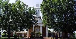
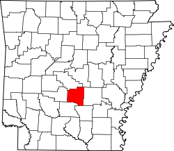
Grant County is a county in the U.S. state of Arkansas. Its population was 17,958 at the 2020 United States Census. [1] The county seat is Sheridan. [2]
Grant County is included in the Little Rock – North Little Rock – Conway, AR Metropolitan Statistical Area.
Formed on February 4, 1869, Grant County was named in honor of U.S. President-elect Ulysses S. Grant. [3] [4] It is an alcohol prohibition or dry county.
Robert W. Glover, a Missionary Baptist pastor who served in both houses of the Arkansas General Assembly (1905-1912) from Sheridan, introduced in 1909 the resolution calling for the establishment of four state agricultural colleges. [5] His brother, David Delano Glover, a Methodist, was a state representative in the 1907 session and a member of the United States House of Representatives from 1929 to 1935, having been unseated in 1934 by Grant County native John Little McClellan who at the time was practicing law in Camden. McClellan later went on to become Arkansas's longest serving U.S. senator.
According to the U.S. Census Bureau, the county has a total area of 633 square miles (1,640 km2), of which 632 square miles (1,640 km2) is land and 1.1 square miles (2.8 km2) (0.2%) is water. [6] Grant County is considered part of the Arkansas Timberlands geographical area.
Census | Pop. | Note | %± |
---|---|---|---|
1870 | 3,943 | — | |
1880 | 6,185 | 56.9% | |
1890 | 7,786 | 25.9% | |
1900 | 7,671 | −1.5% | |
1910 | 9,425 | 22.9% | |
1920 | 10,710 | 13.6% | |
1930 | 9,834 | −8.2% | |
1940 | 10,477 | 6.5% | |
1950 | 9,024 | −13.9% | |
1960 | 8,294 | −8.1% | |
1970 | 9,711 | 17.1% | |
1980 | 13,008 | 34.0% | |
1990 | 13,948 | 7.2% | |
2000 | 16,464 | 18.0% | |
2010 | 17,853 | 8.4% | |
2020 | 17,958 | 0.6% | |
2023 (est.) | 18,383 | [7] | 2.4% |
U.S. Decennial Census [8] 1790–1960 [9] 1900–1990 [10] 1990–2000 [11] 2010 [12] |
Race | Number | Percentage |
---|---|---|
White (non-Hispanic) | 16,166 | 90.02% |
Black or African American (non-Hispanic) | 447 | 2.49% |
Native American | 70 | 0.39% |
Asian | 76 | 0.42% |
Pacific Islander | 1 | 0.01% |
Other/Mixed | 758 | 4.22% |
Hispanic or Latino | 440 | 2.45% |
As of the 2020 United States census, there were 17,958 people, 6,863 households, and 5,007 families residing in the county.
As of the 2000 census, [15] there were 16,464 people, 4,241 households, and 4,780 families residing in the county. The population density was 26 inhabitants per square mile (10/km2). There were 6,960 housing units at an average density of 11 per square mile (4.2/km2). The racial makeup of the county was 95.55% White, 2.47% Black or African American, 0.45% Native American, 0.13% Asian, 0.03% Pacific Islander, 0.64% from other races, and 0.73% from two or more races. 1.15% of the population were Hispanic or Latino of any race.
There were 6,241 households, out of which 35.60% had children under the age of 18 living with them, 64.70% were married couples living together, 8.50% had a female householder with no husband present, and 23.40% were non-families. 20.40% of all households were made up of individuals, and 9.00% had someone living alone who was 65 years of age or older. The average household size was 2.61 and the average family size was 3.00.
In the county, the population was spread out, with 25.90% under the age of 18, 8.00% from 18 to 24, 29.60% from 25 to 44, 24.30% from 45 to 64, and 12.20% who were 65 years of age or older. The median age was 37 years. For every 100 females, there were 98.50 males. For every 100 females age 18 and over, there were 96.30 males.
The median income for a household in the county was $37,182, and the median income for a family was $42,901. Males had a median income of $31,842 versus $22,098 for females. The per capita income for the county was $17,547. About 7.80% of families and 10.20% of the population were below the poverty line, including 12.50% of those under age 18 and 13.00% of those age 65 or over.
The largest self-identified ancestry groups in Grant County, Arkansas are: [16]
Over The past few election cycles Grant county has trended heavily towards the GOP. The last Democrat (as of 2024) to carry this county was Bill Clinton in 1996.
Year | Republican | Democratic | Third party(ies) | |||
---|---|---|---|---|---|---|
No. | % | No. | % | No. | % | |
2024 | 6,755 | 83.62% | 1,192 | 14.76% | 131 | 1.62% |
2020 | 6,794 | 82.85% | 1,268 | 15.46% | 138 | 1.68% |
2016 | 5,725 | 76.90% | 1,373 | 18.44% | 347 | 4.66% |
2012 | 4,829 | 74.53% | 1,468 | 22.66% | 182 | 2.81% |
2008 | 5,023 | 73.94% | 1,562 | 22.99% | 208 | 3.06% |
2004 | 4,205 | 62.11% | 2,524 | 37.28% | 41 | 0.61% |
2000 | 3,285 | 54.63% | 2,535 | 42.16% | 193 | 3.21% |
1996 | 1,925 | 34.77% | 2,948 | 53.25% | 663 | 11.98% |
1992 | 2,272 | 36.66% | 3,190 | 51.47% | 736 | 11.87% |
1988 | 2,717 | 55.40% | 2,142 | 43.68% | 45 | 0.92% |
1984 | 3,167 | 59.16% | 2,148 | 40.13% | 38 | 0.71% |
1980 | 2,007 | 38.04% | 3,078 | 58.34% | 191 | 3.62% |
1976 | 1,047 | 21.61% | 3,797 | 78.39% | 0 | 0.00% |
1972 | 2,414 | 67.41% | 1,147 | 32.03% | 20 | 0.56% |
1968 | 627 | 17.07% | 852 | 23.20% | 2,194 | 59.73% |
1964 | 1,308 | 42.93% | 1,678 | 55.07% | 61 | 2.00% |
1960 | 563 | 24.81% | 1,394 | 61.44% | 312 | 13.75% |
1956 | 818 | 38.24% | 1,272 | 59.47% | 49 | 2.29% |
1952 | 637 | 29.84% | 1,487 | 69.65% | 11 | 0.52% |
1948 | 121 | 9.80% | 883 | 71.50% | 231 | 18.70% |
1944 | 334 | 23.49% | 1,088 | 76.51% | 0 | 0.00% |
1940 | 160 | 13.30% | 1,043 | 86.70% | 0 | 0.00% |
1936 | 147 | 13.06% | 978 | 86.86% | 1 | 0.09% |
1932 | 55 | 3.26% | 1,626 | 96.50% | 4 | 0.24% |
1928 | 439 | 29.54% | 1,045 | 70.32% | 2 | 0.13% |
1924 | 133 | 15.50% | 628 | 73.19% | 97 | 11.31% |
1920 | 230 | 26.59% | 619 | 71.56% | 16 | 1.85% |
1916 | 190 | 16.56% | 957 | 83.44% | 0 | 0.00% |
1912 | 110 | 17.68% | 440 | 70.74% | 72 | 11.58% |
1908 | 160 | 21.28% | 524 | 69.68% | 68 | 9.04% |
1904 | 151 | 26.96% | 406 | 72.50% | 3 | 0.54% |
1900 | 175 | 23.36% | 574 | 76.64% | 0 | 0.00% |
1896 | 125 | 13.43% | 801 | 86.04% | 5 | 0.54% |
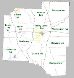
Townships in Arkansas are the divisions of a county. Each township includes unincorporated areas; some may have incorporated cities or towns within part of their boundaries. Arkansas townships have limited purposes in modern times. However, the United States census does list Arkansas population based on townships (sometimes referred to as "county subdivisions" or "minor civil divisions"). Townships are also of value for historical purposes in terms of genealogical research. Each town or city is within one or more townships in an Arkansas county based on census maps and publications. The townships of Grant County are listed below; listed in parentheses are the cities, towns, and/or census-designated places that are fully or partially inside the township. [18] [19]
Grant County is home to Jenkins' Ferry Battleground State Park. [20]
Sheridan County is a county located in the U.S. state of Kansas. Its county seat is Hoxie. As of the 2020 census, the county population was 2,447. The county was named in honor of Phillip Sheridan, a general during the American Civil War.
Saline County is a county located in the U.S. state of Arkansas. As of the 2020 census, the population was 123,416. Its county seat and largest city is Benton. Saline County was formed on November 2, 1835, and named for the salt water (brine) springs in the area, despite a differing pronunciation from saline. Until November 2014, it was an alcohol prohibition or dry county.
Johnson County is a county located in the U.S. state of Arkansas. As of the 2020 census, the population was 25,749. The county seat is Clarksville. Johnson County is Arkansas's 30th county, formed on November 16, 1833, from a portion of Pope County and named for Benjamin Johnson, a Territorial Judge. It is an alcohol prohibition or dry county.
Jackson County is located in the Arkansas Delta in the U.S. state of Arkansas. The county is named for Andrew Jackson, a national hero during the War of 1812. By the county's formation in 1829, Jackson had become the seventh President of the United States. Jackson County is home to seven incorporated towns and four incorporated cities, including Newport, the largest city and county seat. The county is also the site of numerous unincorporated communities and ghost towns. Occupying 633.94 square miles (164,190 ha), Jackson County is the 41st largest county of the 75 in Arkansas. As of the 2020 Census, the county's population was 16,755. Based on population, the county is the 44th-largest county in Arkansas. Although terrain rises in the west, most of Jackson County is within the Arkansas Delta, characterized by largely flat terrain with fertile soils. Historically covered in forest, bayous and swamps, the area was cleared for agriculture by early settlers. It is drained by the White River. No Interstate highways are located in Jackson County, two United States highways and fifteen Arkansas state highways run in the county. A Union Pacific Railroad line also crosses the county.
Howard County is a county located in the U.S. state of Arkansas. As of the 2020 census, the population was 12,785. The county seat is Nashville. Howard County is Arkansas's 74th county, formed on April 17, 1873, and named for James Howard, a state senator. It is a dry county.
Hot Spring County is a county located in the U.S. state of Arkansas. As of the 2020 census, the population was 33,040. The county seat is Malvern. Established on November 2, 1829, in the Arkansas Territory from a part of Clark County; it was named after the hot springs at Hot Springs, Arkansas, which were formerly in the county.
Hempstead County is a county located in the U.S. state of Arkansas. As of the 2020 census, the population was 20,065, down from 22,609 at the 2010 census. The county seat is Hope. Hempstead County is Arkansas's fourth county, formed on December 15, 1818, alongside Clark and Pulaski counties. The county is named for Edward Hempstead, a delegate to the U.S. Congress from the Missouri Territory, which included present-day Arkansas at the time. It is an alcohol prohibition or dry county.
Cleburne County is a county located in the U.S. state of Arkansas. As of the 2020 census, the population was 24,711. The county seat and most populous city is Heber Springs. The county was formed on February 20, 1883, as the last of Arkansas's 75 counties to be formed. It is named for Confederate Major-General Patrick Cleburne. Cleburne is an alcohol prohibition or dry county.
Carroll County is a county located in the U.S. state of Arkansas. As of the 2020 census, the population was 28,260. The county has two county seats, Berryville and Eureka Springs. Carroll County is Arkansas's 26th county, formed on November 1, 1833, and named after Charles Carroll, the last surviving signer of the United States Declaration of Independence.
Leola is a town in Grant County, Arkansas, United States. The population was 501 at the 2010 census. It is the southernmost municipality within the Central Arkansas region.
Poyen is a town in Grant County, Arkansas, United States. The population was 290 at the 2010 census. It is part of the Central Arkansas region.
Prattsville is a city in Grant County, Arkansas, United States. The population was 305 at the 2010 census. It is part of the Central Arkansas region.
Sheridan is a city in and the county seat of Grant County, Arkansas, United States. The community is located deep in the forests of the Arkansas Timberlands. It sits at the intersection of US Highways 167 and 270.
Benton is a city in and the county seat of Saline County, Arkansas, United States. A suburb of Little Rock, it was established in 1837. At the 2020 census, the city had a population of 35,014, making it the 12th most populous city in Arkansas. It is part of the Little Rock–North Little Rock–Conway Metropolitan Statistical Area. The city of Benton, first settled in 1833 and named after Missouri Senator Thomas Hart Benton, was formally chartered in 1836 when Arkansas became a state.
Sidney Township is a civil township of Montcalm County in the U.S. state of Michigan. The population was 2,538 at the 2020 census.
Sheridan Charter Township is a charter township of Newaygo County in the U.S. state of Michigan. The population was 2,518 at the 2020 census.
Geistown is a borough in Cambria County, Pennsylvania, United States. It is part of the Johnstown, Pennsylvania Metropolitan Statistical Area. The population was 2,467 at the 2010 census.
Silver Lake Township is a township in Susquehanna County, Pennsylvania, United States. The population was 1,525 at the 2020 census. The village of Brackney is in the township.
Leola is a small city in and the county seat of McPherson County, South Dakota, United States. It was founded on May 1, 1884, and named for Leola Haynes, daughter of one of the town's founders. The population was 434 as of the 2020 census.
Livingston is a village in Grant and Iowa Counties in the U.S. state of Wisconsin. The population was 664 at the 2010 census. Of this, 657 were in Grant County, and only 7 were in Iowa County.