Leola, Arkansas

Last updated

Leola, Arkansas
Grant County Arkansas Incorporated and Unincorporated areas Leola Highlighted 0539310.svg
Location of Leola in Grant County, Arkansas.
Coordinates: 34°10′12″N92°35′29″W / 34.17000°N 92.59139°W / 34.17000; -92.59139
CountryUnited States
State Arkansas
County Grant
Area
[1]
  Total0.85 sq mi (2.21 km2)
  Land0.85 sq mi (2.21 km2)
  Water0.00 sq mi (0.00 km2)
Elevation
[2]
269 ft (82 m)
Population
 (2020)
  Total460
  Density538.64/sq mi (207.86/km2)
Time zone UTC-6 (Central (CST))
  Summer (DST) UTC-5 (CDT)
ZIP code
72084
Area code 870
FIPS code 05-39310
GNIS feature ID2406005 [2]

Leola is a town [3] in Grant County, Arkansas, United States. The population was 501 at the 2010 census. It is the southernmost municipality within the Central Arkansas region.

Contents

Geography

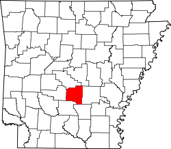
According to the United States Census Bureau, the town has a total area of 0.9 square miles (2.3 km2), all land.

Demographics

Historical population
CensusPop.Note
1910 398
1920 48221.1%
1930 379−21.4%
1940 4128.7%
1950 313−24.0%
1960 3212.6%
1970 39021.5%
1980 48123.3%
1990 476−1.0%
2000 5158.2%
2010 501−2.7%
2020 460−8.2%
U.S. Decennial Census [4]

As of the census [5] of 2000, there were 515 people, 179 households, and 143 families residing in the town. The population density was 591.2 inhabitants per square mile (228.3/km2). There were 213 housing units at an average density of 244.5 per square mile (94.4/km2). The racial makeup of the town was 84.66% White, 0.19% Black or African American, 0.58% Native American, 0.39% Pacific Islander, 12.82% from other races, and 1.36% from two or more races. 14.76% of the population were Hispanic or Latino of any race.

There were 179 households, out of which 39.7% had children under the age of 18 living with them, 63.1% were married couples living together, 12.3% had a female householder with no husband present, and 20.1% were non-families. 16.2% of all households were made up of individuals, and 8.9% had someone living alone who was 65 years of age or older. The average household size was 2.88 and the average family size was 3.17.

In the town, the population was spread out, with 29.3% under the age of 18, 8.9% from 18 to 24, 32.2% from 25 to 44, 19.8% from 45 to 64, and 9.7% who were 65 years of age or older. The median age was 31 years. For every 100 females, there were 102.8 males. For every 100 females age 18 and over, there were 102.2 males.

The median income for a household in the town was $30,625, and the median income for a family was $32,778. Males had a median income of $26,250 versus $17,292 for females. The per capita income for the town was $11,844. About 8.6% of families and 10.0% of the population were below the poverty line, including 6.4% of those under age 18 and 19.0% of those age 65 or over.

Attractions

Cox Creek Lake is a man made lake, created by the Arkansas Game and Fish Commission by damming Cox Creek, a tributary of the Saline River. [6] The Lake covers an area of approximately 254 acres outside Leola's city limits. [7] Camping is permitted, tent or R.V. for a fee, it also includes a boat ramp and a fishing pier. [7]

History

In 1864, the Camden Expedition (part of a larger military operation, the Red River Campaign), under the command of General Frederick Steele, marched his union troops along the Old Camden Road that passed through Leola after his supplies were depleted and Gen. Kirby's Confederates were on his rear flank as they approached the Jenkins' Ferry on the Saline River. A bloody battle of Jenkins' Ferry ensued. The Union troops barely crossed the Saline River, when they did, they burned the pontoon bridge and resulted in a victory in retreated as the Union marched back to Union controlled Little Rock via Prattsville and Old Belfast along the Old Camden Road.

In the late summer of 1921, Winters Syndicate drilled down over 1,920 feet exploring for oil in the Leola area. The Belmont Oil Company planned to develop oil fields in Leola, too. However, no oil was discovered. [8]

Ray Thornton (1928-2016) attended public school in Leola. [9] Thornton is a former U.S. Representative, lawyer, Arkansas Supreme Court justice, university president, and currently is the Public Service Fellow for the University of Arkansas at Little Rock William H. Bowen School of Law. [10] Thornton played "a key role in fashioning the articles of impeachment against President Richard Nixon concerning the Watergate cover-up." [11] Thornton was a party in the Supreme Court of the United States case, U.S. Term Limits, Inc. v. Thornton , [12] that ruled that Arkansas and other states attempts at placing term limits on members of the U.S. House of Representatives and the U.S. Senate, unconstitutional. [11]

Education

The Sheridan School District operates area public schools. On July 1, 1987, the Leola School District was annexed and consolidated into the Sheridan School district. [13]

Climate

The climate in this area is characterized by hot, humid summers and generally mild to cool winters. According to the Köppen climate classification system, Leola has a humid subtropical climate, abbreviated "Cfa" on climate maps. [14]

Related Research Articles

<span class="mw-page-title-main">Grant County, Arkansas</span> County in Arkansas, United States

Grant County is a county in the U.S. state of Arkansas. Its population was 17,958 at the 2020 United States Census. The county seat is Sheridan.

<span class="mw-page-title-main">Brookwood, Alabama</span> City in Alabama, United States

Brookwood is a city in Tuscaloosa County, Alabama, United States. It incorporated in September 1977. As of the 2020 census, the population of the town is 2,504.

<span class="mw-page-title-main">Thornton, Arkansas</span> City in Arkansas, United States

Thornton is a city in Calhoun County, Arkansas, United States. The population was 407 as of the 2010 census, down from 517 in 2000. It is part of the Camden, Arkansas micropolitan area.

<span class="mw-page-title-main">Beaver, Arkansas</span> Town in Arkansas, United States

Beaver is a town in Carroll County, Arkansas, United States. As of the 2020 census it had a population of 67. The community is located on the White River at the western limits of Table Rock Lake deep in the Ozark Mountains. Located north of Eureka Springs, the small town has been featured in movies for its picturesque scenery. The town is known for the Beaver Bridge, a two-panel suspension bridge over the White River listed on the National Register of Historic Places.

<span class="mw-page-title-main">Bono, Arkansas</span> Bono in Arkansas, United States

Bono is a city in Craighead County, Arkansas, United States. The population was 2,131 at the 2010 census, up from 1,512 in 2000. It is included in the Jonesboro, Arkansas Metropolitan Statistical Area. Bono's most prominent landmarks are the Bono Bridge and the Bono Cemetery.

<span class="mw-page-title-main">Mountainburg, Arkansas</span> City in Arkansas, United States

Mountainburg is a town in Crawford County, Arkansas, United States. It is part of the Fort Smith, Arkansas-Oklahoma Metropolitan Statistical Area. As of the 2010 census the population was 631.

<span class="mw-page-title-main">Wynne, Arkansas</span> City in Arkansas, United States

Wynne is the county seat and largest city of Cross County, Arkansas, United States. The population was 8,314 at the 2020 Census. Nestled between the Arkansas Delta and Crowley's Ridge, Wynne is the closest city to the second-largest state park in Arkansas, Village Creek State Park.

<span class="mw-page-title-main">Prattsville, Arkansas</span> City in Arkansas, United States

Prattsville is a city in Grant County, Arkansas, United States. The population was 305 at the 2010 census. It is part of the Central Arkansas region.

<span class="mw-page-title-main">College City, Arkansas</span> Former town in Arkansas, United States

College City is a former town in Lawrence County, Arkansas, United States. The population was 455 at the 2010 census. It is the site of Williams Baptist College, a four-year liberal arts college. The town merged with nearby Walnut Ridge effective January 1, 2017.

<span class="mw-page-title-main">Walnut Ridge, Arkansas</span> City in Arkansas, United States

Walnut Ridge is a city in and the county seat of Lawrence County, Arkansas, United States. The population was 5,098 at the United States Census's 2019 estimate. Walnut Ridge lies immediately north of Hoxie. The two towns form a contiguous urban area with approximately 8,000 residents. Williams Baptist University is in College City, a formerly separate community that merged into Walnut Ridge in 2017.

<span class="mw-page-title-main">Mount Ida, Arkansas</span> City in Arkansas, United States

Mount Ida is a city in and county seat of Montgomery County, Arkansas, United States. Founded in 1842, the city saw a silver boom in the 1880s bring early prosperity and economic development to the area. Today, the economy is largely ranching, poultry farming, silviculture, and tourism around Lake Ouachita. It is known as the quartz crystal capital of the U.S. and is known worldwide for its quartz deposits. The population was 996 as of the 2020 census.

<span class="mw-page-title-main">Benton, Arkansas</span> City in Arkansas, United States

Benton is a city in and the county seat of Saline County, Arkansas, United States and a suburb of Little Rock. It was established in 1837. At the 2020 census, the city had a population of 35,014, making it the 12th most populous city in Arkansas. It is part of the Little Rock–North Little Rock–Conway Metropolitan Statistical Area. The city of Benton, first settled in 1833 and named after Missouri Senator Thomas Hart Benton, was formally chartered in 1836 when Arkansas became a state.

<span class="mw-page-title-main">Bryant, Arkansas</span> City in Arkansas, United States

Bryant is a city in Saline County, Arkansas, United States and a suburb of Little Rock. According to the 2010 Census, the population of the city was 16,688. It is part of the Central Arkansas region.

<span class="mw-page-title-main">Smackover, Arkansas</span> City in Arkansas, United States

Smackover is a small city in northern Union County, Arkansas, United States. According to the 2010 census, the population was at 1,865. It had a large oil boom in the 1920s, with production continuing for some time.

<span class="mw-page-title-main">Laurie, Missouri</span> City in Missouri, United States

Laurie is a city in southern Morgan and northern Camden counties, Missouri, United States. The population was 945 at the 2010 census.

<span class="mw-page-title-main">Winnett, Montana</span> Town in Montana, United States

Winnett is a town in and the county seat of Petroleum County, Montana, United States. The population was 188 at the 2020 census.

<span class="mw-page-title-main">Platte, South Dakota</span> City in South Dakota, United States

Platte is a city in Charles Mix County, South Dakota, United States. The population was 1,311 at the 2022 census. The community is named after the Platte Creek, a tributary of the Missouri River reservoir Lake Francis Case. Platte is located 15 miles east of Lake Francis Case on the Missouri River.

<span class="mw-page-title-main">Grapeland, Texas</span> City in Texas, United States

Grapeland is a city in Houston County, Texas, United States. Its population was 1,465 as of the 2020 census.

<span class="mw-page-title-main">Iraan, Texas</span> City in Texas, United States

Iraan is a city in Pecos County, Texas, United States. Its population was 1,055 at the 2020 census. The city's name is an amalgamation of the first names of Ira and Ann Yates, owners of the ranch land upon which the town was built.

<span class="mw-page-title-main">Cherry Creek, New York</span> Town in New York, United States

Cherry Creek is a town in Chautauqua County, New York, United States. The population was 1,036 at the 2020 census. The name is derived from that of a small stream that flows through the town amid many cherry trees.

References

  1. "2020 U.S. Gazetteer Files". United States Census Bureau. Retrieved October 29, 2021.
  2. 1 2 U.S. Geological Survey Geographic Names Information System: Leola, Arkansas
  3. The Encyclopedia of Arkansas History & Culture , retrieved January 11, 2018
  4. "Census of Population and Housing". Census.gov. Retrieved June 4, 2015.
  5. "U.S. Census website". United States Census Bureau . Retrieved January 31, 2008.
  6. "Cox Creek Lake".
  7. 1 2 Fishing maps agfc.com [ dead link ]
  8. "Oil Distribution News". Oil and Gas News. August 21, 1926. Retrieved June 4, 2012.
  9. Onofrio, Jan (1998). Arkansas Biographical Dictionary. Somerset Publisher, Inc. p. 277.
  10. "UALR Law - Congressman Ray Thornton - University of Arkansas at Little Rock William H. Bowen School of Law". Archived from the original on October 10, 2010. Retrieved June 4, 2012.
  11. 1 2 "Encyclopedia of Arkansas".
  12. 514 U.S. 779 (1995); https://www.law.cornell.edu/supct/html/93-1456.ZO.html
  13. "ConsolidationAnnex_from_1983.xls Archived 2015-09-12 at the Wayback Machine ." Arkansas Department of Education. Retrieved on October 13, 2017.
  14. "Leola, Arkansas Köppen Climate Classification (Weatherbase)". Weatherbase. Retrieved December 18, 2023.