Paragould, Arkansas

Last updated

Paragould, Arkansas
Paragould AR 2011 06 23 017.jpg
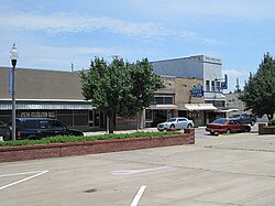
South Pruett Street in Paragould
Greene County Arkansas Incorporated and Unincorporated areas Paragould Highlighted 0553390.svg
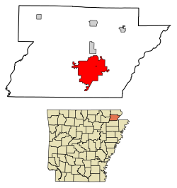
Location of Paragould in Greene County, Arkansas.
Usa edcp location map.svg
Red pog.svg
Paragould, Arkansas
Location in the United States
Coordinates: 36°03′25″N90°30′21″W / 36.05694°N 90.50583°W / 36.05694; -90.50583
CountryUnited States
State Arkansas
County Greene
Area
[1]
  Total32.02 sq mi (82.93 km2)
  Land31.86 sq mi (82.51 km2)
  Water0.16 sq mi (0.42 km2)
Elevation
[2]
289 ft (88 m)
Population
 (2020)
  Total29,537
  Density927.17/sq mi (357.99/km2)
Time zone UTC−6 (Central (CST))
  Summer (DST) UTC−5 (CDT)
ZIP codes
72450-72451
Area code 870
FIPS code 05-53390
GNIS feature ID2404471 [2]
Website Official website

Paragould is the county seat of Greene County, and the 19th-largest city in Arkansas, in the United States. The city is located in northeastern Arkansas on the eastern edge of Crowley's Ridge, a geologic anomaly contained within the Arkansas delta.

Contents

Paragould is the principal city of the Paragould, Arkansas Micropolitan Statistical Area and is also a part of the Jonesboro-Paragould Combined Statistical Area. The population of Paragould was 29,537 as of the 2020 Census, [3] compared to 26,113 at the 2010 census. [4]

History

The city's name is a blend combining the last names of competing railroad magnates J. W. Paramore and Jay Gould. Paramore's Texas & St. Louis Railway (later the Cotton Belt) and Gould's St. Louis, Iron Mountain and Southern Railway (later the Missouri Pacific) intersected here in 1882. A group of citizens chose the name, and it is believed to be the only city in the world with this name. For a time, Gould objected to his name's being second and refused to list the new town on his schedules. [5] In 1888, Paragould was the starting point for the Paragould and Buffalo Island Railway (later the Paragould Southeastern Railway), which eventually made its way to Blytheville, Arkansas. [6]

Sundown town

From 1888 to 1908, Paragould experienced a series of incidents in which White residents threatened and attacked Black residents. Some Black residents were flogged, and some of their homes and churches were burned. Arkansas Governor Jeff Davis ordered the state militia not to intervene on behalf of Black citizens. On numerous occasions White residents ordered Black citizens to leave and never return. In 1908, they threatened them to leave or die, which resulted in an almost complete depopulation of African-Americans in the county, and earned Paragould the designation of a sundown town. [7] Black children were not allowed to participate in any form of public education until 1948, [8] and then by busing them out of the county to Booker T. Washington High School in Jonesboro. [9] In 1957, facing mandated integration, Jonesboro terminated this practice. [10] Prior to 1982, no hotel in Paragould would allow Black people to spend the night. In 1983, when two Black Union Pacific workers attempted to eat at a restaurant, they were locked out. When police reached the scene, they accused the workers of attempting to break into the restaurant. [11] An informal ban on hiring African-Americans was alleged to exist in Paragould until at least 2002. [12]

Geography

Paragould is located southeast of the center of Greene County. U.S. Routes 412 and 49 intersect in the city west of downtown. US 412 leads east 9 miles (14 km) to the Missouri state line at the St. Francis River, and a further 23 miles (37 km) northeast to Kennett, Missouri; to the west US 412 leads 26 miles (42 km) to Walnut Ridge. US 49 leads northeast 32 miles (51 km) to Piggott and southwest 20 miles (32 km) to Jonesboro. The closest major city is Memphis, Tennessee, 82 miles (132 km) to the southeast.

According to the United States Census Bureau, the city has a total area of 31.4 square miles (81.2 km2), of which 31.2 square miles (80.8 km2) is land and 0.2 square miles (0.4 km2), or 0.52%, is water. [4]

Climate

Paragould has a humid subtropical climate (Köppen climate classification Cfa).

Climate data for Paragould, Arkansas (1991–2020 normals, extremes 1979–present)
MonthJanFebMarAprMayJunJulAugSepOctNovDecYear
Record high °F (°C)76
(24)
78
(26)
89
(32)
93
(34)
94
(34)
103
(39)
106
(41)
105
(41)
100
(38)
93
(34)
84
(29)
77
(25)
106
(41)
Mean daily maximum °F (°C)45.7
(7.6)
50.4
(10.2)
59.5
(15.3)
70.2
(21.2)
78.9
(26.1)
87.3
(30.7)
89.8
(32.1)
88.9
(31.6)
83.1
(28.4)
72.6
(22.6)
59.0
(15.0)
48.7
(9.3)
69.5
(20.8)
Daily mean °F (°C)37.0
(2.8)
40.9
(4.9)
49.6
(9.8)
59.8
(15.4)
69.1
(20.6)
77.5
(25.3)
80.4
(26.9)
79.0
(26.1)
72.3
(22.4)
61.1
(16.2)
49.0
(9.4)
40.2
(4.6)
59.7
(15.4)
Mean daily minimum °F (°C)28.2
(−2.1)
31.4
(−0.3)
39.7
(4.3)
49.3
(9.6)
59.3
(15.2)
67.8
(19.9)
71.0
(21.7)
69.1
(20.6)
61.5
(16.4)
49.6
(9.8)
39.0
(3.9)
31.7
(−0.2)
49.8
(9.9)
Record low °F (°C)−14
(−26)
−2
(−19)
5
(−15)
14
(−10)
34
(1)
50
(10)
53
(12)
50
(10)
36
(2)
28
(−2)
16
(−9)
−6
(−21)
−14
(−26)
Average precipitation inches (mm)3.89
(99)
4.03
(102)
4.88
(124)
5.19
(132)
5.14
(131)
3.56
(90)
4.24
(108)
3.84
(98)
3.31
(84)
4.40
(112)
4.64
(118)
4.62
(117)
51.74
(1,314)
Average snowfall inches (cm)1.0
(2.5)
0.8
(2.0)
0.4
(1.0)
0.0
(0.0)
0.0
(0.0)
0.0
(0.0)
0.0
(0.0)
0.0
(0.0)
0.0
(0.0)
0.0
(0.0)
0.0
(0.0)
0.3
(0.76)
2.5
(6.4)
Average precipitation days (≥ 0.01 in)10.09.411.310.411.48.88.98.66.98.79.811.2115.4
Average snowy days (≥ 0.1 in)0.60.60.20.00.00.00.00.00.00.00.00.51.9
Source: NOAA [13] [14]

Demographics

Historical population
CensusPop.Note
1890 1,666
1900 3,32499.5%
1910 5,24857.9%
1920 6,30620.2%
1930 5,966−5.4%
1940 7,07918.7%
1950 9,66836.6%
1960 9,9472.9%
1970 10,6397.0%
1980 15,24843.3%
1990 18,54021.6%
2000 22,01718.8%
2010 26,11318.6%
2020 29,53713.1%
U.S. Decennial Census [15]
The former Greene County Courthouse is one of twelve sites in Paragould listed on the National Register of Historic Places. Paragould AR 2011 06 23 003.jpg
The former Greene County Courthouse is one of twelve sites in Paragould listed on the National Register of Historic Places.
Greene County Museum Green County Museum Paragould AR 002.jpg
Greene County Museum

2020 census

Paragould racial composition [16]
RaceNumberPercentage
White (non-Hispanic)25,43886.1%
Black or African American (non-Hispanic)8723.0%
Native American 1000.3%
Asian 1560.5%
Pacific Islander 2801.0%
Other/Mixed 1,3964.7%
Hispanic or Latino 1,2954.4%

As of the 2020 United States census, there were 29,537 people, 10,755 households, and 7,439 families residing in the city.

2010 census

As of the 2010 United States Census, there were 26,113 people living in the city. The racial makeup of the city was 94.4% White, 0.8% Black, 0.4% Native American, 0.3% Asian, <0.1% Pacific Islander, <0.1% from some other race and 1.2% from two or more races. 2.8% were Hispanic or Latino of any race.

2000 census

As of the census [17] of 2000, there were 22,017 people, 8,941 households, and 6,133 families living in the city. The population density was 714.6 inhabitants per square mile (275.9/km2). There were 9,789 housing units at an average density of 317.7 per square mile (122.7/km2). The racial makeup of the city was 97.9% White, <0.1% Black or African American, 0.4% Native American, 0.2% Asian, <0.1% Pacific Islander, 0.6% from other races, and 0.9% from two or more races. 1.3% of the population were Hispanic or Latino of any race.

There were 8,941 households, out of which 31.9% had children under the age of 18 living with them, 53.7% were married couples living together, 11.4% had a female householder with no husband present, and 31.4% were non-families. 27.5% of all households were made up of individuals, and 13.0% had someone living alone who was 65 years of age or older. The average household size was 2.40 and the average family size was 2.92.

In the city, the population was spread out, with 24.8% under the age of 18, 9.6% from 18 to 24, 28.0% from 25 to 44, 21.7% from 45 to 64, and 15.8% who were 65 years of age or older. The median age was 36 years. For every 100 females, there were 90.7 males. For every 100 females age 18 and over, there were 86.9 males.

The median income for a household in the city was $30,815, and the median income for a family was $39,431. Males had a median income of $28,103 versus $20,623 for females. The per capita income for the city was $18,076. About 8.4% of families and 12.0% of the population were below the poverty line, including 12.1% of those under age 18 and 12.1% of those age 65 or over.

Government and infrastructure

Federal Building and Post Office Paragould AR 2011 06 23 014.jpg
Federal Building and Post Office

Paragould is governed by a mayor and city council. Other city offices include an attorney, treasurer, and chief administrative officer. A city clerk records government activity and is a point of contact for citizens, while various boards and commissions assist with governmental functions. [18]

The city's primary utility provider is Paragould Light Water Water and Cable. [19] Its formerly used City Light and Water Building from 1938 has faced demolition. [20]

Education

Paragould High School Paragould High School.jpg
Paragould High School

Paragould is home to Crowley's Ridge College, and a campus of Black River Technical College.

Paragould has two public school districts serving different parts of the city: the Greene County Tech School District and the Paragould School District. [21] It also has Crowley's Ridge Academy and St. Mary's Catholic School private school systems.[ citation needed ]

The Northeast Arkansas School District was formed on July 1, 1985, by the merger of the former Paragould School District with the Oak Grove School District. [22] By 1997 the name of the new district became the Paragould School District. [23]

Television

KPMF-LD, a MyNetworkTV/Quest affiliated TV station serving the Jonesboro and Memphis markets, and owned by HC2 Holdings.

K17LV-D, translator station of ABC/NBC/CW+ affiliated station KAIT in Jonesboro, and owned by Atlanta-based Gray Television.

Infrastructure

Transportation

Highways

Health care

Arkansas Methodist Medical Center is Paragould's only hospital. The 127-bed acute-care hospital's campus includes a professional office building with a community wellness center.[ citation needed ]

Law enforcement

On December 15, 2012, it was announced that "beginning in 2013, the department would deploy a new street crimes unit to high crime areas on foot to take back the streets." [24] The remaining town hall meetings to inform the public of the new plan were cancelled due to the volume of threats received as a result of national media exposure. This was done for public safety, as continuing to hold the meetings may have posed a danger to attendees. [25] [ needs update ] The planned unit was not deployed.

Cultural appearances

The documentary short film Udaan (2021) was made by Pakistani film maker Amman Abbasi about Baneen Khan, a female Pakistani student from Karachi enrolling at Black River Technical College. [26]

Notable people

Related Research Articles

<span class="mw-page-title-main">Clay County, Arkansas</span> County in Arkansas, United States

Clay County is a county located in the U.S. state of Arkansas. Originally incorporated as Clayton County, as of the 2020 census, its population was 14,552. The county has two county seats, Corning and Piggott. It is a dry county, in which the sale of alcoholic beverages is restricted or prohibited.

<span class="mw-page-title-main">Randolph County, Arkansas</span> County in Arkansas, United States

Randolph County is located between the Ozark Mountains and Arkansas Delta in the U.S. state of Arkansas. The county is named for John Randolph, a U.S. senator from Virginia influential in obtaining congressional approval of the Louisiana Purchase, which includes today's Randolph County. Created as Arkansas's 32nd county on October 29, 1835, Randolph County has two incorporated cities, including Pocahontas, the county seat and most populous city. The county is also the site of numerous unincorporated communities and ghost towns.

<span class="mw-page-title-main">Poinsett County, Arkansas</span> County in Arkansas, United States

Poinsett County is a county located in the U.S. state of Arkansas. As of the 2020 census, the population was 22,965. The county seat is Harrisburg. Poinsett County is included in the Jonesboro–Paragould Combined Statistical Area.

<span class="mw-page-title-main">Greene County, Arkansas</span> County in Arkansas, United States

Greene County is a county located in the U.S. state of Arkansas. As of the 2020 census, the population was 45,736. The county seat is Paragould, which sits atop Crowley's Ridge.

<span class="mw-page-title-main">Craighead County, Arkansas</span> County in Arkansas, United States

Craighead County is a county located in the U.S. state of Arkansas. As of the 2020 census, the population was 111,231. The county has two county seats — Jonesboro and Lake City. Craighead County is Arkansas's 58th county, formed on February 19, 1859, and named for state Senator Thomas Craighead. It is one of several dry counties within the state of Arkansas, in which the sale of alcoholic beverages is largely prohibited.

<span class="mw-page-title-main">Peach Orchard, Arkansas</span> City in Arkansas, United States

Peach Orchard is a city in Clay County, Arkansas, United States. The population was 135 at the 2010 census.

<span class="mw-page-title-main">Piggott, Arkansas</span> City in Arkansas, United States

Piggott is a city in Clay County, Arkansas, United States. It is one of the two county seats of Clay County, along with Corning. It is the northern terminus of the Arkansas segment of the Crowley's Ridge Parkway, a National Scenic Byway. As of the 2010 census, Piggott's population was 3,849. The town was named after James A. Piggott, one of the early settlers and initiator of the local post office.

<span class="mw-page-title-main">Brookland, Arkansas</span> City in Arkansas, United States

Brookland is a city in Craighead County, Arkansas, United States. The population was 1,642 at the 2010 census. It is included in the Jonesboro, Arkansas Metropolitan Statistical Area.

<span class="mw-page-title-main">Jonesboro, Arkansas</span> City in Northeast Arkansas

Jonesboro is a city located on Crowley's Ridge in the northeastern corner of the U.S. State of Arkansas. Jonesboro is one of two county seats of Craighead County. In 2022, the city had an estimated population of 79,876, making it the fifth-most populous city in Arkansas. In 2020, the Jonesboro metropolitan area had a population of 134,196, and the Jonesboro-Paragould Combined Statistical Area had a population of 179,932.

<span class="mw-page-title-main">Monette, Arkansas</span> City in Arkansas, United States

Monette is a city in Craighead County, Arkansas, United States. The city is located in an area of Northeast Arkansas known as Buffalo Island. The population was 1,506 at the 2020 census.

<span class="mw-page-title-main">Delaplaine, Arkansas</span> Town in Arkansas, United States

Delaplaine is a town in Greene County, Arkansas, United States. The population was 116 at the time of the 2010 census.

<span class="mw-page-title-main">Lafe, Arkansas</span> Town in Arkansas, United States

Lafe is a town in Greene County, Arkansas, United States on Crowley's Ridge. The population was 448 at the 2010 census, up from 385 in 2000.

<span class="mw-page-title-main">Marmaduke, Arkansas</span> City in Arkansas, United States

Marmaduke is a city in Greene County, Arkansas, United States. The population was 1,212 in 2020.

<span class="mw-page-title-main">Oak Grove Heights, Arkansas</span> City in Arkansas, United States

Oak Grove Heights is a city in Greene County, Arkansas, United States. The population was 889 at the 2010 census.

<span class="mw-page-title-main">Walnut Ridge, Arkansas</span> City in Arkansas, United States

Walnut Ridge is a city in and the county seat of Lawrence County, Arkansas, United States. The population was 5,098 at the United States Census's 2019 estimate. Walnut Ridge lies immediately north of Hoxie. The two towns form a contiguous urban area with approximately 8,000 residents. Williams Baptist University is in College City, a formerly separate community that merged into Walnut Ridge in 2017.

<span class="mw-page-title-main">Harrisburg, Arkansas</span> City in Arkansas, United States

Harrisburg is a city in Poinsett County, Arkansas, United States. The population was 2,212 at the 2020 census. It is included in the Jonesboro, Arkansas Metropolitan Statistical Area. The city is the county seat of Poinsett County.

<span class="mw-page-title-main">Cardwell, Missouri</span> City in Missouri, United States

Cardwell is a city in southwest Dunklin County, Missouri, United States. The population was 713 at the 2010 census. The current Mayor of Cardwell is Brandon Cupp and the current aldermen are Harvey Beasley, Mike Clark, and Chuck Walls.

<span class="mw-page-title-main">Paragould School District</span> School district in Arkansas, United States

Paragould School District is a public school district headquartered in Paragould, Arkansas. It serves the northern portion of Paragould and Oak Grove Heights.

<span class="mw-page-title-main">Jonesboro–Paragould combined statistical area</span> Statistical Area

The Jonesboro–Paragould Combined Statistical Area is made up of three counties in northeastern Arkansas. The CSA consists of the Jonesboro Metropolitan Statistical Area and the Paragould Micropolitan Statistical Area. As of the 2010 census, the CSA had a population of 163,116.

<span class="mw-page-title-main">Special routes of U.S. Route 49</span>

Several special routes of U.S. Route 49 exist. In order from south to north they are as follows.

References

  1. "2020 U.S. Gazetteer Files". United States Census Bureau. Retrieved October 29, 2021.
  2. 1 2 U.S. Geological Survey Geographic Names Information System: Paragould, Arkansas
  3. "Paragould (city), Arkansas". United States Census Bureau. Retrieved March 27, 2024.
  4. 1 2 "Geographic Identifiers: 2010 Demographic Profile Data (G001): Paragould city, Arkansas". American Factfinder. U.S. Census Bureau. Retrieved November 14, 2016.[ dead link ]
  5. Temple, Robert D. Edge Effects: The Border-Name Places (2nd edition, 2009), iUniverse, ISBN   978-0595477586, p. 320.
  6. "Valuation Docket No. 142, St. Louis Southwestern Railway Company, et al". Interstate Commerce Commission. November 30, 1928. pp. 372, 393–394, 405, 419–423, 472–477. Retrieved March 26, 2024 via Google Books.
  7. Griffith, Nancy Snell (September 7, 2021). "Paragould Race Riots". Encyclopedia of Arkansas. Retrieved February 7, 2022.
  8. Nelson, Rex (July 18, 2020). "Paragould to the Bootheel". Arkansas Democrat-Gazette . Retrieved February 7, 2022.
  9. Hamblen, Mack (November 12, 2020). "Paragould (Greene County)". Encyclopedia of Arkansas. Retrieved February 7, 2022.
  10. Ulmer, Amy (September 8, 2020). "Booker T. Washington High School (Jonesboro)". Encyclopedia of Arkansas. Retrieved February 7, 2022.
  11. Loewen, James (2006). Sundown Towns: A Hidden Dimension of American Racism. Touchstone. p. 278. ISBN   978-0743294485.
  12. Loewen, James (December 3, 2018). "Sundown Towns". Encyclopedia of Arkansas. Retrieved February 7, 2022.
  13. "NowData – NOAA Online Weather Data". National Oceanic and Atmospheric Administration. Retrieved June 22, 2021.
  14. "Station: Paragould 1S, AR". U.S. Climate Normals 2020: U.S. Monthly Climate Normals (1991–2020). National Oceanic and Atmospheric Administration. Retrieved June 22, 2021.
  15. "Census of Population and Housing". Census.gov. Retrieved June 4, 2015.
  16. "Explore Census Data". data.census.gov. Retrieved December 30, 2021.
  17. "U.S. Census website". United States Census Bureau . Retrieved January 31, 2008.
  18. "Government". City of Paragould. Retrieved May 25, 2023.
  19. "Paragould Becomes a Gig City". Paragould Regional Chamber of Commerce. July 21, 2021. Retrieved May 25, 2023.
  20. Heard, Kenneth (August 13, 2017). "1938 building faces demolition". Northwest Arkansas Democrat Gazette . Retrieved May 15, 2023.
  21. "2020 CENSUS - SCHOOL DISTRICT REFERENCE MAP: Greene County, AR" (PDF). U.S. Census Bureau . Retrieved August 5, 2022. - Text list
  22. "ConsolidationAnnex_from_1983.xls." Arkansas Department of Education. Retrieved on October 13, 2017.
  23. Home. Paragould School District. February 11, 1997. Retrieved on October 14, 2017. "Paragould School District is a consolidated district comprising the former districts of Oak Grove, Stanford, and Paragould."
  24. "Armed task force to patrol streets". Archived from the original on January 31, 2013.
  25. "PPD cancels town hall events". Archived from the original on January 31, 2013.
  26. Wissott, Lauren (May 18, 2021). "Amman Abbasi on his CAAMFest-selected short 'Udaan'". Filmmaker . Retrieved August 27, 2021.
  27. "Hall of Fame: Weldon 'Hoss' Bowlin". University of West Alabama. Retrieved December 12, 2022. a native of Paragould, Ark.
  28. Cook, Nancy Darlene. "Jeanne Laverne Carmen (1930–2007)". Encyclopedia of Arkansas. Retrieved December 12, 2022. born ... in Greene County near Paragould
  29. Crowley, Larry (June 8, 1994). "How Iris Rose Dement's Roots Are in Arkansas Gospel, But She Blooms with Missouri Folk". The Phoenix New Times. Retrieved December 12, 2022. Iris ... born to [parents] of the cotton-farming community of Paragould, Arkansas
  30. "Death Takes Van Des Autels". El Paso Herald-Post. September 3, 1968. p. 20. Retrieved December 12, 2022. Mr. Des Autels was born in Paragould, Ark., and came to El Paso as a youngster.
  31. Dumas, Ernest. "Jimmie Lou Fisher (1941–2022)". Encyclopedia of Arkansas . Retrieved December 12, 2022. died ... at the Arkansas Methodist Medical Center and is buried ... in Paragould
  32. "Gov. Junius Marion Futrell". National Governors Association. January 15, 2019. Retrieved December 12, 2022. buried at the Linwood Cemetery, Paragould, Arkansas
  33. Price, Robert (January 31, 2017). "Trice Harvey dies at 80". The Bakersfield Californian. Retrieved December 12, 2022. Harvey ... was born ... in Paragould, Ark.
  34. "Homer Lenderman, Jr.'s Biography". Vote Smart. Retrieved December 12, 2022. Home City: Paragould, AR