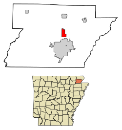
Oak Grove Heights, Arkansas | |
---|---|
Coordinates: 36°07′20″N90°30′25″W / 36.12222°N 90.50694°W | |
Country | United States |
State | Arkansas |
County | Greene |
Area | |
• Total | 3.00 sq mi (7.77 km2) |
• Land | 3.00 sq mi (7.76 km2) |
• Water | 0.01 sq mi (0.02 km2) |
Elevation | 308 ft (94 m) |
Population (2020) | |
• Total | 1,104 |
• Density | 368.61/sq mi (142.34/km2) |
Time zone | UTC-6 (Central (CST)) |
• Summer (DST) | UTC-5 (CDT) |
FIPS code | 05-51060 |
GNIS feature ID | 2407018 [2] |
Website | www |
Oak Grove Heights is a city [3] in Greene County, Arkansas, United States. The population was 889 at the 2010 census.
According to the United States Census Bureau, the town has a total area of 7.9 km2 (3.0 mi2), of which 7.9 km2 (3.0 mi2) is land and 0.33% is water.
Census | Pop. | Note | %± |
---|---|---|---|
1980 | 486 | — | |
1990 | 513 | 5.6% | |
2000 | 727 | 41.7% | |
2010 | 889 | 22.3% | |
2020 | 1,104 | 24.2% | |
U.S. Decennial Census [4] |
As of the 2010 United States Census, there were 889 people living in the town. The racial makeup of the town was 97.4% White, 1.0% Black, 0.1% Native American and 0.2% Asian. 1.2% were Hispanic or Latino of any race.
As of the census [5] of 2000, there were 727 people, 264 households, and 218 families living in the town. The population density was 92.3/km2 (239.0/mi2). There were 282 housing units at an average density of 35.8/km2 (92.7/mi2). The racial makeup of the town was 99.04% White, and 0.96% from two or more races.
There were 264 households, out of which 37.5% had children under the age of 18 living with them, 71.6% were married couples living together, 6.8% had a female householder with no husband present, and 17.4% were non-families. 15.9% of all households were made up of individuals, and 5.7% had someone living alone who was 65 years of age or older. The average household size was 2.75 and the average family size was 3.07.
In the town, the population was spread out, with 27.2% under the age of 18, 11.4% from 18 to 24, 28.2% from 25 to 44, 24.8% from 45 to 64, and 8.4% who were 65 years of age or older. The median age was 33 years. For every 100 females, there were 102.5 males. For every 100 females age 18 and over, there were 98.1 males.
The median income for a household in the town was $31,979, and the median income for a family was $37,083. Males had a median income of $25,333 versus $18,000 for females. The per capita income for the town was $12,603. About 7.9% of families and 9.8% of the population were below the poverty line, including 7.1% of those under age 18 and 19.2% of those age 65 or over.
It is in the Paragould School District. [6] Two schools are in Oak Grove Heights: Oak Grove Elementary School (grades 2-4) and Oak Grove Middle School (grades 5-6). [7] [8]
Zoned schools of Oak Grove Heights that are in Paragould are: Paragould Primary School (PreKindergarten-Grade 1), Paragould Junior High School (Grades 7-8), and Paragould High School (9-12). [9]
Greene County is a county located in the U.S. state of Arkansas. As of the 2020 census, the population was 45,736. The county seat is Paragould, which sits atop Crowley's Ridge.
Big Flat is a town in Baxter and Searcy counties in the U.S. state of Arkansas. The population was 88 at the 2020 census.
South Lead Hill is a town in Boone County, Arkansas, United States. The population was 102 at the 2010 census. It is part of the Harrison Micropolitan Statistical Area.
Oak Grove is a town in Carroll County, Arkansas, United States. The population was 386 at the 2020 census.
Okolona is a town near the western edge of Clark County, Arkansas, United States. The population was 147 at the 2010 census.
Crawfordsville, historically Crawfordville, is a town in Crittenden County, Arkansas, United States. The population was 479 at the 2010 census.
Twin Groves is a town in northwestern Faulkner County, Arkansas, United States. The name of the town comes from two neighboring communities — Solomon Grove and Zion Grove — which joined to incorporate as a town in 1991. The town's population was 335 at the 2010 census, up from 276 at the 2000 census. Twin Groves is part of the Central Arkansas region.
Delaplaine is a town in Greene County, Arkansas, United States. The population was 116 at the time of the 2010 census.
Paragould is the county seat of Greene County, and the 19th-largest city in Arkansas, in the United States. The city is located in northeastern Arkansas on the eastern edge of Crowley's Ridge, a geologic anomaly contained within the Arkansas delta.
Bodcaw is a town in Nevada County, Arkansas, United States. The population was 121 at the 2020 census. It is part of the Hope Micropolitan Statistical Area.
Rosston is a town in south-central Nevada County, Arkansas, United States. The population was 265 at the 2000 census. It is part of the Hope Micropolitan Statistical Area.
Willisville is a town in Nevada County, Arkansas, United States. The population was 148 at the 2020 census. It is part of the Hope Micropolitan Statistical Area.
Western Grove is a town in northeastern Newton County, Arkansas, United States. The population was 384 at the 2010 census. It is part of the Harrison Micropolitan Statistical Area.
Daisy is a town in Pike County, Arkansas, United States. Its population is 88 as of the 2020 census. Daisy is also the home of Daisy State Park.
Hector is a town in Pope County, Arkansas, United States. The population was 450 at the 2010 census. It is part of the Russellville Micropolitan Statistical Area.
O'Kean is a town in Randolph County, Arkansas, United States. The population was 192 at the 2020 census.
Ravenden Springs is a town in Randolph County, Arkansas, United States. The population was 119 at the 2020 census.
Traskwood is a city in Saline County, Arkansas, United States. The population was 518 at the 2010 census. It is part of the Little Rock–North Little Rock–Conway Metropolitan Statistical Area.
Caldwell is a town in St. Francis County, Arkansas, United States. The population was 555 at the 2010 census, an increase from 465 in 2000.
Goshen is a city in Washington County, Arkansas, United States. The population was 2,102 at the 2020 census. It is part of the Northwest Arkansas region. According to Business Insider, it is the “most educated” city in the state of Arkansas.
5027 Hwy 135 NParagould, AR 72450- Compare to the town boundaries.
5097 Highway 135 N Paragould, AR 72450