Osceola, Arkansas | |
|---|---|
 Clockwise from top: Mississippi County Courthouse copper dome is visible among mature trees as seen from the Hale Avenue Historic District, the courthouse grounds and main entrance, the Mississippi River at Sans Souci landing, Mississippi County Library, Osceola High School | |
 Location in Mississippi County, Arkansas | |
| Coordinates: 35°41′40″N89°59′36″W / 35.69444°N 89.99333°W | |
| Country | United States |
| State | Arkansas |
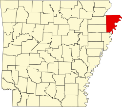
| County | Mississippi |
| First Settled | 1830 |
| First Incorporation (Plum Point) | 1837 |
| Second Incorporation (Osceola) | January 12, 1853 |
| Government | |
| • Type | Mayor–council |
| Area | |
• Total | 9.42 sq mi (24.40 km2) |
| • Land | 9.42 sq mi (24.40 km2) |
| • Water | 0 sq mi (0.00 km2) |
| Elevation | 236 ft (72 m) |
| Population | |
• Total | 6,976 |
• Estimate (2024) | 6,496 |
| • Density | 740.6/sq mi (285.96/km2) |
| Time zone | UTC−6 (Central (CST)) |
| • Summer (DST) | UTC−5 (CDT) |
| ZIP code | 72370 |
| Area code | 870 |
| FIPS code | 05-52580 |
| GNIS feature ID | 2404446 [2] |
| Website | osceolaarkansas |
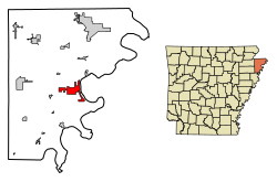
Osceola is a city in and a dual county seat of Mississippi County, Arkansas, United States. [4] Located along the Mississippi River within the Arkansas Delta, the settlement was founded in 1837 and incorporated in 1853. Occupying an important location on the river, the city's economy grew as steamboat traffic increased. Timber and cotton harvesting would develop, and the city experienced rapid growth and development throughout the early 20th century. The city's economy has since diversified to include a robust industrial sector. The population was 6,976 at the 2020 census, [3] down from 7,757 in 2010.
Contents
- History
- Prehistory
- Louisiana Purchase through Statehood
- Antebellum period, Civil War and Reconstruction
- The New South
- Geography
- Region
- Geology
- Hydrology
- Climate
- Demographics
- 2020 census
- 2010 census
- 2000 census
- Government
- Mayor–city council
- Education
- Infrastructure
- Electric
- Water/Wastewater
- Industry
- Notable people
- Notes
- References
- External links