Armorel, Arkansas | |
|---|---|
 Armorel  Armorel | |
| Coordinates: 35°55′20″N89°48′03″W / 35.92222°N 89.80083°W | |
| Country | United States |
| State | Arkansas |
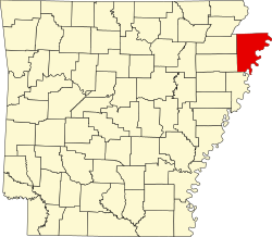
| County | Mississippi |
| Established | 1899 |
| Area | |
• Total | 3.8 km2 (1.48 sq mi) |
| • Land | 3.6 km2 (1.39 sq mi) |
| • Water | 0.23 km2 (0.09 sq mi) |
| Elevation | 79 m (259 ft) |
| Population | |
• Total | 312 |
| • Density | 86.4/km2 (223.8/sq mi) |
| Time zone | UTC-6 (Central (CST)) |
| • Summer (DST) | UTC-5 (CDT) |
| ZIP code | 72310 |
| Area code | 870 |
| FIPS code | 05-02230 |
| GNIS feature ID | 2805619 [2] |
Armorel is an unincorporated community and census-designated place (CDP) in Mississippi County, Arkansas, United States. As of the 2020 census, it had a population of 312. [3] It is in a largely rural area with most of its land devoted to forests and farms. Most of the town lies between Arkansas highways 18 and 312. The town's name was formed from the abbreviations of Arkansas and Missouri, along with the first three initials of its founder, Wilson.