Creamery Package, Arkansas | |
|---|---|
 Creamery Package  Creamery Package | |
| Coordinates: 35°33′12″N90°9′53″W / 35.55333°N 90.16472°W | |
| Country | |
| State | |
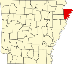
| County | Mississippi |
| Township | Scott |
| Elevation | 71 m (233 ft) |
| Time zone | UTC-6 (Central (CST)) |
| • Summer (DST) | UTC-5 (CDT) |
| GNIS feature ID | 76703 [1] |
Creamery Package (formerly Hitt) is an unincorporated community in Scott Township, Mississippi County, Arkansas, United States. [1] It is north of Interstate 55, exit 36 and southeast of Dyess. [2]