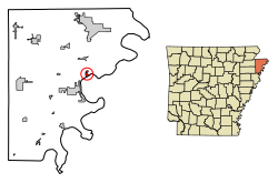
Luxora, Arkansas

Last updated

Luxora, Arkansas
ChrisLitherlandLuxora.jpg
Mississippi County Arkansas Incorporated and Unincorporated areas Luxora Highlighted 0542170.svg
Location in Mississippi County, Arkansas
Coordinates: 35°45′25″N89°55′48″W / 35.75694°N 89.93000°W / 35.75694; -89.93000
Country United States
State Arkansas
County Mississippi
Incorporated1897
Named for Luxora Waller
Area
[1]
  Total0.85 sq mi (2.20 km2)
  Land0.85 sq mi (2.20 km2)
  Water0.00 sq mi (0.00 km2)
Elevation
[2]
246 ft (75 m)
Population
 (2020) [3]
  Total942
  Density1,106.93/sq mi (427.44/km2)
Time zone UTC-6 (Central (CST))
  Summer (DST) UTC-5 (CDT)
ZIP code
72358
Area code 870
FIPS code 05-42170
GNIS feature ID2404978 [2]

Luxora is a city [4] in Mississippi County, Arkansas, United States. The population was 942 at the 2020 census, [3] down from 1,178 in 2010.

Contents

History

The city was originally settled as the community of Elmot Landing in the 1880s next to the Mississippi River. By 1897, the town had moved inland, behind the federal levee and was incorporated as Luxora, named after the daughter of a local businessman. [5]

During World War II, the Civil Aeronautics Authority operated an intermediate landing field in the vicinity of Luxora. This field was also utilized by Air Cadets at Blytheville Army Airfield and Walnut Ridge Army Air Field during the war. [6]

Geography

Luxora is located in eastern Mississippi County, Arkansas. It is bordered to the southeast by the Tennessee state line, which follows a side channel of the Mississippi River. U.S. Route 61 passes through the northwest side of the city, leading north 14 miles (23 km) to Blytheville and southwest 5 miles (8 km) to Osceola.

According to the United States Census Bureau, the city has a total area of 0.9 square miles (2.3 km2), in terms of geographical area. [1]

Demographics

Historical population
CensusPop.Note
1900 943
1910 677−28.2%
1920 1,17974.2%
1930 1,074−8.9%
1940 1,25817.1%
1950 1,3023.5%
1960 1,236−5.1%
1970 1,56626.7%
1980 1,73911.0%
1990 1,338−23.1%
2000 1,317−1.6%
2010 1,178−10.6%
2020 942−20.0%
U.S. Decennial Census [7]

2020 census

Luxora racial composition [8]
RaceNumberPercentage
White (non-Hispanic)33335.35%
Black or African American (non-Hispanic)53356.58%
Native American 10.11%
Other/Mixed 323.4%
Hispanic or Latino 434.56%

As of the 2020 United States census, there were 942 people, 358 households, and 200 families residing in the city.

2010 census

As of the 2010 United States Census, there were 1,178 people living in the town. The racial makeup of the town was 60.8% Black, 33.1% White, 0.5% Native American and 1.0% from two or more races. 4.6% were Hispanic or Latino of any race.

2000 census

At the 2000 census, [9] there were 1,317 people, 477 households and 352 families living in the town. The population density was 584.5/km2 (1,514.5/mi2). There were 537 housing units at an average density of 238.3/km2 (617.5/mi2). The racial makeup of the town was 40.93% White, 56.04% Black or African American, 0.08% Native American, 1.97% from other races, and 0.99% from two or more races. 2.73% of the population were Hispanic or Latino of any race.

There were 477 households, of which 38.6% had children under the age of 18 living with them, 43.0% were married couples living together, 26.0% had a female householder with no husband present, and 26.0% were non-families. 23.9% of all households were made up of individuals, and 11.1% had someone living alone who was 65 years of age or older. The average household size was 2.76 and the average family size was 3.29.

Age distribution was 34.8% under the age of 18, 7.6% from 18 to 24, 24.8% from 25 to 44, 21.1% from 45 to 64, and 11.7% who were 65 years of age or older. The median age was 31 years. For every 100 females, there were 87.1 males. For every 100 females age 18 and over, there were 78.2 males.

The median household income was $20,304, and the median family income was $23,906. Males had a median income of $22,375 versus $18,698 for females. The per capita income for the town was $9,060. About 30.7% of families and 32.4% of the population were below the poverty line, including 37.7% of those under age 18 and 30.3% of those age 65 or over.

Education

Public education for elementary and secondary students is provided by the Rivercrest School District (formerly the Southern Mississippi County School District), which includes the Southern Mississippi County Elementary School at Luxora (prekindergarten through grade 4). Students graduate from Rivercrest High School located near Wilson.

On July 1, 1986, the Luxora School District consolidated into the Southern Mississippi County School District. [10]

Related Research Articles

<span class="mw-page-title-main">Mississippi County, Arkansas</span> County in Arkansas, United States

Mississippi County is the easternmost county in the U.S. state of Arkansas. As of the 2020 census, the population was 40,685. There are two county seats, Blytheville and Osceola. The county is named for the Mississippi River which borders the county to the east. Mississippi County is part of the First Congressional District in Arkansas.

<span class="mw-page-title-main">Big Flat, Arkansas</span> Town in Arkansas, United States

Big Flat is a town in Baxter and Searcy counties in the U.S. state of Arkansas. The population was 88 at the 2020 census.

<span class="mw-page-title-main">Briarcliff, Arkansas</span> City in Arkansas, United States

Briarcliff is a second-class city in Baxter County, Arkansas, United States. The population was 236 at the 2010 census.

<span class="mw-page-title-main">South Lead Hill, Arkansas</span> Town in Arkansas, United States

South Lead Hill is a town in Boone County, Arkansas, United States. The population was 102 at the 2010 census. It is part of the Harrison Micropolitan Statistical Area.

<span class="mw-page-title-main">Greenway, Arkansas</span> City in Arkansas, United States

Greenway is a city in eastern Clay County, Arkansas, United States. The population was 209 at the 2010 census.

<span class="mw-page-title-main">Horseshoe Lake, Arkansas</span> Town in Arkansas, United States

Horseshoe Lake is a town in Crittenden County, Arkansas, United States. The population was 264 at the 2020 census.

<span class="mw-page-title-main">Grubbs, Arkansas</span> City in Arkansas, United States

Grubbs is a city in Jackson County, Arkansas, United States. The population was 386 at the 2010 census.

<span class="mw-page-title-main">Birdsong, Arkansas</span> Town in Arkansas, United States

Birdsong is a town in Mississippi County, Arkansas, United States. The population was 32 at the 2020 census, down from 41 in 2010.

<span class="mw-page-title-main">Blytheville, Arkansas</span> City in Arkansas, United States

Blytheville is the county seat and the largest city in Mississippi County, Arkansas, United States. It is approximately 60 miles (100 km) north of West Memphis. The population was 13,406 at the 2020 census, down from 15,620 in 2010.

<span class="mw-page-title-main">Burdette, Arkansas</span> Town in Arkansas, United States

Burdette is a town in Mississippi County, Arkansas, United States. The population was 140 at the 2020 census, down from 191 in 2010.

<span class="mw-page-title-main">Dell, Arkansas</span> Town in Arkansas, United States

Dell is a town in Mississippi County, Arkansas, United States. The population was 194 at the 2020 census.

<span class="mw-page-title-main">Dyess, Arkansas</span> Town in Arkansas, United States

Dyess is a town in Mississippi County, Arkansas, United States. The town was founded as Dyess Colony in 1934 as part of the Roosevelt administration's agricultural relief and rehabilitation program. It was the largest agrarian community established by the federal government during the Great Depression. It was the boyhood home of country singer Johnny Cash. As of the 2020 census, the population of Dyess was 339, down from 410 in 2010.

<span class="mw-page-title-main">Etowah, Arkansas</span> Town in Arkansas, United States

Etowah is a town in Mississippi County, Arkansas, United States. The population was 254 at the 2020 census, down from 351 in 2010.

<span class="mw-page-title-main">Keiser, Arkansas</span> City in Arkansas, United States

Keiser is a city in Mississippi County, Arkansas, United States. The population was 751 at the 2020 census.

<span class="mw-page-title-main">Victoria, Arkansas</span> Town in Arkansas, United States

Victoria is a town in Mississippi County, Arkansas, United States. The population was 20 as of the 2020 census, down from 37 in 2010. It is named after a sister of the town's founder, Robert E. Lee Wilson.

<span class="mw-page-title-main">Wilson, Arkansas</span> City in Arkansas known for its cotton production

Wilson is a city in Mississippi County, Arkansas, United States. The community is located in the Arkansas Delta and is surrounded by fertile cropland historically used to produce cotton. Wilson started as a company town in 1886 by Robert E. Lee Wilson, who would build a cotton empire and run it from the city. The Wilson Company would become so successful that all of the town's buildings were rebuilt in the Tudor Revival architectural style following Wilson's son's honeymoon to England in 1925. Wilson incorporated in 1959, becoming a town with public roads and municipal government. The extensive property holdings of the Lee Wilson and Company remained in the Wilson family until 2010. The community has seen a rapid decline in economic activity and population since the advent of mechanization on the farm, reducing the need for manual labor to produce cotton. The population was 766 at the 2020 census, down from 903 at the 2010 census.

<span class="mw-page-title-main">DeValls Bluff, Arkansas</span> City in Arkansas, United States

DeValls Bluff is a city in and the county seat of the southern district of Prairie County, Arkansas, United States. The population was 619 at the 2010 census.

<span class="mw-page-title-main">Traskwood, Arkansas</span> City in Arkansas, United States

Traskwood is a city in Saline County, Arkansas, United States. The population was 518 at the 2010 census. It is part of the Little Rock–North Little Rock–Conway Metropolitan Statistical Area.

<span class="mw-page-title-main">Caldwell, Arkansas</span> Town in Arkansas, United States

Caldwell is a town in St. Francis County, Arkansas, United States. The population was 555 at the 2010 census, an increase from 465 in 2000.

<span class="mw-page-title-main">Corinth, Arkansas</span> Town in Arkansas, United States

Corinth is a town in Yell County, Arkansas, United States. The population was 65 at the 2000 census. It is part of the Russellville Micropolitan Statistical Area.

References

  1. 1 2 "2021 U.S. Gazetteer Files: Arkansas". United States Census Bureau. Retrieved June 14, 2022.
  2. 1 2 U.S. Geological Survey Geographic Names Information System: Luxora, Arkansas
  3. 1 2 "P1. Race – Luxora city, Arkansas: 2020 DEC Redistricting Data (PL 94-171)". U.S. Census Bureau. Retrieved June 14, 2022.
  4. Local.Arkansas.gov - Luxora , retrieved September 3, 2012
  5. Schlesinger, Toney Butler. "Luxora (Mississippi County)". Encyclopedia of Arkansas. Retrieved December 9, 2023.
  6. "USAF Summary Sheet - Fries, Leonard J." www.aviationarchaeology.com. Retrieved December 9, 2023.
  7. "Census of Population and Housing". Census.gov. Retrieved June 4, 2015.
  8. "Explore Census Data". data.census.gov. Retrieved December 30, 2021.
  9. "U.S. Census website". United States Census Bureau . Retrieved January 31, 2008.
  10. "ConsolidationAnnex_from_1983.xls Archived 2015-09-12 at the Wayback Machine ." Arkansas Department of Education. Retrieved on July 31, 2017.