Manila, Arkansas | |
---|---|
Coordinates: 35°52′48″N90°10′00″W / 35.88000°N 90.16667°W | |
Country | United States |
State | Arkansas |
County | Mississippi |
Government | |
• Mayor | Tracey Reinhart |
Area | |
• Total | 3.78 sq mi (9.78 km2) |
• Land | 3.78 sq mi (9.78 km2) |
• Water | 0.00 sq mi (0.00 km2) |
Elevation | 243 ft (74 m) |
Population | |
• Total | 3,682 |
• Density | 974.85/sq mi (376.43/km2) |
Time zone | UTC-6 (Central (CST)) |
• Summer (DST) | UTC-5 (CDT) |
ZIP code | 72442 |
Area code | 870 |
FIPS code | 05-43820 |
GNIS feature ID | 2405008 [2] |
Manila is a city in Mississippi County, Arkansas, United States. The population was 3,682 at the 2020 census, [3] up from 3,342 in 2010. It was the hometown of World War I sniper Herman Davis.
Manila has its origins in a herdsman's camp established by John Needham in the late 1860s. By the late 1890s, a community known as "Cinda" (named after an early postmaster's sister) had developed in the area. In 1901, this community incorporated as a city, and chose the name "Manila" to honor Commodore George Dewey's 1898 victory in the Battle of Manila Bay during the Spanish–American War. [4]
In the early 1900s, the Jonesboro, Lake City and Eastern Railroad (later part of the St. Louis-San Francisco Railway system) extended a rail line to Manila. In 1910, the Manila Depot was constructed by the railroad. [4] This train station now serves as a museum, and is listed on the National Register of Historic Places.
In 1925, a memorial was established in the city for Herman Davis. The memorial was designated a state park in 1953, and the Arkansas Department of Parks and Tourism is responsible for its maintenance. [5]
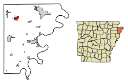
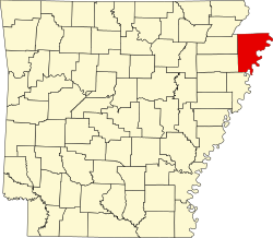
Manila is located in northwestern Mississippi County in the Arkansas Delta region. The city is situated at the intersection of Arkansas Highway 18 and Arkansas Highway 77, 9 miles (14 km) south of the Arkansas–Missouri state line. According to the United States Census Bureau, the city has a total area of 3.8 square miles (9.8 km2), all land. [1]
Ecologically, Manila is located within the St. Francis Lowlands ecoregion within the larger Mississippi Alluvial Plain. The St. Francis Lowlands are a flat region mostly covered with row crop agriculture today, though also containing sand blows and sunken lands remaining from the 1811–12 New Madrid earthquakes. Waterways have mostly been channelized, causing loss of aquatic and riparian wildlife habitat. [6] The Big Lake National Wildlife Refuge, which preserves some of the bottomland hardwood forest typical of this ecoregion prior to development for row agriculture lies just east of Manila.
Census | Pop. | Note | %± |
---|---|---|---|
1910 | 562 | — | |
1920 | 971 | 72.8% | |
1930 | 1,226 | 26.3% | |
1940 | 1,248 | 1.8% | |
1950 | 1,729 | 38.5% | |
1960 | 1,753 | 1.4% | |
1970 | 1,961 | 11.9% | |
1980 | 2,553 | 30.2% | |
1990 | 2,635 | 3.2% | |
2000 | 3,055 | 15.9% | |
2010 | 3,342 | 9.4% | |
2020 | 3,682 | 10.2% | |
U.S. Decennial Census [7] |
Race | Number | Percentage |
---|---|---|
White (non-Hispanic) | 3,380 | 91.8% |
Black or African American (non-Hispanic) | 21 | 0.57% |
Native American | 6 | 0.16% |
Asian | 18 | 0.49% |
Other/Mixed | 116 | 3.15% |
Hispanic or Latino | 141 | 3.83% |
As of the 2020 United States census, there were 3,682 people, 1,347 households, and 863 families residing in the city.
As of the census [9] of 2000, there were 3,055 people, 1,214 households, and 842 families residing in the city. The population density was 946.2 inhabitants per square mile (365.3/km2). There were 1,304 housing units at an average density of 403.9 per square mile (155.9/km2). The racial makeup of the city was 98.20% White, 0.03% Black or African American, 0.39% Native American, 0.07% Asian, 0.26% from other races, and 1.05% from two or more races. 1.08% of the population were Hispanic or Latino of any race.
There were 1,214 households, out of which 34.1% had children under the age of 18 living with them, 55.8% were married couples living together, 10.0% had a female householder with no husband present, and 30.6% were non-families. 27.4% of all households were made up of individuals, and 14.6% had someone living alone who was 65 years of age or older. The average household size was 2.47 and the average family size was 3.02.
In the city, the population was spread out, with 25.9% under the age of 18, 8.6% from 18 to 24, 28.0% from 25 to 44, 21.6% from 45 to 64, and 15.9% who were 65 years of age or older. The median age was 36 years. For every 100 females, there were 89.3 males. For every 100 females age 18 and over, there were 85.6 males.
The median income for a household in the city was $24,896, and the median income for a family was $33,105. Males had a median income of $31,344 versus $19,063 for females. The per capita income for the city was $13,754. About 13.4% of families and 18.4% of the population were below the poverty line, including 18.6% of those under age 18 and 26.4% of those age 65 or over.
The Manila Municipal Airport (IATA: MXA, ICAO: KMXA, FAA LID: MXA) is a public-use airport located two nautical miles (4 km) northeast of the central business district of Manila, in Mississippi County, Arkansas, United States. It is owned by the City of Manila.
The climate in this area is characterized by hot, humid summers and generally mild to cool winters. According to the Köppen Climate Classification system, Manila has a humid subtropical climate, abbreviated "Cfa" on climate maps. [10]
Stuttgart is a city in and the county seat of the northern district of Arkansas County, Arkansas, United States. As of the 2010 census it had a population of 9,326.
Beaver is a town in Carroll County, Arkansas, United States. As of the 2020 census it had a population of 67. The community is located on the White River at the western limits of Table Rock Lake deep in the Ozark Mountains. Located north of Eureka Springs, the small town has been featured in movies for its picturesque scenery. The town is known for the Beaver Bridge, a two-panel suspension bridge over the White River listed on the National Register of Historic Places.
Bay is a city in Craighead County, Arkansas, United States. The population was 1,876 at the 2020 census. It is included in the Jonesboro Metropolitan Statistical Area.
Black Oak is a town in Craighead County, Arkansas, United States. The population was 262 in the 2010 census. It is included in the Jonesboro, Arkansas Metropolitan Statistical Area.
Bono is a city in Craighead County, Arkansas, United States. The population was 2,131 at the 2010 census, up from 1,512 in 2000. It is included in the Jonesboro, Arkansas Metropolitan Statistical Area. Bono's most prominent landmarks are the Bono Bridge and the Bono Cemetery.
Monette is a city in Craighead County, Arkansas, United States. The city is located in an area of Northeast Arkansas known as Buffalo Island. The population was 1,506 at the 2020 census.
College City is a former town in Lawrence County, Arkansas, United States. The population was 455 at the 2010 census. It is the site of Williams Baptist College, a four-year liberal arts college. The town merged with nearby Walnut Ridge effective January 1, 2017.
Walnut Ridge is a city in and the county seat of Lawrence County, Arkansas, United States. The population was 5,098 at the United States Census's 2019 estimate. Walnut Ridge lies immediately north of Hoxie. The two towns form a contiguous urban area with approximately 8,000 residents. Williams Baptist University is in College City, a formerly separate community that merged into Walnut Ridge in 2017.
Dell is a town in Mississippi County, Arkansas, United States. The population was 194 at the 2020 census.
Etowah is a town in Mississippi County, Arkansas, United States. The population was 254 at the 2020 census, down from 351 in 2010.
Keiser is a city in Mississippi County, Arkansas, United States. The population was 751 at the 2020 census.
Leachville is a city in Mississippi County, Arkansas, United States. The population was 2,039 at the 2020 census. Leachville was incorporated in 1916.
Mount Ida is a city in and the county seat of Montgomery County, Arkansas, United States. Founded in 1842, the city saw a silver boom in the 1880s bring early prosperity and economic development to the area.
West Helena is the western portion of Helena-West Helena, Arkansas, a city in Phillips County, Arkansas, United States. As of the 2000 census, this portion of the city population was 8,689.
Benton is a city in and the county seat of Saline County, Arkansas, United States. A suburb of Little Rock, it was established in 1837. At the 2020 census, the city had a population of 35,014, making it the 12th most populous city in Arkansas. It is part of the Little Rock–North Little Rock–Conway Metropolitan Statistical Area. The city of Benton, first settled in 1833 and named after Missouri Senator Thomas Hart Benton, was formally chartered in 1836 when Arkansas became a state.
Smackover is a small city in northern Union County, Arkansas, United States. According to the 2010 census, the population was at 1,865. It had a large oil boom in the 1920s, with production continuing for some time.
Delta is a village in Madison Parish, Louisiana, United States. The population was 232 at the 2020 census. It is part of the Tallulah Micropolitan Statistical Area.
The city of Canton is the county seat of Madison County, Mississippi, United States, and is situated in the northern part of the metropolitan area surrounding the state capital, Jackson. The population of Canton was 10,948 at the 2020 census, down from 13,189 in 2010.
Iuka is a city in and the county seat of Tishomingo County, Mississippi, United States. Its population was 3,028 at the 2010 census. Woodall Mountain, the highest point in Mississippi, is located just south of Iuka.
Dawson Springs is a home rule-class city in Hopkins and Caldwell counties in the U.S. state of Kentucky. As of the 2020 census, the population of the city was 2,452.
{{citation}}
: CS1 maint: multiple names: authors list (link) (color poster with map, descriptive text, summary tables, and photographs).