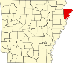
Gosnell, Arkansas

Last updated

Gosnell, Arkansas
PXL 20240307 151853349.jpg
Gosnell City Hall
Motto(s): 
Moving Forward, Moving Strong
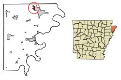
Mississippi County Arkansas Incorporated and Unincorporated areas Gosnell Highlighted 0527700.svg
Location in Mississippi County, Arkansas
Coordinates: 35°57′32″N89°58′41″W / 35.95889°N 89.97806°W / 35.95889; -89.97806
Country United States
State Arkansas
County Mississippi
IncorporatedMarch 12, 1968
Named for Lemuel Ward Gosnell (1854-1926)
Government
  MayorJason Taylor
Area
[1]
  Total1.61 sq mi (4.18 km2)
  Land1.61 sq mi (4.18 km2)
  Water0.00 sq mi (0.00 km2)
Elevation
[2]
243 ft (74 m)
Population
 (2020) [3]
  Total2,910
  Density1,801.86/sq mi (695.84/km2)
Time zone UTC-6 (Central (CST))
  Summer (DST) UTC-5 (CDT)
ZIP codes
72315, 72319
Area code 870
FIPS code 05-27700
GNIS feature ID2403717 [2]
Website cityofgosnell.net

Gosnell is a city in northern Mississippi County, Arkansas, United States. The population was 2,910 at the 2020 census, [3] down from 3,548 at the 2010 census.

Contents

History

In the 1870s, a portion of the area east of what became the city of Gosnell was constituted as the North Sawba Cemetery. [4] Much of the land between Blytheville and Big Lake was purchased in the late 1800s by Lemael W. Gosnell, a dentist and pioneer farmer. In time, the community came to be named for him. [5] A Tennessee native, L.W. Gosnell originally came to Mississippi County in 1876, working as a store clerk at Barfield Landing and Blytheville before becoming a partner in a general store in Blytheville. [6]

The small community received its first railroad service sometime prior to 1903, after the Paragould and Southeastern Railroad extended its line from Hornersville, Missouri to Chickasawba, Arkansas (now eastern Blytheville). [7]

By the mid-1920's, the community, now formally known as Gosnell, opened its own one room schoolhouse. For over a decade, the school was overseen by Superintendent C.F. Cooper, who oversaw the growth of the school and the addition of a high school curriculum by the time of his retirement in 1930. [8] During the 1937 flood, the community hosted 300 homeless victims of the flood. It was reported that a large number of wild animals had fled from the eastern section of the county after a break in the levee resulted in flooding from the Mississippi River. [9] [10]

In 1942, the U.S. Army came to Mississippi County to survey for land to construct a pilot training school. By April of that year, they had notified 62 individual land owners in the Gosnell community that their land was being taken by the federal government. [11] By June, Blytheville Army Airfield, a B-25 pilot training facility with three runways, was in operation. The school closed in 1946, and was converted into a suburb. The facility reopened in 1954 as Blytheville Air Force Base, a B-57 and later B-52 base. [12]

Gosnell was incorporated as a first-class city on March 12, 1968. Gosnell's first mayor after incorporation was Andy Bevill. [5]

Geography

Gosnell is located in the Arkansas Delta in northern Mississippi County. It is bordered to the east by the city of Blytheville, the county seat. The Missouri state line is less than 3 miles (5 km) to the north. According to the United States Census Bureau, Gosnell has a total area of 1.6 square miles (4.1 km2), all land. [1]

Ecologically, Gosnell is located within the St. Francis Lowlands ecoregion near its border with the Northern Holocene Meander Belts ecoregion; both are subregions of the larger Mississippi Alluvial Plain. The St. Francis Lowlands are a flat region mostly covered with row crop agriculture today, though also containing sand blows and sunken lands remaining from the 1811–12 New Madrid earthquakes. Waterways have mostly been channelized, causing loss of aquatic and riparian wildlife habitat. [13] The Big Lake National Wildlife Refuge, which preserves some of the bottomland hardwood forest typical of this ecoregion prior to development for row agriculture, lies 6 miles (10 km) west of Gosnell.

Historical sites

Leaving Blytheville on Chickasawba Street, one reaches Gosnell Road. Upon traveling 1.3 miles (2.1 km) one comes to the place of the famous Chickasawba Indian Mound 25 feet high and base circumference approximately 130 feet. This mound most likely served as either a Signal or a Temple Mound as no pottery or skeleton bones have been found here. [14]

Demographics

Historical population
CensusPop.Note
1970 1,386
1980 3,215132.0%
1990 3,78317.7%
2000 3,9684.9%
2010 3,548−10.6%
2020 2,910−18.0%
U.S. Decennial Census [15]
2014 Estimate [16]

2010 census

As of the census [17] of 2010, there were 3,548 people, 1,387 households, and 951 families residing in the city. The racial makeup of the city was 72.9% White, 22.0% Black or African American, 0.4% Native American, 1.0% Asian, 1.6% from other races, and 2.1% from two or more races. Hispanic or Latino of any race were 3.5% of the population.

There were 1,238 households, out of which 48.1% had children under the age of 18 living with them, 45.9% were married couples living together, 23.2% had a female householder with no husband present, 7.8% had a male householder with no wife present, and 23.2% were non-families. 19.2% of all households were made up of individuals, and 4.8% had someone living alone who was 65 years of age or older. The average household size was 2.87 and the average family size was 3.26.

The median income for a household in the city was $43,722, and the median income for a family was $46,389. The per capita income for the city was $15,917.

2000 census

As of the census [17] of 2000, there were 3,968 people, 1,369 households, and 1,074 families residing in the city. The population density was 2,367.1 inhabitants per square mile (913.9/km2). There were 1,578 housing units at an average density of 941.3 per square mile (363.4/km2). The racial makeup of the city was 80.12% White, 15.15% Black or African American, 0.43% Native American, 1.01% Asian, 1.86% from other races, and 1.44% from two or more races. Hispanic or Latino of any race were 3.45% of the population.

There were 1,369 households, out of which 48.3% had children under the age of 18 living with them, 54.9% were married couples living together, 18.4% had a female householder with no husband present, and 21.5% were non-families. 17.5% of all households were made up of individuals, and 4.1% had someone living alone who was 65 years of age or older. The average household size was 2.90 and the average family size was 3.29.

In the city, the population was spread out, with 34.9% under the age of 18, 10.8% from 18 to 24, 32.0% from 25 to 44, 17.5% from 45 to 64, and 4.8% who were 65 years of age or older. The median age was 28 years. For every 100 females, there were 96.7 males. For every 100 females age 18 and over, there were 92.1 males.

The median income for a household in the city was $31,423, and the median income for a family was $37,176. Males had a median income of $30,995 versus $17,625 for females. The per capita income for the city was $13,371. About 15.5% of families and 17.1% of the population were below the poverty line, including 16.5% of those under age 18 and 31.4% of those age 65 or over.

Economy

Gosnell used to depend on the nearby Blytheville/Eaker Air Force Base but since its closing in the early 1990s, the city has lost many of its inhabitants. [18] The city is home to the Gosnell School District, which as of 2011 has an enrollment of 1438 K-12. [19]

Annual cultural events

Gosnell's Annual Cotton Festival is in October. [20]

Education

Public education is available to elementary and secondary school students at Gosnell School District, which leads to graduation from Gosnell High School. The district and high school mascot and athletic emblem is the Pirate with the spirit colors of blue and gold.

Government

State and federal representation

The United States Postal Service operates one post office in Gosnell.

Climate

Gosnell has a humid subtropical climate (Köppen climate classification Cfa).

Totals and averages: [21]

Climate data for Gosnell, Arkansas
MonthJanFebMarAprMayJunJulAugSepOctNovDecYear
Mean daily maximum °F (°C)45
(7)
50
(10)
59
(15)
70
(21)
79
(26)
88
(31)
90
(32)
90
(32)
83
(28)
72
(22)
60
(16)
48
(9)
70
(21)
Mean daily minimum °F (°C)29
(−2)
33
(1)
41
(5)
51
(11)
61
(16)
69
(21)
72
(22)
71
(22)
63
(17)
51
(11)
42
(6)
32
(0)
51
(11)
Average precipitation inches (mm)3.67
(93)
4.31
(109)
4.54
(115)
4.91
(125)
5.23
(133)
3.90
(99)
4.02
(102)
2.61
(66)
2.88
(73)
4.08
(104)
4.70
(119)
5.07
(129)
49.92
(1,268)
Source: [22]

Other information

Tornado activity

Gosnell area historical tornado activity is slightly above the Arkansas state average and is 220% greater than the overall U.S. average. On May 15, 1968, an F4 (maximum wind speeds 207-260 mph) tornado 5.6 miles (9.0 km) away from the Gosnell city center killed 35 people and injured 364 people and caused between $5,000 and $50,000 in damages.

On April 16, 1998, an F4 tornado 10.1 miles (16.3 km) away from the city center killed two people and injured twelve and caused $350,000 in damages.

Earthquake activity

Gosnell-area historical earthquake activity is significantly above the Arkansas state average. It is 91% greater than the overall U.S. average.

Magnitude types: regional Lg-wave magnitude (LG), body-wave magnitude (MB)

Natural disasters

The number of natural disasters in Mississippi County (11) is near the US average (12).

Major disasters (Presidential) declared: 7

Emergencies declared: 4

Causes of natural disasters: Storms: 6, Floods: 5, Tornadoes: 4, Winter Storms: 4, Hurricane: 1 (Note: Some incidents may be assigned to more than one category). [23]

Related Research Articles

<span class="mw-page-title-main">Mississippi County, Arkansas</span> County in Arkansas, United States

Mississippi County is the easternmost county in the U.S. state of Arkansas. As of the 2020 census, the population was 40,685. There are two county seats, Blytheville and Osceola. The county is named for the Mississippi River which borders the county to the east. Mississippi County is part of the First Congressional District in Arkansas.

<span class="mw-page-title-main">Bay, Arkansas</span> City in Arkansas, United States

Bay is a city in Craighead County, Arkansas, United States. The population was 1,876 at the 2020 census. It is included in the Jonesboro Metropolitan Statistical Area.

<span class="mw-page-title-main">Monette, Arkansas</span> City in Arkansas, United States

Monette is a city in Craighead County, Arkansas, United States. The city is located in an area of Northeast Arkansas known as Buffalo Island. The population was 1,506 at the 2020 census.

<span class="mw-page-title-main">Crawfordsville, Arkansas</span> Town in Arkansas, United States

Crawfordsville, historically Crawfordville, is a town in Crittenden County, Arkansas, United States. The population was 479 at the 2010 census.

<span class="mw-page-title-main">Guy, Arkansas</span> City in Arkansas, United States

Guy is a city in Faulkner County, Arkansas, United States. The population was 708 at the 2010 census, up from 202 at the 2000 census. It is part of the Central Arkansas region.

<span class="mw-page-title-main">Blytheville, Arkansas</span> City in Arkansas, United States

Blytheville is the county seat and the largest city in Mississippi County, Arkansas, United States. It is approximately 60 miles (100 km) north of West Memphis. The population was 13,406 at the 2020 census, down from 15,620 in 2010.

<span class="mw-page-title-main">Burdette, Arkansas</span> Town in Arkansas, United States

Burdette is a town in Mississippi County, Arkansas, United States. The population was 140 at the 2020 census, down from 191 in 2010.

<span class="mw-page-title-main">Dell, Arkansas</span> Town in Arkansas, United States

Dell is a town in Mississippi County, Arkansas, United States. The population was 194 at the 2020 census.

<span class="mw-page-title-main">Leachville, Arkansas</span> City in Arkansas, United States

Leachville is a city in Mississippi County, Arkansas, United States. The population was 2,039 at the 2020 census. Leachville was incorporated in 1916.

<span class="mw-page-title-main">Luxora, Arkansas</span> City in Arkansas, United States

Luxora is a city in Mississippi County, Arkansas, United States. The population was 942 at the 2020 census, down from 1,178 in 2010.

<span class="mw-page-title-main">Manila, Arkansas</span> City in Arkansas, United States

Manila is a city in Mississippi County, Arkansas, United States. The population was 3,682 at the 2020 census, up from 3,342 in 2010. It was the hometown of World War I sniper Herman Davis.

<span class="mw-page-title-main">Osceola, Arkansas</span> City in Arkansas, United States

Osceola is a city in, and a dual county seat of, Mississippi County, Arkansas, United States. Located along the Mississippi River within the Arkansas Delta, the settlement was founded in 1837 and incorporated in 1853. Occupying an important location on the river, the city's economy grew as steamboat traffic increased. Timber and cotton harvesting would develop, and the city experienced rapid growth and development throughout the early 20th century. The city's economy has since diversified to include a robust industrial sector. The population was 6,976 at the 2020 census, down from 7,757 in 2010.

<span class="mw-page-title-main">Trumann, Arkansas</span> City in Arkansas, United States

Trumann is a city in Poinsett County, Arkansas, United States. The population was 7,399 at the 2020 census. It is included in the Jonesboro Metropolitan Statistical Area.

<span class="mw-page-title-main">Charleston, Mississippi</span> City in Mississippi, United States

Charleston is a city in north central Mississippi and one of the two county seats of Tallahatchie County, which is located on both sides of the Tallahatchie River. This city is located east of the river and its population was 2,193 at the 2010 census.

<span class="mw-page-title-main">Cooter, Missouri</span> City in Missouri, United States

Cooter is a city in Pemiscot County, Missouri, United States. The population was 343 at the 2020 census.

<span class="mw-page-title-main">Holland, Missouri</span> Town in Missouri, United States

Holland is a town in Pemiscot County, Missouri, United States. The population was 194 at the 2020 census.

<span class="mw-page-title-main">Steele, Missouri</span> City in Missouri, United States

Steele is a city in southern Pemiscot County in the Missouri Bootheel of southeastern Missouri, United States. The population was 1,853 at the 2020 census.

<span class="mw-page-title-main">Jones, Oklahoma</span> Town in Oklahoma, United States

Jones is a town in Oklahoma County, Oklahoma. It is named after Charles G. Jones, a three-time mayor of Oklahoma City. The population was 2,692 at the time of the 2010 census.

<span class="mw-page-title-main">Saluda, North Carolina</span> City in North Carolina, United States

Saluda is a city in Polk and Henderson counties in the U.S. state of North Carolina. The population was 713 at the 2010 census. Saluda is famous for sitting at the top of the Norfolk Southern Railway's Saluda Grade, which was the steepest main line standard-gauge railway line in the United States until Norfolk Southern ceased operations on the line in 2001. Saluda is close to the South Carolina state line, between Asheville, North Carolina, and Spartanburg, South Carolina.

<span class="mw-page-title-main">Gosnell High School</span> Public comprehensive school in Gosnell, Arkansas, United States

Gosnell High School is an accredited comprehensive public high school located in the city of Gosnell, Arkansas, United States, located northwest of Blytheville. The school provides secondary education for students in grades 7 through 12. It is one of four public high schools in Mississippi County, Arkansas and the sole high school administered by the Gosnell School District.

References

  1. 1 2 "2021 U.S. Gazetteer Files: Arkansas". United States Census Bureau. Retrieved June 13, 2022.
  2. 1 2 U.S. Geological Survey Geographic Names Information System: Gosnell, Arkansas
  3. 1 2 "P1. Race – Gosnell city, Arkansas: 2020 DEC Redistricting Data (PL 94-171)". U.S. Census Bureau. Retrieved June 13, 2022.
  4. "North Sawba Cemetery on BAAF grounds". The Courier News. August 10, 1942. p. 1. Retrieved December 30, 2023.
  5. 1 2 Lendennie, Pat. "Gosnell (Mississippi County)". www.encyclopediaofarkansas.net. Central Arkansas Library System. Archived from the original on June 16, 2010. Retrieved December 30, 2023.
  6. Presley, Leister E., Mrs. (1889). Goodspeed's Biographical and historical memoirs of northeast Arkansas. Chicago, Nashville and St, Louis: The Goodspeed publishing co. p. 503.{{cite book}}: CS1 maint: multiple names: authors list (link)
  7. Poor, Henry V. (1904). Poor's Manual of Railroads. Vol. 39. New York, NY: Poor's Railroad Manual Company. p. 532.
  8. "Gosnell School Holds Exercises". Newspapers.com. Blytheville, Arkansas: The Courier News. p. 3. Retrieved December 30, 2023.
  9. "Game Finds Refuge from Flood at Gosnell". The Courier News. February 9, 1937. p. 2. Retrieved December 30, 2023.
  10. "8000 Homeless Receive Care in North District". The Courier News. January 26, 1937. p. 3. Retrieved December 30, 2023.
  11. "File Suits to Condemn Gosnell Area". The Courier News. April 24, 1942. p. 9. Retrieved December 30, 2023.
  12. Hartley, Jillian. "Eaker Air Force Base". Encyclopedia of Arkansas. Retrieved December 30, 2023.
  13. PD-icon.svg This article incorporates public domain material from Woods, A.J., Foti, T.L., Chapman, S.S., Omernik, J.M.; et al. Ecoregions of Arkansas (PDF). United States Geological Survey.{{citation}}: CS1 maint: multiple names: authors list (link) (color poster with map, descriptive text, summary tables, and photographs).
  14. "Gosnell | Mississippi County, Arkansas". Archived from the original on February 27, 2014. Retrieved May 14, 2013.
  15. "Census of Population and Housing". Census.gov. Retrieved June 4, 2015.
  16. "Annual Estimates of the Resident Population for Incorporated Places: April 1, 2010 to July 1, 2014". Archived from the original on May 22, 2015. Retrieved June 4, 2015.
  17. 1 2 "U.S. Census website". United States Census Bureau . Retrieved January 31, 2008.
  18. Schulte, Bret. "A Rough Road Once the Pentagon Pulls the Plug". U.S. News & World Report. May 23, 2005, p. 30.
  19. "Search for Public School Districts - District Detail for GOSNELL SCHOOL DISTRICT". nces.ed.gov. Retrieved October 28, 2021.
  20. "Blytheville Courier News: Local News: Gosnell ready for annual Cotton Festival (10/05/11)". www.couriernews.net. Archived from the original on June 5, 2015.
  21. "Weather averages Blytheville, Arkansas".
  22. "Ashburn, VA Monthly Weather Forecast". weather.com. Retrieved August 27, 2022.
  23. "Gosnell, Arkansas (AR 72315) profile: Population, maps, real estate, averages, homes, statistics, relocation, travel, jobs, hospitals, schools, crime, moving, houses, news, sex offenders".