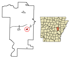
DeValls Bluff, Arkansas

Last updated

DeValls Bluff, Arkansas
Prairie County Courthouse, De Valls Bluff, AR 001.jpg
Prairie County Courthouse, Southern District
Prairie County Arkansas Incorporated and Unincorporated areas De Valls Bluff Highlighted 0518640.svg
Location of De Valls Bluff in Prairie County, Arkansas.
Coordinates: 34°47′5″N91°27′37″W / 34.78472°N 91.46028°W / 34.78472; -91.46028
Country United States
State Arkansas
County Prairie
IncorporatedApril 4, 1866 [1]
Area
[2]
  Total1.16 sq mi (3.00 km2)
  Land1.09 sq mi (2.83 km2)
  Water0.07 sq mi (0.17 km2)
Elevation
190 ft (58 m)
Population
 (2020)
  Total520
  Density476.19/sq mi (183.83/km2)
Time zone UTC-6 (Central (CST))
  Summer (DST) UTC-5 (CDT)
ZIP code
72041
Area code 870
FIPS code 05-18640
GNIS feature ID0076762

DeValls Bluff is a city in and the county seat of the southern district of Prairie County, Arkansas, United States. [3] The population was 619 at the 2010 census.

Contents

History

Duvall's Bluffs, Prairie Co., Arkansas. Depot of supplies of the Army of the Southwest, 1863 Duvall's Bluffs, Prairie Co., Arkansas. Depot of supplies of the Army of the Southwest.jpg
Duvall's Bluffs, Prairie Co., Arkansas. Depot of supplies of the Army of the Southwest, 1863

Prairie County has always been important to Arkansas for the transportation of people and goods throughout the state. Initially, it was the White River that gave the agricultural county its importance for transport, since waterways were the primary means of long-distance transportation in the period before the development of railroads. Prairie County was cut from Arkansas, Pulaski, Monroe, St. Francis, and White counties in 1846 and included present-day Lonoke County. [4] European settlement in Prairie County came in the 19th century, with Jacob M. DeVall and his son, Chappel, becoming the first recorded settlers around DeValls Bluff according to 1851 tax records.

During the Civil War, the city was a trading center on the White River, which continued to be the primary shipping corridor when the Arkansas River was innavigable. A railroad connection between North Little Rock and DeValls Bluff gave the city further strategic importance. Union forces traveling up the White from Arkansas Post under the command of Brigadier General Willis Gorman captured DeValls Bluff on January 18, 1863. However, the Union forces eventually returned to Arkansas Post, and the city returned to Confederate control. Following the capture of Little Rock, Union cavalry led by Brigadier General John Wynn Davidson joined with gunboats under the command of Lieutenant George Bache in Clarendon on August 9, 1863, and traveled up the White River to capture DeValls Bluff. Major General Frederick Steele proceeded to DeValls Bluff from Helena, and the city was used to house supplies and injured Union soldiers for the remainder of the war. [5]

Geography

An oxbow lake of the White River in DeValls Bluff White River Oxbow at DeValls Bluff, AR.jpg
An oxbow lake of the White River in DeValls Bluff

DeValls Bluff is located at 34°47′5″N91°27′37″W / 34.78472°N 91.46028°W / 34.78472; -91.46028 (34.784760, -91.460346). [6] The city is located within the Grand Prairie section of Prairie County, a subdivision of the Mississippi embayment within the Mississippi Alluvial Plain. Historically, the Grand Prairie was a flat grassland between the Arkansas River and the White River. However, the area was subject to clear cutting for row agriculture by early settlers. Today, the area is defined by rice cultivation, aquaculture and duck hunting.

According to the United States Census Bureau, the town has a total area of 2.8 km2 (1.1 sq mi), of which 2.7 km2 (1.0 sq mi) is land and 0.2 km2 (0.077 sq mi) (6.42%) is water.

Demographics

Historical population
CensusPop.Note
1880 186
1890 380104.3%
1900 60559.2%
1910 92452.7%
1920 885−4.2%
1930 672−24.1%
1940 6862.1%
1950 83021.0%
1960 654−21.2%
1970 622−4.9%
1980 73818.6%
1990 702−4.9%
2000 78311.5%
2010 619−20.9%
2020 520−16.0%
Encyclopedia of Arkansas
History and Culture
[1]

As of the census [7] of 2000, there were 783 people, 334 households, and 218 families residing in the town. The population density was 293.5 people /km2 (760 people/sq mi). There were 389 housing units at an average density of 145.8 units /km2 (378 units/sq mi). The racial makeup of the town was 67.82% White, 31.80% Black or African American, 0.13% Asian, and 0.26% from two or more races. 0.13% of the population were Hispanic or Latino of any race.

There were 334 households, out of which 33.2% had children under the age of 18 living with them, 43.7% were married couples living together, 17.4% had a female householder with no husband present, and 34.7% were non-families. 31.7% of all households were made up of individuals, and 17.1% had someone living alone who was 65 years of age or older. The average household size was 2.34 and the average family size was 2.96.

In the town the population was spread out, with 28.6% under the age of 18, 6.8% from 18 to 24, 25.5% from 25 to 44, 20.9% from 45 to 64, and 18.1% who were 65 years of age or older. The median age was 38 years. For every 100 females, there were 79.6 males. For every 100 females age 18 and over, there were 77.5 males.

The median income for a household in the town was $21,534, and the median income for a family was $32,708. Males had a median income of $28,088 versus $16,771 for females. The per capita income for the town was $13,582. About 18.4% of families and 23.6% of the population were below the poverty line, including 28.7% of those under age 18 and 22.1% of those age 65 or over.

Education

Hazen School District is the area school district, [8] and operates Hazen High School.

The DeValls Bluff School District consolidated into the Hazen district on July 1, 2006. [9]

Related Research Articles

<span class="mw-page-title-main">Prairie County, Arkansas</span> County in Arkansas, United States

Prairie County is in the Central Arkansas region of the U.S. state of Arkansas. The county is named for the Grand Prairie, a subregion of the Arkansas Delta known for rice cultivation and aquaculture that runs through the county. Created as Arkansas's 54th county in 1846, Prairie County is home to four incorporated towns, including DeValls Bluff, the southern district county seat, and two incorporated cities, including Des Arc, the northern district county seat. The county is also the site of numerous unincorporated communities and ghost towns. Occupying 676 square miles (175,000 ha), Prairie County is the median-sized county in Arkansas. As of the 2020 Census, the county's population was 8,282. Based on population, the county is the ninth-smallest county of the 75 in Arkansas.

<span class="mw-page-title-main">Monroe County, Arkansas</span> County in Arkansas, United States

Monroe County is located in the Arkansas Delta in the U.S. state of Arkansas. The county is named for James Monroe, the fifth President of the United States. Created as Arkansas's 20th county on November 2, 1829, Monroe County is home to two incorporated towns and three incorporated cities, including Clarendon, the county seat, and Brinkley, the most populous city. The county is also the site of numerous unincorporated communities and ghost towns.

<span class="mw-page-title-main">Crawford County, Arkansas</span> County in Arkansas, United States

Crawford County is a county located in the Ozarks region of the U.S. state of Arkansas. As of the 2020 census, the population was 60,133. The county seat and largest city is Van Buren. Crawford County was formed on October 18, 1820, from the former Lovely County and Indian Territory, and was named for William H. Crawford, the United States Secretary of War in 1815.

<span class="mw-page-title-main">Arkansas County, Arkansas</span> County in Arkansas, United States

Arkansas County is a county located in the U.S. state of Arkansas. As of the 2020 census, the population was 17,149. Located in the Arkansas Delta, the county has two county seats, DeWitt and Stuttgart.

<span class="mw-page-title-main">Big Flat, Arkansas</span> Town in Arkansas, United States

Big Flat is a town in Baxter and Searcy counties in the U.S. state of Arkansas. The population was 88 at the 2020 census.

<span class="mw-page-title-main">Hermitage, Arkansas</span> City in Arkansas, United States

Hermitage is a city in Bradley County, Arkansas, United States. The United States Census Bureau estimated the population to be 830 as of the 2010 census.

<span class="mw-page-title-main">St. Francis, Arkansas</span> City in Arkansas, United States

St. Francis is a city in northeastern Clay County, Arkansas, United States, along the St. Francis River. The population was 250 at the 2010 census.

<span class="mw-page-title-main">White Hall, Arkansas</span> City in Arkansas, United States

White Hall is a city in Washington Township, located in Jefferson County, Arkansas, United States. With a population of 5,526 in the 2010 census, it is included in the Pine Bluff Metropolitan Statistical Area and the greater Little Rock-North Little Rock-Pine Bluff Combined Statistical Area. White Hall is home to the Pine Bluff Arsenal.

<span class="mw-page-title-main">Smithville, Arkansas</span> Town in Arkansas, United States

Smithville is a town in Lawrence County, Arkansas, United States. The population was 78 at the 2010 census.

<span class="mw-page-title-main">Morrison Bluff, Arkansas</span> Town in Arkansas, United States

Morrison Bluff is a town in Logan County, Arkansas, United States. The population was 64 at the 2010 census and an estimated 81 in 2017.

<span class="mw-page-title-main">Carlisle, Arkansas</span> City in Arkansas, United States

Carlisle is a city in Lonoke County, Arkansas, United States. It is the easternmost municipality within the Little Rock–North Little Rock–Conway Metropolitan Statistical Area. Carlisle was incorporated in 1878. As of the 2010 census it had a population of 2,214.

<span class="mw-page-title-main">Roe, Arkansas</span> Town in Arkansas, United States

Roe is a town in Monroe County, Arkansas, United States. Located at the junction of U.S. Route 79 and Arkansas Highway 33, the population was 68 at the 2020 census, down from 114 in 2010.

<span class="mw-page-title-main">Oden, Arkansas</span> Town in Arkansas, United States

Oden is a town in Montgomery County, Arkansas, United States. As of the 2020 census, its population was 180, down from 232 in 2010.

<span class="mw-page-title-main">Des Arc, Arkansas</span> City in Arkansas, United States

Des Arc is a city on the White River in the Arkansas Delta, United States. It is the largest city in Prairie County, Arkansas, and the county seat for the county's northern district. Incorporated in 1854, Des Arc's position on the river has shaped its culture, history, and economy, beginning as a major lumber shipping port but leaving the city vulnerable to major floods in 1927 and 1937. As river shipping declined, Des Arc was bypassed by railroads, Interstate highways, and much of the post-industrial society. Des Arc's history is preserved by seven listings on the National Register of Historic Places, and the region's history is interpreted at Lower White River Museum State Park. The city's population stopped growing in the 1980s and has been declining since, with a population of 1,717 at the 2010 Census.

<span class="mw-page-title-main">Fredonia (Biscoe), Arkansas</span> City in Arkansas, United States

Fredonia (Biscoe) is a city in Prairie County, Arkansas, United States. The population was 363 at the 2010 census.

<span class="mw-page-title-main">Hazen, Arkansas</span> City in Arkansas, United States

Hazen is a city in Prairie County, Arkansas, United States. The population was 1,481 at the 2020 census.

<span class="mw-page-title-main">Ulm, Arkansas</span> Town in Arkansas, United States

Ulm is a town in Prairie County, Arkansas, United States. The population was 205 at the 2000 census.

<span class="mw-page-title-main">Gillham, Arkansas</span> Town in Arkansas, United States

Gillham is a town in Sevier County, Arkansas, United States. The population was 188 at the 2000 census. It is located six miles from Gillham Lake.

<span class="mw-page-title-main">Garner, Arkansas</span> Town in Arkansas, United States

Garner is a town in White County, Arkansas, United States. The population was 284 at the 2000 census.

<span class="mw-page-title-main">Griffithville, Arkansas</span> Town in Arkansas, United States

Griffithville is a town in White County, Arkansas, United States. The population was 262 at the 2000 census.

References

  1. 1 2 Sayger, Bill (September 6, 2012). "DeValls Bluff (Prairie County)". Encyclopedia of Arkansas History and Culture. Butler Center for Arkansas Studies at the Central Arkansas Library System. Retrieved January 7, 2014.
  2. "2020 U.S. Gazetteer Files". United States Census Bureau. Retrieved October 29, 2021.
  3. "Find a County". National Association of Counties. Archived from the original on May 31, 2011. Retrieved June 7, 2011.
  4. Sickel, Marilyn Hambrick (September 6, 2012). "Prairie County". Encyclopedia of Arkansas History and Culture. Butler Center for Arkansas Studies at the Central Arkansas Library System . Retrieved January 11, 2014.
  5. Sesser, David (September 6, 2012). "Capture of Des Arc and DeValls Bluff". Encyclopedia of Arkansas History and Culture . Butler Center for Arkansas Studies at the Central Arkansas Library System. Retrieved January 11, 2014.
  6. "US Gazetteer files: 2010, 2000, and 1990". United States Census Bureau. February 12, 2011. Retrieved April 23, 2011.
  7. "U.S. Census website". United States Census Bureau . Retrieved January 31, 2008.
  8. "2020 CENSUS - SCHOOL DISTRICT REFERENCE MAP: Prairie County, AR" (PDF). U.S. Census Bureau . Retrieved February 19, 2023.
  9. "ConsolidationAnnex_from_1983.xls Archived 2015-09-12 at the Wayback Machine ." Arkansas Department of Education. Retrieved on October 13, 2017.