Clinton, Arkansas | |
---|---|
Coordinates: 35°35′11″N92°27′28″W / 35.58639°N 92.45778°W | |
Country | United States |
State | Arkansas |
County | Van Buren |
Area | |
• Total | 13.75 sq mi (35.61 km2) |
• Land | 13.45 sq mi (34.85 km2) |
• Water | 0.30 sq mi (0.77 km2) |
Elevation | 610 ft (190 m) |
Population (2020) | |
• Total | 2,509 |
• Density | 186.49/sq mi (72.00/km2) |
Time zone | UTC-6 (Central (CST)) |
• Summer (DST) | UTC-5 (CDT) |
ZIP code | 72031 |
Area code | 501 |
FIPS code | 05-14260 |
GNIS feature ID | 2404076 [2] |
Website | www |
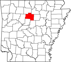
Clinton is the county seat of Van Buren County, Arkansas, United States. [3] The population was 2,602 at the 2010 census, making it the most populous city in the county.
The city was named for DeWitt Clinton, the New York governor who built the Erie Canal; he had also been a U.S. Senator from New York.
On February 5, 2008, an EF4 tornado struck Clinton during the 2008 Super Tuesday tornado outbreak, killing three people and destroying many homes and businesses, including a boat manufacturing facility. [4]
According to the United States Census Bureau, the city has a total area of 11.6 square miles (30 km2), of which 11.4 square miles (30 km2) is land and 0.2 square miles (0.52 km2) (1.64%) is water.
Clinton is situated on the shore of the Archey Fork, a tributary of the Upper Little Red River which flows into Greers Ferry Lake. This body of water is known for its rich and diverse fish habitat and recreational uses. A channelization project in 1982 [5] following a major flood event has recently been re-engineered by The Nature Conservancy in cooperation with city officials and corporate sponsors. The multi-phase restoration project has witnessed the installation of a cantilevered stream bed, bank stabilization, and habitat regeneration. The restoration is now part of the city's downtown park and trail system. [6]
Census | Pop. | Note | %± |
---|---|---|---|
1880 | 166 | — | |
1890 | 176 | 6.0% | |
1900 | 297 | 68.8% | |
1940 | 915 | — | |
1950 | 853 | −6.8% | |
1960 | 744 | −12.8% | |
1970 | 1,029 | 38.3% | |
1980 | 1,284 | 24.8% | |
1990 | 2,213 | 72.4% | |
2000 | 2,283 | 3.2% | |
2010 | 2,602 | 14.0% | |
2020 | 2,509 | −3.6% | |
U.S. Decennial Census [7] 2014 Estimate [8] |
Race | Number | Percentage |
---|---|---|
White (non-Hispanic) | 2,088 | 83.22% |
Black or African American (non-Hispanic) | 24 | 0.96% |
Native American | 19 | 0.76% |
Asian | 16 | 0.64% |
Other/Mixed | 134 | 5.34% |
Hispanic or Latino | 228 | 9.09% |
As of the 2020 United States census, there were 2,509 people, 942 households, and 608 families residing in the city.
As of the census [10] of 2000, there were 2,283 people, 1,007 households, and 626 families residing in the city. The population density was 200.3 inhabitants per square mile (77.3/km2). There were 1,123 housing units at an average density of 98.5 per square mile (38.0/km2). The racial makeup of the city was 95.71% White, 0.04% Black or African American, 0.74% Native American, 0.13% Asian, 1.31% from other races, and 2.06% from two or more races. 2.67% of the population were Hispanic or Latino of any race.
There were 1,007 households, out of which 26.1% had children under the age of 18 living with them, 49.7% were married couples living together, 8.8% had a female householder with no husband present, and 37.8% were non-families. 35.5% of all households were made up of individuals, and 20.6% had someone living alone who was 65 years of age or older. The average household size was 2.22 and the average family size was 2.87.
In the city, the population was spread out, with 23.1% under the age of 18, 7.5% from 18 to 24, 23.8% from 25 to 44, 23.6% from 45 to 64, and 22.0% who were 65 years of age or older. The median age was 42 years. For every 100 females, there were 90.3 males. For every 100 females age 18 and over, there were 85.3 males.
The median income for a household in the city was $22,206, and the median income for a family was $30,792. Males had a median income of $24,750 versus $19,152 for females. The per capita income for the city was $15,514. About 15.7% of families and 17.9% of the population were below the poverty line, including 21.7% of those under age 18 and 16.7% of those age 65 or over.
The National Championship Chuckwagon Races are held annually at the Bar of Ranch in Clinton. The event is a major tourist attraction drawing many thousands to the area each Labor Day weekend with rodeo and futurity events, auctions, live music performances, and the grand finale Snowy River race. [11]
The Van Buren County Courthouse in Clinton is listed on the state historic registry. [12]
Public education for elementary and secondary students is available from the Clinton School District with students graduating from Clinton High School. Clinton High is rated by US News & World Report at #36 out of 292 high schools in Arkansas. [13]
Intercity bus service to the city is provided by Jefferson Lines. [14]
In 2023, Monica Potts wrote in The Atlantic that "Almost everyone goes to an evangelical church". [19]
Van Buren County is a county located in the U.S. state of Arkansas. As of the 2020 census, the population was 15,796. The county seat is Clinton. The county was formed on November 11, 1833, and named for Martin Van Buren, President of the United States, who was Vice President at the time of the county's formation. Van Buren County was a dry county until November 3, 2020, as the county residents voted to make it a wet county.
Union County is a county located on the central southern border of the U.S. state of Arkansas. As of the 2020 census, the population was 39,054. The county seat is El Dorado. The county was formed on November 2, 1829, and named in recognition of the citizens' petition for a new county, which said that they were petitioning "in the spirit of Union and Unity." The county is directly adjacent to the south to Union Parish in the state of Louisiana.
Searcy County is a county located in the U.S. state of Arkansas. As of the 2020 census, the population was 7,828. The county seat is Marshall. The county was formed December 13, 1838, from a portion of Marion County and named for Richard Searcy, the first clerk and judge in the Arkansas Territory. The city of Searcy, Arkansas, some 70 miles away, shares the name despite having never been part of Searcy County. The county is an alcohol prohibition or dry county.
Hempstead County is a county located in the U.S. state of Arkansas. As of the 2020 census, the population was 20,065, down from 22,609 at the 2010 census. The county seat is Hope. Hempstead County is Arkansas's fourth county, formed on December 15, 1818, alongside Clark and Pulaski counties. The county is named for Edward Hempstead, a delegate to the U.S. Congress from the Missouri Territory, which included present-day Arkansas at the time. It is an alcohol prohibition or dry county.
Fulton County is a county located in the U.S. state of Arkansas. As of the 2020 census, the population was 12,075. The county seat is Salem. Fulton County was formed on December 21, 1842, and named for William Fulton, the last governor of the Arkansas Territory. It is an alcohol prohibition or dry county.
Faulkner County is a county located in the Central Arkansas region of the U.S. state of Arkansas. As of the 2020 census, the population was 123,498, making it the fifth most populous of Arkansas's 75 counties. The county seat and largest city is Conway. Faulkner County was created on April 12, 1873, one of nine counties formed during Reconstruction, and is named for Sandford C. Faulkner, better known as Sandy Faulkner, a popular figure in the state at the time.
Dallas County is a county located in the U.S. state of Arkansas. As of the 2020 census, the population was 6,482, making it the fourth-least populous county in Arkansas. The county seat is Fordyce. Dallas County is Arkansas's 49th county, formed on January 1, 1845; it was named for George M. Dallas, 11th Vice President of the United States.
Crawford County is a county located in the Ozarks region of the U.S. state of Arkansas. As of the 2020 census, the population was 60,133. The county seat and largest city is Van Buren. Crawford County was formed on October 18, 1820, from the former Lovely County and Indian Territory, and was named for William H. Crawford, the United States Secretary of War in 1815.
Conway County is a county located in the U.S. state of Arkansas. Created as Arkansas's 11th county on October 20, 1825, Conway County has four incorporated municipalities, including Morrilton, the county seat and most populous city. The county is also the site of numerous unincorporated communities and ghost towns. The county is named for Henry Wharton Conway, a politician from a powerful political family who served as the delegate from the Arkansas Territory to the U.S. Congress from 1823 to 1827.
Cleburne County is a county located in the U.S. state of Arkansas. As of the 2020 census, the population was 24,711. The county seat and most populous city is Heber Springs. The county was formed on February 20, 1883, as the last of Arkansas's 75 counties to be formed. It is named for Confederate Major-General Patrick Cleburne. Cleburne is an alcohol prohibition or dry county.
Gassville is a city in Baxter County, Arkansas, United States. According to the 2020 census, the city population was 2,171.
Decatur is a city, in Benton County, Arkansas, United States. The population was 1,773 at the 2020 census. It is part of the Northwest Arkansas region. This town is named after Commodore Stephen Decatur, Jr.
Fairfield Bay is a city in Cleburne and Van Buren counties in the northern part of the U.S. state of Arkansas. The population was 2,108 at the 2020 census. The population in its portion in Van Buren County, which accounts for the bulk of the city limits, made the city the most populous in Van Buren County as of the 2000 census, but with a slight decline in population, lost the distinction to Clinton as of 2010.
Bay is a city in Craighead County, Arkansas, United States. The population was 1,876 at the 2020 census. It is included in the Jonesboro Metropolitan Statistical Area.
Van Buren is the second-largest city in the Fort Smith, Arkansas–Oklahoma Metropolitan Statistical Area and the county seat of Crawford County, Arkansas, United States. The city is located directly northeast of Fort Smith at the Interstate 40 – Interstate 540 junction. The city was incorporated in 1845 and as of the 2020 census had a population of 23,218, ranking it as the state's 21st largest city. According to 2023 population estimates from the U.S. Census Bureau, Van Buren’s population is 24,138. With a 4% growth rate from 2020 to 2023, Van Buren is Arkansas’s eighth-fastest growing city.
Mayflower is a city in Faulkner County, Arkansas, United States. The population was 2,234 at the 2010 census, up from 1,631 at the 2000 census. It is located in the Central Arkansas region.
Shirley is a town in northeast Van Buren County, Arkansas, United States, along the Middle Fork of the Little Red River. A one-time railroad outpost, the community today is oriented toward agriculture and recreational activities due to the river and Greers Ferry Lake. The population was 223 at the 2010 census.
Bald Knob is a city in White County, Arkansas, United States. The population was 2,897 at the 2010 census.
Judsonia is a city in White County, Arkansas, United States. Stan Robinson is the current mayor, first elected in 2018. The population was 1,854 at the 2020 census. The city is located immediately northeast of neighboring Searcy, and north of the Little Red River before it turns southeast toward the White River.
Mulhall is a town in Logan (mostly) and Payne counties in Oklahoma, United States. The population was 212 as of the 2020 United States census. It is part of the Oklahoma City Metropolitan Statistical Area.
He is a resident of Clinton, AR.
{{cite web}}
: CS1 maint: bot: original URL status unknown (link)- "in the halls of the town’s only high school" would logically refer to Clinton High as it is the only high school in Clinton, Arkansas. Original title of the article is: ""