Plant | |
---|---|
Coordinates: 35°43′25″N92°27′38″W / 35.72361°N 92.46056°W Coordinates: 35°43′25″N92°27′38″W / 35.72361°N 92.46056°W | |
Country | United States |
State | Arkansas |
County | Van Buren |
Plant is an unincorporated community in Van Buren County, Arkansas, United States. [1]
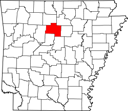
A post office called Plant was established in 1895, and remained in operation until 1954. [2] The post office has since disappeared due to decay. It is uncertain why the name "Plant" was applied to this community. [3] The only remaining structure that bears the community name is the Plant Baptist Church and Cemetery, located 4.9 miles east of U.S. Route 65, on the north side of Arkansas Highway 110. The main industry in Plant is cattle husbandry. The area is also known for its wildlife hunting, mainly whitetail deer, turkey, and squirrel. Children in Plant attend the Clinton School District, which is nineteen miles south of the community.
Success is a town in Clay County, Arkansas, United States. The population was 149 at the 2010 census.
Stamps is a town in Lafayette County, Arkansas, United States. The population was 1,693 at the 2010 census, down from 2,131 at the 2000 census.
Moyers is an unincorporated community located in Pushmataha County, Oklahoma, United States.
Protem is an unincorporated community in southeastern Taney County, Missouri, United States. It is located on Route 125, and is approximately two miles north of the Missouri-Arkansas state line. Protem is part of the Branson, Missouri Micropolitan Statistical Area.
Stet is an unincorporated community on the Ray/Carroll County line and part of the Kansas City metropolitan area. It is located approximately fourteen miles northwest of Carrollton at the intersection of Missouri Supplemental Routes K and JJ.
Auto is an unincorporated community in Greenbrier County, West Virginia, United States. Auto is 2.5 miles (4.0 km) southeast of Falling Spring.
Okay is an unincorporated community in Howard County, Arkansas, United States.
Light is an unincorporated community in Greene County, Arkansas, United States. Light is located at the junction of U.S. Route 412 and Arkansas Highway 228, 14.5 miles (23.3 km) west of Paragould. Light has a post office with ZIP code 72439.
Prim is an unincorporated community in Cleburne County, Arkansas, United States. Prim is located at the junction of Arkansas Highway 225 and Arkansas Highway 263, 9 miles (14 km) north-northeast of Greers Ferry. Prim has a post office with ZIP code 72130.
Figure Five is an unincorporated community in Crawford County, Arkansas, United States.
Forty Four is an unincorporated community in Izard County, Arkansas, United States.
Three Brothers is an unincorporated community in northwestern Baxter County, Arkansas, United States.
Safe is an unincorporated community in southeastern Maries County, in the U.S. state of Missouri. The community is located on Missouri Route H on a hill just west of and above the Bourbeuse River. The community is approximately six miles north-northeast of St. James.
Credit is an extinct town in Craighead County, Arkansas, United States.
Elevenpoint is an unincorporated community in Randolph County, Arkansas.
Health is an unincorporated community in Madison County, Arkansas, United States. The community is located on a high ridge of the Boston Mountains in the southwestern corner of Madison County at an elevation of 2,411 feet (735 m).
Rushing is an unincorporated community in Stone County, Arkansas, United States.
Ten Mile is an unincorporated community in Washington County, Pennsylvania.
Harness is an extinct town in Stone County, Arkansas, United States. The GNIS classifies it as a populated place.
Village is an unincorporated village in Columbia County, Arkansas.