Bee Branch, Arkansas

Last updated

Bee Branch, Arkansas
1912beebranch.jpg
Picture of Bee Branch taken in 1912.
USA Arkansas location map.svg
Red pog.svg
Bee Branch, Arkansas
Bee Branch's position in Arkansas.
Usa edcp location map.svg
Red pog.svg
Bee Branch, Arkansas
Bee Branch, Arkansas (the United States)
Coordinates: 35°27′22″N92°23′42″W / 35.45611°N 92.39500°W / 35.45611; -92.39500
Country United States
State Arkansas
County Van Buren County
Elevation
[1]
778 ft (237 m)
Population
 (2020)
  Total293
Time zone UTC-6 (Central (CST))
  Summer (DST) UTC-5 (CDT)
ZIP code
72013 [2]
GNIS feature ID2805621 [1]

Bee Branch is an unincorporated community and census-designated place (CDP) in Van Buren County, Arkansas, United States. It was first listed as a CDP in the 2020 census with a population of 293. [3]

Contents

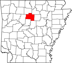
More than 70% of the local population consist of married couples. [2] The majority of the population were born out-of-state and exclusively speak the English language. [2] The nearest towns are Clinton and Fairfield Bay.

History

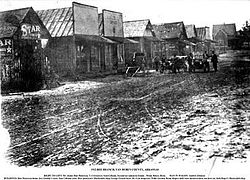
The community has had a post office since Willie D. Neal was named postmaster in 1860. When the post office moved in 1879 near the present-day intersection of U.S. 65 and Highway 92, it applied for the name Crossroads, but was rejected as it had already been duplicated in several parts of the state. The name Bee Branch was chosen for a large beehive in a tree near the post office. [4]

Bee Branch was indirectly affected by an outbreak of tornadoes in November 2005.

Climate

The warmest summers that Bee Branch has witnessed occurred in 1998, 2003, 2005, 2006, 2007, 2009, 2010, 2012, 2013, 2014, 2015 and 2016. [5]

Education

Public education in the townsite is provided by South Side School District, [6] [7] which operates South Side High School.

Infrastructure

The community is located near secondary roads and no Interstate highways in the immediate area. U.S. Route 65 is the most major highway to go through Bee Branch.

Demographics

Historical population
CensusPop.Note
2020 293
U.S. Decennial Census [8]
2020 [9]

2020 census

Bee Branch CDP, Arkansas – Demographic Profile
(NH = Non-Hispanic)
Note: the US Census treats Hispanic/Latino as an ethnic category. This table excludes Latinos from the racial categories and assigns them to a separate category. Hispanics/Latinos may be of any race.
Race / EthnicityPop 2020 [9] % 2020
White alone (NH)25185.67%
Black or African American alone (NH)20.68%
Native American or Alaska Native alone (NH)31.02%
Asian alone (NH)00.00%
Pacific Islander alone (NH)00.00%
Some Other Race alone (NH)10.34%
Mixed Race/Multi-Racial (NH)196.48%
Hispanic or Latino (any race)175.80%
Total293100.00%

Notable people

Bee Branch is also the home town of fisherman Larry Nixon. [10]

Arkansas State Representative Kim Hammer, a Baptist clergyman from Saline County, was reared in Bee Branch and graduated from South Side High School.

Jim McKnight, professional baseball player, whose son also played in the Major Leagues, was born in Bee Branch.

Amber Straughn, NASA astronomer and James Webb Space Telescope Deputy Project Scientist, was raised in Bee Branch and graduated from South Side High School in 1998.

Related Research Articles

<span class="mw-page-title-main">Van Buren County, Arkansas</span> County in Arkansas, United States

Van Buren County is a county located in the U.S. state of Arkansas. As of the 2020 census, the population was 15,796. The county seat is Clinton. The county was formed on November 11, 1833, and named for Martin Van Buren, President of the United States, who was Vice President at the time of the county's formation. Van Buren County was a dry county until November 3, 2020, as the county residents voted to make it a wet county.

<span class="mw-page-title-main">El Paso, Arkansas</span> Unincorporated community in southwestern White County, Arkansas

El Paso is an unincorporated community and census-designated place (CDP) in southwestern White County, Arkansas, United States. It was first listed as a CDP in the 2020 census with a population of 267. Its name is Spanish for "the pass", referring to a small gap in the hills on the community's northern edge. Once known as Peach Orchard Gap in its early settlement, the origin of El Paso's Spanish name is unknown.

Magnet Cove is a census-designated place (CDP) and former town in Hot Spring County, Arkansas, United States. It is located in the Ouachita Mountains southeast of Hot Springs, on Arkansas Highway 51 north of U.S. Highway 270. As of the 2020 census, the town of Magnet Cove had a population of 692.

Dora is an unincorporated community and census-designated place (CDP) in Crawford County in the western part of the U.S. state of Arkansas. It is located approximately three miles west of Van Buren on the Arkansas-Oklahoma border along Interstate 40. The community is part of the Fort Smith, Arkansas-Oklahoma Metropolitan Statistical Area. Dora shares its ZIP code (72956) and other municipal services with Van Buren.

<span class="mw-page-title-main">New Blaine, Arkansas</span> Census-designated place in Arkansas, United States

New Blaine is an unincorporated community and census-designated place (CDP) in Logan County, Arkansas, United States. Per the 2020 census, the population was 173.

Acorn, Arkansas is an unincorporated community and census-designated place (CDP) in Polk County, Arkansas, United States, approximately 6 miles north of Mena. The town is located at the junction of U.S. Route 59, U.S. Route 71 and U.S. Route 270 in the northern part of the county. Though Acorn is only a three-way junction, it marks the end of three separate U.S. highway concurrencies: U.S. 59 & 71 from Texarkana, U.S. 59 & 270 from Heavener, Oklahoma, and U.S. 71 & 270 from "Y" City.

Midway is a census-designated place in Baxter County, Arkansas, United States. Midway is 5.5 miles (8.9 km) northwest of Mountain Home. Per the 2020 census, the population was 1,036. Midway has a post office with ZIP code 72651. Long home to a rural trading post, Midway became a boomtown during the construction of the Bull Shoals Dam, and later evolved to serve tourists and retirees attracted to the lake.

Princeton is a small unincorporated rural village in Princeton Township, Dallas County, Arkansas, United States, located at the junction of Arkansas highways 8 and 9, 7.5 miles (12.1 km) southwest of Carthage. Princeton Cemetery, which is listed on the National Register of Historic Places, is located in the community. It was first listed as a CDP in the 2020 census with a population of 13.

Springfield is an unincorporated community and census-designated place (CDP) located in the north central part of Arkansas in Conway County. It was first listed as a CDP in the 2020 census with a population of 223.

<span class="mw-page-title-main">Evansville, Arkansas</span> Census-designated place in Arkansas, United States

Evansville is an unincorporated community and census-designated place (CDP) in southwest Washington County, Arkansas, United States. It was first listed as a CDP in the 2020 census with a population of 102.

Centerville is an unincorporated community and census-designated place (CDP) in Yell County, Arkansas, United States. Centerville is located at the junction of Arkansas Highways 7 and 154, 6.5 miles (10.5 km) north-northeast of Ola. It was first listed as a CDP in the 2020 census with a population of 283.

Walcott is an unincorporated community and census-designated place (CDP) in Greene County, Arkansas, United States. Walcott is located at the junction of Arkansas highways 141 and 168, 10 miles (16 km) west of Paragould. It was first listed as a CDP in the 2020 census with a population of 152.

Lawson is an unincorporated community and census-designated place (CDP) in Union County, Arkansas, United States. Lawson was founded by Lawson Smith, who was born in 1813 and died in 1899. Lawson is located on Arkansas Highway 129, 10.5 miles (16.9 km) east of El Dorado. Lawson has a post office with ZIP code 71750. It was first listed as a CDP in the 2020 census with a population of 260.

Urbana is an unincorporated community and census-designated place (CDP) in Union County, Arkansas, United States. Urbana is 13 miles (21 km) east-southeast of El Dorado. Urbana has a post office with ZIP code 71768. It was first listed as a CDP in the 2020 census with a population of 177.

Oneida is an unincorporated community and census-designated place (CDP) in Phillips County, Arkansas, United States. Oneida is located along Arkansas Highway 85, 3.5 miles (5.6 km) north-northeast of Lake View. Oneida has a post office with ZIP code 72369. It was first listed as a CDP in the 2020 census with a population of 13.

Gregory is an unincorporated community and census-designated place (CDP) in Woodruff County, Arkansas, United States. It was first listed as a CDP in the 2020 census with a population of 43. Gregory is located along Arkansas Highway 33, 9 miles (14 km) south of Augusta. Gregory has a post office with ZIP code 72059.

Jerusalem is an unincorporated community and census-designated place (CDP) in Conway County, Arkansas, United States. It was first listed as a CDP in the 2020 census with a population of 137. Jerusalem is located on Arkansas Highway 124, 18 miles (29 km) north-northwest of Morrilton. Jerusalem has a post office with ZIP code 72080.

Edgemont is an unincorporated community and census-designated place (CDP) in Cleburne County, Arkansas, United States. Edgemont is located on the north side of Greers Ferry Lake along Arkansas Highway 16, 2 miles (3.2 km) northwest of Greers Ferry. Edgemont has a post office with ZIP code 72044.

Batavia is an unincorporated community and census-designated place (CDP) in Boone County, Arkansas, United States. It was first listed as a CDP in the 2020 census with a population of 328.

Aplin is an unincorporated rural village in Perry County, Arkansas, United States. The community is located along Arkansas Highway 60, 10.3 miles (16.6 km) west-southwest of Perryville. In addition to several homes, there is a hearth manufactury located at Aplin, and a church. The Camp House, which is listed on the National Register of Historic Places, is near the community.

References

  1. 1 2 U.S. Geological Survey Geographic Names Information System: Bee Branch, Arkansas
  2. 1 2 3 General information about Bee Branch, Arkansas Archived July 22, 2011, at the Wayback Machine at PikPuk
  3. "Bee Branch CDP, Arkansas". United States Census Bureau . Retrieved April 7, 2022.
  4. Trower, Kathy (July 4, 2004). "Bee Branch in Van Buren County was literally named after beehive". Arkansas Democrat-Gazette (River Valley & Ozark ed.). Little Rock: WEHCO Media. p. 88. Retrieved April 26, 2020 via NewsBank.
  5. "Global Analysis - Annual 2016". NOAA. Retrieved January 19, 2017.
  6. "SCHOOL DISTRICT REFERENCE MAP (2010 CENSUS): Van Buren County, AR." U.S. Census Bureau. Retrieved on June 2, 2018.
  7. "General Highway Map Van Buren County, Arkansas" (PDF). Arkansas Department of Transportation . Retrieved March 17, 2021. - See Bee Branch on the map, compare to the school district map.
  8. "Decennial Census of Population and Housing by Decades". US Census Bureau.
  9. 1 2 "P2 HISPANIC OR LATINO, AND NOT HISPANIC OR LATINO BY RACE – 2020: DEC Redistricting Data (PL 94-171) – Bee Branch CDP, Arkansas". United States Census Bureau .
  10. Larry Nixon information at Bassmaster