Benton County, Arkansas | |
|---|---|
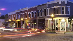
The Benton County Courthouse in Bentonville Downtown Bentonville Mildred B. Cooper Memorial Chapel in Bella Vista Downtown Rogers | |
 Flag  Seal | |
 Location within the U.S. state of Arkansas | |
| Coordinates: 36°20′16″N94°15′23″W / 36.337819°N 94.256298°W | |
| Country | |
| State | |
| Founded | September 30, 1836 |
| Named after | Thomas Hart Benton |
| Seat | Bentonville |
| Largest city | Rogers |
| Government | |
| • County judge | Barry Moehring |
| Area | |
• Total | 884.363 sq mi (2,290.49 km2) |
| • Land | 847.733 sq mi (2,195.62 km2) |
| • Water | 36.630 sq mi (94.87 km2) 4.14% |
| Population (2020) | |
• Total | 284,333 |
• Estimate (2024) | 321,566 |
| • Density | 335.404/sq mi (129.500/km2) |
| Time zone | UTC−6 (Central) |
| • Summer (DST) | UTC−5 (CDT) |
| Area code | 479 |
| Congressional district | 3rd |
| Website | bentoncountyar.gov |


Benton County is a county in the Northwest region of the U.S. state of Arkansas. Created as Arkansas' 35th county on September 30, 1836, Benton County contains thirteen incorporated municipalities, including Bentonville, the county seat, and Rogers, the most populous city. The county was named after Thomas Hart Benton, a U.S. Senator from Missouri influential in Arkansas statehood.
Contents
- History
- Geography
- Hydrology
- Protected areas
- Demographics
- 2020 census
- 2010 census
- 2000 census
- Culture
- Economy
- Transportation
- Major highways
- Airports
- Rail
- Government and politics
- Government
- Politics
- Communities
- Cities
- Towns
- Census-designated places
- Townships
- Education
- See also
- Notes
- References
- External links
The county is located within the Springfield Plateau of the Ozarks. Much of eastern Benton County is located along Beaver Lake, a reservoir of the White River. The county contains three protected areas: Logan Cave National Wildlife Refuge, Pea Ridge National Military Park, and Devil's Eyebrow Natural Area, as well as parts of the Ozark National Forest, Hobbs State Park – Conservation Area, and two state wildlife management areas.
Benton County occupies 884.86 square miles (229,180 ha) and contained a population of 284,333 people in 100,749 households as of the 2020 Census, [1] ranking it tenth in size and second in population among the state's 75 counties. The county's economy is heavily influenced by the presence of Walmart, headquartered in Bentonville, and hundreds of associated businesses, with agriculture, tourism, and construction also important sectors. Benton County's median household income is the highest in Arkansas and slightly above the national median. [2] [3]


