Centerton, Arkansas

Last updated

Centerton, Arkansas
Benton County Arkansas Incorporated and Unincorporated areas Centerton Highlighted 0512820.svg
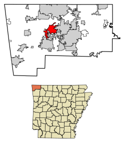
Location of Centerton in Benton County, Arkansas.
Coordinates: 36°21′25″N94°17′51″W / 36.35694°N 94.29750°W / 36.35694; -94.29750
Country United States
State Arkansas
County Benton
Government
  MayorBill Edwards
Area
[1]
  Total13.78 sq mi (35.69 km2)
  Land13.64 sq mi (35.33 km2)
  Water0.14 sq mi (0.35 km2)
Elevation
[2]
1,309 ft (399 m)
Population
 (2020)
  Total17,792
  Density1,304.21/sq mi (503.56/km2)
Time zone UTC-6 (Central (CST))
  Summer (DST) UTC-5 (CDT)
ZIP code
72719
Area code 479
FIPS code 05-12820
GNIS feature ID2404021 [2]
Website www.centertonar.us

Centerton is a city in Benton County, Arkansas, United States. Located west of Bentonville on Highway 102, Centerton has grown from a railroad stop and fruit orchard community in the early 20th century into a suburban bedroom community within the rapidly growing Northwest Arkansas (NWA) region. The city's population has grown from 491 in 1990 to 16,244 in 2019. [3] Centerton is considered to be one of the fastest growing cities in Arkansas and consistently ranks amongst the safest cities in the state.

Contents

History

Native American hunters and early settlers were drawn to present-day Centerton by natural springs, including what is now known as McKissick Spring. In the Antebellum South era, an early church and school built along the spring were named Center Point, for the community's central location in Benton County. Though the area did not see any formal action during the Civil War, Union troops camped at McKissick Spring on March 5, 1862, shortly before the Battle of Pea Ridge.

After the Reconstruction era, the Arkansas-Oklahoma Railroad Company connected Rogers, Arkansas and Grove, Oklahoma through western Benton County. The railroad opened the apple and strawberry orchards of the county to new markets, bringing economic prosperity, development, and population growth to the region. Upon laying out the town in 1900, the name was changed to Centerton, as Center Point was already registered in Howard County. [4]

Geography

Centerton is located near the center of Benton County and Arkansas Highway 102 runs through the center of the city and leads east 5 miles (8 km) to Bentonville and west 11 miles (18 km) to Decatur.

The city has a total area of 11.9 square miles (30.8 km2), of which 11.7 square miles (30.4 km2) is land and 0.12 square miles (0.3 km2), or 1.13%, is water. [5]

Region

The Northwest Arkansas region consists of three Arkansas counties: Benton, Madison, and Washington. The area had a population of 347,045 at the 2000 census which had increased to 463,204 by the 2010 Census (an increase of 33.47 percent). The region does not consist of the usual principal-city-with-suburbs morphology; though today Centerton is largely a suburb of Bentonville. The Northwest Arkansas Regional Airport is located south of Centerton and is used to connect all of the Northwest Arkansas region to the rest of the nation. For more than the last decade, Northwest Arkansas has been one of the fastest-growing regions in the United States. [6]

Demographics

Historical population
CensusPop.Note
1920 212
1930 206−2.8%
1940 2196.3%
1950 200−8.7%
1960 177−11.5%
1970 31276.3%
1980 42536.2%
1990 49115.5%
2000 2,146337.1%
2010 9,515343.4%
2020 17,79287.0%
U.S. Decennial Census [7]

2020 census

Centerton racial composition [8]
RaceNumberPercentage
White (non-Hispanic)12,41281.76%
Black or African American (non-Hispanic)6183.47%
Native American 1991.12%
Asian 9284.22%
Pacific Islander 320.18%
Other/Mixed 1,2757.17%
Hispanic or Latino 2,32811.78%

As of the 2020 United States census, there were 17,792 people, 4,996 households, and 3,776 families residing in the city.

2010 census

As of the 2010 census Centerton had a population of 9,515. The racial and ethnic composition of the population was 78.7% non-Hispanic white, 3.5% non-Hispanic black, 1.2% Native American, 2.3% Asian, 0.1% Pacific Islander, 2.6% from two or more races and 12.2% Hispanic or Latino. [9]

2000 census

As of the census [10] of 2000, there were 2,146 people, 730 households, and 602 families residing in the city. The population density was 533.8 inhabitants per square mile (206.1/km2). There were 796 housing units at an average density of 198.0 per square mile (76.4/km2). The racial makeup of the city was 96.37% White, 0.14% Black or African American, 0.93% Native American, 0.19% Asian, 0.70% from other races, and 1.68% from two or more races. 4.05% of the population were Hispanic or Latino of any race.

There were 730 households, out of which 50.5% had children under the age of 18 living with them, 69.3% were married couples living together, 10.3% had a female householder with no husband present, and 17.4% were non-families. 13.3% of all households were made up of individuals, and 3.7% had someone living alone who was 65 years of age or older. The average household size was 2.94 and the average family size was 3.23.

In the city, the population was spread out, with 34.6% under the age of 18, 7.5% from 18 to 24, 38.5% from 25 to 44, 13.1% from 45 to 64, and 6.3% who were 65 years of age or older. The median age was 29 years. For every 100 females, there were 94.6 males. For every 100 females age 18 and over, there were 91.8 males.

The median income for a household in the city was $46,600, and the median income for a family was $50,000. Males had a median income of $31,216 versus $22,731 for females. The per capita income for the city was $17,530. About 6.2% of families and 7.7% of the population were below the poverty line, including 10.1% of those under age 18 and 5.8% of those age 65 or over.

Economy

Region

The Northwest Arkansas economy was historically based upon agriculture and poultry. In recent decades, NWA has seen rapid growth and diversification of its economy based upon the big companies based there, Walmart, Tyson Foods, J.B. Hunt, and Pinnacle Emergency Vehicles, while also seeing a growing University of Arkansas and cultural amenities sector. Although impacted by the Great Recession, NWA's economy fared better than most peer metropolitan areas, the state of Arkansas and the United States overall. Between 2007 and 2013, the region saw unemployment rates significantly below those of peer regions and the national average; while also seeing a 1% net growth of jobs. The NWA gross domestic product grew 7.0% over the aforementioned time period, and bankruptcies, building permits and per capita incomes are returning to pre-Recession rates. [11]

The professional, education and health care sectors of the Northwest Arkansas economy have been growing steadily since 2007. Between 2007 and 2013, the region has seen a growth of 8,300 jobs in the region, with 6,100 added in education and health professions and 4,300 jobs added in the leisure and hospitality jobs related to the region's cultural amenities. [11] The government and transportation sectors have remained relatively constant between 2007 and 2013, however the manufacturing sector has seen steady decline, mirroring national averages. The construction and real estate sectors saw large declines attributable to the poor housing market during the economic downturn.

Education

Public education for elementary and secondary students in the majority of Centerton is provided by Bentonville School District. A very small portion to the west is in the boundary for the Decatur School District. [12] Centerton is home to 3 of the district's schools.

Centerton Gamble Elementary School in Centerton serves kindergarten through grade 4 and includes much of Centerton. Other portions of Centerton are zoned to Elm Tree, Mary Mae Jones, Osage Creek, and Vaughn elementary schools. [13] Centerton is divided between Ardis Ann Middle School, Creekside Middle School, and Ruth Barker Middle School. [14] Much of Centerton is zoned to Grimsley Junior High School in Centerton, while some sections are zoned to Lincoln Junior High School. [15] All portions of Centerton in the Bentonville district are zoned to Bentonville West High School in Centerton. [16]

Decatur High School is the comprehensive high school of the Decatur district.

Centerton is also home to one of Northwest Arkansas's private schools. Lifeway Christian School serves preschool through grade 12 and is based in the city's First Baptist Church Centerton.

Related Research Articles

<span class="mw-page-title-main">Benton County, Arkansas</span> County in Arkansas, United States

Benton County is a county within the Northwest Arkansas region with a culture, economy, and history that have transitioned from rural and agricultural to suburban and white collar since the growth of Walmart, which is headquartered in Benton County. Created as Arkansas's 35th county on September 30, 1836, Benton County contains thirteen incorporated municipalities, including Bentonville, the county seat, and Rogers, the most populous city. The county was named after Thomas Hart Benton, a U.S. Senator from Missouri influential in Arkansas statehood.

<span class="mw-page-title-main">Avoca, Arkansas</span> Town in Arkansas, United States

Avoca is a town in Benton County, Arkansas, United States. The population was 487 at the 2020 census. It is part of the Northwest Arkansas region.

<span class="mw-page-title-main">Bella Vista, Arkansas</span> City in Arkansas, United States

Bella Vista is a city in Benton County, Arkansas, United States. First established in 1917 as a summer resort destination, Bella Vista has evolved and redesigned itself over the succeeding years. Bella Vista became a retirement community in 1965, and, after much contention and a 2006 vote of its property owners, became an incorporated city.

<span class="mw-page-title-main">Bentonville, Arkansas</span> City in Arkansas, United States

Bentonville is the ninth-most populous city in the US state of Arkansas, and the county seat of Benton County. The city is centrally located in the county with Rogers adjacent to the east. The city is the birthplace and headquarters of Walmart, the world's largest retailer. It is one of the four main cities in the three-county Northwest Arkansas Metropolitan Statistical Area, which is ranked 105th in terms of population in the United States with 546,725 residents in 2020, according to the United States Census Bureau. The city itself had a population of 54,164 at the 2020 Census, an increase of 53% from the 2010 Census. Bentonville is considered to be one of the fastest growing cities in the state and consistently ranks amongst the safest cities in Arkansas.

<span class="mw-page-title-main">Bethel Heights, Arkansas</span> City in Arkansas, United States

Bethel Heights was a city in Benton County, Arkansas, United States. Always a small, sparsely populated community, the region coalesced around a school named Bethel in the late 19th century but did not incorporate until 1967 to avoid annexation by larger neighboring communities. The town offered police and fire protection and wastewater service to residents, but sent students to Springdale Public Schools and purchased water from Springdale Water Utilities. By the 21st century, Northwest Arkansas was gaining population rapidly, and Bethel Heights reincorporated as a city and grew from a population of 714 in 2000 to 2,372 at the 2010 census. Growth put pressure on the city's subsurface discharge wastewater treatment system, and following a series of wastewater treatment plant violations, voters dissolved the city and completely annexed into Springdale in August 2020.

<span class="mw-page-title-main">Cave Springs, Arkansas</span> City in Arkansas, United States

Cave Springs is a city in Benton County, Arkansas. The population was 5,495 at the time of the 2020 census, up from 1,729 in 2010 census. It is part of the Northwest Arkansas metropolitan area. In June 2022, Cave Springs was named the 3rd highest average home values in the state of Arkansas.

<span class="mw-page-title-main">Decatur, Arkansas</span> City in Arkansas, United States

Decatur is a city, in Benton County, Arkansas, United States. The population was 1,773 at the 2020 census. It is part of the Northwest Arkansas region. This town is named after Commodore Stephen Decatur, Jr.

<span class="mw-page-title-main">Gravette, Arkansas</span> City in Arkansas, United States

Gravette is a city in Benton County, Arkansas, United States. The population was 3,547 as of the 2020 census. It is part of the Northwest Arkansas region.

<span class="mw-page-title-main">Highfill, Arkansas</span> Town in Arkansas, United States

Highfill is a town in Benton County, Arkansas, United States. The population was 1,587 as of the 2020 census. It is home to the Northwest Arkansas National Airport, which serves all of the Northwest Arkansas region. In September 2023, officials of the airport voted to detach itself from the city over taxing and public service disputes.

<span class="mw-page-title-main">Little Flock, Arkansas</span> City in Arkansas, United States

Little Flock is a city in Benton County, Arkansas, United States. The population was 3,055 at the 2020 census. It is part of the Northwest Arkansas region.

<span class="mw-page-title-main">Lowell, Arkansas</span> City in Arkansas, United States

Lowell is a city in Benton County, Arkansas, United States. Located within the Ozarks, the first settlement was along Old Wire Road in the 1840s, and although destroyed during the Civil War, the community was reestablished by J. R. McClure and thrived when the St. Louis–San Francisco Railway came through the area in the 1880s. The city is a growing bedroom community within the rapidly growing Northwest Arkansas region. Lowell is the headquarters of trucking company J.B. Hunt. Lowell's population was 9,839 at the 2020 census, an increase of 34% since 2010.

<span class="mw-page-title-main">Pea Ridge, Arkansas</span> City in Arkansas

Pea Ridge is a city in Benton County, Arkansas, United States. The name Pea Ridge is derived from a combination of the physical location of the original settlement of the town, across the crest of a ridge of the Ozark Mountains, and for the hog peanuts or turkey peas that had been originally cultivated by Native American tribes centuries before European settlement, which later helped to provide basic subsistence once those pioneer settlers arrived.

<span class="mw-page-title-main">Rogers, Arkansas</span> City in the United States

Rogers is a city in Benton County, Arkansas, United States. Located in the Ozarks, it is part of the Northwest Arkansas region, one of the fastest growing metro areas in the country. Rogers was the location of the first Walmart store, whose corporate headquarters is located in neighboring Bentonville. Daisy Outdoor Products, known for its air rifles, has both its headquarters and its Airgun Museum in Rogers. The city houses a popular shopping center, the Pinnacle Hills Promenade, and a music venue, the Walmart AMP, that has housed performances by big-name artists and local performers alike.

<span class="mw-page-title-main">Siloam Springs, Arkansas</span> City in Arkansas, United States

Siloam Springs is a city in Benton County, Arkansas, United States, and located on the western edge of the Northwest Arkansas metropolitan area. As of the 2020 census, the population of the city was 17,287. The community was founded in 1882 and was characterized by the purported healing powers of the spring water feeding Sager Creek and trading with nearby Native American tribes. The city shares a border on the Arkansas–Oklahoma state line with the city of West Siloam Springs, Oklahoma, which is within the Cherokee Nation territory. It is home of John Brown University.

<span class="mw-page-title-main">Springdale, Arkansas</span> City in Arkansas, United States

Springdale is the fourth-most populous city in Arkansas, United States. It is located in both Washington and Benton counties in Northwest Arkansas. Located on the Springfield Plateau deep in the Ozark Mountains, Springdale has long been an important industrial city for the region. In addition to several trucking companies, the city is home to the world headquarters of Tyson Foods, the world's largest meat producing company. Originally named Shiloh, the city changed its name to Springdale when applying for a post office in 1872. It is included in the four-county Northwest Arkansas Metropolitan Statistical Area, which is ranked 102nd in terms of population in the United States with 546,725 in 2020 according to the United States Census Bureau. The city had a population of 84,161 at the 2020 Census.

<span class="mw-page-title-main">Johnson, Arkansas</span> City in Arkansas, United States

Johnson is a city in Washington County, Arkansas, United States. The community is located in the Ozark Mountains and is surrounded by valleys and natural springs. Early settlers took advantage of these natural features and formed an economy based on mining lime, the Johnson Mill and trout. Although a post office was opened in the community in 1887, Johnson did not incorporate until it required the development of a city government to provide utility services in 1961. Located between Fayetteville and Springdale in the heart of the rapidly growing Northwest Arkansas metropolitan statistical area, Johnson has been experiencing a population and building boom in recent years, as indicated by a 46% growth in population between the 2000 and 2010 censuses.

<span class="mw-page-title-main">Arkansas Highway 102</span> State highway in Arkansas, United States

Highway 102 is an east–west state highway in Benton County, Arkansas. The highway connects two of western Benton County's population centers to Bentonville and Interstate 49 (I-49), the main north–south route in the Northwest Arkansas region.

<span class="mw-page-title-main">Bentonville School District</span> School district in Arkansas, United States

Bentonville Schools is a comprehensive community school district serving students in kindergarten through 12th grade from Bentonville, Arkansas, in Benton County. Bentonville Schools encompasses 141.54 square miles (366.6 km2) of land, including most of Bentonville, and portions of Bella Vista, Cave Springs, Centerton, Gravette, Highfill, Little Flock, Rogers, and Springdale.

<span class="mw-page-title-main">Northwest Arkansas</span> Metropolitan area in Arkansas, United States

Northwest Arkansas (NWA) is a metropolitan area and region in Arkansas within the Ozark Mountains. It includes four of the ten largest cities in the state: Fayetteville, Springdale, Rogers, and Bentonville, the surrounding towns of Benton and Washington counties, and adjacent rural Madison County, Arkansas. The United States Census Bureau-defined Fayetteville–Springdale–Rogers Metropolitan Statistical Area includes 3,213.01 square miles (8,321.7 km2) and 576,403 residents, ranking NWA as the 98th most-populous metropolitan statistical area in the U.S. and the 13th fastest growing in the United States.

Bentonville West High School is a public high school for students in grades nine through twelve located in Centerton, Arkansas. Founded in 2016, with a current enrollment of 2,158 students (2021-2022), Bentonville West High School is one of the two high schools in Bentonville School District. The school includes a football stadium that cost about $3.7 million to build.

References

  1. "2020 U.S. Gazetteer Files". United States Census Bureau. Retrieved October 29, 2021.
  2. 1 2 U.S. Geological Survey Geographic Names Information System: Centerton, Arkansas
  3. "Population and Housing Unit Estimates" . Retrieved May 21, 2020.
  4. "Centerton (Benton County)". Encyclopedia of Arkansas History & Culture . Little Rock: Butler Center for Arkansas Studies at the Central Arkansas Library System. February 16, 2018. Retrieved June 8, 2018.
  5. "Geographic Identifiers: 2010 Demographic Profile Data (G001): Centerton city, Arkansas". U.S. Census Bureau, American Factfinder. Archived from the original on February 12, 2020. Retrieved September 20, 2013.
  6. "Northwest Arkansas leads growth in state, 14th fastest-growing metro area nationwide – Talk Business & Politics". Talk Business & Politics. March 22, 2018. Retrieved May 6, 2018.
  7. "Census of Population and Housing". Census.gov. Retrieved June 4, 2015.
  8. "Explore Census Data". data.census.gov. Retrieved January 1, 2022.
  9. 2010 general profile of population and housing characteristics of Centerton from the US census
  10. "U.S. Census website". United States Census Bureau . Retrieved January 31, 2008.
  11. 1 2 "2013 State of the Northwest Arkansas Region Report" (PDF). University of Arkansas Sam Walton College of Business and the Northwest Arkansas Council. 2013. p. 9. Archived from the original (PDF) on October 29, 2013. Retrieved September 14, 2014.
  12. "2020 CENSUS - SCHOOL DISTRICT REFERENCE MAP: Benton County, AR" (PDF). U.S. Census Bureau . Retrieved May 25, 2022.
  13. "22/23 Elementary Attendance Areas" (PDF). Bentonville School District. Archived from the original (PDF) on September 18, 2022. Retrieved September 18, 2022. - Linked from here
  14. "22/23 Middle School Attendance Areas" (PDF). Bentonville School District. Archived from the original (PDF) on September 18, 2022. Retrieved September 18, 2022. - Linked from here
  15. "22/23 Junior High School Attendance Areas" (PDF). Bentonville School District. Archived from the original (PDF) on September 18, 2022. Retrieved September 18, 2022. - Linked from here
  16. "22/23 High School Attendance Areas" (PDF). Bentonville School District. Archived from the original (PDF) on September 18, 2022. Retrieved September 18, 2022. - Linked from here