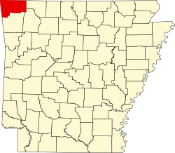
Township 12 | |
---|---|
Township | |
Coordinates: 36°14′21″N94°31′22″W / 36.23917°N 94.52278°W Coordinates: 36°14′21″N94°31′22″W / 36.23917°N 94.52278°W | |
Country | |
State | |
County | Benton |
Area | |
• Total | 43.028 sq mi (111.44 km2) |
• Land | 41.913 sq mi (108.55 km2) |
• Water | 1.115 sq mi (2.89 km2) |
Population (2010) | |
• Total | 15,158 |
• Density | 361.65/sq mi (139.63/km2) |
Time zone | CST (UTC-6) |
• Summer (DST) | CDT (UTC-5) |
Area code(s) | 479 |
Township 12 is one of thirteen current townships in Benton County, Arkansas, USA. As of the 2010 census, its total population was 15,158.
A civil township is a widely used unit of local government in the United States that is subordinate to a county. The term town is used in New England, New York, and Wisconsin to refer to the equivalent of the civil township in these states. Specific responsibilities and the degree of autonomy vary based on each state. Civil townships are distinct from survey townships, but in states that have both, the boundaries often coincide and may completely geographically subdivide a county. The U.S. Census Bureau classifies civil townships as minor civil divisions. Currently, there are 20 states with civil townships.
Benton County is a county located in the U.S. state of Arkansas. As of the 2010 census, the population was 221,339, making it the second-most populous county in Arkansas. The county seat is Bentonville. The county was formed on September 30, 1836 and was named after Thomas Hart Benton, a U.S. Senator from Missouri. In 2012, Benton County voters elected to make the county wet, or a non-alcohol prohibition location.
Arkansas is a state in the southern region of the United States, home to over 3 million people as of 2018. Its name is of Siouan derivation from the language of the Osage denoting their related kin, the Quapaw Indians. The state's diverse geography ranges from the mountainous regions of the Ozark and the Ouachita Mountains, which make up the U.S. Interior Highlands, to the densely forested land in the south known as the Arkansas Timberlands, to the eastern lowlands along the Mississippi River and the Arkansas Delta.
According to the United States Census Bureau, Township 12 covers an area of 43.028 square miles (111.44 km2); 41.913 square miles (108.55 km2) of land and 1.115 square miles (2.89 km2) of water.
The United States Census Bureau is a principal agency of the U.S. Federal Statistical System, responsible for producing data about the American people and economy. The Census Bureau is part of the U.S. Department of Commerce and its director is appointed by the President of the United States.
Gentry is a city in Benton County, Arkansas, United States. The population was 3,158 at the 2010 census. The city was founded in the Ozark Mountains in 1894 along what would become the Kansas City Southern Railroad. The city's prior prosperity in the orchard industry, especially apples, was further strengthened by the rail connection. Following the decline of the apple industry in the 1930s, Gentry shifted its economy towards poultry along with many other areas of northwest Arkansas. Today, Gentry is located within the Fayetteville-Springdale-Rogers Metropolitan Area. Gentry is known for the Wild Wilderness Drive-Through Safari, located 2 miles (3 km) north of the city limits.
Siloam Springs is a city in Benton County, Arkansas, United States. The city shares a border on the Arkansas-Oklahoma state line with the city of West Siloam Springs, Oklahoma, which is within the Cherokee Nation territory. The town was founded in 1882 and was characterized by the purported healing powers of the spring water feeding Sager Creek and trading with nearby Native American tribes. John Brown University (JBU) was founded in 1919 as a private, interdenominational, Christian liberal arts college in the city. Today, Siloam Springs is known for its efforts to preserve and revitalize the city's historic downtown and as a promoter of the arts via Sager Creek Arts Center and the JBU art gallery. The community is located on the western edge of the growing Northwest Arkansas metropolitan area and has had a population increase of 47% to 15,039 between the 2000 and 2010 censuses.
Smyrna Township is one of nineteen current townships in Pope County, Arkansas, USA. As of the 2010 census, its unincorporated population was 187. The township is a part of the Ozark National Forest.
Griffin Township is one of nineteen current townships in Pope County, Arkansas, USA. As of the 2010 census, its total population was 839.
Valley Township is one of nineteen current townships in Pope County, Arkansas, USA. As of the 2010 census, its unincorporated population was 3,258.
Boston Township is one of thirty-seven townships in Washington County, Arkansas, USA. As of the 2010 census, its unincorporated population was 392.
Brush Creek Township is one of thirty-seven townships in Washington County, Arkansas, USA. As of the 2010 census, its unincorporated population was 2,877.
Cane Hill Township is one of thirty-seven townships in Washington County, Arkansas, USA. As of the 2010 census, its unincorporated population was 1,530.
Elixir Township is one of twenty current townships in Boone County, Arkansas, USA. As of the 2010 census, its total population was 2,802.
Bellefonte Township is one of 20 current townships in Boone County, Arkansas, USA. As of the 2010 census, its total population was 2,380.
Blythe Township is one of twenty current townships in Boone County, Arkansas, USA. As of the 2010 census, its total population was 245.
Bryan Township is one of twenty current townships in Boone County, Arkansas, USA. As of the 2010 census, its total population was 1,018.
Summit Township is one of twenty current townships in Boone County, Arkansas, USA]. At the 2010 census, its total population was 556.
Gaither Township is one of twenty current townships in Boone County, Arkansas, USA. As of the 2010 census, its total population was 676.
Ewing Township is one of twenty current townships in Boone County, Arkansas, USA. As of the 2010 census, its total population was 458.
Long Creek Township is one of twenty current townships in Boone County, Arkansas, USA. As of the 2010 census, its total population was 902.
Prairie Township is one of twenty current townships in Boone County, Arkansas, USA. As of the 2010 census, its total population was 444.
Omega Township is one of twenty-one current townships in Carroll County, Arkansas, USA. As of the 2010 census, its total population was 418. As of the 2010 census, the population of Carroll County was 27,446
Township 3 is one of thirteen current townships in Benton County, Arkansas, USA. As of the 2010 census, its total population was 20,037.
Township 5 is one of thirteen current townships in Benton County, Arkansas, USA. As of the 2010 census, its total population was 12,792.
Township 8 is one of thirteen current townships in Benton County, Arkansas, USA. As of the 2010 census, its total population was 12,637.
Township 11 is one of thirteen current townships in Benton County, Arkansas, USA. As of the 2010 census, its total population was 12,273.