Pea Ridge, Arkansas

Last updated

Pea Ridge, Arkansas
PeaRidgeHistoricCommercialDistrictAR.JPG
Benton County Arkansas Incorporated and Unincorporated areas Pea Ridge Highlighted 0554200.svg
Location of Pea Ridge in Benton County, Arkansas.
Coordinates: 36°26′58″N94°07′20″W / 36.44944°N 94.12222°W / 36.44944; -94.12222
Country Flag of the United States.svg  United States
State Flag of Arkansas.svg  Arkansas
County Benton
Area
[1]
  Total7.58 sq mi (19.64 km2)
  Land7.58 sq mi (19.64 km2)
  Water0.00 sq mi (0.00 km2)
Elevation
[2]
1,312 ft (400 m)
Population
 (2020)
  Total6,559
  Density864.96/sq mi (333.94/km2)
Time zone UTC-6 (Central (CST))
  Summer (DST) UTC-5 (CDT)
ZIP code
72751
Area code 479
FIPS code 05-54200
GNIS feature ID2404492 [2]
Website cityofpearidge.com

Pea Ridge is a city in Benton County, Arkansas, United States. The name Pea Ridge is derived from a combination of the physical location of the original settlement of the town, across the crest of a ridge of the Ozark Mountains, and for the hog peanuts or turkey peas that had been originally cultivated by Native American tribes centuries before European settlement, which later helped to provide basic subsistence once those pioneer settlers arrived.

Contents

The rural town is best known as the location of the pivotal American Civil War engagement the Battle of Pea Ridge, or, as it is locally known, the Battle of Elkhorn Tavern, which took place approximately 5 miles (8 km) east of the town. The site of the battle is preserved as the Pea Ridge National Military Park.

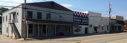
The town's downtown business district is on the National Register of Historic Places and largely comprises commercial structures from the late 19th and early 20th centuries. The population of Pea Ridge was 6,559 as of the 2020 census. [3] It is part of the Northwest Arkansas region. The local weekly newspaper is the Times of Northeast Benton County .

Geography

Arkansas Highway 94 is the main road through the city, leading south 8 miles (13 km) to the center of Rogers and northwest 6 miles (10 km) to the Missouri border. Arkansas Highway 72 leads east 5 miles (8 km) to U.S. Route 62 at Pea Ridge National Military Park, and southwest 9 miles (14 km) to Bentonville.

According to the United States Census Bureau, the city has a total area of 7.4 square miles (19.1 km2), all land. [3]

Demographics

Historical population
CensusPop.Note
1940 72
1950 268272.2%
1960 38041.8%
1970 1,088186.3%
1980 1,48836.8%
1990 1,6208.9%
2000 2,34644.8%
2010 4,794104.3%
2020 6,55936.8%
U.S. Decennial Census [4]

2020 census

Pea Ridge racial composition [5]
RaceNumberPercentage
White (non-Hispanic)5,44483.0%
Black or African American (non-Hispanic)550.84%
Native American 590.9%
Asian 390.59%
Pacific Islander 40.06%
Other/Mixed 4376.66%
Hispanic or Latino 5217.94%

As of the 2020 United States census, there were 6,559 people, 2,021 households, and 1,455 families residing in the city.

2010 census

As of the 2010 Census, Pea Ridge had a population of 4,794. The racial and ethnic composition of the population was 90.7% white, 0.7% African American, 0.9% Native American, 0.3% Asian, 2.0% from two or more races and 5.8% Hispanic or Latino. [6]

There were 1300 households, out of which 37.3% had children under the age of 18 living with them, 63.3% were married couples living together, 7.8% had a female householder with no husband present, and 24.1% were non-families. 21.6% of all households were made up of individuals, and 12.0% had someone living alone who was 65 years of age or older. The average household size was 2.63 and the average family size was 3.05.

In the city, the population was spread out, with 26.9% under the age of 18, 6.9% from 18 to 24, 29.5% from 25 to 44, 21.6% from 45 to 64, and 15.1% who were 65 years of age or older. The median age was 36 years. For every 100 females, there were 95.7 males. For every 100 females age 18 and over, there were 93.5 males.

The median income for a household in the city was $37,244, and the median income for a family was $42,222. Males had a median income of $29,340 versus $21,298 for females. The per capita income for the city was $15,149. 7.7% of the population and 6.0% of families were below the poverty line. Out of the total population, 9.9% of those under the age of 18 and 7.6% of those 65 and older were living below the poverty line.

Education

Most of Pea Ridge is zoned to the Pea Ridge School District. A small section is zoned to Rogers Public Schools. [7] Pea Ridge High School is the comprehensive high school of the former.

See also

Related Research Articles

<span class="mw-page-title-main">Benton County, Arkansas</span> County in Arkansas, United States

Benton County is a county within the Northwest Arkansas region with a culture, economy, and history that have transitioned from rural and agricultural to suburban and white collar since the growth of Walmart, which is headquartered in Benton County. Created as Arkansas's 35th county on September 30, 1836, Benton County contains thirteen incorporated municipalities, including Bentonville, the county seat, and Rogers, the most populous city. The county was named after Thomas Hart Benton, a U.S. Senator from Missouri influential in Arkansas statehood.

<span class="mw-page-title-main">Avoca, Arkansas</span> Town in Arkansas, United States

Avoca is a town in Benton County, Arkansas, United States. The population was 487 at the 2020 census. It is part of the Northwest Arkansas region.

<span class="mw-page-title-main">Centerton, Arkansas</span> City in Arkansas, United States

Centerton is a city in Benton County, Arkansas, United States. Located west of Bentonville on Highway 102, Centerton has grown from a railroad stop and fruit orchard community in the early 20th century into a suburban bedroom community within the rapidly growing Northwest Arkansas (NWA) region. The city's population has grown from 491 in 1990 to 16,244 in 2019. Centerton is considered to be one of the fastest growing cities in Arkansas and consistently ranks amongst the safest cities in the state.

<span class="mw-page-title-main">Decatur, Arkansas</span> City in Arkansas, United States

Decatur is a city, in Benton County, Arkansas, United States. The population was 1,773 at the 2020 census. It is part of the Northwest Arkansas region. This town is named after Commodore Stephen Decatur, Jr.

<span class="mw-page-title-main">Elm Springs, Arkansas</span> City in Arkansas, United States

Elm Springs is a city in Benton and Washington Counties, Arkansas, United States. Located immediately west of Springdale in the Northwest Arkansas metropolitan statistical area, Elm Springs has been gaining population in recent years, including a 47% increase in population between the 2000 and 2010 censuses.

<span class="mw-page-title-main">Garfield, Arkansas</span> Town in Arkansas, United States

Garfield is a town in Benton County, Arkansas, United States. The population was 593 at the 2020 census. It is part of the Northwest Arkansas region.

<span class="mw-page-title-main">Gateway, Arkansas</span> Town in Arkansas, United States

Gateway is a town in Benton County, Arkansas, United States. The population was 436 at the 2020 census, up from 405 in 2010. It is part of the Northwest Arkansas region. The town's name reflects its situation as the "gateway" to and from Arkansas.

<span class="mw-page-title-main">Little Flock, Arkansas</span> City in Arkansas, United States

Little Flock is a city in Benton County, Arkansas, United States. The population was 3,055 at the 2020 census. It is part of the Northwest Arkansas region.

<span class="mw-page-title-main">Lowell, Arkansas</span> City in Arkansas, United States

Lowell is a city in Benton County, Arkansas, United States. Located within the Ozarks, the first settlement was along Old Wire Road in the 1840s, and although destroyed during the Civil War, the community was reestablished by J. R. McClure and thrived when the St. Louis–San Francisco Railway came through the area in the 1880s. The city is a growing bedroom community within the rapidly growing Northwest Arkansas region. Lowell is the headquarters of trucking company J.B. Hunt. Lowell's population was 9,839 at the 2020 census, an increase of 34% since 2010.

<span class="mw-page-title-main">Berryville, Arkansas</span> City in Arkansas, United States

Berryville is a city in Carroll County, Arkansas, United States. The population was 5,682 at the 2020 census. making it the largest city in Carroll County. Along with Eureka Springs, it is one of the two county seats of Carroll County.

<span class="mw-page-title-main">Piggott, Arkansas</span> City in Arkansas, United States

Piggott is a city in Clay County, Arkansas, United States. It is one of the two county seats of Clay County, along with Corning. It is the northern terminus of the Arkansas segment of the Crowley's Ridge Parkway, a National Scenic Byway. As of the 2010 census, Piggott's population was 3,849. The town was named after James A. Piggott, one of the early settlers and initiator of the local post office.

<span class="mw-page-title-main">Rector, Arkansas</span> City in Arkansas, United States

Rector is a city in southeastern Clay County, Arkansas, United States. The population was 1,977 at the 2010 census.

<span class="mw-page-title-main">Cedarville, Arkansas</span> City in Arkansas, United States

Cedarville is a city in Crawford County, Arkansas, United States. It is part of the Fort Smith, Arkansas-Oklahoma Metropolitan Statistical Area. The population was 1,410 at the 2020 census.

<span class="mw-page-title-main">Dyer, Arkansas</span> City in Arkansas, United States

Dyer is a city in Crawford County, Arkansas, United States. It is part of the Fort Smith, Arkansas-Oklahoma Metropolitan Statistical Area. The population was 876 at the 2010 census.

<span class="mw-page-title-main">Lonsdale, Arkansas</span> Town in Arkansas, United States

Lonsdale is a town in Garland County, Arkansas, United States. It is part of the Hot Springs Metropolitan Statistical Area. The population was 103 at the 2020 census.

<span class="mw-page-title-main">Black Rock, Arkansas</span> City in Arkansas, United States

Black Rock is a city in Lawrence County, Arkansas, United States, along the Black River. The population was 662 at the 2010 census.

<span class="mw-page-title-main">Walnut Ridge, Arkansas</span> City in Arkansas, United States

Walnut Ridge is a city in and the county seat of Lawrence County, Arkansas, United States. The population was 5,098 at the United States Census's 2019 estimate. Walnut Ridge lies immediately north of Hoxie. The two towns form a contiguous urban area with approximately 8,000 residents. Williams Baptist University is in College City, a formerly separate community that merged into Walnut Ridge in 2017.

<span class="mw-page-title-main">Benton, Arkansas</span> City in Arkansas, United States

Benton is a city in and the county seat of Saline County, Arkansas, United States and a suburb of Little Rock. It was established in 1837. At the 2020 census, the city had a population of 35,014, making it the 12th most populous city in Arkansas. It is part of the Little Rock–North Little Rock–Conway Metropolitan Statistical Area. The city of Benton, first settled in 1833 and named after Missouri Senator Thomas Hart Benton, was formally chartered in 1836 when Arkansas became a state.

<span class="mw-page-title-main">Pickens, Mississippi</span> Town in Mississippi, United States

Pickens is a town in Holmes County, Mississippi, United States. Per the 2020 census, the population was 920.

<span class="mw-page-title-main">Lake Benton, Minnesota</span> City in Minnesota, United States

Lake Benton is a city in Lincoln County, Minnesota, United States. The population was 683 at the 2010 census.

References

  1. "2020 U.S. Gazetteer Files". United States Census Bureau. Retrieved October 29, 2021.
  2. 1 2 U.S. Geological Survey Geographic Names Information System: Pea Ridge, Arkansas
  3. 1 2 "Geographic Identifiers: 2010 Demographic Profile Data (G001): Pea Ridge city, Arkansas". U.S. Census Bureau, American Factfinder. Archived from the original on February 12, 2020. Retrieved September 23, 2013.
  4. "Census of Population and Housing". Census.gov. Retrieved June 4, 2015.
  5. "Explore Census Data". data.census.gov. Retrieved January 1, 2022.
  6. 2010 general profile of population and housing characteristics of Pea Ridge from the US census
  7. "2020 CENSUS - SCHOOL DISTRICT REFERENCE MAP: Benton County, AR" (PDF). U.S. Census Bureau . Retrieved May 25, 2022.