Maysville, Arkansas

Last updated

Maysville, Arkansas
Maysville, Arkansas limits.jpg
Maysville southern limits, February 2013
Benton County Arkansas Incorporated and Unincorporated areas Maysville Highlighted 0544810.svg
Location of Maysville in Benton County, Arkansas.
USA Arkansas location map.svg
Red pog.svg
Maysville, Arkansas
Coordinates: 36°24′13″N94°36′07″W / 36.40361°N 94.60194°W / 36.40361; -94.60194
Country United States
State Arkansas
County Benton
Area
[1]
  Total2.35 sq mi (6.10 km2)
  Land2.35 sq mi (6.10 km2)
  Water0.00 sq mi (0.00 km2)
Elevation
[2]
1,043 ft (318 m)
Population
 (2020)
  Total117
  Density49.70/sq mi (19.19/km2)
Time zone UTC-6 (Central (CST))
  Summer (DST) UTC-5 (CDT)
Area code 479
GNIS feature ID77622 [2]

Maysville is an unincorporated community and census-designated place (CDP) in Benton County, Arkansas, United States. It is the westernmost settlement in the state of Arkansas. [3] Per the 2020 census, the population was 117. [4] It is located in the Northwest Arkansas region.

Contents

History

A post office has been in operation at Maysville since 1850. [5] Maysville once rivaled Bentonville in size, according to local history. [6]

Maysville is the location of (or is the nearest community to) Coats School, which is located on Spavinaw Creek Rd. and Sellers Farm, which is located on Old Hwy. on State Line. Both are listed on the National Register of Historic Places. [7]

Demographics

Historical population
CensusPop.Note
2010 130
2020 117−10.0%
U.S. Decennial Census [8]
2010 [9] 2020 [10]

2020 census

Maysville CDP, Arkansas – Demographic Profile
(NH = Non-Hispanic)
Note: the US Census treats Hispanic/Latino as an ethnic category. This table excludes Latinos from the racial categories and assigns them to a separate category. Hispanics/Latinos may be of any race.
Race / EthnicityPop 2010 [9] Pop 2020 [10] % 2010% 2020
White alone (NH)1079182.31%77.78%
Black or African American alone (NH)000.00%0.00%
Native American or Alaska Native alone (NH)725.38%1.71%
Asian alone (NH)221.54%1.71%
Pacific Islander alone (NH)000.00%0.00%
Some Other Race alone (NH)000.00%0.00%
Mixed Race/Multi-Racial (NH)12129.23%10.26%
Hispanic or Latino (any race)2101.54%8.55%
Total130117100.00%100.00%

Education

It is in the Gravette School District, [11] which operates Gravette High School.

Related Research Articles

<span class="mw-page-title-main">Prairie Creek, Arkansas</span> CDP in Arkansas, United States

Prairie Creek is a census-designated place (CDP) in Benton County, Arkansas, United States. Per the 2020 census, the population was 2,217. It is a lakefront community adjacent to Beaver Lake and Rogers within the Northwest Arkansas region.

<span class="mw-page-title-main">Salem, Saline County, Arkansas</span> CDP in Arkansas, United States

Salem is a census-designated place (CDP) in Saline County, Arkansas, United States. Per the 2020 census, the population was 2,544. It is part of the Little Rock–North Little Rock–Conway Metropolitan Statistical Area.
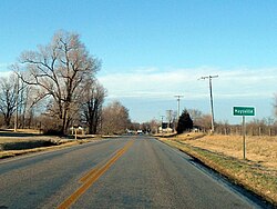
<span class="mw-page-title-main">Center Ridge, Arkansas</span> Census-designated place in Arkansas, United States

Center Ridge is an unincorporated census-designated place in Conway County, Arkansas, United States. Per the 2020 census, the population was 2,235.

<span class="mw-page-title-main">New Church, Virginia</span> Census-designated place in Virginia, United States

New Church is a census-designated place (CDP) in Accomack County, Virginia, United States. Per the 2020 census, the population was 256.

<span class="mw-page-title-main">Sanford, Virginia</span> Census-designated place in Virginia, United States

Sanford is a census-designated place (CDP) in Accomack County, Virginia, United States. It was first listed as a CDP in 2010. Per the 2020 census, the population was 168.

<span class="mw-page-title-main">Roland, Arkansas</span> Census-designated place in Arkansas, United States

Roland is a census-designated place in Pulaski County, Arkansas, United States. It is part of the Central Arkansas metropolitan area. Per the 2020 census, the population was 820.

<span class="mw-page-title-main">Cherokee City, Arkansas</span> Census-designated place in Arkansas, United States

Cherokee City is an unincorporated census-designated place (CDP) in Benton County, Arkansas, United States. Per the 2020 census, the population was 73. It is the location of Coon Creek Bridge, which is located on Cty Rd. 24 and is listed on the National Register of Historic Places. The community was named for the Cherokee, since the Trail of Tears crossed the landscape when the Cherokee migrated west to Indian territory, now Oklahoma in the late 1830s. The town is within the Northwest Arkansas region, located about 5 miles east of Oklahoma and 4 miles south of the Missouri state line.

<span class="mw-page-title-main">New Blaine, Arkansas</span> Census-designated place in Arkansas, United States

New Blaine is an unincorporated community and census-designated place (CDP) in Logan County, Arkansas, United States. Per the 2020 census, the population was 173.

Midway is a census-designated place in Baxter County, Arkansas, United States. Midway is 5.5 miles (8.9 km) northwest of Mountain Home. Per the 2020 census, the population was 1,036. Midway has a post office with ZIP code 72651. Long home to a rural trading post, Midway became a boomtown during the construction of the Bull Shoals Dam, and later evolved to serve tourists and retirees attracted to the lake.

<span class="mw-page-title-main">Kingston, Arkansas</span> Census-designated place in Arkansas, United States

Kingston is an unincorporated community and census-designated place (CDP) in northeast Madison County, Arkansas, United States. It was first listed as a CDP in the 2020 census with a population of 97.

<span class="mw-page-title-main">Uniontown, Arkansas</span> Census-designated place in Arkansas, United States

Uniontown is an unincorporated community and census-designated place (CDP) in Crawford County, Arkansas, United States. It is located on Arkansas Highway 220 near the Oklahoma border, 4.5 miles (7.2 km) west-northwest of Cedarville. Uniontown has a post office with ZIP code 72955.

<span class="mw-page-title-main">Avilla, Arkansas</span> Census-designated place in Arkansas, United States

Avilla is a census-designated place in Saline County, Arkansas, United States. Per the 2020 census, the population was 1,325.

<span class="mw-page-title-main">Hagarville, Arkansas</span> Census-designated place in Arkansas, United States

Hagarville is a census-designated place in Johnson County, Arkansas, United States. Per the 2020 census, the population was 142.

<span class="mw-page-title-main">Lost Bridge Village, Arkansas</span> Census-designated place in Arkansas, United States

Lost Bridge Village is a residential subdivision near the town of Garfield in Benton County, Arkansas, United States. Per the 2020 census, the population was 397. It is located in the Northwest Arkansas region.

<span class="mw-page-title-main">Rye, Arkansas</span> Census-designated place in Arkansas, United States

Rye is a census-designated place in Cleveland County, Arkansas, United States. Per the 2020 census, the population was 123.

<span class="mw-page-title-main">Staves, Arkansas</span> Census-designated place in Arkansas, United States

Staves is a census-designated place in Cleveland County, Arkansas, United States. Per the 2020 census, the population was 133.

<span class="mw-page-title-main">Tumbling Shoals, Arkansas</span> Census-designated place in Arkansas, United States

Tumbling Shoals is a census-designated place in Cleburne County, Arkansas, United States. Per the 2020 census, the population was 902.

Woodlawn is a census-designated place in Cleveland County, Arkansas, United States. Per the 2020 census, the population was 174.

Morrow is an unincorporated community and census-designated place (CDP) in Washington County, Arkansas, United States. A post office has been in operation at Morrow since 1883; The community had the name of G. W. Morrow, an early postmaster. it was first listed as a CDP in the 2020 census with a population of 263;

Wesley is an unincorporated community and census-designated place (CDP) in western Madison County, Arkansas, United States. Wesley is located at the junction of Arkansas highways 74 and 295, 13 miles (21 km) by road west-southwest of Huntsville. Wesley has a post office with ZIP code 72773. It was first listed as a CDP in the 2020 census with a population of 161.

References

  1. "2020 U.S. Gazetteer Files". United States Census Bureau. Retrieved October 29, 2021.
  2. 1 2 U.S. Geological Survey Geographic Names Information System: Maysville, Arkansas
  3. "EXTREME SETTLEMENTS: A COMPREHENSIVE LIST". Weekend Roady. May 2, 2013. Retrieved August 20, 2014.
  4. "Maysville CDP, Arkansas". United States Census Bureau . Retrieved April 15, 2022.
  5. "Post Offices". Jim Forte Postal History. Retrieved February 1, 2018.
  6. History of Benton, Washington, Carroll, Madison, Crawford, Franklin, and Sebastian Counties, Arkansas. Higginson Book Company. 1889. p. 111.
  7. "National Register Information System". National Register of Historic Places . National Park Service. March 13, 2009.
  8. "Decennial Census of Population and Housing by Decades". US Census Bureau.
  9. 1 2 "P2 HISPANIC OR LATINO, AND NOT HISPANIC OR LATINO BY RACE – 2010: DEC Redistricting Data (PL 94-171) – Maysville CDP, Arkansas". United States Census Bureau .
  10. 1 2 "P2 HISPANIC OR LATINO, AND NOT HISPANIC OR LATINO BY RACE – 2020: DEC Redistricting Data (PL 94-171) – Maysville CDP, Arkansas". United States Census Bureau .
  11. "2020 CENSUS - SCHOOL DISTRICT REFERENCE MAP: Benton County, AR" (PDF). U.S. Census Bureau . Retrieved May 25, 2022.

36°24′13″N94°36′07″W / 36.40361°N 94.60194°W / 36.40361; -94.60194