Garfield, Arkansas

Last updated

Garfield, Arkansas
US 62 in Garfield, AR.jpg
Highway 62 runs through Garfield
Garfield, AR city seal.png
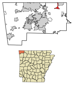
Benton County Arkansas Incorporated and Unincorporated areas Garfield Highlighted 0525750.svg
Location of Garfield in Benton County, Arkansas.
Coordinates: 36°27′1″N93°58′25″W / 36.45028°N 93.97361°W / 36.45028; -93.97361
Country United States
State Arkansas
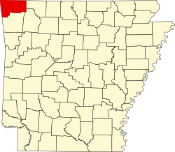
County Benton
Area
[1]
  Total3.09 sq mi (8.01 km2)
  Land3.09 sq mi (8.01 km2)
  Water0.00 sq mi (0.00 km2)
Elevation
[2]
1,490 ft (450 m)
Population
 (2020)
  Total593
  Density191.85/sq mi (74.08/km2)
Time zone UTC-6 (Central (CST))
  Summer (DST) UTC-5 (CDT)
ZIP code
72732
Area code 479
FIPS code 05-25750
GNIS feature ID2406542 [2]
Website garfield-arkansas.us

Garfield is a town [3] in Benton County, Arkansas, United States. The population was 593 at the 2020 census. [4] It is part of the Northwest Arkansas region.

Contents

History

Garfield was platted in 1883. [5] A post office has been in operation at Garfield since 1887. [6]

Geography

Garfield is located in northeast Benton County at 36°27′1″N93°58′25″W / 36.45028°N 93.97361°W / 36.45028; -93.97361 (36.450152, -93.973519). [7] U.S. Route 62 passes through the town, leading northeast to Gateway near the Missouri border and southwest to Rogers.

According to the United States Census Bureau, the town has a total area of 3.0 square miles (7.7 km2), all land. [4]

Demographics

Historical population
CensusPop.Note
1890 112
1940 104
1950 83−20.2%
1960 48−42.2%
1970 163239.6%
1980 18714.7%
1990 30864.7%
2000 49059.1%
2010 5022.4%
2020 59318.1%
U.S. Decennial Census [8]
2018 Estimate [9]

At the 2000 census, [10] there were 490 people, 177 households and 136 families residing in the town. The population density was 133.5 inhabitants per square mile (51.5/km2). There were 198 housing units at an average density of 54.0 per square mile (20.8/km2). The racial makeup of the town was 97.35% White, 1.43% Native American, 0.61% Asian, and 0.61% from two or more races. 1.43% of the population were Hispanic or Latino of any race.

There were 177 households, of which 37.9% had children under the age of 18 living with them, 67.2% were married couples living together, 6.2% had a female householder with no husband present, and 22.6% were non-families. 18.1% of all households were made up of individuals, and 7.3% had someone living alone who was 65 years of age or older. The average household size was 2.77 and the average family size was 3.18.

29.4% of residents were under the age of 18, 8.4% from 18 to 24, 28.8% from 25 to 44, 20.2% from 45 to 64, and 13.3% who were 65 years of age or older. The median age was 37 years. For every 100 females, there were 109.4 males. For every 100 females age 18 and over, there were 104.7 males.

The median household income was $33,393 and the median family income was $38,750. Males had a median income of $27,031 versus $22,404 for females. The per capita income for the town was $13,159. About 9.8% of families and 10.3% of the population were below the poverty line, including 9.0% of those under age 18 and 3.8% of those age 65 or over.

Education

Garfield Elementary School is listed on the National Register of Historic Places. Garfield Elementary.jpg
Garfield Elementary School is listed on the National Register of Historic Places.

Public education for early childhood, elementary and secondary school students in most of Garfield is provided by the Rogers School District. A northern portion is within the Pea Ridge School District. [11] The former school district operates Garfield Elementary School, and this school feeds into Lingle Middle School and Rogers Heritage High School. [12] The latter school district operates Pea Ridge High School.

Related Research Articles

<span class="mw-page-title-main">Carroll County, Arkansas</span> County in Arkansas, United States

Carroll County is a county located in the U.S. state of Arkansas. As of the 2020 census, the population was 28,260. The county has two county seats, Berryville and Eureka Springs. Carroll County is Arkansas's 26th county, formed on November 1, 1833, and named after Charles Carroll, the last surviving signer of the United States Declaration of Independence.

<span class="mw-page-title-main">Benton County, Arkansas</span> County in Arkansas, United States

Benton County is a county within the Northwest Arkansas region with a culture, economy, and history that have transitioned from rural and agricultural to suburban and white collar since the growth of Walmart, which is headquartered in Benton County. Created as Arkansas's 35th county on September 30, 1836, Benton County contains thirteen incorporated municipalities, including Bentonville, the county seat, and Rogers, the most populous city. The county was named after Thomas Hart Benton, a U.S. Senator from Missouri influential in Arkansas statehood.

<span class="mw-page-title-main">Avoca, Arkansas</span> Town in Arkansas, United States

Avoca is a town in Benton County, Arkansas, United States. The population was 487 at the 2020 census. It is part of the Northwest Arkansas region.

<span class="mw-page-title-main">Centerton, Arkansas</span> City in Arkansas, United States

Centerton is a city in Benton County, Arkansas, United States. Located west of Bentonville on Highway 102, Centerton has grown from a railroad stop and fruit orchard community in the early 20th century into a suburban bedroom community within the rapidly growing Northwest Arkansas (NWA) region. The city's population has grown from 491 in 1990 to 16,244 in 2019. Centerton is considered to be one of the fastest growing cities in Arkansas and consistently ranks amongst the safest cities in the state.

<span class="mw-page-title-main">Decatur, Arkansas</span> City in Arkansas, United States

Decatur is a city, in Benton County, Arkansas, United States. The population was 1,773 at the 2020 census. It is part of the Northwest Arkansas region. This town is named after Commodore Stephen Decatur, Jr.

<span class="mw-page-title-main">Gateway, Arkansas</span> Town in Arkansas, United States

Gateway is a town in Benton County, Arkansas, United States. The population was 436 at the 2020 census, up from 405 in 2010. It is part of the Northwest Arkansas region. The town's name reflects its situation as the "gateway" to and from Arkansas.

<span class="mw-page-title-main">Highfill, Arkansas</span> Town in Arkansas, United States

Highfill is a town in Benton County, Arkansas, United States. The population was 1,587 as of the 2020 census. It is home to the Northwest Arkansas National Airport, which serves all of the Northwest Arkansas region. In September 2023, officials of the airport voted to detach itself from the city over taxing and public service disputes.

<span class="mw-page-title-main">Pea Ridge, Arkansas</span> City in Arkansas

Pea Ridge is a city in Benton County, Arkansas, United States. The name Pea Ridge is derived from a combination of the physical location of the original settlement of the town, across the crest of an Ozark Mountains ridge, and for the hog peanuts or turkey peas that had been originally cultivated by Native American tribes centuries before European settlement, which later helped to provide basic subsistence once those pioneer settlers arrived.

<span class="mw-page-title-main">Prairie Creek, Arkansas</span> CDP in Arkansas, United States

Prairie Creek is a census-designated place (CDP) in Benton County, Arkansas, United States. Per the 2020 census, the population was 2,217. It is a lakefront community adjacent to Beaver Lake and Rogers within the Northwest Arkansas region.

<span class="mw-page-title-main">Springtown, Arkansas</span> Town in Arkansas, United States

Springtown is a town in Benton County, Arkansas, United States. The population was 83 at the 2020 census. It is part of the Northwest Arkansas region.

<span class="mw-page-title-main">Gum Springs, Arkansas</span> Town in Arkansas, United States

Gum Springs is a town in Clark County, Arkansas, United States. The population was 120 at the 2010 census, down from 194 in 2000.

<span class="mw-page-title-main">Lonsdale, Arkansas</span> Town in Arkansas, United States

Lonsdale is a town in Garland County, Arkansas, United States. It is part of the Hot Springs Metropolitan Statistical Area. The population was 103 at the 2020 census.

<span class="mw-page-title-main">Tull, Arkansas</span> Town in Arkansas, United States

Tull is a town in Grant County, Arkansas, United States. The population was 448 at the 2010 census, up from 358 in 2000. It is part of the Central Arkansas region.

<span class="mw-page-title-main">Perla, Arkansas</span> Town in Arkansas, United States

Perla is a town in Hot Spring County, Arkansas, United States. The population was 241 at the 2010 census, up from 115 at the 2000 census. The city's water association filed for Chapter 9 Bankruptcy in the Western District of Arkansas Bankruptcy Court on May 26, 2019.

<span class="mw-page-title-main">Hector, Arkansas</span> Town in Arkansas, United States

Hector is a town in Pope County, Arkansas, United States. The population was 450 at the 2010 census. It is part of the Russellville Micropolitan Statistical Area.

<span class="mw-page-title-main">Benton, Arkansas</span> City in Arkansas, United States

Benton is a city in and the county seat of Saline County, Arkansas, United States and a suburb of Little Rock. It was established in 1837. At the 2020 census, the city had a population of 35,014, making it the 12th most populous city in Arkansas. It is part of the Little Rock–North Little Rock–Conway Metropolitan Statistical Area. The city of Benton, first settled in 1833 and named after Missouri Senator Thomas Hart Benton, was formally chartered in 1836 when Arkansas became a state.

<span class="mw-page-title-main">Palestine, Arkansas</span> Town in Arkansas, United States

Palestine is a town in St. Francis County, Arkansas, United States, along the L'Anguille River. The population was 681 at the 2010 census, a decline from 741 in 2000.

<span class="mw-page-title-main">Corinth, Arkansas</span> Town in Arkansas, United States

Corinth is a town in Yell County, Arkansas, United States. The population was 65 at the 2000 census. It is part of the Russellville Micropolitan Statistical Area.

<span class="mw-page-title-main">Norway, Iowa</span> City in Iowa, United States

Norway is a city in Benton County, Iowa, United States. The population was 466 at the time of the 2020 census. The city is approximately 17 miles (27 km) southwest of downtown Cedar Rapids. It is part of the Cedar Rapids Metropolitan Statistical Area. Norway is the setting of the movie The Final Season.

<span class="mw-page-title-main">Covington, Oklahoma</span> Town in Oklahoma, United States

Covington is a town in Garfield County, Oklahoma, United States. The population was 477 at the 2020 census.

References

  1. "2020 U.S. Gazetteer Files". United States Census Bureau. Retrieved October 29, 2021.
  2. 1 2 U.S. Geological Survey Geographic Names Information System: Garfield, Arkansas
  3. "Welcome - Town of Garfield". Town of Garfield, Arkansas. Retrieved September 24, 2010.
  4. 1 2 "Geographic Identifiers: 2010 Demographic Profile Data (G001): Garfield town, Arkansas". U.S. Census Bureau, American Factfinder. Archived from the original on February 12, 2020. Retrieved September 24, 2013.
  5. History of Benton, Washington, Carroll, Madison, Crawford, Franklin, and Sebastian Counties, Arkansas. Higginson Book Company. 1889. p. 110.
  6. "Post Offices". Jim Forte Postal History. Retrieved January 5, 2017.
  7. "US Gazetteer files: 2010, 2000, and 1990". United States Census Bureau. February 12, 2011. Retrieved April 23, 2011.
  8. "Census of Population and Housing". Census.gov. Retrieved June 4, 2015.
  9. "Population Estimates". United States Census Bureau . Retrieved June 8, 2018.
  10. "U.S. Census website". United States Census Bureau . Retrieved January 31, 2008.
  11. "2020 CENSUS - SCHOOL DISTRICT REFERENCE MAP: Benton County, AR" (PDF). U.S. Census Bureau . Retrieved May 25, 2022.
  12. "Feeder School Pattern" (PDF). Rogers Public Schools . Retrieved September 18, 2022.