Brightwater, Arkansas

Last updated
2.Pea Ridge to Brightwater.png

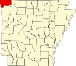
Brightwater is a community in Benton County, Arkansas, United States. [1] It is the location of (or is the nearest community to) Springfield to the Fayetteville Road-Brightwater Segment, which is located at N Old Wire Road/Benton Cty Rd. 67, south of US 62 and is listed on the National Register of Historic Places. [2]

Brightwater got its start c.1840. [3] A post office called Brightwater was established in 1882, and remained in operation until 1907. [4]

Related Research Articles

<span class="mw-page-title-main">Decatur, Arkansas</span> City in Arkansas, United States

Decatur is a city, in Benton County, Arkansas, United States. The population was 1,773 at the 2020 census. It is part of the Northwest Arkansas region. This town is named after Commodore Stephen Decatur, Jr.

<span class="mw-page-title-main">Arkansas Highway 72</span> State highway in Arkansas, United States

Highway 72 is a designation for two east–west state highways in Benton County, Arkansas. A western route of 26.32 miles (42.36 km) runs east from Highway 43 at Maysville to U.S. Route 71B (US 71B) in Bentonville. A second route of 12.67 miles (20.39 km) begins at Interstate 49/US Route 71 (I-49/US 71) in Bentonville and runs northeast to US 62 near Avoca. The route is one of the original Arkansas state highways.

Bruno is an unincorporated community in southwest Marion County, Arkansas, United States. Yellville lies approximately eight miles to the northeast along Arkansas Route 235.

<span class="mw-page-title-main">Cherokee City, Arkansas</span> Census-designated place in Arkansas, United States

Cherokee City is an unincorporated census-designated place (CDP) in Benton County, Arkansas, United States. Per the 2020 census, the population was 73. It is the location of Coon Creek Bridge, which is located on Cty Rd. 24 and is listed on the National Register of Historic Places. The community was named for the Cherokee, since the Trail of Tears crossed the landscape when the Cherokee migrated west to Indian territory, now Oklahoma in the late 1830s. The town is within the Northwest Arkansas region, located about 5 miles east of Oklahoma and 4 miles south of the Missouri state line.

Colville is an unincorporated community in Benton County, Arkansas, United States. It is the location of Mt. Hebron M.E. Church South and Cemetery, which is located at 1079 Mt. Hebron Road and is listed on the National Register of Historic Places.

<span class="mw-page-title-main">Maysville, Arkansas</span> Census-designated place in Arkansas, United States

Maysville is an unincorporated community and census-designated place (CDP) in Benton County, Arkansas, United States. It is the westernmost settlement in the state of Arkansas. Per the 2020 census, the population was 117. It is located in the Northwest Arkansas region.

Osage Mills is an unincorporated community in Benton County, Arkansas, United States. The millsite and associated dam is located on Little Osage Creek about eight miles southwest of Rogers. It is the location of the following places listed on the National Register of Historic Places on January 28, 1988:

Pedro is an unincorporated community in Benton County, Arkansas, United States.

<span class="mw-page-title-main">War Eagle, Arkansas</span> Unincorporated community in Arkansas, United States

War Eagle is an unincorporated community in Benton County, Arkansas, United States. It is the location of War Eagle Bridge, which carries CR 98 over War Eagle Creek and is listed on the National Register of Historic Places.

Bates is an unincorporated community in Scott County, Arkansas, United States. It is the location or nearest community of Bates School, at 1074 Bates School Rd., which is listed on the U.S. National Register of Historic Places.

Durham is an unincorporated community in eastern Washington County, Arkansas, United States. The community is on Arkansas Highway 16 along the White River valley between Elkins to the northwest and Thompson in Madison County to the southeast. Its elevation is 1,247 feet (380 m).

<span class="mw-page-title-main">Uniontown, Arkansas</span> Census-designated place in Arkansas, United States

Uniontown is an unincorporated community and census-designated place (CDP) in Crawford County, Arkansas, United States. It is located on Arkansas Highway 220 near the Oklahoma border, 4.5 miles (7.2 km) west-northwest of Cedarville. Uniontown has a post office with ZIP code 72955.

Wild Cherry is an unincorporated community in southwest Fulton County, Arkansas, United States. It is located along Arkansas Highway 223, just north of the Fulton-Izard county line. Wild Cherry Road runs north from the community. It is approximately six miles east of the eastern shore of Norfork Lake and about 11 miles north of Calico Rock. The elevation is 850 feet.

Bloomfield is an unincorporated community in Benton County, Arkansas, United States.

Creech is an unincorporated community in Benton County, Arkansas, United States.

Little Sugar Creek is a stream in northwestern Benton County, Arkansas and southwestern McDonald County, Missouri. It is a tributary of the Elk River.

Jolly is an unincorporated community in eastern Newton County, in the U.S. state of Missouri. A variant name was "Jollification". The community is on Capps Creek approximately eight miles west-southwest of Monett in adjacent Barry County and five miles southwest of Pierce City in southwest Lawrence County.

McGuire is an extinct town in Washington County, in the U.S. state of Arkansas. The community is located southeast of Fayetteville on Arkansas Highway 74. The White River flows past the southwest side of the community.

Weddington is an unincorporated community in Washington County, in the U.S. state of Arkansas.

Wheeler is an unincorporated community in Washington County, in the U.S. state of Arkansas. The community is approximately four miles northwest of Fayetteville and lies adjacent to the Clear Creek floodplain.

References

  1. U.S. Geological Survey Geographic Names Information System: Brightwater, Arkansas
  2. "National Register Information System". National Register of Historic Places . National Park Service. March 13, 2009.
  3. History of Benton, Washington, Carroll, Madison, Crawford, Franklin, and Sebastian Counties, Arkansas. Higginson Book Company. 1889. p. 95.
  4. "Post Offices". Jim Forte Postal History. Retrieved January 5, 2017.

36°25′04″N94°03′25″W / 36.41778°N 94.05694°W / 36.41778; -94.05694