War Eagle Creek

Last updated

War Eagle Creek
War Eagle Creek at Withrow Springs State Park.jpg
War Eagle Creek at Withrow Springs State Park
USA Arkansas relief location map.svg
Red pog.svg
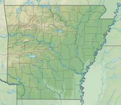
Location of the mouth of the War Eagle Creek in Arkansas
EtymologyWar Eagle, a Native American chiefton
Location
Country United States
State Arkansas
Physical characteristics
Source 
  coordinates 35°50′28″N93°37′10″W / 35.84111°N 93.61944°W / 35.84111; -93.61944
Mouth  
  coordinates
36°13′47″N93°59′53″W / 36.22972°N 93.99806°W / 36.22972; -93.99806
Discharge 
  locationHindsville, AR
  average299 cu/ft. per sec. [1]
Basin features
Progression White RiverMississippi River
River system Mississippi River
Bridges Eagle Creek Bridge
GNIS feature ID56034 [2]

War Eagle Creek is a stream in Benton, Washington and Madison counties of northwest Arkansas, United States, that is a tributary of the White River. [2]

Contents

War Eagle Creek, as it passes under the War Eagle Bridge GENERAL VIEW OF BRIDGE FROM RIVER'S EDGE, LOOKING SOUTH - War Eagle Bridge, Spanning War Eagle Creek at Benton County Road No. 98, War Eagle, Benton County, AR HAER ARK,4-WARE,1-6.tif
War Eagle Creek, as it passes under the War Eagle Bridge

Description

The stream source area is in Madison County in the Boston Mountains just west of the community of Boston and north of Arkansas Route 16 at an elevation of about 2,100 feet (640 m). [3] The stream flows northwest passing under and then running parallel to Arkansas Route 23 passing the communities of Witter and Aurora. It flows past the east side of Huntsville and crosses under U.S. Route 412 northeast of Harmony. It turns to the northwest as passes the south side of Withrow Springs State Park and under Route 23 again. It continues passing under Arkansas Highway 45 to the north of Hindsville and passes through the northeast corner of Washington County and into Benton County. The stream passes under Arkansas Highway 303 just west of War Eagle and makes a sharp turn (incised meander) to the south. The stream enters the waters of Beaver Lake just prior to re-entering Washington County. Prior to the creation of Beaver Lake, the stream entered the White River about three miles to the west-southwest. [4]

The creek has the name of War Eagle, an Indian chieftain. [5]

See also

References

  1. "USGS Current Conditions for USGS 07049000 War Eagle Creek near Hindsville, AR".
  2. 1 2 U.S. Geological Survey Geographic Names Information System: War Eagle Creek
  3. Boston, Arkansas, 7.5 Minute Topographic Quadrangle, USGS, 1973
  4. Arkansas Atlas and Gazetteer, DeLorme, 2nd edition 2002, pp 22 and 31 ISBN   0-89933-345-1
  5. History of Benton, Washington, Carroll, Madison, Crawford, Franklin, and Sebastian Counties, Arkansas. Higginson Book Company. 1889. p. 16.

Commons-logo.svg Media related to War Eagle Creek at Wikimedia Commons